
34°40’41.9″N 83°41’55.5″W
by Richard L. Thornton, Architect and City Planner
The 2.84 mi (4.57 km) long Nacoochee Valley is located between Cleveland and Helen, GA in the Northeast Georgia Mountains. It is 76 miles (122 km) north of Atlanta. The valley was created by a line of ancient volcanoes, which erupted about three miles ( 4.8 km) south of the ancient Blue Ridge Mountains. However, some volcanoes also erupted through the older mountains. The eastern end of the valley extends into an ancient, 12 mile (19.2 km) diameter caldera volcano, whose hidden crater extends northward almost to the North Carolina Line.
Archaeologist Robert Wauchope determined that the Nacoochee Valley has been continuously occupied by humans since the Ice Age. Beginning around 1000 BC, a number of villages were founded in the valley, which continued to exist until around 1700 AD. During this period, it was one of the most densely occupied locations in North America. During the 1600s, the valley also contained Spanish-speaking mining village. In 1828, a spot near the hill we studied was the location of the beginning of the first major gold rush in the United States.

In 1653, Richard Briggstock somehow escaped the blockade of English Commonwealth ships around Barbados to hitch a ride with a Dutch merchant vessel to the mouth of the Savannah River. From there, he and his party paddled up the Savannah to Northeast Georgia. From the Upper Savannah around present day Elberton, they took a well-worn trading path past herds of massive Woodland Bison before arriving at the European colony of Melilot at the headwaters of the Oconee River in present day Gwinnett County, now part of Metro Atlanta. At Melilot, they were officially welcomed by representatives of the Parakusa (High King) of the Kingdom of Apalache.

All French, Spanish, English and Dutch maps placed Fort Caroline at the mouth of the Altamaha River and until 1721, labeled the Altamaha River as the May River. No 16th century artifacts have been found near the 1/12th scale reproduction of Fort Caroline in Jacksonville, FL, which was constructed in 1962 on land donated to the federal government by Jacksonville. In contrast, National Park Service archaeologist, James Ford, found a treasure trove of 16th century French and Spanish artifacts at the real location in Georgia. However, this is being kept a secret because of hundreds of millions of dollars have been spent, creating a 72 square mile fake historic park in Florida. The current false location on the St. John’s River, plus the myth of the Fountain of Eternal Youth in St. Augustine, FL was a scam, created by a real estate speculator from New York in the 1840s.
Melilot was founded in 1566 by the survivors of Fort Caroline. According to Charles de Rochefort, the Frenchmen were given refuge in his kingdom on the condition that they marry Apalache gals. Melilot continued to be shown on European maps until around 1690. I didn’t notice that asymmetrical “blob” above the CH in Apalache until recently. That’s the Nacoochee Valley, which was the capital of the Kingdom of Apalache.

Briggstock was seeking a suitable location for the Royalist planters of Barbados to relocate, in order to escape the Puritan dominated English Commonwealth. He knew that the leaders of Apalache were allowing Europeans to colonize their northern frontier to establish a buffer between the Apalache Heartland in the Apalachen (North Georgia) Mountains and marauding Northern tribes . . . primarily the Iroquois.
Apalache is what the Creek Indians called themselves, until British colonists told them that their name was Creek. The Florida Apalachee never called themselves by that name until the Spanish told them that was their new name.
After spending several months in what is now Georgia, western North Carolina and northeastern Alabama, Briggstock ultimately decided to look elsewhere, eventually moving to the Dominion of Virginia. The Apalache state religion forbade slavery and the High King required that all single (male and female) European colonists marry Apalache prior to being granted land.
Upon returning to Barbados, Briggstock learned that the English Commonwealth had decided not to molest the Royalists in Barbados. He subsequently gave his notes and sketches of mid-17th century Georgia to French Protestant minister and ethnologist, Charles de Rochefort. De Rochefort used this information to write ten chapters of a book, published in 1658. The Apalache Chronicles [2013] by Marilyn Rae and Richard Thornton is an annotated English translation of those ten chapters. The book is available at Ancient Cypress Press, Amazon.com and Barnes & Noble. Since I am of Itsate Creek descent, I was able to translate the many Itsate Creeks words recorded by Briggstock. Muskogee Creeks in Oklahoma would not understand these words.

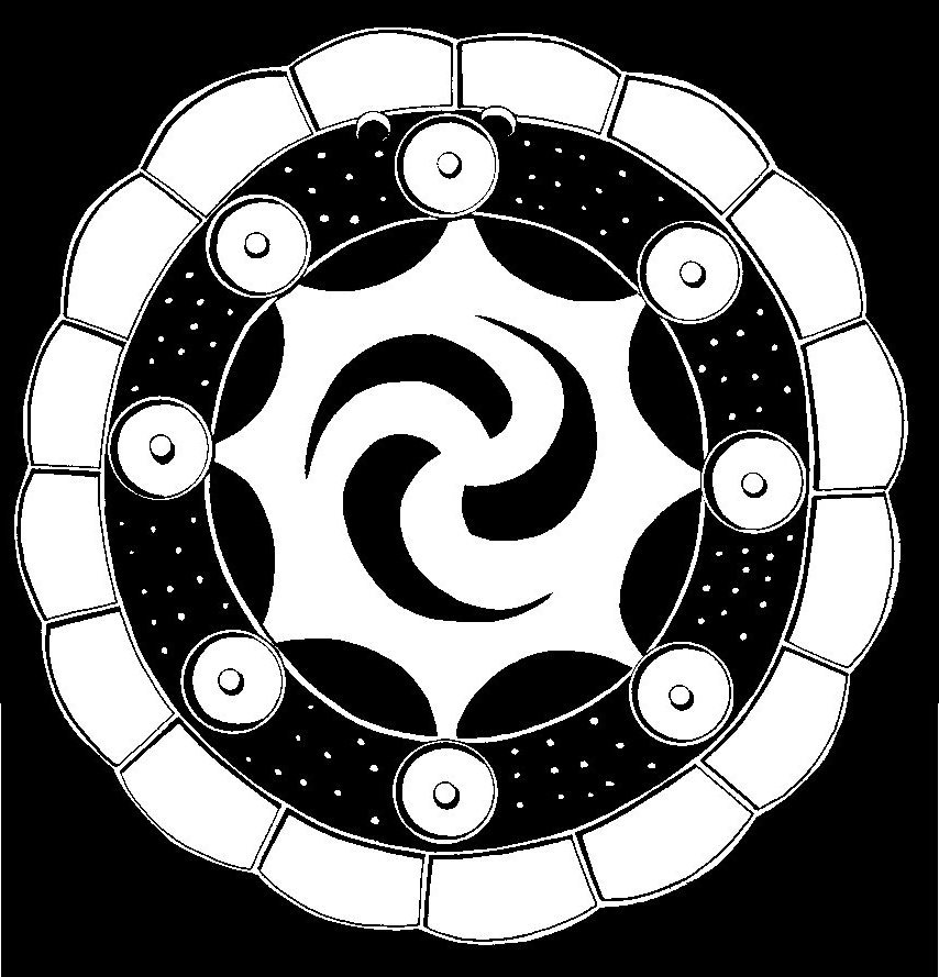
One of the most interesting illustrations in De Rochefort’s book is an engraving of the Sun Temple in the capital of Apalache. It was dedicated to the Apalache Sun Goddess Amana, who was symbolized both by the Apalache and in western Europe, during the Bronze Age, by a spiral. He made the mountains look like the Grant Tetons and Sun Temple look like a Spanish mission. Note that the temple has a device that attracts lightning. The priests in the temple knew how to focus sunlight in order to ignite the sacred fire in its inner sanctum.
Apparently, Charles de Rochefort thought that the capital of the Kingdom of Apalache was near Melilot. Marilyn Rae and I presumed that this was the case because there are almost continuous ruins along the Apalachee, North Oconee and Middle Oconee Rivers in Northeast Georgia. However, we could find no location that matched the description of the Capital of Apalache by De Rochefort in this region. I did not notice the blob in the map above until several years after the book was published.

For 200 years, people who traveled past this 65 feet high dome-shaped form, 3,564.2 ft (1.09 km) southeast of the famous Nacoochee Mound, have wondered if it was an “Indian mound” or a natural hill. In the late 1820s, this landmark was the official location of the first discovery of gold in the Georgia Mountains . . . but we now know that humans have been mining for gold here for at least 4,000 years. Early miners cut a deep gash in the southeast side of the hill with a supercharged water hose, hoping to find “Cherokee gold” buried within the mound. They apparently found none.
The famous archaeologists, Robert Wauchope, spent much of the year 1939, exploring the Nacoochee Valley. Only a few years after the first five Clovis points were discovered near Clovis, NM, Wauchope found a total of 35 accidentally, while excavation Proto-Creek town sites. Few people knew about the presence of a dense Clovis occupation in Northeast Georgia until Wauchope published his book in 1966. Archaeological Survey of Northern Georgia by Robert Wauchope is no longer in print, but used copies sometimes may be purchased from Ebay or Amazon.com.
Wauchope’s main focus were the permanent towns and villages in the Nacoochee Valley, which were very closely spaced. Some went through the complete sequence of indigenous cultural periods from the Deptford Culture around 1200-1000 BC to the Late Lamar Culture, around 1700 AD. Although he searched for Cherokee villages, he never found any . . . only scattered 18th century farmsteads that contained a mixture of Creek-style artifacts and 18th century European goods.

Shortly after arriving in the valley, Wauchope was shown a complex of royal tombs in Squirrel Gap, near the confluence of the Chattahoochee River and Duke’s Creek. He discovered two stone plaques, one in Elizabethan English, the other in the Apalache (Creek) writing system, which marked the tomb of Roanoke Colony survivor, Eleanor Dare, and her daughter.
Wauchope was soon shown 24 other stone tablets, engraved with Elizabethan words, that had been found along the Chattahoochee River by farmers between 1824 and 1911. These discoveries were made long before the national publicity about the Eleanor Dare Stone found in extreme northeastern North Carolina. Since Brenau College was in possession of the Dare Stone from North Carolina, Wauchope recommended to the farmers that they take them to Brenau College. Wauchope then arranged for two of his former professors from Harvard to take the train down to Gainesville and examine all stone tablets in the possession of the college. All of those found in the Nacoochee Valley and along the Upper Chattahoochee River were determined to be authentic by the two professors.
Hontaoase is an Itsate Creek word which means “Descendants of people, who irrigated crops.” Hontaoase was specifically mentioned on several of the authentic Eleanor Dare stones found by farmers along the upper Chattahoochee River. However, it was a word completely unknown to mid-20th century academicians. Most assumed that it was a Cherokee word, since at the time many Georgians assumed that the Cherokees had always lived in northern Georgia. Of course, earlier generations of Georgians knew that the Cherokees presence in the state was rather brief. One of the grounds used in the Supreme Court by Georgia’s attorneys was that the Cherokees were unwanted squatters, who were not indigenous to the southern tip of the Appalachian Mountains.

Several months later, Wauchope dug test trenches at several locations on the mound-shaped form in the photo above. He found another stone tablet, engraved in the same Elizabethan English as the grave marker, which stated that the house of Eleanor Dare and her Apalache husband (a provincial king) was formerly on the top of mound-shaped hill.
At the time, Brenau College in Gainesville, GA was producing an outdoor drama about the settlement of some Roanoke Colony survivors in the Nacoochee Valley. North Carolina officials were trying to discredit the play, fearing that it would compete with their outdoor drama, “The Lost Colony,” which was about 500 miles to the east. The discovery of multiple artifacts associated with Eleanor Dare by a professional archaeologist with a doctorate from Harvard would fully support the premise of the Georgia play.

The University of North Carolina quickly offered Wauchope a position, which paid twice his salary at the University of Georgia . . . under the conditions that he leave the University of Georgia immediately (mid-quarter) and never discuss his discoveries in the Nacoochee Valley. He accepted the offer, but once World War II began, he was appointed an officer in the Office of Strategic Services, forerunner of the CIA. After the war, he began teaching at Tulane University in New Orleans, and remained there the rest of his career.

Architectural analysis of the mysterious hill
With the permission of the owner, I began studying the mysterious hill in the spring of 2018. I quickly determined that the hill per se, was a natural formation, created by the Chattahoochee River first forming a horseshoe bend and then cutting across the neck of the hill. However, the hill had definitely been “sculptured” to create a mound-like shape, plus terraces that faced the Winter Solstice sunset. Several large boulders were visible within virgin soil at some locations. On the other hand there were man-made terraces, created by fill soil and also ancient ramps.
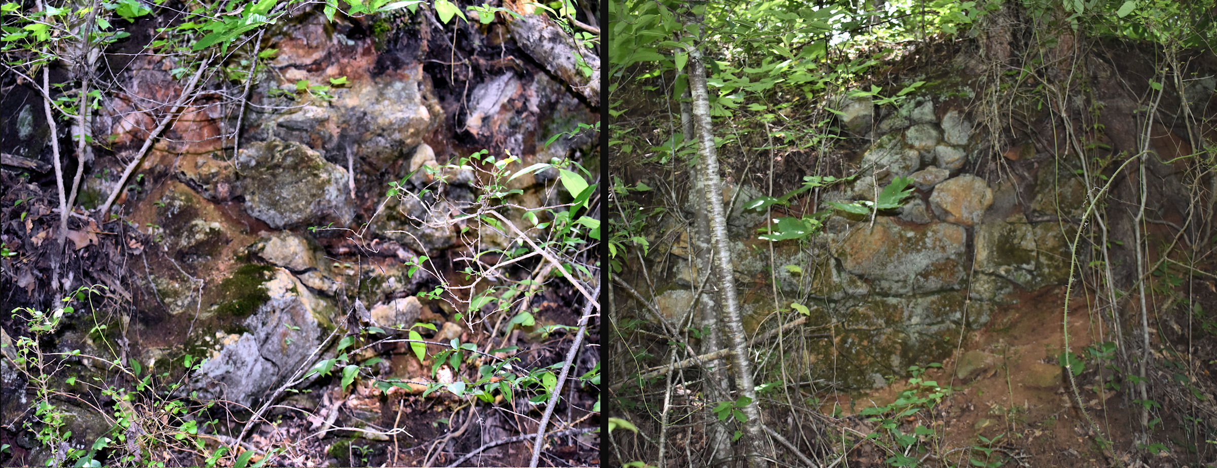
I was surprised to find several stone masonry retaining walls that supported the man-made terraces on the southwest end of the hill. Stone retaining walls were found by archaeologist Adam King in 2006 around the largest plaza at Etowah Mounds National Historic Landmark in Cartersville, GA. Even King does not seem to know that archaeologists Lewis Larsen and Arthur Kelly found a rectangular stone temple at the base of Etowah’s Mound C in 1955. The discovery is mentioned in their 1957 report, Excavations at Etowah Mounds (1954-1956), but not mentioned in the Etowah Mounds Museum. Apparently, the existence of stone architecture in Georgia is knowledge, forbidden to the general public.
There appears to have been two terraces on the southwest end of the Amana Temple. The lower one was immediately accessible from two ramps, one leading to an elite village and the other leading to a public plaza. The upper plaza was accessed by a spiral ramp. It in turn was connected to the “temple mount” by a sloping ramp, aligned southwest-northeast.


The Kenimer Mound is a very large five-sided mound, sculpted from the top of Kenimer Hill. It is identical in every aspect to the five-side Sun God Temple mounds, sculpted from hills by Itza and Kekchi Mayas in the Highlands of Chiapas, Guatemala and Belize. The symbol of the Sun God among these people was a cross within a circle. This symbol is called the Sacred Fire among the Creeks and Uchee today.

Until the late 20th century, the ruins of a stone-walled temple were visible on the top of the Kenimer Mound. A newly arrived couple from Florida paid a contractor to demolish the stone ruins and transport the stone to their home construction site, where they were used to build chimneys and landscaping walls. Eyewitnesses to the stone ruins do not recall if the temple was rectangular or round. It was probably rectangular, because that was typical of Itsate (Itza Maya) temples elsewhere. The name of the town near the Kenimer Mound was also Itsate.
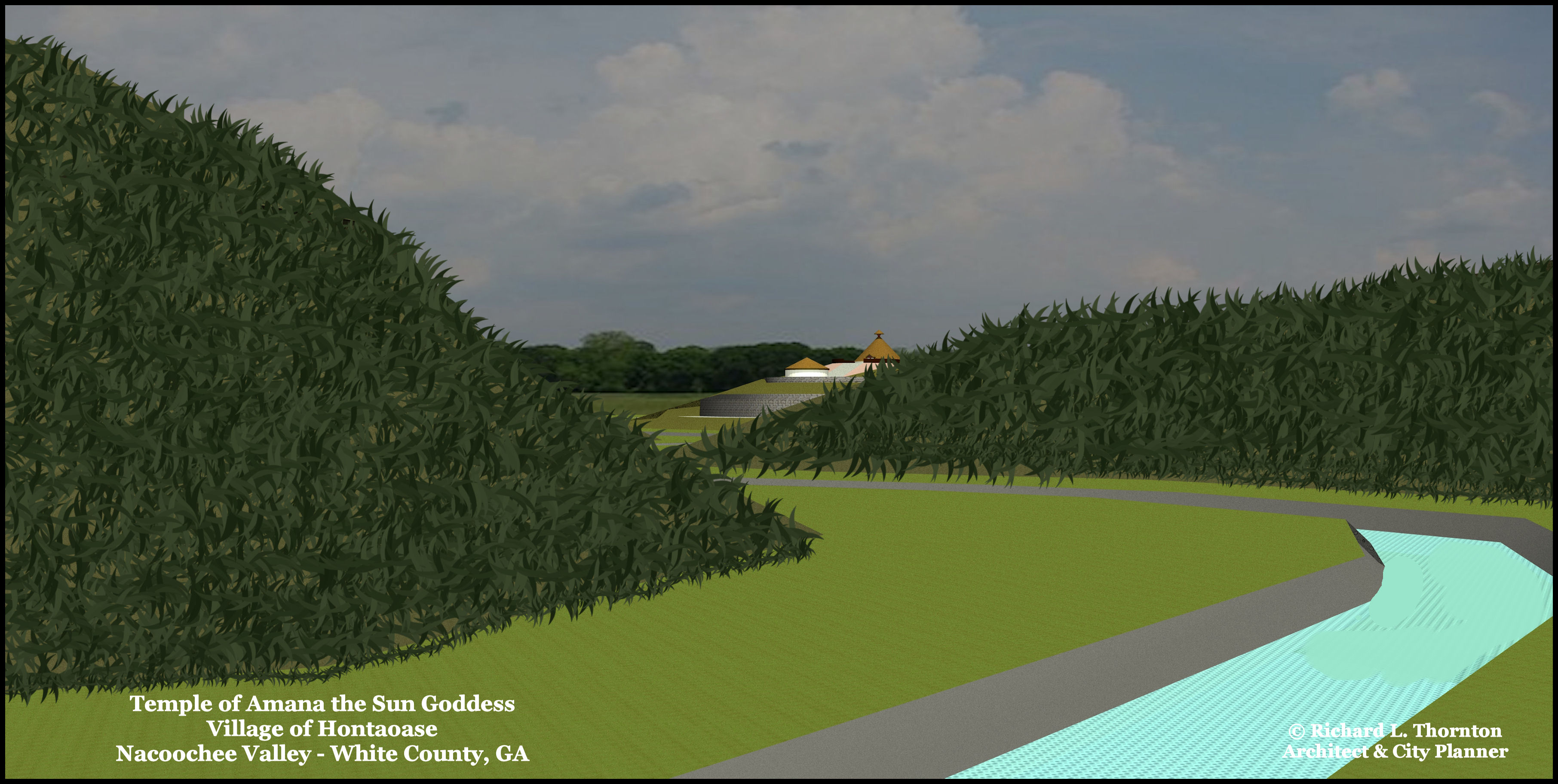
Following are several views of a computer model of the Temple of Amana and the adjacent elite village of Hontaoase. The computer model was created from a LIDAR scan, ERSI topographic map and on-site measuring with a laser device.


Were any remains ever found in the “Royal Tombs ” mentioned?
LikeLike
No, not in the tomb of Eleanor Dare and her daughter. HOWEVER, I think that there are other tombs that never have been opened at more remote mountain top Apalache cemeteries. I have visited several mountain top tomb complexes, but do not disturb them. The one where Eleanor Dare was buried was ground center for the Georgia Gold Rush. The miners tore into tombs and mounds with hydraulic hoses, hoping to find gold. Apalache tombs were created by excavating the soil under large rock outcrops. The tomb was sealed by quarried stone masonry with clay mortar. The masonry was then coated with lime stucco – often painted with bright colors.
LikeLike
Your articles just get better and better! Thank you.😁
Finished my travel for summer. Work starts Tuesday. I still plan a way to get up there and experience seeing these places.
Stay safe.
On Thu, Aug 1, 2019, 7:04 PM The Americas Revealed wrote:
> alekmountain posted: ” 34°40’41.9″N 83°41’55.5″W by Richard L. Thornton, > Architect and City Planner The 2.84 mi (4.57 km) long Nacoochee Valley is > located between Cleveland and Helen, GA in the Northeast Georgia Mountains. > It is 76 miles (122 km) north of Atlanta. ” >
LikeLike