
by Richard L. Thornton, Architect & City Planner
One Summer In Mexico ~ Part 58
It’s like being in a time machine. I am continuing to digitize and analyze the many hundreds of color slides of Mexico that I took during the last two weeks in August and early September 1970. These were developed after I returned to Atlanta. I was already working day and night at Georgia Tech, when Kodak sent the slides to me. I barely had time to use a ball point pen to write the name of the Maya or Totonac city on the slide. I pulled a few of the best slides from the best known archaeological sites like Chichen Itza, Uxmel and Palenque to use later while teaching courses in Pre-Columbian architecture . . . but the vast majority lay in metal slide boxes for five decades. To initially see the contents of the slides, I would have been required to set up my slide projector in the fraternity’s upstairs chapter meeting room . . . but I just didn’t have the time.
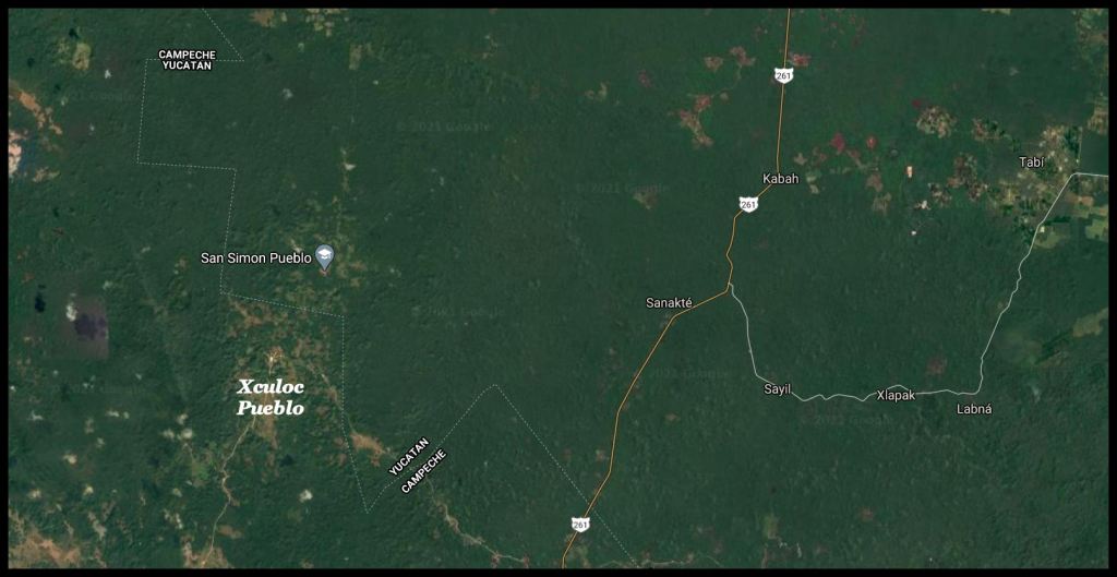
I am not sure what happened, but when I was in Mexico on the Barrett Fellowship, the ruins of the Maya cities of Kabah, Sayil and Labna were considered to be in Campeche by Dr. Román Piña Chán, the maps and the people living near by. Either the boundary between the states of Yucatan and Campeche have changed or surveyors have traversed a more accurate boundary. Culturally, these cities did most resemble the Maya cities in Campeche.
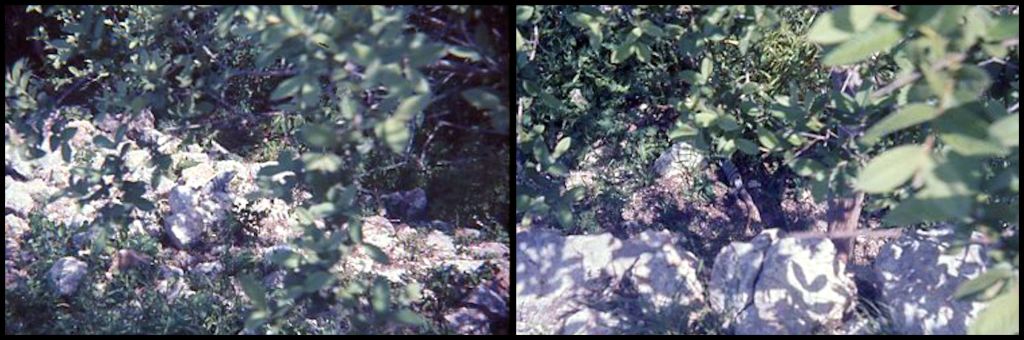

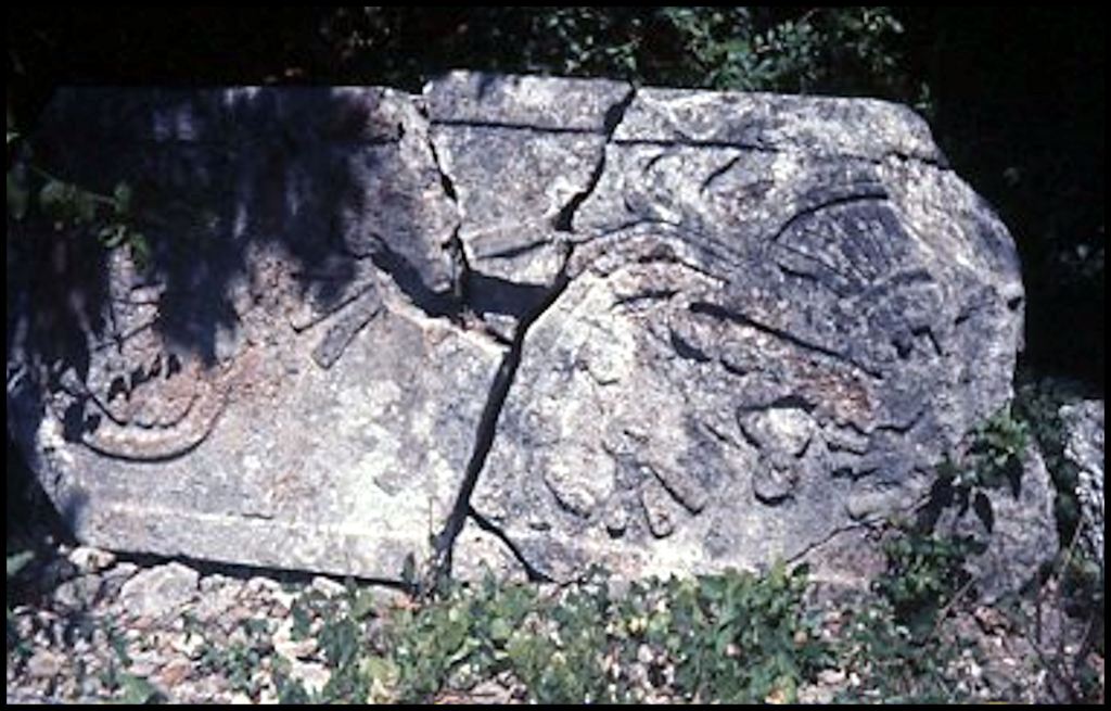
When Ana Rojas and I were roaming the jungle of eastern Campeche, we constantly saw anonymous stone ruins, partially concealed by the dense vegetation. We had many surprises while exploring the jungle in or near these little known ruins. One of the biggest surprises (that I had completely forgotten) were two large stone stela, laying flat on the jungle floor. One of them was broken, but still legible. In retrospect, I wish that I had taken photos of the details of these stelas, but at least, I did document both of them, so I would remember their existence . . . eventually.
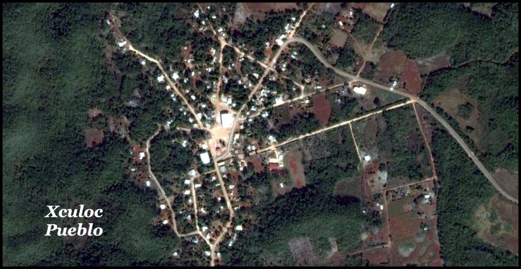
While exploring a one lane dirt road that cut off the main 1 1/2 land dirt “state highway” leading to Sayil, we came upon a Maya village that had seemed not to change since Pre-Hispanic times. A weathered, painted wood sign said it was name Xoculoc. What we found was a cluster of traditional Maya houses, most with thatched roofs, cluster around a dirt oval plaza. It looked little different than Upper Creek towns, encountered by the Hernando de Soto Expedition in 1540 AD. There were very few vehicles, either cars or donkey carts. Most people seemed to walk everywhere they went.
I was able to find Xoculoc on Google Maps. One can still make out the ancient oval plaza, but the architectural character of the village has changed radically. Almost all structures have metal roofs. A paved two lane road passes through the old plaza then connects the village to a paved two-lane state highway. A hexagonal zocalo has been constructed in the southeast section of the old oval plaza. A large, metal roofed structure, perhaps a church, has been constructed in the northern end of the old oval plaza.
Several Mennonite colonies are located in or near Xoculoc. This immigration has booted the population to about 500 persons. At most, it had about 200 people in 1970.

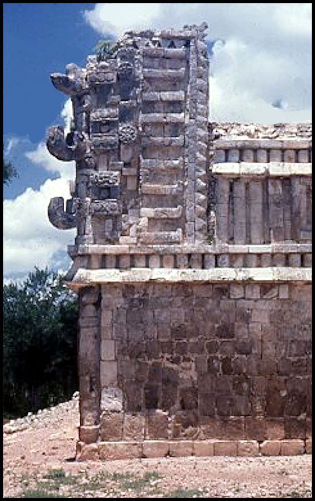
While we were in the center of the village, my guide, Ana, asked a resident if they had any Maya ruins. She said yes . . . at the north end of the village. We drove up a dirt trail and were surprised to see substantial stone ruins. One building had been expertly restored, while the other structures remained in ruins. There was no museum or even a sign, when we visited. As can be seen in the satellite image below, there is some sort of metal roofed building now in front of the ruins . . . perhaps a small museum and office. When we were there the caretaker of the site lived with his family in a traditional Maya hut, near the ruins.

In 1970, the terrain in and around the archaeological zone was very barren. This is clearly evident in the photo above. The satellite image above suggests that some trees have been planted and that there is now a more formal entrance to the site.


Xoculoc was not an exception, but rather a typical small town that just happened to be better preserved. There were stone ruins throughout Campeche. Everywhere I went in Yucatan, Campeche, Tabasco and Chipas, there was abundant evidence that mankind had been there a long, long time.

Howdy, I truely enjoy your time machine. It must have been a thrill to discover even a restored building.
On Sat, Mar 27, 2021 at 1:34 PM The Americas Revealed wrote:
> alekmountain posted: ” by Richard L. Thornton, Architect & City Planner > One Summer In Mexico ~ Part 58 It’s like being in a time machine. I am > continuing to digitize and analyze the many hundreds of color slides of > Mexico that I took during the last two weeks in Aug” >
LikeLiked by 1 person
It really is like a time machine. From age 21 until now, I never looked at these slides, because until the scanner came along, there was no way to digitize them. Another way of describing the felling is that I have been asleep for 50 years.
LikeLike
Amazing ! It must have been an awesome experience seeing pieces of history with your own eyes. In its own place, not a museum but a first hand experience.
LikeLiked by 1 person
You are exactly right. I would not know until the 21st century how much that isolated village resembled the ancestral Creek towns visited by the 16th century French and Spanish explorers.
LikeLiked by 1 person
Hi Richard I simply loved this post What a wonderful experience even though there were no Glyphs to be found. The Maya City Hall must once have been a magnificent place. Thanks for sharing your knowledge and superb photo’s Hope all is well with you. Stay safe.
LikeLiked by 1 person
My guess is that these people were not literate in the Maya writing system. there was no writing on the two stelas. One Mexican anthropologist has speculated that they were Itza Mayas from Chiapas – who did not utilize a writing system until settling at Chichen Itza and acquiring the knowledge from literate immigrants. It was the Itza who also settled in the Southeastern United States.
LikeLiked by 2 people