The origins of the Chickasaw and Creek Peoples – Part Four
by Richard Thornton, Architect and City Planner
Several tribes that joined the Creek Confederacy have names that mean such things as “Sea People” or “Water People.” Their migration legends have them crossing large bodies of water to reach the Creek Homeland, which is now the State of Georgia. Obviously, they did not cross over a land bridge from Siberia.
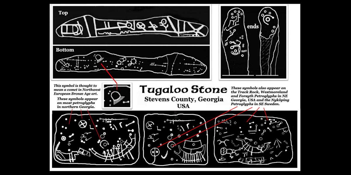
(above) Tugaloo Stone – The Tugaloo Stone is one of the most important Pre-Columbian artifacts in the Americas, but it is little known outside of Stevens County, GA, where it is on display. Most of the relatively few tourists, who have seen the Tugaloo Stone, assume it was made by the Cherokees. Ironically, it is absolute proof that explorers or traders from several parts of Europe visited the Savannah River Basin in ancient times. Four types of European Bronze Age boats are displayed on the sides of the rock.
Virtually any graduate of a high school in Sweden, Denmark or Norway would instantly recognize these symbols as belonging to the Scandinavian Bronze Age or Early Iron Age. In fact, when I first sought help in translating the Tugaloo Stone from professors at Lund University . . . where I attended classes in Medieval Swedish History, Ancient Swedish History and Historic Preservation, while working in nearby Landskrona . . . the professors angrily demanded that the engraved stone be immediately returned to Sweden, from where it was obviously stolen by a tourist or art thief! It took me several weeks to convince them that this was a artifact found in the State of Georgia, USA!
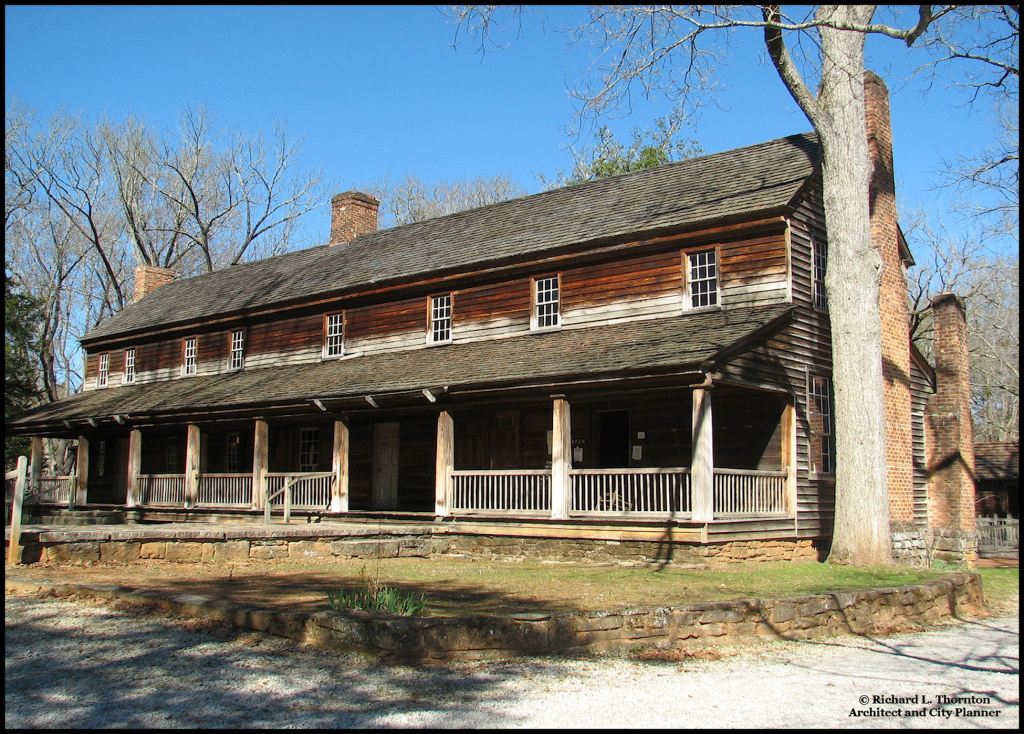
This very special legacy from the past has traditionally been thought to have been discovered on a knoll near the Tugaloo River in 1796 by a laborer or slave, working for heirs of Major Jesse Walton. Walton had been killed by hostile Cherokees in 1789 after being granted a land tract there in 1785. This was a revenge killing, because of his role in the invasion of western North Carolina in 1776. Throughout the 1800s this artifact was used as a stepping stone for mounting horses or climbing into carriages. The stone came along with the Travelers Rest Inn, when the property was donated to the State of Georgia in 1955.

In 1955 and 1956, the Tugaloo Stone was examined briefly by art history and archaeology professors from the University of Georgia . . . but like all scholars before them, they looked at it upside down. They determined that the complex symbols on all sides of the stone were “an early form of Cherokee writings.” The stone was then placed in the back yard of the Travelers Rest Inn and soon forgotten.
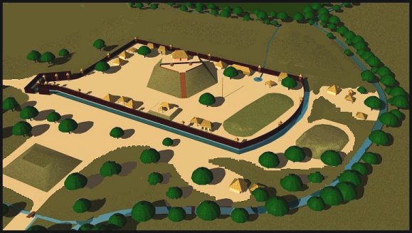
In August 1977, archaeologists Ed and Bobbie Smith obtained a charcoal rubbings from the sides of the Tugaloo Stone then Bobbie converted them into drawings, which were used to make a laminated plastic sign next to the stone. Unfortunately, they also tried to interpret it upside down, but nevertheless, did not recognize the many Scandinavian Bronze Age symbols on all sides. Seventeen years earlier, University of Georgia archaeology professor and future department director, Joseph Caldwell, found that the Native American town of Tugaloo was occupied by Creek Indians from around 200 AD until around 1700 AD. About a decade later, part of the town’s plaza was reoccupied by Uchee Indians. That area of the state was labeled “Uchee” until after the American Revolution.
Their work failed to stimulate further thought by their peers in Georgia. The only brief mention of the Tugaloo Stone published by the University of Georgia Dept. of Anthropology interprets it as being an early form of Cherokee writing. All of the state government’s literature on the nearby Native American town of Tugaloo labels it to be Georgia’s oldest Cherokee village . . . dating back to around 1400 AD.
In February 2018, I illuminated the Tugaloo stone with intense ultraviolet light then photographed all sides with a high resolution digital camera. The symbols were then enhanced with special software to the point, where I could convert them to black pixels digitally. Then I looked at the images . . . right side up. LOL
See The Tugaloo Stone . . . when Bronze Age boats came up the Savannah River – The Americas Revealed (apalacheresearch.com) for a more detailed discussion of the Tugaloo Stone!
Bilbo Mound Chronology – Savannah, GA
The Bilbo Mound, artificial harbor and man-made canal was radiocarbon dated by Louisiana archaeologist, William Haag. The mound was begun on a man-made island near the Savannah River around 3545 BC. In other words, there is no date on when the canal and island were built. The builders apparently did not make pottery. The earliest fiber-tempered pottery in that area appeared around 2400 BC. This coincides with a cold period in northern Europe, a twenty year long rain storm that virtually depopulated Ireland and the abandonment of Skara Brae in the Orkney Islands. More sophisticated pottery appeared around 1800 BC and 1500 BC.
Around 1200 BC a storm or tsunami swept through the Danish Archipelago and Jutland Peninsula. Most trees were leveled and up to a meter of muck was deposited on the landscape. Very few humans would have survived this event, unless they were in large boats. Between 1200 BC and 1150 BC, most Bronze Age societies in the Eastern Mediterranean Basis collapsed, resulting in a Dark Age of cultural and demographic decline.
Island Carib-Arawak Migration Legend
The names of the Carib, Taino, Toa, Ciboney and Guanahatabey tribes of the Caribbean Basin do not refer to water or ocean, but the approximate chronologies of their migrations provide some benchmarks for interpreting the migration of ancestors of water-based tribal names, which later joined the Creek Confederacy. Groups of Taino and Toa villages in Georgia and Alabama, did ultimately join the Creek Confederacy.
During the 1650s, surviving Caribs in the Lesser Antilles were befriended by French Huguenot pastor and natural scientist, Charles de Rochefort. At that time, all non-Taino indigenous peoples in the Caribbean Basin were called Caribs. The term Arawak was not in general use. During the same period, he befriended Richard Brigstock, a planter in Barbados, who spent almost a year in the northern part of what would become the State of Georgia. De Rochefort recorded their oral history of the Caribs and interpolated that information with information that Brigstock brought back to Barbados, before moving his family to Virginia.
Because of a French law that forbade Protestants from publishing books, Charles de Rochefort anonymously published l’Histoire Naturelle et Morale des isles Antilles de l’Amérique in 1657. The second, 1658 edition was published after he moved to Amsterdam. It included his name and ten additional chapters on what would become in 74 years, the British Province of Georgia. This second edition also includes much more information on the “Caribs.”
De Rochefort stated that the Carib (Arawak) peoples originated on the South Atlantic Coast between what is now St. Mary’s, Georgia and Charleston, SC. He associated them with the construction of shell rings and large earthworks. He said that at some time in the ancient past, most of the Caribs began migrating southward. Other bands of Caribs migrated northward and established villages in the mountains of what is now North Carolina. Some migrated as far south as Peru, before the excess populations began migrating back north again. In their return migration northward, some even reached southern Georgia.
At one time, there had been many Carib villages in what is now western North Carolina. However, when Brigstock visited that region in 1653, he found that most of the valleys were occupied by large Apalachete (Creek) towns and some Shawnee villages. There were still a few Carib villages in remote locations. Note that Richard Brigstock did not encounter any Cherokee villages. He did even hear their name mentioned!
Uchee Migration Legend
(original name used in Georgia, South Carolina and Alabama)
Alternatives = Yuchi (Tennessee), Yuchee/Euchee (Florida & Oklahoma), Ogeechee (Georgia), Ouete/Ouede (Georgia), Ogeechee (Georgia), Tohokohlogi (Iroquois) and Hogologee (Georgia)
The Uchee called themselves the Tsoyoha, which means “Sun-Children of.”
There were numerous Uchee villages to the north, west, east and south of Savannah, GA when that colony was founded in 1733. The Uchee always claimed to be the oldest indigenous people in the Southeastern North America. They found the Lower Southeast uninhabited, when they arrived at the mouth of the Savannah River after crossing the Atlantic Ocean.
However, they were not the oldest inhabitants in all of North America. The Algonquians were living to the north, when the Uchee arrived. They also stated that they could see shell rings, shell mounds, earthen mounds and earthworks, which were created in the past, but whoever built these structures no longer lived along the Atlantic Coast.
This Uchee oral tradition collaborates Charles de Rochefort’s statements. Most of the shell rings date from the period of 2400 BC to 1800 BC. Some were occupied as late as 1000 BC in Georgia and South Carolina. However, archaeologists believe that shell ring construction began as early as 3,000 BC. The earliest sites probably have been destroyed by hurricanes and rising ocean levels.
According to the Uchee Migration Legend, their ancestors became consummate traders. Their villages spread up the Edisto, Savannah, Ogeechee and Altamaha Rivers . . . ultimately establishing villages as far north as as Virginia and and as far west as the Mississippi River. However, the two major Uchee populations remained the Savannah River and Ogeechee River Basins, plus the Cumberland Plateau region of Tennessee.
Uchee etymologies

Uchee is derived from the Muskogee Creek word Ue-si, which is pronounced [Ū : ĕ : jzhē]. Ue-si means “Water-Offspring of.” Yuchi, Yuchee and Euchee are just different spellings of the word that appeared after the American Revolution.
The root word, “Ue” is interesting, because it is not used by any other indigenous people in the Americas, except the Mixtec-Soque, but is found among some of the original peoples, who occupied Europe. On the other hand, “oka” the word for water in Itsate Creek, Apalachicola Creek, Chickasaw, Choctaw and Alabama IS similar to the word for water in several South American languages.
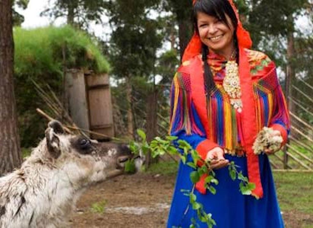
“Ue” was the word for water by a Eurasian, pre-Indo-European people, who first occupied the Balkans. Some became the “Sea Peoples,” who ravaged several Bronze Age civilizations in the 12th century BC. Others migrated northward to Scandinavia and up the North Sea coast of Norway, where they mixed with the Sami. This is the reason that the Sami Tribes in northwestern and northern Scandinavia have black hair and tan skins, even though they live north of the Arctic Circle.
Some remained isolated in the mountains of Illyria, which now called Albania. The Albanian word for water is uje, pronounced [ū : ŷē]. Some settled in the high mountains between Austria and Switzerland, where today the word for water is aua. Many settled in western France and Ireland, where the word for water, respectively, is eau and uisce. The archaic word for water among the Sami and Finns was Uissi (pronounced very close to Uchee) but is now vissi.
Ue-te: This was a Uchee tribe that was located on Tybee Island and near Savannah, GA. Their name mixes the Muskogee word for water and the Itza Maya word for people. They had scattered villages along the Ogeechee River and a large capital town near the headwaters of the Ogeechee River in Talliaferro County, GA, named Kofa. Kofa was visited by the Hernando de Soto Expedition and means “mixed (people). Their elite were originally Itza Mayas. Tybee is derived from the Itza Maya and Itsate Creek word for salt, taube. Their name means “Water-People” with the “te” being the Itza Maya suffix for people or tribe.
Ogeechee: The Ogeechee occupied a province at the mouth of the Ogeechee River, plus had scattered villages up the Ogeechee River. Ogeechee is the Anglicization of Oka-si, which is an Itsate Creek word meaning “Water-People.” The Native American ethnic name is pronounced pronounced [Ō : kä : jzhē].
Oconee or Oka-te Migration Legend
This was originally a very large branch of the Proto-Creek Apalache Confederacy, but was devastated by slave raids and European diseases in the late 1600s and early 1700s. The slave raids , which were encouraged by colonial officials in Virginia, North Carolina and South Carolina, were carried out by the Rickohockens from their base near, Bedford, Virginia until 1680 . . . then by Rickohokens based where Augusta, Georgia is today then Cherokees, based in northeastern Tennessee. Colonial officials issued 14 brands to the Cherokees to mark human captives . . . one for each tribal member of the Cherokee Alliance. Most of the surviving Oconee either moved to Florida and later became Seminoles or relocated to the Chattahoochee River.
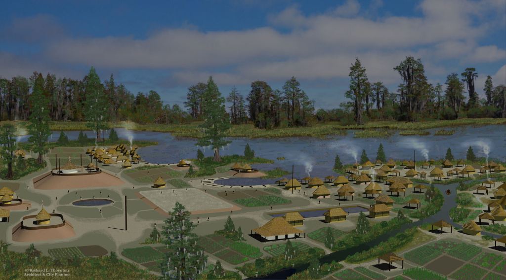
The Oconee began as a cluster of villages along the edge and on the islands of Lake Serape, which is now the Okefenokee Swamp. Archaeologists with the US Fish and Wildlife Service have identified at least 74 mounds around and in the Okefenokee. Most date from the Woodland Period (1000 BC – 900 AD). Serape is a Panoan adjective and noun from Peru, which means river/lake bank crumbling into the water.
These villages were occupied by several distinct ethnic groups who had crossed the ocean to reach southern Georgia. The Uchee claimed to have crossed the Atlantic. The Panoans and Arawaks crossed the Caribbean Sea after walking from Peru. As their population swelled, new villages and clusters of farmsteads were created farther and farther due north. The Oconee next became concentrated around the confluence of the Oconee and Ocmulgee Rivers. Most of the Oconee lived on dispersed farmsteads that utilized slash and burn agriculture. New fields would be cleared as the soil wore out in older fields.
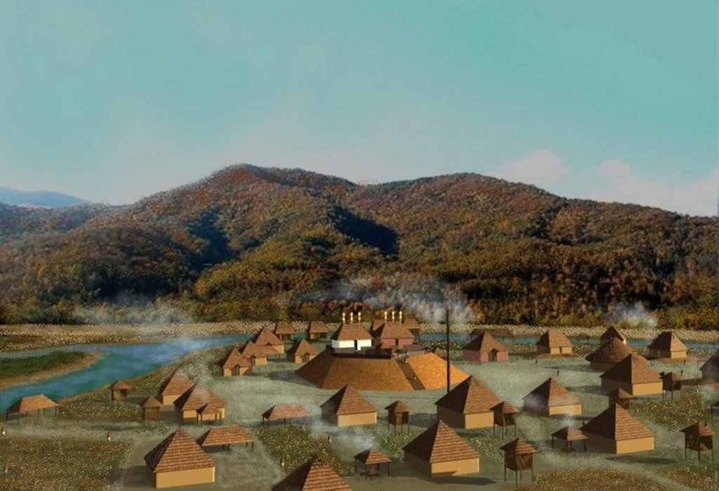
Around 1000 AD Itza Mayas established colonies on a horseshoe bend in Ocmulgee River (Lamar Mounds), on a horseshoe bend in Etowah River (Etowah Mounds) plus along the Oconee River near Sparta and Greenville, GA . They apparently invited Oconee to settle farmsteads in their colony. At this point, the Oconee began also calling themselves the Oka-te, which has an Itza Maya suffix and means, “Water People.”
The Itza-Panoan elite lived in villages that covered 3-5 acres and usually contained several mounds. During the period from around 900 AD to 1250 AD, the Uchee commoners lived in dispersed farmsteads. Later when the elite villages were fortified, the commoners knew that they could flee to the heavily fortified provincial capitals in times of emergency. This approach to land use seemed to have worked well as long as most of what is now Georgia and eastern Tennessee and western North Carolina were relatively peaceful, except for squabbles between single towns or clans. However, this system did not work when an enemy was numerous and had no intention of moving on. Again in the late 1600s and early 1700s, everything fell apart quickly when slave raiders, armed with muskets, appeared on the scene.

The Okate continued northward from the headwaters of the Oconee River near Gainesville, GA and established a trading colony on the Oconaluftee River in the Great Smoky Mountains of North Carolina. The location is now on the reservation of the Eastern Band of Cherokee Indians. Oconaluftee is an Anglicized Creek word which means, “Oconee People Massacred.” The Museum of the Cherokees on the reservation now claims in it brochure and exhibits to have lived at the site of their reservation for 12,000 years. Given that all rivers on the reservation have Creek names. That is impossible.
The Itsate-speaking elite of the Okate built a large town in what is now the Birdtown section of the Cherokee reservation with a principal mound identical to the one at Shoulderbone. Despite being the largest mound in North Carolina, this site was never studied by archaeologists before being leveled to build a sewage treatment plant in the late 1980s.
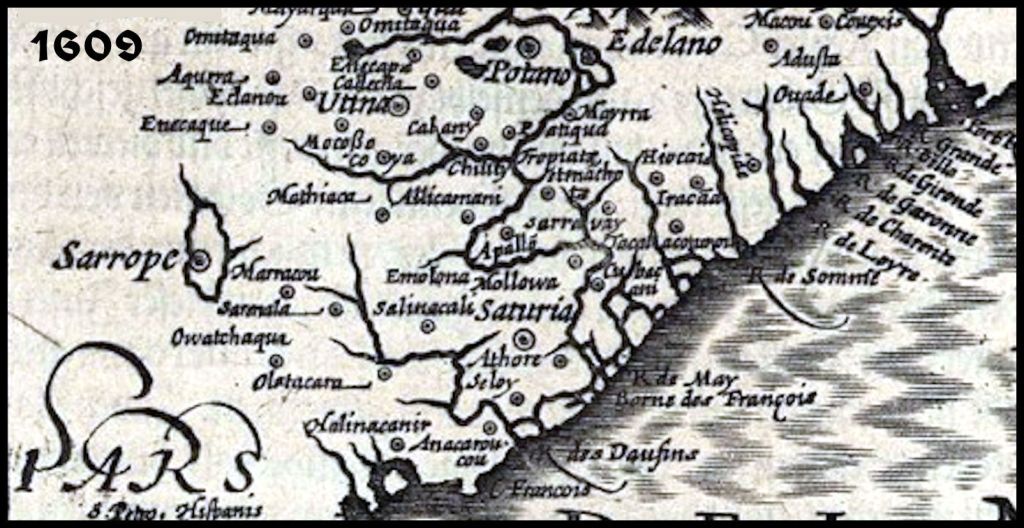
Around 1000 AD another large Muskogean town was begun on the Tuckasegee River, near its confluence with the Oconaluftee. It also has received very little attention from the archaeological profession, but was saved from development by being purchased by the Eastern Band of Cherokees . . . who declared it to be the site of the first Cherokee town, Kituwa. Late 17th century French maps show Kituwa to be located on the Holston River in northeastern Tennessee.
Kituwa is actually an Alabama Indian word, meaning “where sacred fire is kindled.” The root verb, kita, means “to ignite a fire” and has the same Indo-European origin and meaning as the Proto-Norse word, kynda.
The Uchee Commoners, who accompanied the Okate elite to the Great Smoky Mountains constructed at least one round, palisaded town upstream from the elite village. It was located where the new Cherokee High School was constructed. There are probably several more under the soil of the Oconaluftee River flood plain or under the waters of nearby Fontana Lake.
Uchee villages are easier to discern, because they have a round palisade, round council house, round houses and a round plaza defined by roofed sheds. French maps, until after 1707, only showed western North Carolina occupied by Creek and Shawnee villages. Cherokee villages never had formal layouts or timber palisades. Nevertheless, ECBI press releases and a model of the Cherokee High School village at the Museum of the Cherokee, describe the unearthed archaeological site as being the oldest known, definite Cherokee village. Architects designed the site plan of the new school to resemble the circle of sheds that typify Uchee communities even today. Of course, Oconaluftee does mean, “Oconees massacred.”

While carrying out an archaeological survey of northern Georgia in 1939, archaeologist Robert Wauchope noticed that there was a period of time corresponding to the second occupation of Etowah Mounds in which the population of the Lower Southeast seemed to drop starkly. There were numerous, ancient towns and villages that were occupied before or after this “Middle Mississippian” Period. He did not understand their temporary abandonment.
In the 1960s, archaeologists Arthur Kelly, Lewis Larson and Joseph Caldwell obtained radiocarbon dates for Etowah Mounds and several other town sites in northern Georgia that were unoccupied during Etowah’s second occupation (1250 AD-1375 AD). They noted that particularly in the Northeast and North-Central Georgia Mountains, many towns and villages were either unoccupied or drastically reduced in size.
During this period, many Okate elite villages were fortified. This suggests that the cause of the population decline outside the Etowah River Valley was related to large scale warfare. The aggressor of this warfare may have been the founders of Etowah’s second occupation, but this is not known for certain.
Conversely, the King of Apalache told Richard Brigstock that there were large bands of migratory, predatory peoples entering the lower Southeast from the west during this era. They were like swarms of locusts that devoured all the resources of provinces they entered . . . even eating the local people, they could catch. [See The Apalache Chronicles by Marilyn Rae & Richard Thornton.]
Etymology
Okate means “Water People” in the Itsate Creek language. It is pronounced [Ō : käw : tē].
Oconee is the Anglicization of the hybrid Itsate Creek/Southern Arawak word Oka-ani, which means Water Elite (people).

Migrations of the Wateree People
Watar-re was their name in their language. The Spanish called them, the Guatari. The Catawba called them Yi-Watari. The Cherokees could not pronounce an R sound and so called them Wataw-gi, which was Anglicized by early settlers in NE Tennessee to Watauga. It is interesting that the Catawba verb meaning “to float on water” (as a boat or canoe) is wataren. That is powerful evidence that the root word of Wateree means exactly what is says. The suffix “re” meant kingdom or nation on both sides of the Atlantic. The Spanish word for king, rey, is derived from it. Many old tribal place names in Ireland end with “ry” which is pronounced the same as “re.”
The Wataree at the time of Columbus’s voyages was a very large tribe that occupied most of northwestern North Carolina. In the 1500s they were repeatedly exposed to European pathogens, despite being originally located over 200 miles from the Atlantic Coast. Both the Hernando De Soto Expedition in 1540 and the Juan Pardo Expedition in 1567 went through the heart of their territory. In the late 1500s, hundreds of Iberian or Spanish Sephardic gem miners flocked to the Toe River Valley, which most of the Northwest North Carolina Mountains. The Wateree-Catawba River Valley became an “underground railroad” of sorts, for Sephardic refugees to reach the west side of the Appalachians via the Little Tennessee or French Broad Rivers. These European refugees brought their pathogens with them.
Beginning around 1645, the Rickohockens began raiding the mountains to the south to obtain slaves for Virginia tobacco plantations. Some Wateree moved westward into the Watauga River Valley of Tennessee. Some moved southward to the Franklin, NC area or NE Georgia. Others moved southeastward down the Catawba River into South Carolina.
The Waterees participated on the Yamasee side in the Yamasee war of 1717. They lost many warriors in battle and even more non-combatants, who were sold in slavery. There was a Wateree Resettlement among the Catawbas. Those moving east, eventually became Lumbees. Those moving west became associated with the Cherokee Alliance. Those moving south eventually joined the Creek Confederacy in Georgia or the emerging Seminole Confederacy in Florida. After 1720, the Waterees in South Carolina consisted of scattered clusters of families in South Carolina and Georgia, who soon lost knowledge of their own ethnic identity.
Etymology
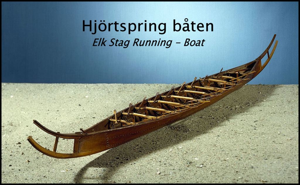
Wateree is the modern Anglicization of Watar-re, which means “Water Kingdom, Nation or Tribe.” Watar meant “water” in the Archaic West German language of southern Denmark, Schleswig, Friesland and the Netherlands. This is where the Angles, Saxons and Friesians originated. The tribes of the North Sea coast of Europe built sailing vessels quite similar to the Viking Longboat and were skilled mariners. The Wateree probably began as a small flotilla, occupied mostly by men, who would marry Indigenous American women, once they settled in the New World.

WOW ! Thank you for this outstanding post Richard. Your explanation about the tribes and their language is excellent . If I wasn’t so busy studying the Minoan language I think I would be interested in learning some of the Native American language’s or at least some of their sayings.
LikeLiked by 1 person
There is a Minoan Bronze Age ship engraved on the Tugaloo Stone!
LikeLiked by 2 people
Well I missed that I will go back and take another look. Thanks Richard.
LikeLiked by 1 person
Hi Richard, Just checked the image of the boat on the Tugaloo Stone. I can’t understand what the Minoans were doing in Georgia USA but I intend to do some more research . If I find anything I will let you know but it may take some time.because I have only just started to learn Linear A which is the Minoans Linear A has not yet been deciphered which makes it harder to understand. .This will give me more insentive for my research.
LikeLiked by 1 person
The reason? Northeast Georgia contains the purest gold in the world. There are also many types of gems – including diamonds and rubies. When Europeans first began exploring here in the 1500s, the gold and copper nuggets, plus the gems, could be found on the surface.
LikeLiked by 1 person
Yes I discovered that today as well as some other information which you may have already discovered yourself, but I need to do more research to see if I can find any Minoan Linear A tablets which refer to the Minoans in America. But Hieroglyphs were used before Linear A so I will look for those too. It’s a long shot but you never know..
LikeLiked by 1 person
These could have been Minoans based in Iberia or just plain lost . . . not knowing how to get back to the Pillars of Hercules.
LikeLiked by 2 people