SLIDE SHOW
In 2003, the Economic Development Director of a rural Georgia county asked me as an after thought, if I could use the architectural software that was utilized in the preparation of drawings for a small history and archaeology museum to show visitors what a nearby Native American mound complex looked like. I said yes, but eventually realized that architectural software then produced in the United States was incapable of rendering pre-Industrial Era building materials. I had to find a software made for European architects, who regularly work with very old buildings.
By late 2004, I was apparently one of two architects in the world, who was utilizing the new CADD and Virtual Reality software to portray ancient archaeological sites. The Architecture Channel in the UK actually broadcasted a program on our work and posted our now crude looking drawings on its website. Now such things are common place, but mine have a special “look” because of my love of Nature.
by Richard L. Thornton, Architect & City Planner

2023 – Mount Yonah and the Chattahoochee River – BricsCAD & Artlantis rendering
When moving to Northern Virginia in 1987, I decided that it was time for me to switch to computer drafting. At that time, perhaps 95% of Architects, Civil Engineers and Surveyors in the United States were still producing drawings by hand. I bought a state-of-the-art Leading Edge computer with a whopping 30 MB hard drive, but no mouse. Microsoft soon made a mouse that was compatible with Leading Edge and Windows 1 operating software.
After sending in by snail mail the warranty information for the mouse (there was no internet) I received a telephone call from a Microsoft administrator. Microsoft was developing the Visio graphics software into architectural computer drafting software. If I agreed to be a Beta tester, I would get free software and technical help.
I said yes, but told them that I could not afford the $12,000 being asked for plotting machines. No problem – Microsoft knew somebody that was building plotters in their basement, which didn’t look fancy, but worked well – for a little over $200. Note – CADD means Computer-Aided Design and Drafting.
I continued to use experimental Microsoft VisioCAD software throughout my time in Virginia then a monopoly suit by AutoCAD and US Justice Department forced Microsoft to divest its CADD software. I was forced to buy an early version of AutoCAD in 1996 for the restoration of the Roselawn Estate in Cartersville, GA, but is was much slower than VisioCAD and not compatible with my plotter. I had to pay reprographic shops in Atlanta to plot out the drawings.
Eventually, the IntelliCAD consortium formed to develop VisioCAD into a commercial software. All of my drawings for the (now famous) downtown revitalization programs of Smyrna and Kennesaw, GA were done with IntelliCAD, but its three dimensional and color-rendering capabilities were primitive by today’s standards.

My first (very crude) three-dimensional IntelliCAD rendering in 1998. It portrayed a planned historic district in Downtown Kennesaw, GA with landscape and urban design improvements. The project was developed and looks spectacular now.

For the next five years, I produced a series of three dimensional CADD drawings for the City of Smyrna’s Revitalization. IntelliCAD was steadily improved, but the computer-generated drawings still look crude by today’s standards. Nevertheless, one year Smyrna was named the outstanding downtown revitalization program in the nation by the Urban Land Institute!
In 2003, the Economic Development Director of Hancock County, GA asked me if it was possible to apply my CADD software to preparing a 3D drawing of Shoulderbone Mounds in their county to put on exhibit in the planned museum. I said yes. The County Commissioners approved the contract and then I discovered that it was impossible to portray Pre-Columbian earthworks with IntelliCAD.
I panicked and began searching the new internet to find some sort of architectural software that could portray pre-industrial building materials and buildings that were not rectangular blocks. A company in Montreal was offering an IntelliCAD-compatible CADD package for historic preservation architects, composed of two new startup companies in Europe . . . BricsCAD in Ghent, Belgium and Artlantis in Paris, France. Artlantis contained a vast array of building materials that were used in ancient times and the Middle Ages. I bought the package and the rest is history. Since then, I have produced several thousand 3D computer models of individuals structures and entire towns.

My first BricsCAD-Artlantis rendering in 2003 – still crude, but better!
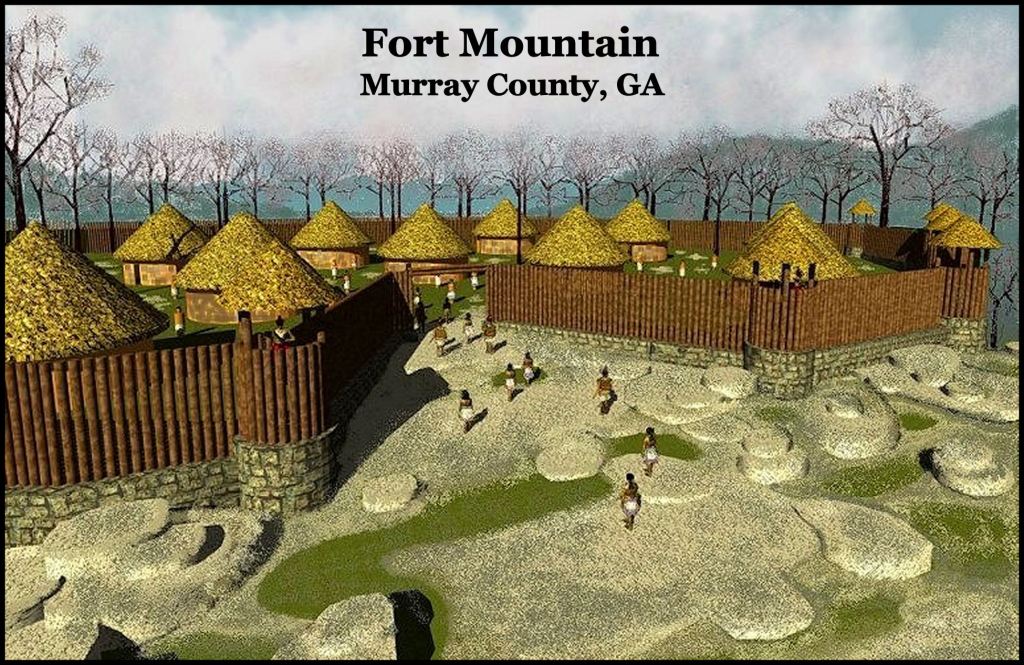
2004 – Fort Mountain – Murray County, GA

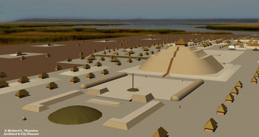
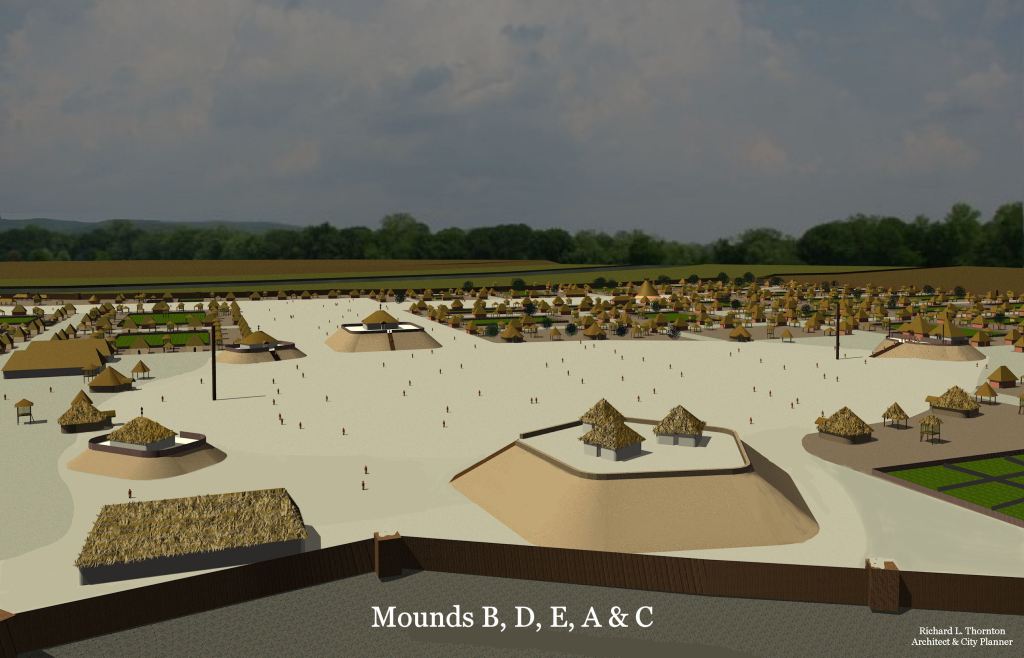
2004 – Ocmulgee in 1150 AD – for book

2004 – Ocmulgee Rotunda – for book
In the summer of 2006, the US Army Corps of Engineers drained the Lower Reservoir of Carters Lake sufficiently to reveal the ruins of the Capital of Kaushe (Coosa) where the De Soto Expedition stayed for several weeks. The Muscogee-Creek Nation contracted with me to first review all available archaeological reports then on the day when the water level was the lowest, paddle my canoe to the ruins of Caushe to determine its town plan and architectural footprints. I used a hand-held GPS device to align the ruins and footprints to a digital topographic map, provided to me by the US Army Corps of Engineers.

In 2007, Judge Patrick Moore of the Muscogee-Creek Nation read an article about archaeological discoveries next to Lake Okeechobee, which seemed to prove that Mayas from Yucatan had settled there and mixed with Muskogeans, to become some of the ancestors of the Creek Indians. He asked me to study these sites. I produced a series of 3D site plans and architectural renderings.
2007 – For the American Museum of Natural History – New York City
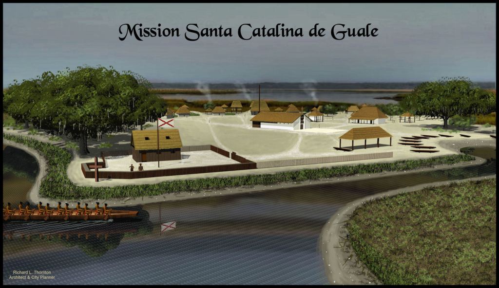
2008 – St. Catherines Island, GA – for Fernbank Museum in Atlanta
2008 – Rendering of the Tabasco city of La Venta for professional article

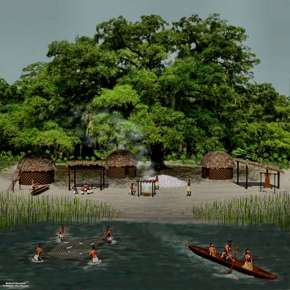
2008 – Chontal Maya town on an island in the Tabasco Coastal Marshes, Mexico.
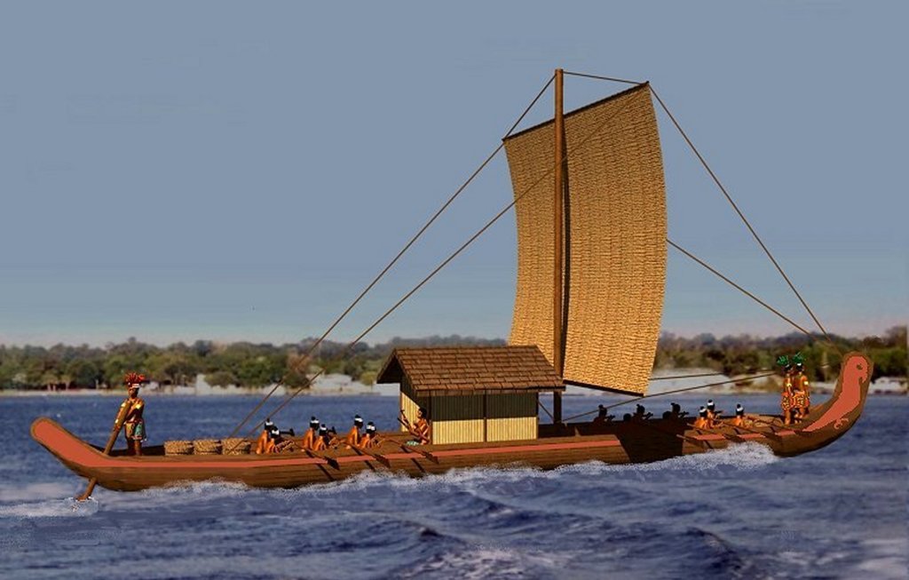
2008 – Rendering of a Chontal Maya seacraft for a professional article

Computer rendering of Tali on the Tellico River in Tennessee for a 2008 Christmas Card.

2009 – Trail of Tears Monument for Oklahoma Centennial Commission

2010 – Edzna, Campeche, Mexico – Birthday gift to Ana Rojas, marking the the 40th anniversary of our unforgettable romance in the jungles of Campeche. We never forgot each other. I set up my computer in the office of an abandoned chicken house, near Track Rock Gap to create this gift. I had no clue that in 2011, I would stumble upon the ruins of the Track Rock Terrace Complex nearby.
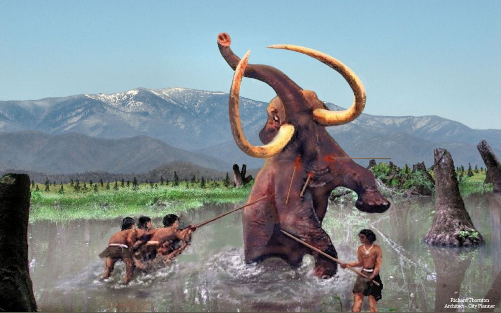
2011 – Ice Age in Cohutta Mountains, Georgia

2011 – Devil’s Backbone – Charlestown, Indiana for Jon Haskell, videographer

2012 – Birdseye view of Track Rock ruins, used by History Channel

2013 – Fort Caroline on the Altamaha River in Georgia – for book

2014 – Fort Saint George, Maine – for book

2014 – Track Rock Terrace Complex

2014 – St. Croix, Maine – for book
2015 – Fort built by Captain Juan Pardo
2016 – Roods Creek on the Lower Chattahoochee River

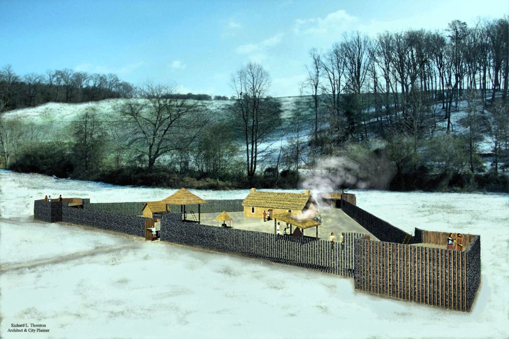
2017 -Singer Moye Archaeological Site in SW Georgia
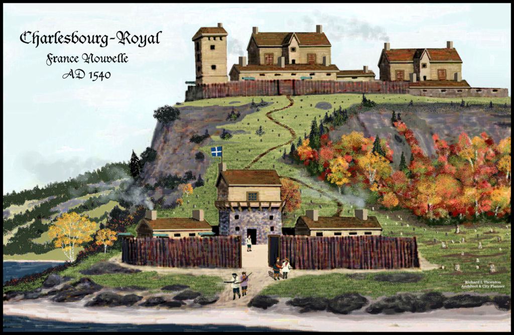
2017 – Charlesbourg, Quebec for Canadian History textbook

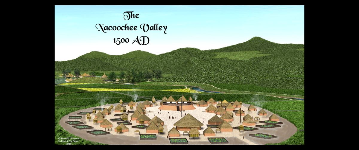
2017 – Nacoochee Mound for book
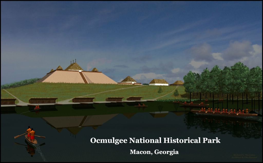
2018 – Ocmulgee for American History textbook

2021
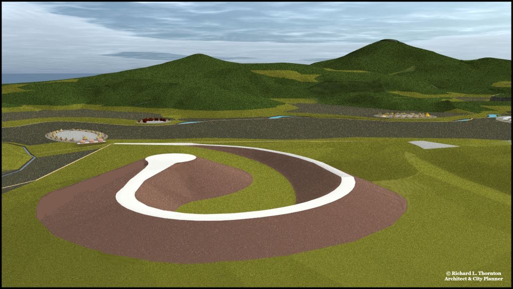
2022 – Nacoochee Valley Sky Serpent
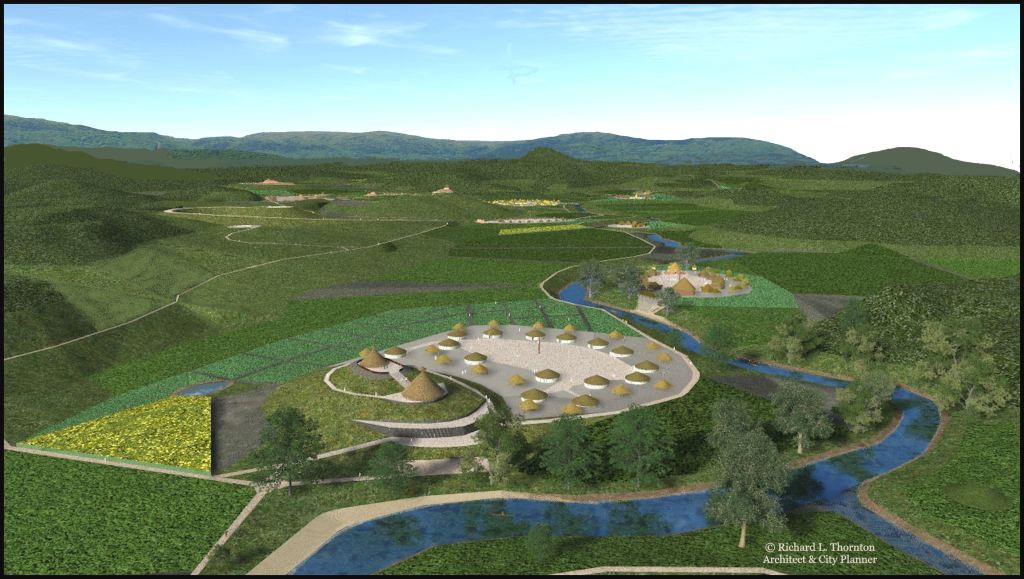
2023 – Temple of Amana and Elite Village of Hontaoase

Kenimer Pyramid and the provincial capital of Itstate

Have you taken advantage of LiDar imaging?
LikeLiked by 1 person
Yes, I am using LIDAR throughout the computer model of the 12 mile long Chattahoochee Headwaters Basin.
LikeLike