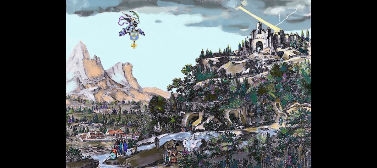
Well, actually the scene is in the Alpine Village’s northern suburb of Robertstown . . . as it looked in 1653 AD. The somewhat exaggerated peak in the background is Brasstown Bald . . . which the Apalachete called Notele. That’s how the Nottely River got its name.
Helen was the location of the ancient town of Cho’ite, named after the Cho’ite people, who immigrated there from Tabasco, Mexico. The oldest mounds dated from 1000 BC or earlier. Beginning in 1566, the government of Apalache allowed immigrants . . . both Indigenous Americans and from across the Atlantic Ocean, to make a home in Cho’ite. After Jamestown was settled, an increasing flow of Virginia Natives, escaped bond servants and African slaves arrived there. Located just south of a key juncture of continental trade routes, it was the logical site for a fortified Spanish trading post and mission.
by Richard L. Thornton, Architect & City Planner
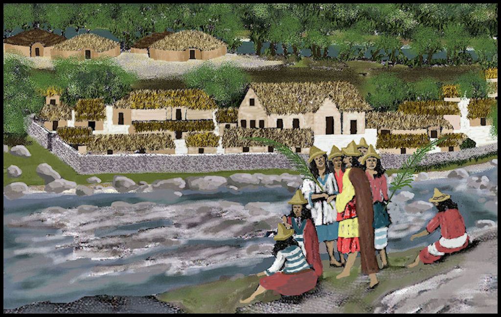
Detail of the lithograph, showing the fortified compound, built by the Spanish in 1646.
A decade ago, linguist Marilyn Rae sent me this 17th century lithograph from the Carter Brown Library at Brown University by email and asked if it portrayed the Track Rock Terrace Complex. After translating and reading the book, it was in, we speculated that the scene was at the Little Mulberry River Park in Gwinnett County, a northeastern suburb of Atlanta. The park contains ancient agricultural terraces and the foundations of 17th century European houses, plus some large, steep hills . . . but it is not set at the foot of tall mountains.
After moving to the Nacoochee Valley, I decided that the Spanish fort was somewhere near Sautee, GA in the main part of the valley. However, the landscape there does not quite match either. There are ancient volcanoes on each side of the valley, but the Chattahoochee River there is not a fast moving mountain stream with boulders in it.
In a previous article, I told you that I had found a book written by a traveler from Washington, DC in 1845, who described seeing the ruins of a fort a few miles north of the main valley in Robertstown. A near-visible infrared scan did identify the location of the fort’s blockhouse on a natural terrace overlooking the Chattahoochee River in Robertstown. It is at the termination point of a road, built by the Spanish in 1646 to connect St. Augustine with the headwaters of the Chattahoochee River.
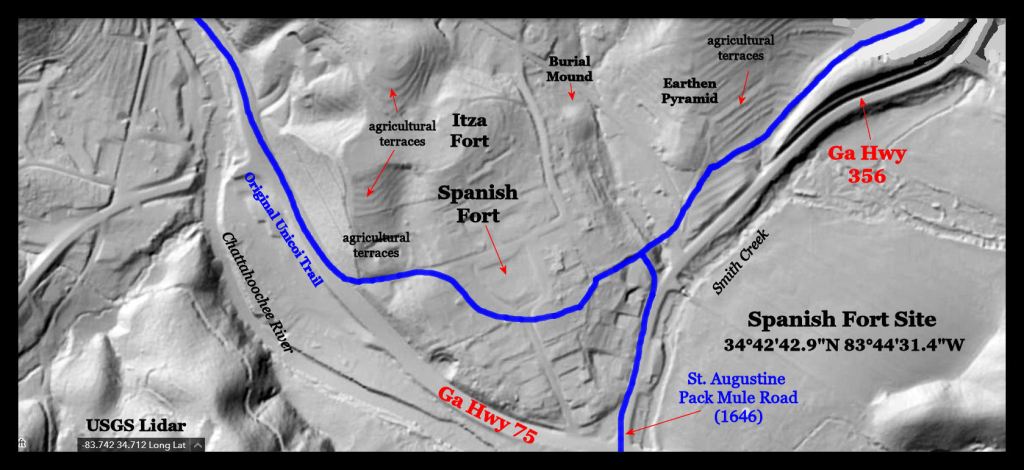

I have maps going back to 1886, showing no structures on this site until the late 20th century, when two shed structures were built near the parking. The site was pastureland, when graded to make an elementary school playground in the 1930s. It has been used as a playground every since.
The archaeological zone is surrounded by tall mountains that have the same feeling as the 17th century lithographs . . . minus the Alps-like shape of the mountains in this fanciful image. At this location, the Chattahoochee is a fast running creek with boulders in it.
To the northwest are the lower slopes of Brasstown Bald, Georgia’s tallest mountain, which the Apalachete (Creek Indians) called Notale. The people climbed the mountain in the early autumn to give prayers to the Painted Buntings (birds) who lived near the top of the mountain, for them to take to the Sun Goddess, who lived at Teotihuacan in Mexico.
I am currently working on the Virtual Reality computer model of the fort. It should be ready for publishing in the first week of December 2023.
Now you know, what I am up to these days!
