Since radiocarbon dating became widely available in the 1960s, archaeologists have noted three periods of cultural collapse at many locations in North America and Mexico, but until recently, when geologists became much more involved with archaeological sites, there were few attempts “to connect the dots on the map.”
The Secret Native American History of the Southeastern United States – Part 10
by Richard L. Thornton, Architect & City Planner
When writing reports in The Americas Revealed, I try not to pretend that I have the ultimate knowledge on any subject other that the recipe for perfect Brunswick Stew. The reason is that virtually all the knowledge that I pass onto readers is accumulative. It has arrived in bits and pieces over my entire professional career. I was only able to apply deductive reasoning to this particular riddle, after a whole lot of bits and pieces had accumulated. That was the reason that I named my 300-page biographical design portfolio . . . Lessons Learned.
The following lessons were how I learned about the Little Ice Ages.

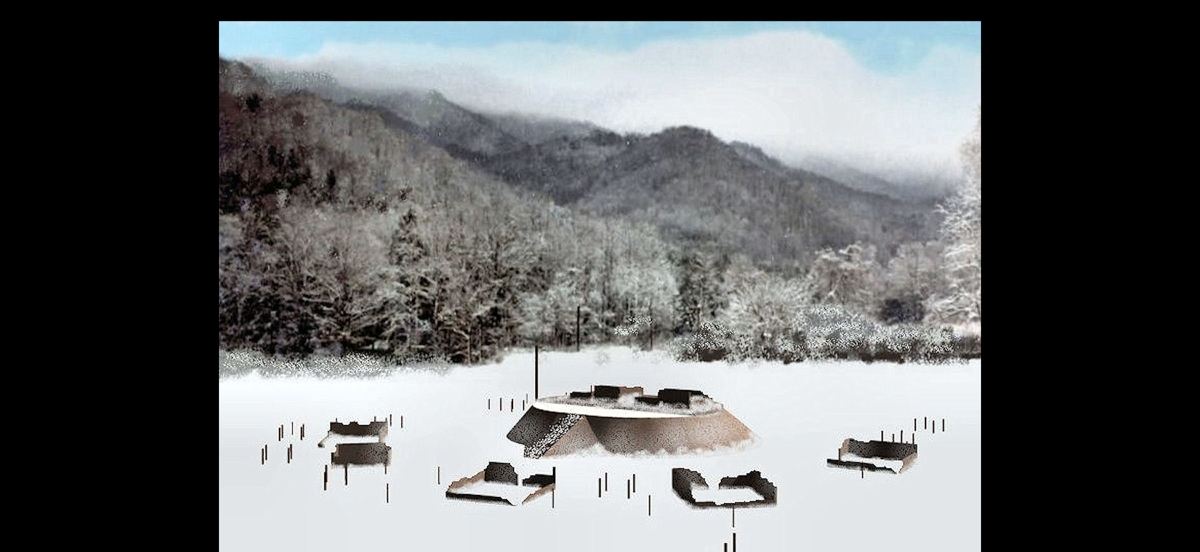
The Great Spiral Mound at Itzasi (Lamar Village) c. 1935
Winter 1970 – Our textbook for an introductory course in Anthropology, taught by Dr. Lewis Larson, was appropriately, Introduction to American Anthropology by Gordon P. Wiley (1966). Like me, Dr. Wiley’s first exposure to field archaeology was under the mentorship of Dr. Arthur Kelly. After getting his B.S. in Anthropology in Arizona, Wiley worked at Ocmulgee Mounds in Macon, GA during 1936 through 1939.
Even as a graduate student, Willey was the first archaeologist to link Georgia’s ceramics with tree ring and climatic analysis . . . did much of the excavation of the Lamar Mound, Great Spiral Mound and Swift Creek Village at Ocmulgee . . . plus, played a key role in the identification and dating of the Swift Creek and Napier Cultures in Georgia that built large villages and mounds during the Woodland Period. He went on to excavate many sites around the Americas and become Dean of the Department of Anthropology at Harvard University.
Willey’s book noted that both the Swift Creek Culture and the Hopewell Culture in the Midwest “disappeared” during the 500s AD. He suspected that climatic conditions caused the cultural collapse because tree rings in Georgia showed short growing seasons in that period. In a separate report in 1939, Willey had noted that construction of the Lamar Mound had ceased in the 1600s during a period of short growing seasons, lasting over a century.
In class, Dr. Larson told us that since Willey left Georgia, it was now known that the Swift Creek Culture continued, north of the Fall Line after 550 AD, but with diminished populations. Swift Creek towns and villages had been discovered in highlands of northern Georgia, where the distinctive style of pottery was still being made up to around 750 AD in NW Georgia and up to around 1000 AD in Towns and Rabun Counties in extreme NE Georgia. Remember the words “Towns County.”

July 1970 – After climbing to the top of Cerro Gordo, a 10,000 feet tall mountain overlooking Teotihuacan, I excitedly called Dr. Román Piña Chan at the Museo Nacional de Anthropologia. I had seen and photographed ancient stone ruins on TOP of Cerro Gordo, plus a stone-lined aqueduct leading from a now-dry ancient reservoir on top, down to the Pyramid of the Moon. Cerro Gordo was an extinct volcano, so perhaps the reservoir was actually the lake that one sees in many dormant and extinct volcanoes.
After my color slides had been developed, Dr. Piña Chan set up a catered lunch in his office for him, some staff members and his graduate assistants, so I could show them my slides. He was shocked . . . well, actually embarrassed, that a Gringo architecture student had discovered an ancient acropolis, which had literally flown under the radar of Mexican archaeologists. Apparently, no Mexican archeologist had ever thought of climbing up through the stone-walled agricultural terraces on Cerro Gordo to the top.
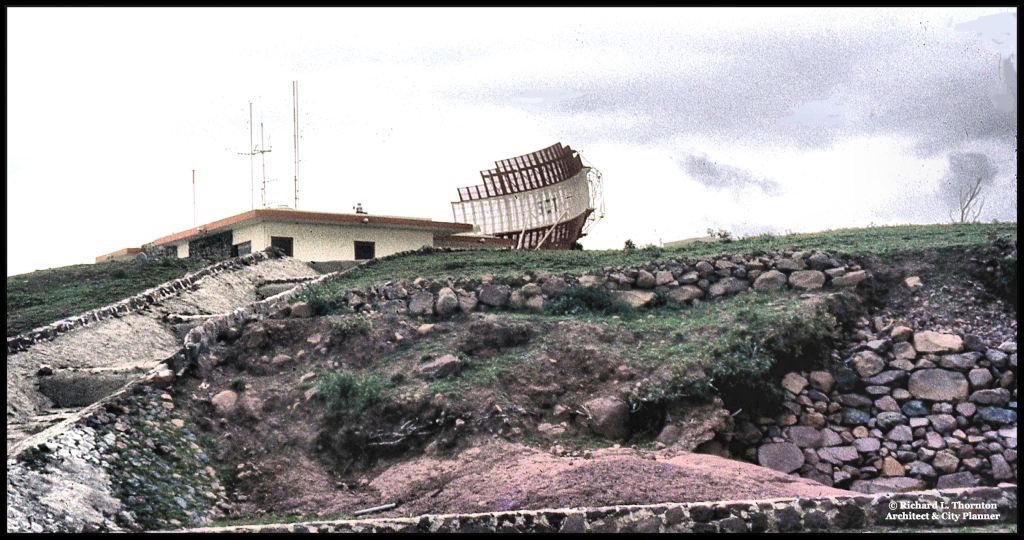
July 1970 – The Mexico City Air Traffic Control Radar Center was literally built on top of an ancient acropolis, older than Teotihuacan, without the knowledge of the Institutio Nacional de Arqueologia E Historia.
Dr. Piña Chan had no explanation for the previously unknown stone ruins. I did write in my daily journal this information: “Teotihuacan had suddenly stagnated around 550 AD. Around 600 AD, all of the public buildings were burned. A continually declining population of commoners did live in Teotihuacan until around 750 AD.” Note that the dates are the same as the Swift Creek Culture in NW Georgia.

August 1970 – Archaeologists at Edzna, Campeche told Ana Rojas and I that about half of the population of central and northern Campeche had departed around 550 AD. There was no evidence of mass deaths or warfare during that period. No area of Mexico or Central America showed any evidence of a sudden influx of Campeche Mayas.
1976 – At this time, the Muskogee-Creek Nation in Oklahoma did not exist, but the Georgia General Assembly had passed an act in 1972, which recognized the Creeks as still living in Georgia, and eligible for state recognized reservations. I was working with some friends in President Carter’s staff to create a Creek reservation on land owned by the state, which was next to Ocmulgee National Monument . . . in the future to become the National Capital of the Creek People. The 220-acre tract had originally been part of the Monument, but had been given back to Macon by the National Park Service.
In parallel, we hoped to create a large Creek reservation around Carters Lake in NW Georgia at which large numbers of Creeks in the Southeast and Oklahoma could move to. The land was owned by the Federal government and not being used for anything, but parking for fishermen. In late 1977, I was hired by the City of Asheville to plan its Downtown. Don’t know what happened to the Creek Reservation project after then.

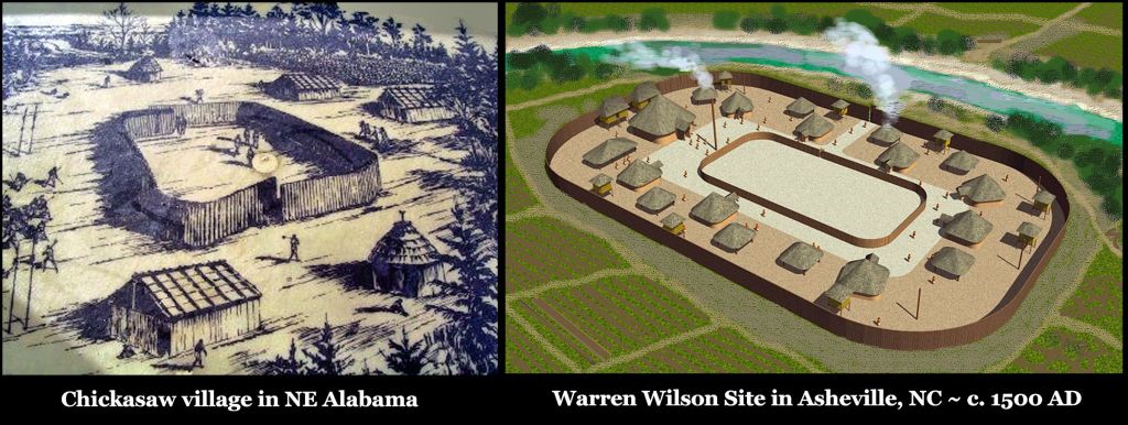
Model of Itzasi (Lamar Village) after the Great Flood – built for the Muscogee-Creek Nation.
A ranger at Ocmulgee National Monument gave me an archaeological report from 1974. National Park Service archaeologists had continued digging at the Lamar Village, where Arthur Kelly and Gordon Willey had stopped. They discovered that the town of Itzasi had actually be founded around 990 AD and that there was a Swift Creek village underneath the Proto-Creek artifacts. The same people, who founded Itzasi, founded Etula (Etowah) a couple of years later. Both town names are Itza Maya.
Around 1200 AD, a catastrophic flood had swept across Itzasi, turning it into an island and covering it with three feet of alluvial muck. The town had been rebuilt and thrived until the 1600s, when “something” had caused its population to dwindle into a small village by the early 1700s.
Asheville, NC – Spring 1982 – Two archaeologists, employed by the State of North Carolina, came by my office in Asheville City Hall, prior to our meeting with some university professors, led by Dr. Charles Hudson of UGA. The profs were claiming that De Soto came through Asheville in the spring of 1540.
The archaeologists told me that it was impossible. All of the “Mississippian” towns in the Lower French Broad River Valley were abandoned around 1500 AD. There was no evidence of agriculture until the Shawnee established a town at Biltmore Village around 1600 AD. They thought perhaps that a drought or cold weather was the cause of the depopulation.
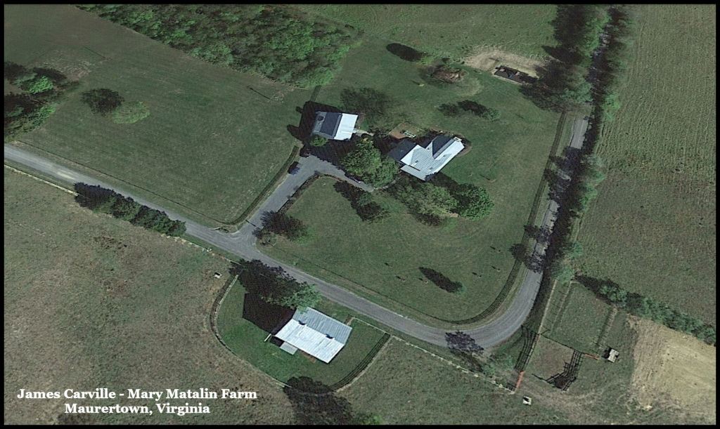
Fall 1988 – While taking measurements of the 1790s house, just purchased by Jay Monahan and his wife, Katie Couric, I found potsherds and stone tools in the garden soil that seemed to belong in Mesoamerica or northern South America. The Department of Anthropology at the University of Virginia refused to look at them. The same thing happened again in 1993, when a contractor working at the house nearby that I designed for James Carville and Mary Matalin, dug up several stone metates, tortilla grills, painted pottery and stone-lined sarcophagi.
(Foreground) - Location of the Hopewell Village along Toms Brook
Spring 1989 – One of the National Park Service archaeologists, working at our Shenandoah Valley farm, rang the doorbell excitedly. They had unearthed both an Adena Village and a Hopewell Culture village. What they thought was a Confederate artillery redan had actually been an Adena burial mound. He was surprised that the radiocarbon date on the Hopewell Village was about 650-700 AD . . . over a century after Hopewell sites were abandoned in Ohio.
Summer 1992 – While working on the restoration of a late 18th-early 19th farm on a horseshoe bend in the Seven Bends area of the Shenandoah River, I noticed that the entire bend had an ancient stone wall, partially covered with alluvial sand, around it. Within the bend were earthworks, such as terraced plazas and earthen ramps that seemed to belong in southern Mexico.
I convinced the owner to hire my friend, Archaeologist Bill Gardner of Thunderbird Site fame, to walk over the farm and give his thoughts. Bill took along an associate, who had experience with Woodland sites in Virginia and West Virginia.
The perimeter wall had Hopewell potsherds near it. The archaeologists thought that there was a large Hopewell Culture town here that post-dated 600 AD. Bill thought that the wall’s builders might have been refugees from Ohio, but was just speculating. They could not explain the Mesoamerican-style earthworks. They seemed to have been built over the Hopewell town, but were not like any other Native American town sites in Virginia that they knew.

December 1992 – Vivi the French Courtesan gave me Román Piña Chan’s new book on Chichen Itza as a Christmas present. One of Vivi’s grandmothers was a Tamulte Maya from Tabasco, so she is equally as interested in Mexican archaeology as I am.
Dr. Piña Chan updated an earlier book on the subject because the recently acquired ability to read Maya inscriptions had radically changed understanding of this famous city. It was founded by Itza Mayas, who fled the eruption of El Chichon Caldera Volcano in 800 AD.
Its climate was not so nearly affected by the Great Drought, which wiped out large cities in the southern Maya realm, yet a drought hit northern Yucatan around 1150-1200 AD, which caused Chichen Itza’s general abandonment. Still curious was the immigration of most of the Itza Maya commoners from the city in the late 900s AD and again after a comet flew very close to the ground over Yucatan in 1014 AD.
Cartersville, GA – 1995-1998: During this period, I lived within walking distance of Etowah Mounds. I eventually bought every book on Creek history that the Etowah Mounds Museum store sold. By this time, the archaeology profession generally agreed that there had been cultural collapses around 550 AD, 1200 AD and 1600 AD, but its members disagreed on the causes or else just said that the causes were unknown. Several of the archaeologists-authors of these books from Georgia and North Carolina were also paid consultants for either developers or tribes that wanted to build Cherokee gambling casinos in northern Georgia. They tried to place the arrival of the Cherokees in Georgia at one of those dates.
- The information from these books, which especially surprised me was how different the climate in the Southeast was in the Colonial Period:
- During the 1500s and 1600s, the mountain trails of northwestern South Carolina and Georgia were usually impassible from mid-December to late March due to heavy accumulation of snow.
- Creek towns were originally concentrated along the rivers immediately south of the Blue Ridge Mountains and west of the Smoky Mountains. There were very few Creek towns, south of the Fall Line, because so much of the land was covered by wetlands during the spring and early summer. Above the Fall Line, the melting snow from the mountains temporarily flooded the river valleys and fertilized them, but the land dried sufficiently soon enough to plant corn.
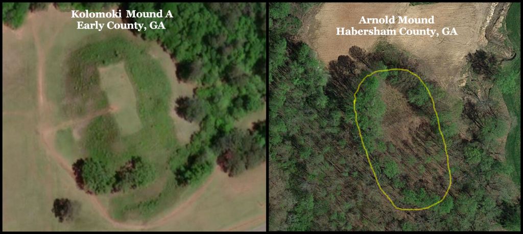
The two identical mounds are 315 miles ( 507 km) apart, yet have the same solar orientation.
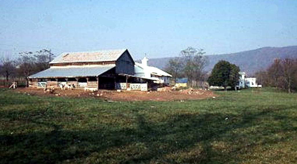
Swift Creek town near my home
Using USGS satellite imager, infrared imagery and LIDAR, I found a large town with a mound almost identical to Mound A at Kolomoki in deep, southwest Georgia. The site is about a mile from my house, to the east and beneath the Alec Mountain Stone Oval. Neighbors to the mound showed me Swift Creek style potsherds that they had found in their gardens.
Directly beneath my property is another town site along Amy’s Creek, which has stone walled agricultural terraces and plazas. There are also some low, long mounds, oriented to the south.
This didn’t make sense. If the people of Kolomoki were forced to abandon their town around 550 AD, because of cold weather, why would they head to the mountains?

Three Major Climatic Disruptions
In the early 21st century, geologists and climatologists became very active in answering questions, unsolved by conventional archaeologists. As seen in the videos, posted on the Americas Revealed last week, geologists have identified two Little Ice Ages that chilled all of the Northern Hemisphere. They occurred in Europe from around 536 AD to 620 AD and from 1303 AD to 1850 AD. The dates are a little different in North America. The majority opinion of scientists is that these two disruptions were caused by large volcanic eruptions.
There was a third Little Ice Age in North America that lasted from around 1130 AD to 1230 AD. West of the Mississippi, it manifested itself additionally as a severe drought. In the Southeast, the cooler temperatures were accompanied by extremely violent storms, which flooded towns and changed the courses of rivers.
It could well be that the acropolis of Ocmulgee was abandoned around 1150 AD due to a Level 5 tornado, because it was immune to floods and the rest of the town remained occupied until the Colonial Era. However, also abandoned around 1150 AD was Tula, the capital of the Toltec Kingdom, Chaco Canyon in NW New Mexico and a cluster of towns near Lake Okeechobee in southern Florida.
Geologists believe that this third Little Ice Age was caused by a series of volcanic eruptions in Alaska, the western United States, Central Mexico, Central America and the Caribbean Basin. The jury is still out on that one. However, there is no evidence, to date, that a massive impact event from an asteroid or comet is the culprit.
Little Ice Ages, droughts, hurricanes and tornadoes do not answer all of the mysteries of the past in eastern North America. As stated in an earlier article, Dr. Lewis Larson was mystified why all of the Swift Creek Culture towns in Southeast and South-Central Georgia would suddenly disappear . . . those in the southwest, northwest and center of the state would slowly atrophy, but Swift Creek Culture villages would remain until around 1000 AD in the northeastern extreme of Georgia . . . which has the states’ coldest winters.
In the 21st century, historians and geologists have identified two other catastrophic natural events, which could have caused many casualties in eastern North America, . . . plus, radically altered many more there and in the Caribbean Basin and southern Mexico . We will discuss them in the next article.
–
Below are two videos about my discoveries near my house!
