Early French Colonial Architecture
Slide Show
by Richard L. Thornton, Architect & City Planner

The following virtual reality images are excerpts from the books, Earthfast . . . the Dawn of a New World and Fort Caroline . . .the Search for America’s Lost Heritage by Richard L. Thornton. All of the Architect’s architectural drawings are copyrighted and may not be used unless licensed to do so by the Architect. Both heavily illustrated books are printed in full color on archival quality, heavy weight, glossy paper stock. Adobe PDF digital copies of these books may be purchased for $15 and downloaded from the publisher at https://www.lulu.com/spotlight/richardlthornton
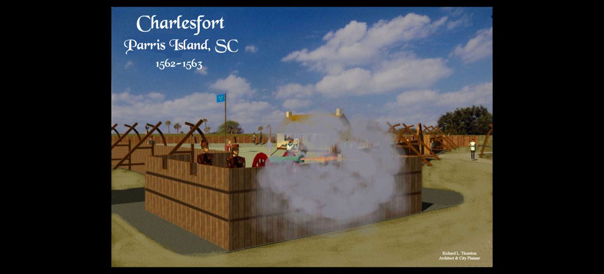
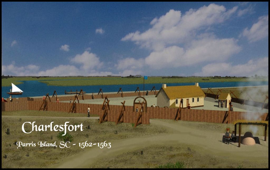
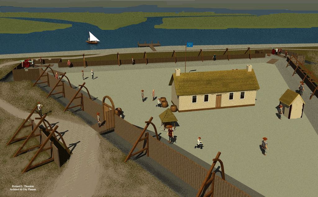
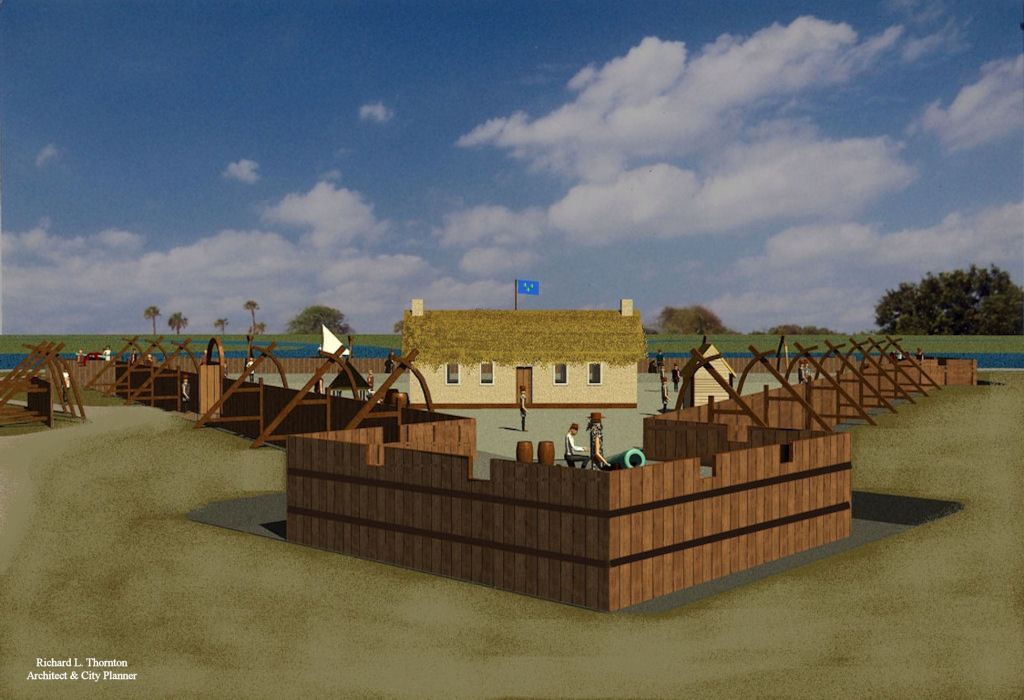
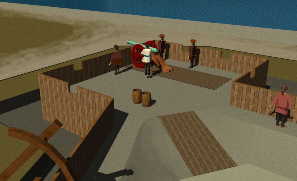
Charlesfort was a infantry fort, erected in 1562 by a relatively small garrison on the coast of South Carolina by Captain Jean Ribault, while he returned to France to recruit more colonists. It was the initial effort by the Kingdom of France to establish a large colony in southeastern North America. The project was sanctioned by King Charles IX of France and the Royal Council. Admiral Gaspard de Coligny, head of the French Navy, was in overall command of the project. Most logistical support for the colony came from La Rochelle, France on the Atlantic Coast.
The planned colony was intended to be a means of bringing peace to France by allowing Protestants and Jews, living in regions of France hostile to them, to relocate to a New World, where they could both be loyal subjects of the King and practice their religion in peace. However, all residents of France, regardless of their religious beliefs, would be welcomed at Nouvelle France.

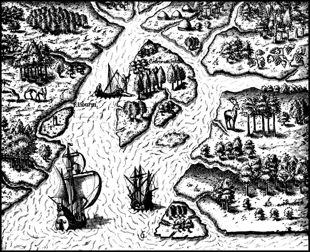
1565 French map of Floridie françoise – the southern boundary of this colony was the St. Marys River, which now flows between Georgia and Florida.
The colony was located in what is now the States of South Carolina and Georgia . . . and in its initial stage was intended to spread up the Savannah and Altamaha Rivers to the then-called “Apalachen” Mountains, where there were known to be gold deposits. France NEVER claimed any lands in the present State of Florida,
No French, Spanish, English, Dutch, German or United States map ever showed either Charlesfort or Fort Caroline in the present state of Florida. The Jacksonville location was a fairytale promoted by a New York-transplant real estate speculator, who bought land on the St. Johns River. It was he, who also made up the story of a Fountain of Youth being in St. Augustine.
The only location along the entire South Atlantic Coast, where corn thrives are near the mouths of the Altamaha and Savannah Rivers. This is the reason that the Atlantic Coast of Florida was sparsely populated and that St. Augustine was always dependent on corn and vegetables imported from elsewhere in the Southeast.
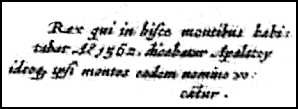
An early French map, which shows the location of Charlesfort, states that a party from there traveled up the Savannah River in 1562 and discovered gold in the Apalachen Mountains. To date, no document in the French Colonial Archives provides details of this expedition. Never dreamed that two years of Latin that I had in high school would suddenly become useful in the 20th century. LOL
Captain Jean Ribault was delayed in bring supplies and more colonists to Charlesfort garrison. They were starving and so literally built a sea-going sailing ship to return to France. It is ironic that they could build a seaworthy vessel, but didn’t know how to fish and catch shrimp with nets.

+

+
+
+
+
+


Interesting. I thought I knew colonial history of Georgia and South Carolina but this is brand new to me as is much of the research you do. Thanks, Chuck Wilson
LikeLike
Thank you! The standard history books that we had in high school and college say very little about the early colonial efforts in North America, other than Jamestown and Plymouth Plantation.
LikeLike