When allowed to return to a natural state, they strongly resemble the coast of Tabasco State, Mexico. However, there is twist. Because of the powerful ocean currents spawned by the Gulf Stream, combined with a succession of storms blowing eastward from the continent and hurricanes churning northward, most of these islands are constantly changing and moving. The southern tip of Cumberland Island is now about a mile south of where it was in 1971!
Series: The 1971 Cumberland Island Expedition
by Richard L. Thornton, Architect and City Planner
Oops!
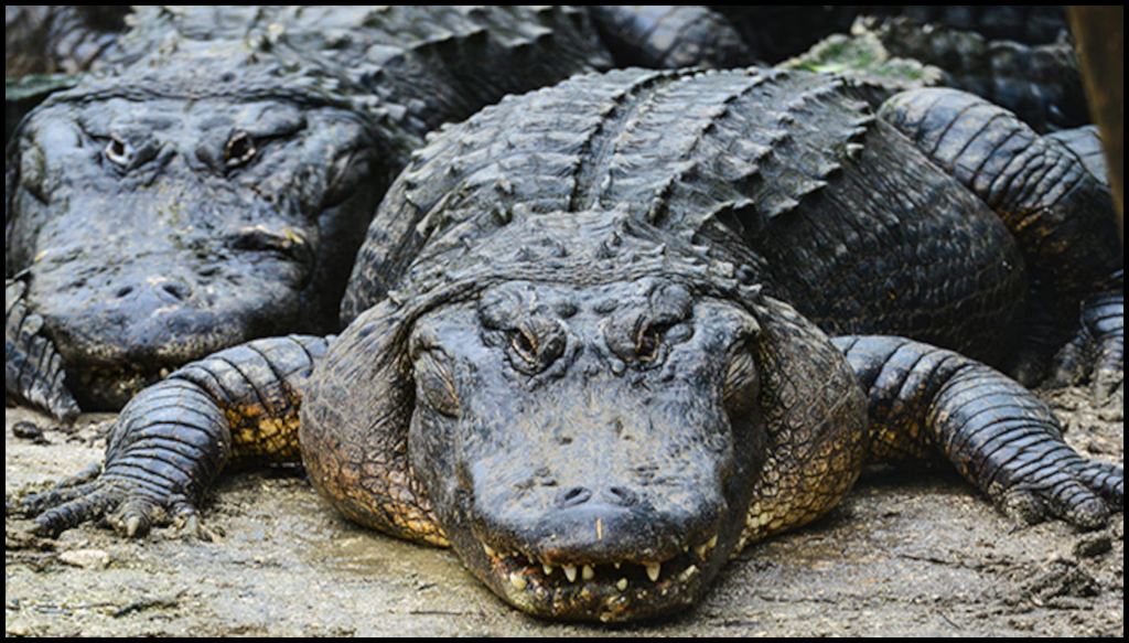
Part One ended as Woody, Craig and I realized that instead of erecting our tents on a small Indian mound, we were sleeping on top of an alligator den! World Book Encyclopedia, the 1971 ancestor of the Internet, said that it was impossible. Alligators could not survive in salt water. Well, then again, World Book is published in Chicago and this was Jawja. These alligators were very big and looked quite healthy.
What we now know is that once the Georgia Coastal Plain plantations were abandoned in the late 1800s, the region re-forested and tribes of alligators began migrating down the Satilla and St. Marys Rivers from the Okefenokee Swamp . . . closer and closer to the tidal marshes. Through natural selection, a salt water alligator tribe quickly evolved.

In the pitch dark, we somehow managed to unpin our tents and drag them inland. About a hundred feet (30 m) from the water’s edge I found a wide expanse of what looked like an indigenous cousin of Bermuda Grass. It was a much better camp site, because there were no hiding places for snakes and biting insects . . . unlike the jungle that we had just vacated. Once everything was moved to the new camp site, we were exhausted from the journey across St. Marys Sound and quickly went back to sleep.
Not for long. A first I thought I was dreaming that I was sleeping on a water bed. Then I noticed that my feet were wet and that the water was rising. All three of us realized at the same time that we were able to be sleeping under water.
In the previous article, I warned readers about always checking tidal charts when camping on the South Atlantic Coast. We had chosen one of the highest tides of the year to go camping. In the process, our portable maritime radio, which was our only contact with the outside world . . . and the cabin cruisier being sailed by the three nurses in Darien, GA . . . was totally ruined by being immersed in salt water. In addition, all of our flashlights were shorted out.
Fortunately, Craig and I had purchased waterproof electric lanterns. Woody was out of luck. He would have to yell out to Craig or I at night to shine our lanterns, if he needed to answer the call of nature at night.
Once upon a time there were no cellular phones, no wind-up emergency radios or National Weather Service emergency radio bands. However, the US Coast Guard Station in Brunswick, GA did maintain a recorded weather message on a maritime band. It was a brief description of low & high tides, temperature, wind speed and any storm warnings. We were now completely cut off from pending weather threats. Basically, we were in the situation as the European explorers and colonists, who ventured into the South Atlantic Coast four centuries earlier.
Somehow, we were able to find a dry spot in the darkness with the two remaining lanterns. To reach it, we dumped all of our belongings into the three life rafts and sloshed through the black water. There was one important omission. A foam plastic cooler, containing a sizable portion of our food, had drifted out into the Cumberland River! We collapsed down onto our wet sleeping bags and somehow went back to sleep.
SLIDE SHOW
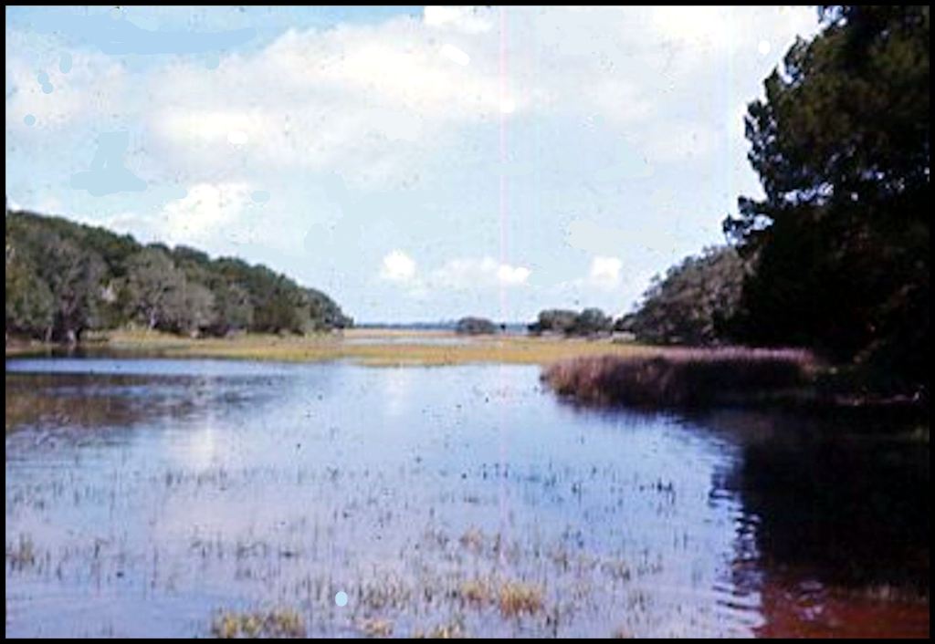
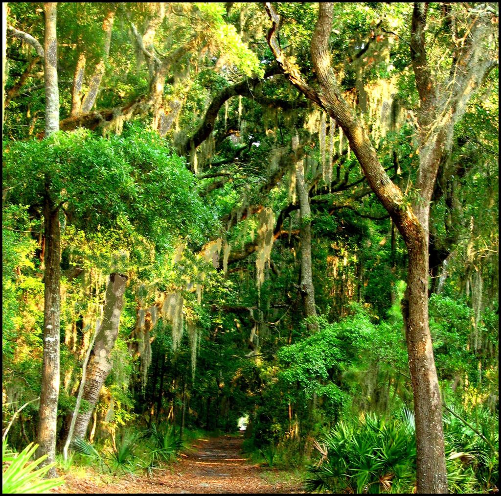
Looking to the south along the Cumberland River, I noticed somewhat higher terrain that seemed to have some sort of beach, which we could pull our boats onto.
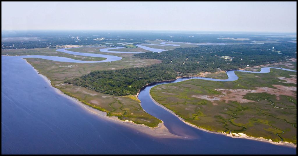
This is the sandy area on the Cumberland River and Cumberland Island that we were trying to reach. Tidal creeks cross the island here, making hiking or driving a vehicle north-south impossible.

Craig could not get his proto-type jet ski motor to start! It would be impossible to transport our camping equipment to the possible new camp site through the jungle.

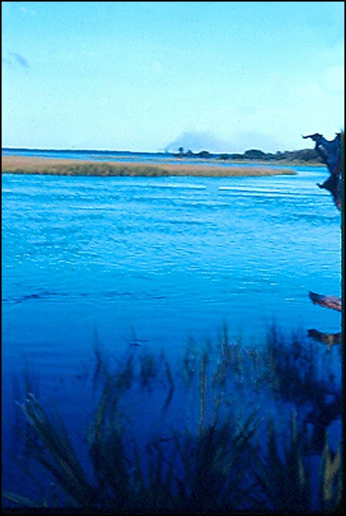
The high tide estuary was shallow enough to walk in, but deep enough to support our life rafts, loaded with camping equipment. It seemed to loop around to the higher terrain.

Although mangrove trees do not grow as far north as Cumberland Island, the jungle on either side of that pond looked like the vegetation of the Gulf Coastal Plain in Mexico . . . in particular, the Mexican states of Tabasco and southern Veracruz.
Early explorers would also soon discovered that these shallow wetlands were the easiest way to get around on Cumberland Island. This estuary took us on our first adventure, where we first appreciated the grand scale of the island.
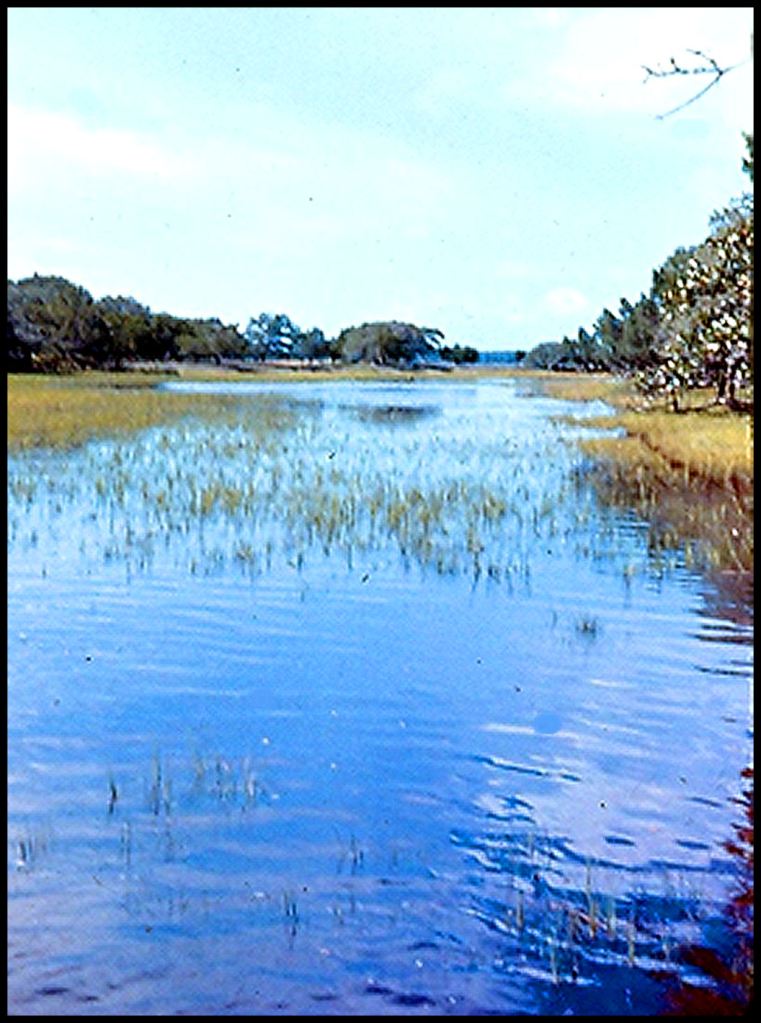
The water was not salty. Evidently, the level of the ocean tide pushed the ground water up into the grassy meadows. At the end of this estuary, we came to an open area of tidal marshes, which crossed most of the island.
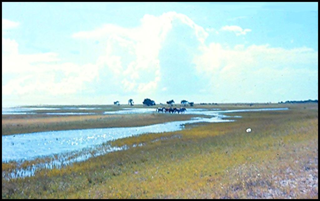
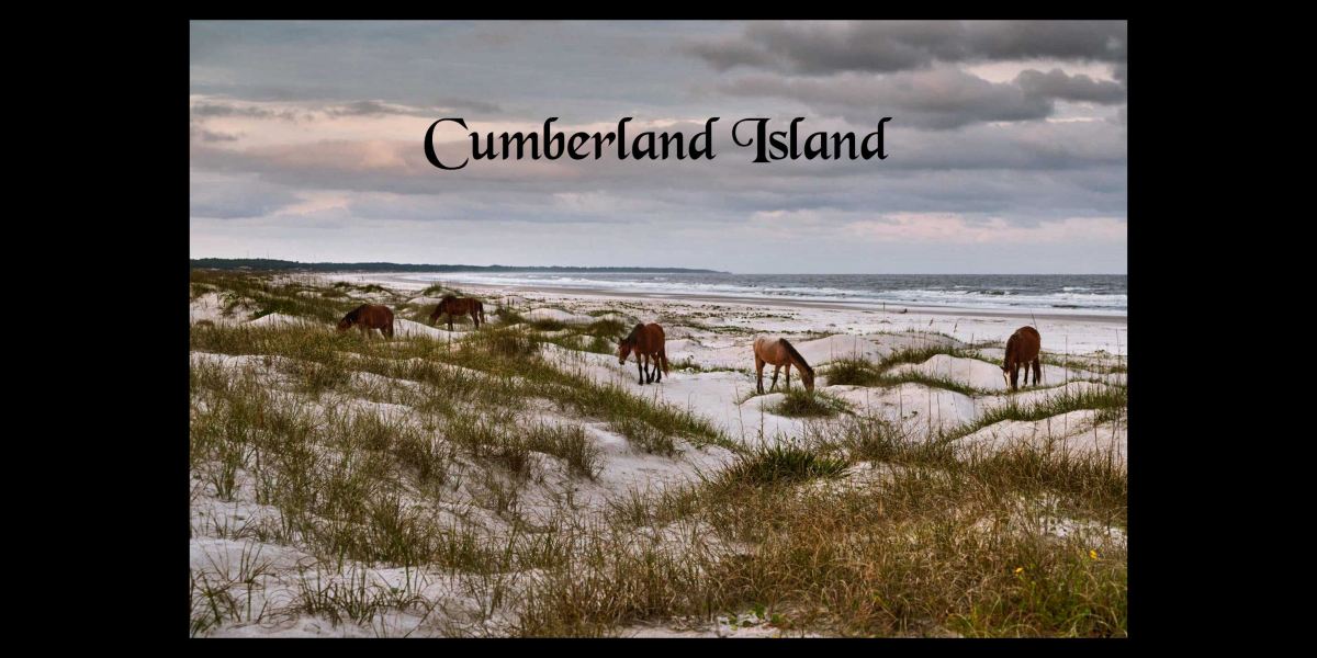
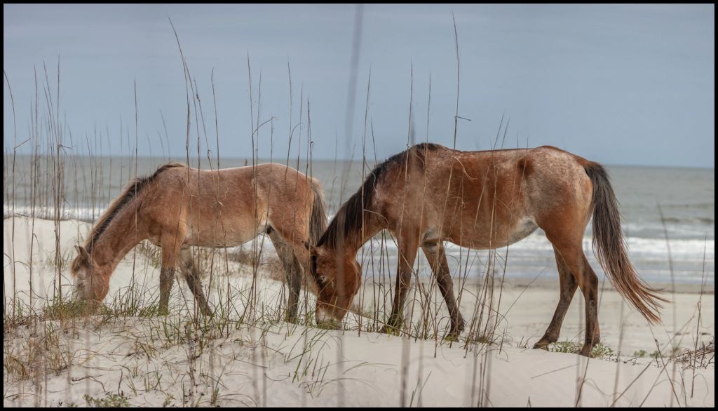
A herd of wild horses crossed in front of us. Were we seeing things?
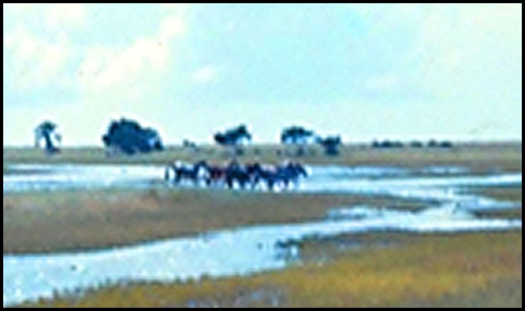
Yes! Wild Horses!
We found an ideal camp site that was elevated above any high tide, close to a mini-harbor, apparently made by Native Americans, yet was shaded by the jungle trees and was on the end of an old wagon trail. We had to paddle our life rafts back to the original camp site and then paddle both boats and the life rafts over to the new site. Things were looking up.
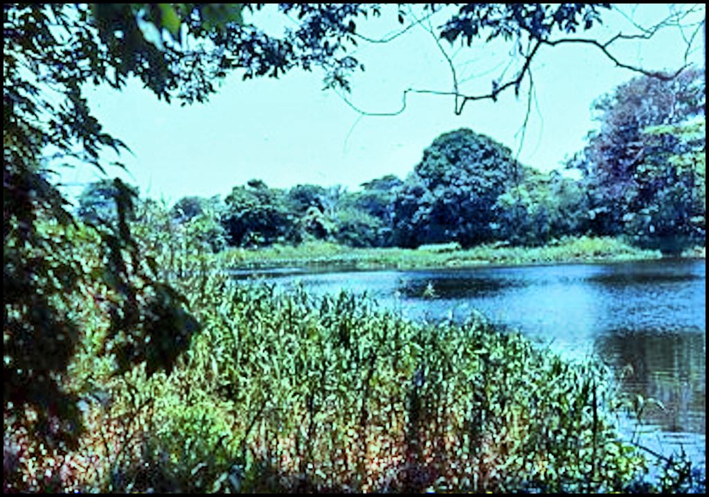
EXACTLY a year earlier, I had taken this slide of a semi-freshwater tidal pond on the coast of Tabasco State, Mexico, which was almost identical to the one that we traversed between the old and new campsites on Cumberland Island. This one is within the archaeological zone of the famous Olmec Civilization city of La Venta.
La Venta, Tabasco – Virtual reality image by Richard L. Thornton, Architect
As I was pulling my life raft along the pond on Cumberland, I got to thinking. Any Pre-Columbian visitor from Tabasco would have felt very much “at home” on the coast of Georgia.
The alligators and horses were the first of many surprises that we would have on Cumberland Island. We had only seen two of the ecological zones on the island. Two others do not look like they belong anywhere in the Southeastern United States.
However, before then we had to survive one of the most dangerous experiences I have ever been through. In fact, the odds were about 99% that today you would be able to google our names and get a head line in the Atlanta Journal-Constitution . . . “Three Georgia Tech students mysteriously disappear on Cumberland Island.” Until then . . .

You crazy kids, you! “The stuff life’s made of,” as Benny Franklin was fond of saying!
LikeLiked by 1 person
LOL - My thoughts about the adventure . . . what were we thinking? Well, part of the problem was that Craig led us to believe that he had a real catamaran and a sea-worthy speed boat . . . not a sheet of plywood attached to a tiny motor, meant for a small fishing boat on an inland lake!
LikeLiked by 2 people
Those marshes look like the tidal marshes of Savannah. I spent my younger summers in that creek, mudwalking, catchimg shrimp and crabs, and later putt-putting around in a plywood boat and 3-hp motor our father made for my sister and me. Later I learned to aquaplane, then to waterski behind my father’s larger boat and motor around the marshy tidal creeks. We never saw any alligators, but I did glimpse a couple of otters at night from time to time. My father, who grew up here, said he had seen alligators in the past.
LikeLiked by 1 person
I’ve always wondered if Creek Indians lent their name to the landscape here, or vice versa.
LikeLiked by 1 person
Actually, most of the branches of the Creek Confederacy were originally Highland tribes. They preferred to build their towns near river shoals or waterfalls.
LikeLiked by 1 person
Makes sense. Why the name Creek?
LikeLiked by 1 person
Originally the British word “crick” was used only to describe estuaries on the coast or along large rivers. The Creeks built their largest towns where there were estuaries flowing into rivers, which they could use as harbors for inland freight canoes. I have drawings of these inland harbors, but can’t attach them to a comment.
LikeLike