
In 1989, land surveyors, contracted by the Shenandoah County, VA Tax Assessor’s Office, were using a primitive version of GIS, when they discovered a village in a mountain valley on the western border of the state, whose occupants had lives that were little different than those pioneers on the frontier of 18th century British colonies. The villagers were of mixed Native American and European heritage.
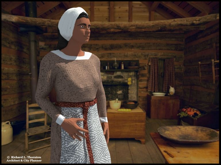
Their log cabins had dirt floors and few glass windows. Most window openings were sealed with exterior and interior wood shutters. Their furniture, spoons and dinner plates were hand-carved from wood, Their tools, knives and forks were hand-forged by blacksmiths in the community. Their children did not attend school and their primary means of transportation were walking and horseback.
This discovery seems to be something out of a “Twilight Zone’ TV program, but it really happened. At the time, it seemed to be a miracle of modern technology. Local and State social workers decided to conceal their existence from the national media, because of the dangers of contact with the modern world.
Architecture of the North American Frontier Series
by Richard L. Thornton, Architect & City Planner
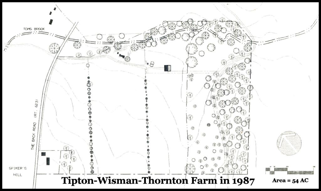
This is the first drawing that I ever produced on an early version of CADD. I obtained the boundaries of the property from a plat literally drawn by George Washington in 1754. That was the only plat ever drawn! The work was in conjunction with an also primitive version of GIS software. The trees were applied with rubber stamps. The large black letters at the bottom were decals, rubbed on from a sheet. I gave a copy of the site plan to the archaeologists and historians from the Harpers Ferry NPS Center.
A time of rapid technological change
Shortly, after moving to the Shenandoah Valley on October 21, 1987, I made the big jump to CADD. I purchased a state-of-art Leading Edge computer, which contained a whopping 30 mb hard drive, which was the “power” necessary to use the first CADD software. I had been using a personal computer with no hard drive for correspondence and construction specifications since 1984. The new computer contained a vastly superior word processing program, which I used to keep a daily journal of construction work on the old house, barn and new cheese creamery. Later I recorded cheese production information and strange events that occurred with increasing frequency.
Digital documents were stored externally on the new plastic magnetic cards, which replaced floppy disks. Microsoft invited me to be a beta-tester for a new CADD software, it was developing, called Visio. Leading Edge would not introduce a new contraption, known as the “mouse” for this computer until around January 1988. Thus, my first CADD drawings were of the 1754-1770-1794 house. A Microsoft Tech Rep also found me a man in Silicon Valley, who was building CADD plotters in his garage, which were compatible with Leading Edge computers.
About half of my graduating class at Georgia Tech never learned CADD or how to write specifications with word processing programs. By the late 1990s, they were completely obsolete and forced to leave the profession.
The advent of the age of the personal computer caused technology to evolve at a dizzying rate. In 1986, Mapping Display and Analysis System (MIDAS), the first desktop GIS product was released for the DOS operating system. However, initially the satellite imagery that the US Government would let the public use, was useless for specific tracts of land.
In 1988, archaeologists and historians in the National Park Service began studying my Colonial-era farm as a key property in the proposed Shenandoah Valley National Battlefield Park. I persuaded the NPS team to persuade the United States Geological Survey in Reston, VA to let me have high-resolution infrared imagery of my 54 acre farm as an experiment. The NPS archaeologists assured the USGS that I was definitely not a Soviet spy . . . just the opposite.
With MIDAS and the USGS infrared images, I immediately found the footprints of twelve former agricultural buildings on my property. I then let the NPS archaeologists used my computer. They immediately found Indian mounds, the burial pits of horses killed in the Battle of Toms Brook and artillery redans on my land. The experiment was such a resounding success that USGS soon began promoting the use of infrared to archaeologists and architects as an alternative to digging up historic sites.

A drawing of my former farm in the Shenandoah Valley, published shortly after the battle.
By 1989, the USGS was allowed to sell black-and-white satellite images that had high enough resolution for tax assessors and planners to see individual buildings. The structures were quite fuzzy, though. Shenandoah County, VA needed to know where new structures had been built, which were not being assessed with property taxes. A surveying firm was hired to literally apply that MIDAS (software) touch. LOL
Eventually, one of the surveyors stumbled upon a large tract of land on the western edge of the county, which was labeled on the tax map, “Public Ownership.” Apparently, tax assessment consultants in the past had assumed that the valley was part of the George Washington National Forest. In fact, it was an out-parcel, surrounded by National Park Service lands.
It could also could have been a top secret U.S. military facility. Indeed, our western edge of the county did have mysterious tracts in which affluent government workers each morning drove down one lane farm driveways into barns. One night, around 1:30 AM . . . during Desert Storm . . ., I was awakened by the noise of numerous, large diesel engines. I went outside to discover in astonishment to see big flat bed trucks hauling M1 Abrams tanks and Bradley Fighting Vehicles out of a one lane, over-grown driveway, to what appeared to be a decrepit, abandoned farm.
The surveyor could not find any evidence of ownership by County, State or Federal governments, plus saw on the satellite images over a dozen farmsteads. He decided to check the valley out, but instead was greeted by some muzzle-loaded shotguns. These farmsteads had probably existed since the 1700s or early 1800s, yet had never been listed on county’s tax maps!
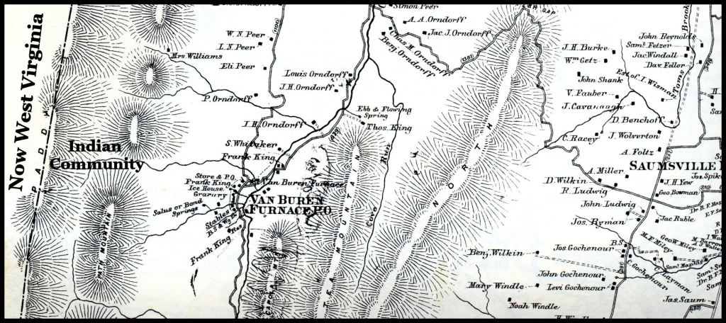
This is a section of the detailed map of Shenandoah County, produced during the Civil War for use by Gen. Stonewall Jackson. The Indian Community was located on the far western edge of Shenandoah County, now inside the George Washington National Forest. In the upper right corner of this excerpt, there is noted, “Est. of J. Wisman.” That is my former farm. I added the Indian Community label.
An initial low profile investigation revealed that several families, who had intermarried with the Log Cabin People, protected them and provided automobile-truck transportation, when needed. Apparently, most of the Log Cabin People never had any professional medical or dentil care. Perhaps, because of their extreme isolation, few of them died from diseases, which everyone else is vaccinated for. Maybe they did have a high death rate . . . at least among newborns and children. However, there were no birth or death records. Graves in the cemetery were marked with stones and there was no church . . . or at least a building that was obviously a place of worship.
On a few occasions, I encountered the assimilated mixed-blood Native Americans in stores. We would instantly recognize that we were both mestizos, so they were friendly with me, but would not tell me where they lived. None of the people I met, knew what tribe they were from. In fact, they knew very little history, period.
I learned about the “Log Cabin People” from a Public Health Nurse, who was a member of our Sunday School class at Woodstock United Methodist Church. She stopped by my office with photos a couple weeks after she had visited the community and begun giving the children vaccinations. She wanted to know how old the log houses were. I told her that they were a style built in Virginia in the 1700s . . . similar to the earliest log houses, built by Finnish colonists along the Delaware River in the New Sweden Colony. My final answer was, “1776?”
The photographs were like someone had traveled into the past with a time machine. She was especially shocked by dirt floors of the cabins and the carved maple trenchers from which all of these people ate their meals. I noticed that some of the people wore store-bought clothing, while others wore hand-made clothing or a mixture of both. They all were very slim. Most of the adults seemed to have lots of teeth missing.
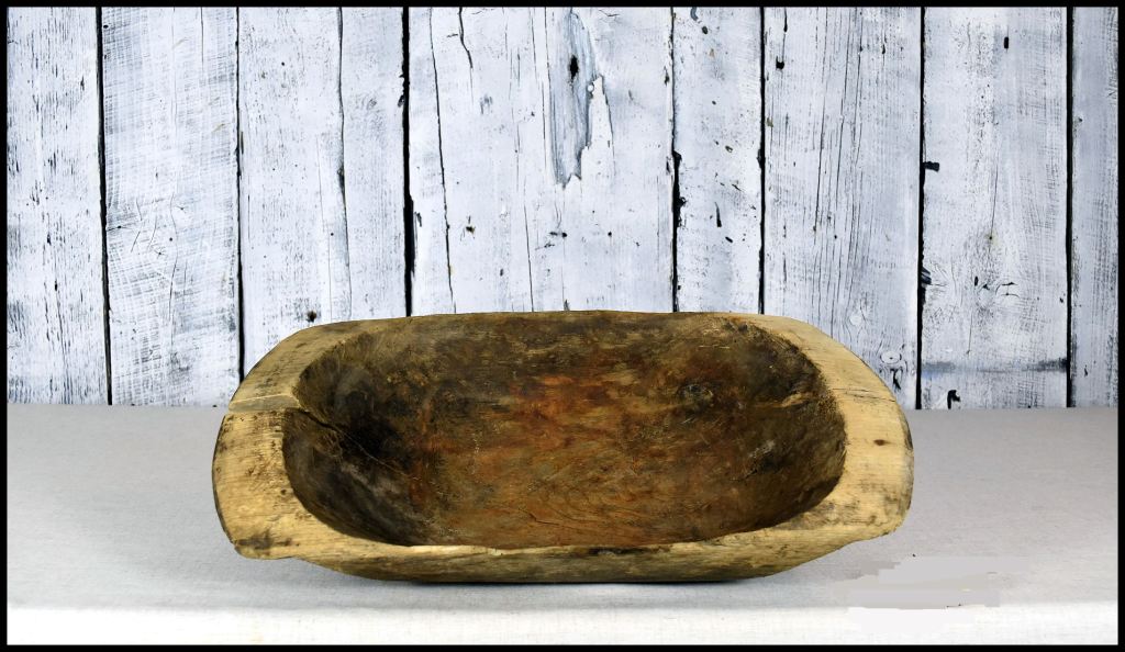
All of their meals were eaten in hand-carved maple trenchers.
Apparently, the staff of the Shenandoah Health Department soon received orders to keep their mouths shut concerning the future of the Log Cabin People. After the first visit to my office, the nurse only gave vague answers to my questions. None of the villagers held deeds to their property. None had ever paid property taxes or any other sort of tax. Yet, they had never been billed for property tax either. That being said . . . the valley where they lived now appears to be wooded in contemporary satellite images.
My guess is that the Log Cabin People were descended from remnant Native Americans, who were moved to this valley from somewhere else. The Province of Virginia established dozens of small Native American reserves during the Colonial Period. Some still exist and are occupied by federally-recognized or state-recognized tribes. The Native men probably cut down trees and made the wood into charcoal for use in the many iron furnaces within Shenandoah County. The Van Buren Furnace on the map above operated from 1837-1884, but many furnaces were constructed before American Revolution.
Late 18th century and early 19th century settlers in Shenandoah County assumed that the Indians were long gone. Nevertheless, several history sources, including the county’s own history text state that Indian men from Shenandoah County served in the Stonewall Brigade during the Civil War. There is no explanation what they were doing in Shenandoah County before then.
Very few people in Shenandoah County ever knew about the Log Cabin People and none in Virginia, outside of the State Health Department, ever heard about them. I wouldn’t even know who to ask, to determine what their ultimate fate was. They have joined the ranks of America’s Secret History.
The Truth Is Out There Somewhere

I lived in Virginia for about 10 years during my youth. We would go to Shenandoah Valley and stay in a series of old wooden cabins located throughout the area. It was called the PATC ( Potomac Appalachian Trail Club) and they operated about a dozen cabins in the valley. We would have to hike to the log cabins because there were no roads available to them. Occasionally we would pass another log cabin that was still occupied by a family while we were hiking to the one we rented. We were told not to talk or bother them so we didn’t. Being a young boy I didn’t ask too much about them but knew they were on federal property and always wondered how people were allow to live in log cabins on public lands. This was while I was still in the Boy Scouts and knew the difference between a AT trail shelter and a log cabin. These PATC log homes were self contained with separate kerosene pits to store lanterns, fully functional log stoves inside, hand cracked water pumps in the kitchen and usually near by covered spring head. It seemed I was told that when the families died off their log cabins homes were added to the PATC network.
I wonder if these log cabins were the former homesteads of the log cabin people in your article?
LikeLiked by 1 person
The community I knew about was on the border between Virginia and West Virginia. The Appalachian Trail follows the Blue Ridge Mountains to Harpers Ferry, doesn’t it. There could have been other family compounds in the Shenandoah Valley area, who also lived in primitive cabins.
LikeLike
The PATC cabins were not necessarily on the AT. They were scattered throughout Virginia, Maryland and maybe West Virginia. I only visited about 4 cabins out of the 12 to 15 that were available. They each required hiking to reach the cabin but it was only an access trail not the AT. I only mentioned the AT to demonstrate that I was familiar with the difference between a trail shelter and a log cabin. Sorry for the confusion.
LikeLiked by 1 person
Back in the late 1990s, a friend of mine who was an elementary school teacher here in White County told me of an area here where families were living in log cabins with dirt floors.
LikeLiked by 1 person
That is amazing, We are only talking about 30 years ago. I wonder if they are still living in those cabins? It could be a similar situation, where land was purchased by the US Forest Service in the 1920s around these communities then the communities were forgotten by public officials.
LikeLiked by 1 person
I don’t know. All I know is that the families were all related, and my friend spoke as if she had actually seen their cabins. There are some very nice houses on that road now.
LikeLiked by 1 person
Hey Richard,
About 15 years ago I was on a 5 day horseback trip in Tennessee with my Mom, Uncle and their group of riding friends in the Townsend Tennessee area when on the third day we rode Bushy Mountain. After a several hour ride we got to a small community that was a good days horseback ride from anything when it was founded in 1901. The state had preserved the structures just as they were when the last person living there was moved out. The structures were made of all hand hewn logs, hand cut boards,rock fire places and dirt floors. They had split rail fences around the animal corrals and 3 spring houses made of stone stepping down a large creek that was on the side of the clearing. The cemetery had dates from the early 1900’s to the 1970’s when the last person that lived there was buried. Sounds a lot like what you are describing, out of the way isolated communitys keeping to themselves. Seeing this site was just one of the many cool things I saw on one of our adventures. It was really cool to see that Tennessee had taken over and was keeping up the site.
Thanks for all your work.
LikeLiked by 1 person
I really appreciate your supportive comments. I do not make any income from The Americas Revealed, but is it way for me to network with kindred souls.
LikeLike