
In fact, numerous obsidian blades and points have been found on the surface in the vicinity of Sautee Community in the Nacoochee Valley!
by Richard L. Thornton, Architect & City Planner
Since the mid-1800s, collectors of Native American artifacts and archaeologists have assumed that if one finds a obsidian blade or point in the eastern United States, it came from somewhere west of the Rocky Mountains. In fact, in recent decades archaeologists have used the discovery of obsidian artifacts at a site as proof that indigenous peoples at that location were on a trade route connecting them to the Rocky Mountains. That’s what they were taught in college.
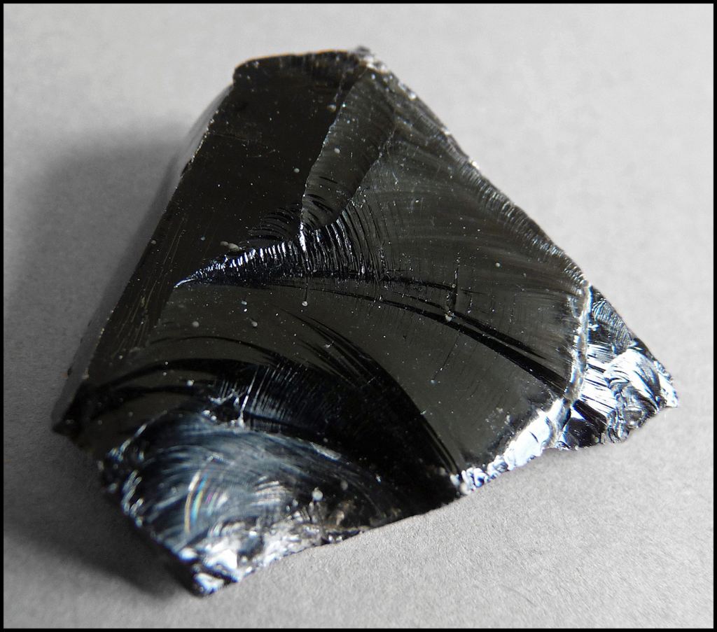
Obsidian is a glass-like igneous rock, which is associated with volcanic activity. It is formed by the rapid cooling of viscous lava from volcanoes. Obsidian is extremely rich in silica (about 65 to 80 percent), is low in water, and has a chemical composition similar to rhyolite. Obsidian has a glassy lustre and is slightly harder than window glass. Though obsidian is typically jet-black in color, the presence of hematite (iron oxide) produces red and brown varieties, and the inclusion of tiny gas bubbles may create a golden sheen. Other types with dark bands or mottling in gray, green, or yellow are also known.
When retrieved from damp, clay soil, an obsidian artifact may look like chert, a relatively common, black metamorphic rock from regions of the Southeast with sedimentary rock strata. Native Americans frequently used chert for atlatl points and war arrowheads. Chert is a sedimentary rock that’s made of silicon dioxide in the form of microcrystalline quartz. It’s hard, dense, and brittle, with a conchoidal fracture that produces smooth, sharp edges. However, obsidian is generally somewhat translucent. Chert is not, even though, chemically it is similar to obsidian. Obsidian has been vitrified by extreme heat.

The portion of my obsidian artifact collection from a battlefield on the crest of Cerro Gordo, overlooking Teotihuacan. The obsidian artifacts from Puebla, Chiapas and Michoacan States are a slightly different color.
The archaeology and geology textbooks are wrong!
From my time spent at archaeological sites in Mexico, I am quite familiar with obsidian. In fact, I have a sizable collection of obsidian atlatl points and Mesoamerican sword blades from an ancient battlefield site on the crest of Cerro Gordo Mountain, overlooking Teotihuacan, plus collections from other states in Mexico. Dr. Román Piña Chan kept two samples, but let me keep the rest, since obsidian artifacts are so endemic in Mexico.
So, for most of my adult life, I assumed the archaeology and geology books were right. Generally, you are only going to find obsidian artifacts in extreme western United States, plus the western edge of Mesoamerica and South America.
About eight years ago, I gave a tour of the Nacoochee Valley to Garth and Cheryl Norman from American Fork, Utah. Garth was an archaeologist. He sadly passed away in 2021, during the Pandemic. This was about a year and a half before I moved to the Nacoochee Valley.
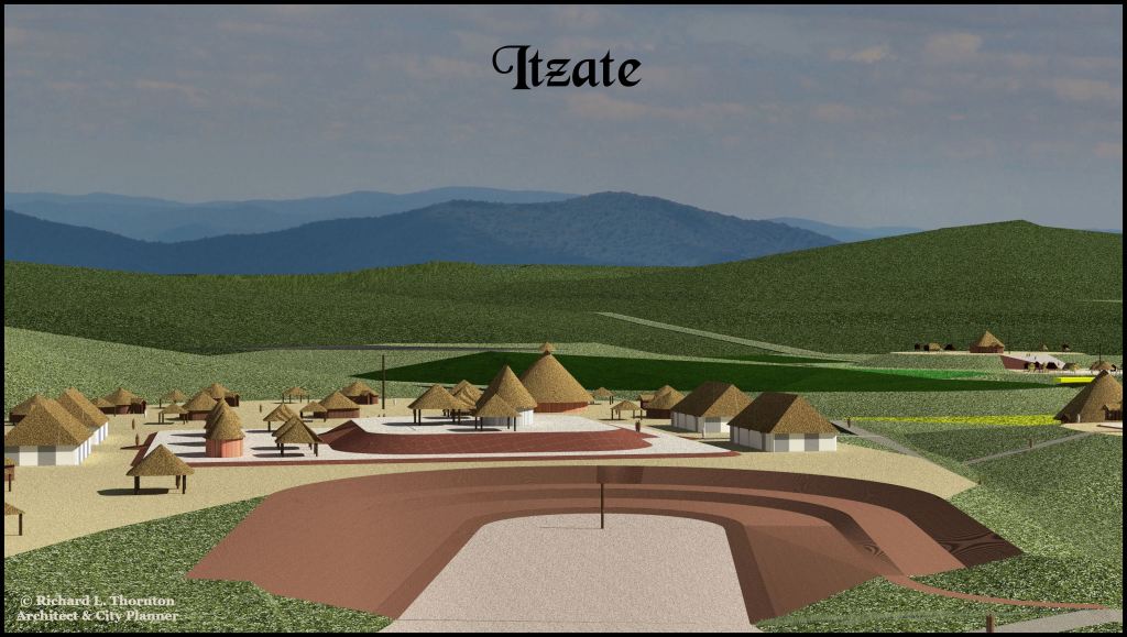
The site of one of my Mother Towns, Itzate, abounds in obsidian artifacts. The Sautee-Nacoochee Community Center Complex, a soccer field, U.S. Post Office, Old Sautee Store and Nacoochee Presbyterian Church are now located on top of the earthworks.
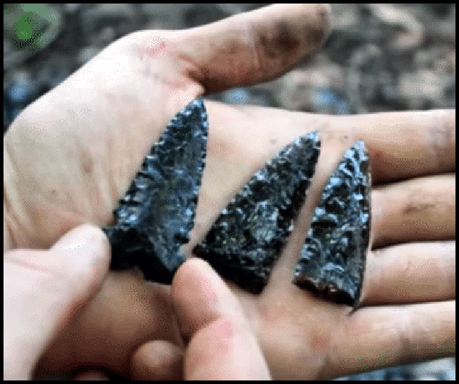
As Garth, Cheryl and I were chatting at the edge of the Sautee-Nacoochee Community Center gravel parking lot, Garth suddenly looked down then began picking up obsidian blades. After examining them, he concluded that they were from Chiapas State, Mexico. Since the Itzas were from Chiapas, that is possible. However, these may have been home-grown artifacts.
One of the obsidian blades, picked up by Garth Norman
After I moved to the cottage near Alec Mountain, I began talking to the locals. Many obsidian artifacts have been picked up off the surface around the community center. Some people told me that there were deposits of obsidian rocks scattered about Northeast Georgia. Those that knew their locations, kept them a secret.
One man showed me three, perfect obsidian atlatl points, which he had unearthed. He refused to tell me the location of the archaeological site, other than the vague statement of “somewhere around here.” I didn’t quite believe him at the time.
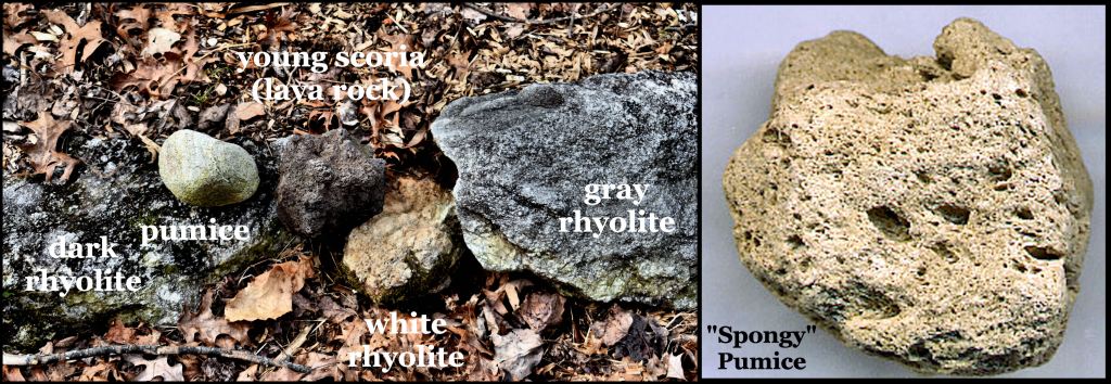
Then I moved to the fixer-upper cottage at the same elevation as the Alec Mountain Stone Oval. I quickly noticed that all the rocks on my property were volcanic! Most were rhyolite, but there was also some pumice, conglomerate, basalt and black scoria boulders like in the Pedregal in Mexico City. While digging holes for shrubbery I encountered several YOUNG lava bombs in the top soil. Below the top soil was six to 14 inches of hard-packed volcanic ash, before you reached the clay sub-soil. I eventually found deposits of soft volcanic ash in rock crevices and bowls. These I used to improve the soil in my new garden terraces.
The lava bombs and volcanic ash in my top soil can only mean one thing. There have been volcanic eruptions in Northeast Georgia during the recent past.
I vaguely remembered a field trip taken by a geology class at Georgia Tech to the Northeast Georgia Mountains. The professor told us that the reason that most of the mountains here look like volcanoes was that they WERE volcanoes, but now are extinct. They had not erupted since the time of the dinosaurs. Obsidian deposits are associated with volcanoes, so there is obsidian.

Chimney Mountain Volcano in April 2017. By the autumn of 2018, hot gases had killed all of the trees, shrubs and vines on the top of mountain, leaving it bare rock. The United States Geological Survey now classifies it as an active gas volcano. That means that their scientists do not think there is a lava pool near the surface. The gases are created by friction at nearby fault lines. The mountain belched smoke and steam throughout the period up to 1886. The hot gases in 2017 and 2018 were only visible under certain atmospheric conditions.
But not so long ago
In 1939, archaeologist Robert Wauchope encountered a layer of “archaeologically sterile” alluvial sand up to 15 feet (4.6 m) along the floor of the Nacoochee Valley. Below the sand were dense strata of human occupation, going back to the Ice Age. Above it were scattered European artifacts, typical of the 1700s and 1800s, but few Native American artifacts. Evidently, “something” melted all the snow at one time, or there was a hurricane even more severe than Helene.
Eventually, I found a brief description of an enormous explosion near the top of Chimney Mountain in 1700 AD, which blew off a section of the flank of the mountain and caused the Creeks living in the Nacoochee Valley to move their capital southward to near Ocmulgee Mounds. This must have been a catastrophic explosion and release of heat, if all the snow for miles around melted almost instantly.
Now you know . . . but very few people, living near this mountain know!
