
Slide Show
This Siouan town was directly beneath a magnificent, five-sided Itza or Kekchi Maya earthen pyramid and about 500 meters from the oldest known Chickasaw town. The three distinct peoples co-existed for many centuries. Earth lodges were being built at Kolomoki Mounds, Georgia by around 100 AD, or earlier.
Although academicians from the Midwest and Great Plains have posted articles on the internet claiming that the earth lodges were first built on the Great Plains in the early 1500s, the migration of the Siouan earth lodge peoples can be followed from the Southeast to the Northern Plains, via their village sites. The oldest excavated earth lodge on the Missouri River dates from the early 1700s.
by Richard L. Thornton, Architect & City Planner

The Kenimer Pyramid – overlooking the Siouan and Chickasaw towns
Itzate nobility lived on a series of terraces to the north of the pyramid. The structure was estimated by UGA archaeology professor Mark Williams to date from around 600 AD. The architecture of the pyramid is identical to the earthen pyramids built by the Itza and Kekchi Mays to their sun god. The Itza and Kekchi regions of southern Mesoamerica and Georgia were the only locations in the world where five-sided pyramids were constructed repeatedly.
This earthen pyramid is in pristine condition, except for its stone components. During the late 20th century “someone” removed the stone ruins of the temple to build a foundation and chimneys for their dream mountain house. At about the same time, a large carved stone stela was removed from the plaza of the pyramid. The stela is probably much older than the pyramid, because it contains symbols, typical of southern Sweden in the period from around 1800 BC to 1200 BC.
Archaeologist Robert Wauchope in the Nacoochee Valley
Shortly after receiving a PhD in Anthropology from Harvard University, the famous archaeologist Robert Wauchope was hired by the Works Progress Administration (WPA) in 1939 to carry out an archaeological survey of northern Georgia in a single year. It was an impossible task, grossly underestimated by the Smithsonian Institute, WPA and Wauchope himself. One year would have been inadequate to cover just the Atlanta Area, Etowah River Valley or the Nacoochee Valley. No one realized how densely populated the region was at the time of Columbus’s voyages.
Wauchope’s dissertation had been extraordinary. It was a comprehensive, heavily illustrated survey of Maya houses in southern Mexico. These are real, architectural drawings, not the typical sketches done by most archaeologists. Either he took advanced courses in architectural graphics or else paid someone to produce them. The dissertation was converted into a book, which I carried in my backpack, while on the fellowship in Mexico.
Waichope ended up spending most of that time in the Nacoochee Valley . . . the 12 mile long headwaters of the Chattahoochee River . . . and he still missed many, many large structures, which I am now finding with LIDAR. Even though he missed many sites, he still documented 38 mounds, stacked stone structures and ceremonial earthworks. Because at the onset of World War II, Wauchope was recruited into the OSS (forerunner of the CIA) his book, Archaeological Survey of Northern Georgia, was not published until 1966.
Laborers under Wauchope’s supervision excavated two Native American community sites at the foot of Kenimer Hills. The Eastwood Site (9WH2) was an oval shaped town with two platform mounds on the northern end. Its oval houses were identical to those built in Campeche by the Mayas 1500 years ago. Indeed, the size and layout of the community was identical to that of Xculoc, a Maya town still occupied in north-central Campeche.
Radiocarbon dating had not been invented, when Robert Wauchope was working in Georgia. However, by comparing strata of the site to nearby villages with better known chronology, he estimated that the Earth Lodge Village dated from after the disappearance of Swift Creek Culture villages in the valley. That would be about 550 AD or a little later. So, it was probably about the same age as the Kenimer Mound and the Eastwood Village.
The village was abandoned some time in the early Colonial Period . . . about 1500 AD -1585 AD. Wauchope did not find any evidence of a Lamar Culture village on top of the older one containing earth lodges. The land seems to have been used for agriculture, while a small Lamar Culture village developed closer to the current location of the Chattahoochee River.

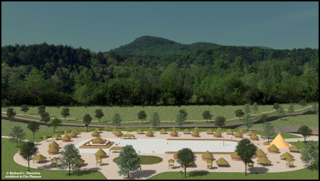
Terrain map created by integrating USGS LIDAR map with architectural models
For thousands of years indigenous peoples camped by the Chattahoochee River. Their hamlets were probably not fully inhabited year round. Bands of hunters or wild food gatherers would move to areas where a particular food type was seasonally abundant.
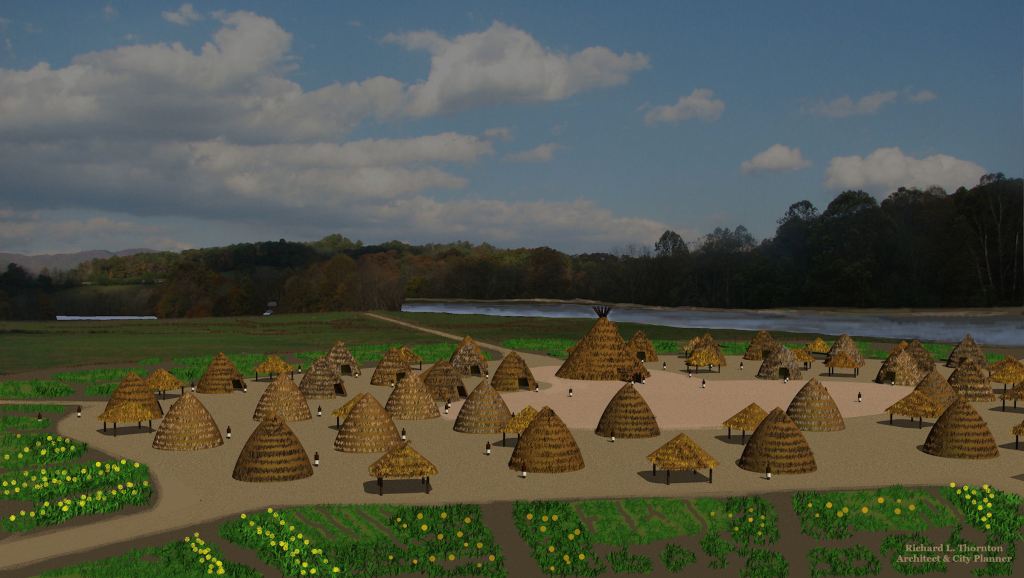
Beginning around 1000-800 AD, a small permanent village developed near the river. The occupants maintained gardens, where they cultivated crops, domesticated from wild plants.
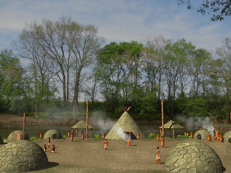
Site 9WH28 (Earth Lodge Village) initially developed on top of the Early Woodland Village with architecture and pottery, typical of the Swift Creek Culture.

The disappearance of the Swift Creek culture coincided with a massive comet impact off the coast of Cape Canaveral, Florida in 539 AD, which flooded the Georgia Coastal Plain with a tsunami. This was followed by about 50 years of cold, cloudy weather. The earth lodges were probably adapted as a means of staying warm in the long, cold winters.
Here is a closer view of one of the houses along with a barn on stilts.

This is a view of one of the houses from above with the thatch removed.

This is an early Kanza earth lodge in Kansas. It is identical to the earth lodges in northern Georgia. The Kanza definitely lived in Northern Georgia, before migrating westward. A Kanza village was recently located, where New Echota was constructed. That site was named Kansayi by the Cherokee . . . “Kanza – Place of.”
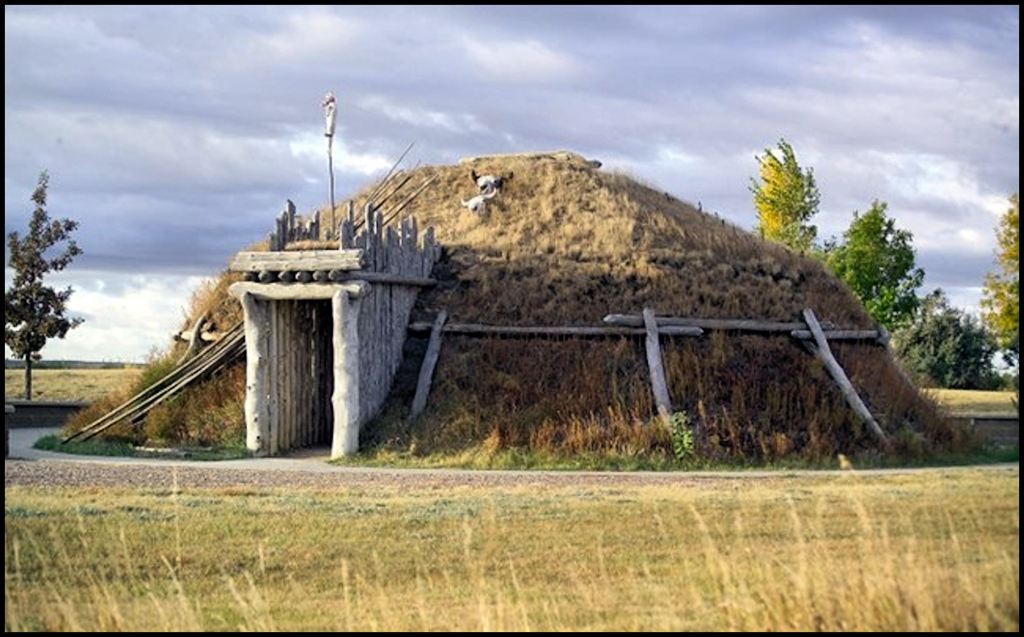
A restored Hidatsa-Ponca square earth lodge in Colorado
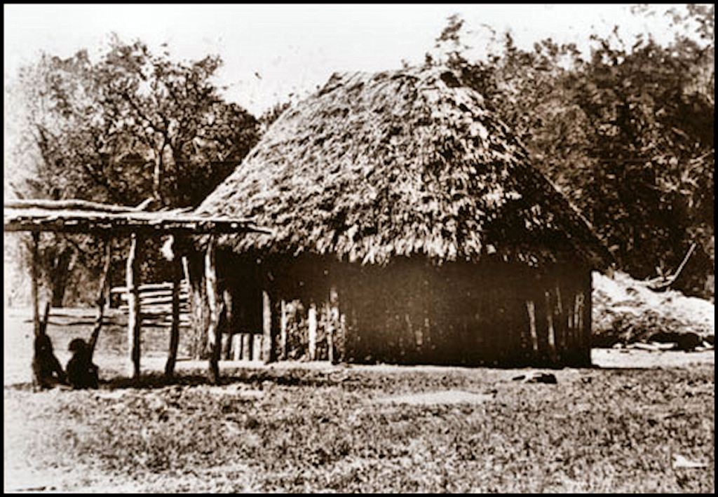
This is a Kanza summer house, composed many vertical saplings. Robert Wauchope unearthed these type of house also. They are show on the architectural Virtual Reality images in this article.
Now you know!

Eager to explore this further I set out to find “Archaeological Survey of Northern Georgia” for myself. Turns out my Alma Matter, Columbia University Teachers College, allows alums to libraries all over the world, including JStore where I got my free PDF. 568 pages, may be more than I bargained for. Cheers
LikeLiked by 1 person
Bully for you! Google Books has it online. I bought the last known original printing of the book about 8 years ago from Amazon.
LikeLike