
It is a Guatemalan Maya and Totonac word meaning promontory, edge of a precipice or high place where one can see a long distance!
Wauka Mountain is in eyesight of thousands of Guatemalan Maya immigrants, who came to Georgia to escape persecution by the brutal fascist junta that formerly ruled their nation.
Long ago, while on a fellowship in Mexico, I secretly went on a mission to make contact with a Pro-Democracy Itza Maya militia in the Lake Atitlan area of Guatemala . . . not knowing that I was part Itza myself. This is where I first saw mountainside agricultural terrace complexes, identical to those in Georgia.
Of course, I had no clue that some day, some of those people, would be my neighbors. At the time, there were very few Latin Americans in Georgia. However, this linguistic discovery yesterday also explains the founding of the acropolis at Ocmulgee National Historical Park . . . about 1,125 years ago!
by Richard L. Thornton, Architect & City Planner
Life is indeed, stranger than fiction
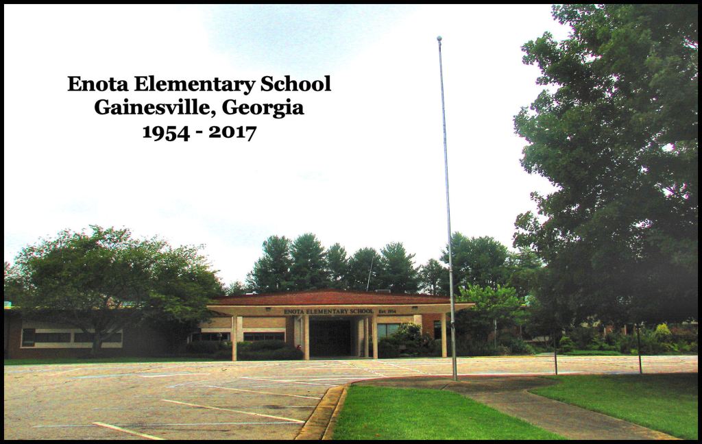
Long, long ago . . . in a land not so far away at all . . . I was the captain of the School Safety Patrol at Enota Elementary School in Gainesville, GA. The primary perk of that lofty position was raising the United States and Georgia flags every school day morning. There was a gap in the tree canopy. so while raising the flag, I could always look northward to see Wauka Mountain. Especially, when Wauka was snow-capped, it made me want to be in the mountains.
Our Boy Scout Troop 26 once climbed Wauka Mountain. From the top you could see the Downtown Atlanta skyline, Stone Mountain, Kennesaw Mountain and Lake Lanier. To the north you could see Yonah Mountain, The Three Sisters, Blood Mountain and Brasstown Bald. It truly was a place, where you could see far.
My two favorite neighbors across the street were Mr. Gardner, Superintendent of the Chattahoochee National Forest and Architect Ed Dodd, who drew the Mark Trail cartoons in newspapers. Mark Trail was about the adventures of forest rangers in the Chattahoochee National Forest.
At that advanced age, my lifetime ambition was to simultaneously be a forest ranger and architect! I now live on a tract of land of tall trees at the crest of a mountain and I have been the Architect of over a thousand new or restored buildings. So . . . I guess our childhood dreams come true.

Both the Maya city, named Waka, and the Georgia acropolis, named Waka . . . but now called Ocmulgee . . . were salt-trading centers, perched on the edge of a natural terrace, over-looking a swamp and river which ran about 165 miles (266 km) to the ocean.
The two decade hunt for the meaning of Waka
Twenty-two years ago, I was researching the history of (then) Ocmulgee National Monument for the Muscogee (Creek) Nation. I soon discovered that its real name was was written as Waka, Wawka or Wauka. What was odd, though, was that there was a large capital town on Lake Okeechobee, Florida with the name of Waka-te (Waka People). It was occupied the exact same time period (900 AD – 1150 AD) as the acropolis at Ocmulgee. Both the Guatemalan Waka and the Georgian Waka were salt -trading centers. At Ocmulgee, archaeologists had unearthed hundreds of massive ceramic ocean-brine drying trays from two to three feet in diameter.

The copper crown, worn by the Itza/Waka Maya Sky serpent in Waka was identical to those worn by the Great Sun (High King) at Proto-Creek town sites in Georgia. In fact, this style of hammered copper art was typical of Waka and Etula (Etowah Mounds) but rare in the Mesoamerica.
The people of the Waka City State in present-day eastern Guatemala worshiped the Sky-Serpent. So did the Itza Mayas in the Guatemalan and Chiapas Highlands. They probably spoke a language similar to Itza.
The Guatemalan Waka was captured in 743 AD by the warriors of Tikal. It then became a vassal of Tikal. Waka was sacked and abandoned around 880 AD after being captured by the arch-rival of Tikal . . . Calakmul in southeastern Campeche. The timing was certainly right. Trading centers in the Southeast, named Waka, were founded about 20 years after the mother city of Waka was devastated.
My clients in Ocmulgee, Oklahoma did NOT like my discovery of the real name of the ancient indigenous city in Georgia. They said that Waka was not a Muskogee word and therefore this could not be true. However, this was in the year 2004 and I neither had developed any proof of a Maya presence in Georgia nor knew the meaning of Waka. It also was not a word in the Yucatan, Campeche, Tabasco or Kekchi dialects that most Mayas speak today.
An archaeology professor at Southern Methodist University has speculated that Waka meant “town center” or “place to get water,” but there was nothing in the Maya languages spoken today that would support his theory. In the same article, he mentioned that Waka was ruled by Teotihuacan nobility from about 200 AD to 600 AD. They had also ruled the Itza Mayas, so I use a Totonac dictionary to reconstruct the language spoken by Itzas, who migrated to Georgia long ago.
On a hunch, I decided to look up Waka in a Totonac-Spanish dictionary. The letters W and K were not traditionally used in Spanish, so I spelled the key word. huaca. Sheezam! It had the meanings listed at the top of the article. That all made sense.
I had one word, undefined, in my list of Mesoamerican place names in North America. I typed in Waca and was shocked to see that it was an alternative spelling of a mountain in Hall and White Counties, Georgia! It was was the mountain that I had looked at each morning, while raising the flags at Etowah Elementary School, so long ago.
A speculative, Chamber of Commerce explanation of Wauka Mountain’s name has crept into the AI-produced references on the internet. It says that the mountain was originally named after a man named John Walker. That does not make sense, when all the old maps spell the word Waka, Wawka or Wauka. Indeed, Wauka Mountain is a promontory, where one can see natural features far away.
In 2022, I discovered with LIDAR a massive Maya Sky Serpent, immediately east of Nacoochee Methodist Church in the Nacoochee Valley. It is about 2000 feet (630 m) north to south. Now we know why it is there.
