What appears to be Native American earthworks on the LIDAR scan, actually are changes to the island that post-date the American Revolution.
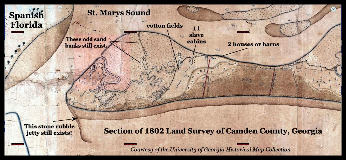
This early appearance of cotton cultivation has great significance. The new owners of Cumberland Island also owned Mulberry Grove Plantation near Savannah . . . where Eli Whitney invented the cotton gin in 1793. This early, intensive cultivation on the site of a large Mocama Village and Spanish mission explains why there are few, if any, visible vestiges of the island’s Pre-Columbian population.
In 1815, Napoleon Bonaparte would be fleeing France to a establish a cotton plantation near Cumberland Island, Georgia. when he was forced to surrender to a British warship. History is stranger than fiction.
The Many Peoples of the South Atlantic Coast Series
by Richard L. Thornton, Architect & City Planner

Satellite image of the southern tip of Cumberland Island
Michael Seibert, Chief Archaeologist for Cumberland Island National Seashore and Fort Frederica National Monument provided me some important information yesterday. What appears to be Native American mounds in the LIDAR scan and USGS topo maps are actually the vestiges of 19th and 20th century activities. There were other misinterpretations.
- What appears to be a shell ring and shell mound on the southwestern tip of the island were actually piles of shells and sand, dredged by the US Army Corps of Engineers from the channel of the Intercoastal Waterway.
- The small lower terrace south of the long terrace is currently used for parking National Park Service vehicles, but was actually constructed by the Carnegie Family as a garden in the late 1800s or early 1900s.
With no earthworks or building footprints to guide me in the recreation of the Mocama villages on Cumberland Island, I will have to speculatively base their appearance on what Carib villages looked like on the Caribbean Islands and in Venezuela.
More about Napoleon Bonaparte . . .
