
The amazing Southeastern Trade Network
Immigrants on the coasts of South Carolina, Georgia, the Florida Panhandle and Alabama also established trade colonies in the Southern Highlands & vice versa!
There is a province and provincial capital in eastern Peru named Satipo. There were formerly provinces and capitals named Satipo on the coast of Georgia and in the Great Smoky Mountains of Tennessee. The former kings of all three provinces all held the Panoan language title of Sati-uriwa. That says it all!
From 16th century French explorers, Captain Rene Goulaine de Laudonnière and Lt. LaRoche Ferrière, we know that vast quantities of salt, dried-or-preserved foods, minerals, greenstone, specialized pottery, flint, mica, gold, copper, sea shells, tools, honey* and kaolin clay were shipped in large freight canoes then distributed by Uchee and Chontal Maya merchants. Tauli (Talli in Spanish) was a town with a Chontal Maya name in eastern Tennessee that functioned as one of those distribution centers.
* Both French and Spanish explorers mentioned eating honey, produced by stingless Maya honey bees.
The Many Peoples of the South Atlantic Coast series
by Richard L Thornton, Architect & City Planner
Once upon a time, long, long ago in the Late Neolithic Period . . . when I was in college . . . we were taught by history and anthropology professors that the “American Indians” in the Southeast had very primitive, subsistence economies. Trade consisted merely of meetings between neighboring “chiefdoms” where the elite bartered “prestige goods.”
Then in the late 1990s, I read William Bartram’s Travels. In the county where my mother grew up, Bartram accompanied a group of Creek Indians, that included my gggg-grandfather, who were observing the survey of a new boundary with the Province of Georgia. Bartram stated that the Creeks were very knowledgeable of mathematics, so quickly realized that the British land surveyors were making mistakes. The Creeks produced their professional surveyors-architects (talliyan) with instruments that the Englishmen didn’t understand. The Creek surveyors completed the project with perfect precision. That does not sound like folks coming from a primitive society!

The De Soto Expedition in the Appalachian Mountains
2005 – Who greeted Hernando de Soto in 1540?
During the 2003 Southeastern American Indian Festival at Ocmulgee Mounds, six members of the Muscogee Creek National Council came up to my booth. They exclaimed, “You’re a real Creek!” then asked me if I was a citizen of the Muscogee Creek Nation. I told them no, but I had some third cousins, whose great-grandparents had moved to Oklahoma from Geogia, who were. They asked me about my educational and professional experiences. They were particularly intrigued that I knew how to make Maya style pottery, which looked just like the stuff in the museums.
A few days later, the MCN National Council member from Tulsa, OK telephoned me. He asked me if I would be willing to utilize my avocational interest in Mexico to do professional research for the Muscogee Creek Nation for about five years. I said, “Yes . . . it would be a great honor.”
District Court Judge Patrick Moore was my primary contact with the client. During that period, he requested eight large museum models of Creek towns, plus emailed me dozens of questions to be answered.
In 2005, he sent me a question from several upset MCN officials concerning a presentation at some intertribal conference by a representative of the Museum of the Cherokee Indian in Cherokee, NC. The presentation was entitled. “De Soto Among the Cherokee.”
She spoke beneath a highly flawed map that showed all of South Carolina, Georgia and Alabama north of Columbia, SC, Savannah. GA and Birmingham, AL always being occupied by the Cherokees, before the arrival of British colonists. She claimed that she was presenting the latest information from professors at the Universities of North Carolina. Georgia and Tennessee. She used UGA professor Charles Hudson’s book, Knights of Spain, Warriors of the Sun as her main source for quotations.
Their question was . . . “All of the town names and political titles she described as being Cherokee sure sounded like Creek words.”
My first response was that there were no Cherokee words mentioned in the De Soto Chronicles. Although the chapter on the supposed Cherokee contacts make up about a third of the book, the expedition was only in North Carolina and Tennessee about three weeks of a four-year journey. Hudson typically used graduate student term papers as the bases of the chapters in his books. The chapter on North Carolina and Tennessee was essentially a novel written by a Cherokee student at UGA. That chapter while attending UGA was apparently the only published document she ever produced.
There was a problem, though. I could only find two names in that chapter, which were definitely Muskogee Creek words – Kofitachiki in South Carolina and Talwamachuse in NW Georgia. The political title, talimeco sounded sounded like Muskogee title, etalwamikko.
I did find two towns with an Alibaamu (Alabama) name, Cholahuma in the Smoky Mountainsand Itaba, the original name of Rome, GA. Itaba meant a border crossing. So, the Alabamas were both in the Black Belt region of SE Alabama and in the Southern Highlands. It was the boundary between the Provinces of Kusa and Talaxi. However, I couldn’t translate the words or even figure out what language the other towns belonged. It would take me twenty years to complete that task.

A Uchee village on the Chestatee River in North Georgia
Indigenous peoples living on the coast and in the highlands
Readers have already been told about the Alibaamu occupying towns on the Lower Coosa River and in the Smoky Mountains. Here are some more.
(1)The Uchees included several related tribes that had trading towns all over the Southeast, but their religious capital with three big mounds was on the Ogeechee River in Taliaferro County, GA at the Fall Line.
(2) The Apalachete or real Apalache originated at the confluence of the Ocmulgee and Oconee Rivers on former Lake Tama, but established their first major town in present-day Savannah, GA, known as Apalashikora (Apalachicola) Here, they ruled the Uchee and Yamasee (see below) until the late 1600s.
The Apalache elite lived on Irene Island in Savannah until survivors of a catastrophic plague moved upstream on the Savannah River about 30 miles. That town was still in existence, when Georgia was founded, but ceased to exist in the late 1740s. The Spanish called Apalachikora, “Chicora.” Early French explorers considered the Georgia Apalache to be the most culturally advanced and politically powerful polity in North America.
Principal mound of Apalachikora on the Savannah River
However, by the 1500s, the main concentration of Apalache towns were in the NE Georgia Piedmont and Mountains, along the Etowah River in NW Georgia and on the Middle Chattahoochee River. This latter province was known as Sipola. It was at the southern end of the Georgia Gold Belt and gave rise to the Spanish myth of the “Province of Cibola.” Apalache buildings were coated with mica flakes, which made them glisten like gold.
In ancient times, the Apalache built a road from the headwaters of freight canoe transportation on a tributary of the Savannah River to the gold fields of the Nacoochee Valley and then northward to the Great Smoky Mountains. It was called the Ue-nene-koi, but in English is called today the Unicoi Trail or GA Highway 17.

Canoes on the Ocmulgee River
About 700 years ago, the Apalache constructed a much longer road to connect their towns on the tributaries of the Oconee River with Ocmulgee Bottoms (Macon, GA) and then Apalachee Bay on the Gulf of Mexico at present-day St. Marks, FL. They established a large trading town with mounds on Lake Jackson in present-day Tallahassee, FL from which they ruled the local, originally primitive Peruvian Arawaks nearby. Not knowing this history is what confused the Spanish conquistadors and still confuses contemporary academicians in Florida.
(3) The Cusabo Tribe was actually a powerful alliance of tribes on the coast of South Carolina, who originated in Peru or the Upper Amazon Basin. Their actual Panoan name was Kaushibo, which means “Strong or Elite – Place of”. They were closely related to the Apalachete of Northeast Georgia, plus maintained close trading relations with Soque, who were located at the headwaters of the Soque and Savannah Rivers in the Blue Ridge Mountains. This is why the Spanish colonists of Santa Elena on Parris Island were able to immediately open up trade relations with the Apalachete.
(4) The Yamasee Tribe (aka as Yamacraw or Yamacora) was actually an alliance of colonists from southern Veracruz and western Tabasco, who had settled in a large town, where Downtown Savannah is today. Yama was the name of their former homeland and their new one. It means a Coastal Plain.
(5) There were a province and capital named Satipo (1) in eastern Peru, (2) Satilla River and St. Andrews Sound on the coast of Georgia and (3) on the Tellico River in the Smoky Mountains of Tennessee.
(6) The Kiale (originally Kiare) initially lived on Kiawah Island, SC but overtime, their capital developed around three mounds on the Oconee River, where Watkinsville, GA now sits. Their descendants in Oklahoma include the Kialegi Creek Tribal Town.
(7) The Etiwa, Italwa or Etowah Tribe was also an alliance of Muskogean peoples around Charleston Bay, who also occupied the Upper French Broad River Basin in the Blue Ridge Mountains of North Carolina and near Hiawassee, GA. The North Carolina province was in the vicinity of present-day Brevard, Etowah and Hendersonville, NC. The surviving North Carolina Mountain Creeks moved to northern Georgia in the late 1700s.
(8) The Wassaw (Guaxule in Spanish) were an Austronesian People. They developed large towns on (1) Wassaw Sound near Savannah, (2) near Elberton, GA on the Savannah River in the Piedmont and (3) in Franklin, NC on the Little Tennessee River (Blue Ridge & Nantahala Mountains.
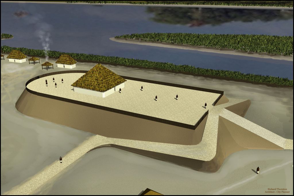
The original village, built by Chontal Mayas on the Etowah River as it appeared around 1000 AD.
(9) Tallasee and Talaxi are the English and Spanish ways of a word that is correctly written Taulashi in Chontal Maya. Tauli is merely the Chontal Maya word for town. Taulasi means Tauli – “Descendants of” or “Colony of.” Etauli (Etowah Mounds) means “Capital Town.” They occupied (1) a province at the mouth of the Altamaha River near Darien, GA, (3) a province near Ocmulgee Mounds, (4) the original town on the Etowah River that is now called Etowah Mounds, (5) a province on the Little Tennessee River near its confluence with the Tennessee and (6) a very large, powerful province on the Upper Coosa River in NE Alabama.
(10) Venezuelan Caribs (Mocama) originally lived (1) along the Medway River (south of Savannah near Midway, GA), (2) on Cumberland Island, GA and (3) around St. Marys Sound, GA. The Mocama were definitely Caribs, not Timucua as they are labeled by Florida academicians. They also established villages in Pre-Columbian times in the mountains of North Carolina and Tennessee. Place names in the Appalachian Mountains with “coa” or “coah” as suffixes are sites of former Carib towns and villages.
(11) The Alecmanni, of all things, had an Anglisk name . . . the language spoken by the Angles, when they lived in southern Sweden. The name means “Herb Healer – Nobility.” Alek became the Creek word for an herbal healer, but now means a medical doctor. The Alecmanni occupied a town just upstream from Fort Caroline on the Altamaha River with large orchards and gardens for growing such tropical plants as cinchona, from which quinine is made. The cinchona went feral and can be seen growing along the edge of the Lower Altamaha River. More proof that Ford Caroline was on the Altamaha River in Georgia!
The main Alecmanni town was on the Altamaha River at Doctortown, GA near Jesup. They also occupied horticultural towns near Alec Mountain in Habersham County, GA and near another Alec Mountain in the Rich Mountain Wildness Area in northwest Georgia.
(12) The Thamacoggen were located on the Middle Altamaha River. They specialized in the construction of large freight canoes and the regional operation of said canoes. Their name is Frisian and means “trade connectors.” Another Thamacoggen town was located on the Middle Fork of the Oconee River in Jackson County, GA (NE GA Piedmont) where they lived until 1785. The original name of Commerce, GA the county seat of Jackson County was Thamacoggen.
The large Oconee-Creek town on the Oconaluftee River in North Carolina. The mound was bull-dozed in 1987 to build a sewage treatment plant for the Eastern Band of Cherokee Indians Reservation. The mound had become an embarrassment, because the Cherokees had recently changed their history to state that they had lived on the lands of the reservation for 10,000 years.
(13) The Oconee had towns with five-sided mounds (1) in and around the Okefenokee Swamp, (2) between Savannah, GA and Port Royal Sound, SC, (3) on the Oconee River in Dublin, GA in the Coastal Plain, (4) several fortified towns near & on the Oconee River in Hancock and Greene Counties, GA near the Fall Line (5) on the Oconee River in Athens, GA, (6) on the Savannah River in Oconee County, SC and (7) on the Oconaluftee River in what is now the North Carolina Cherokee Reservation. Spoiler Alert – The Cherokees have not lived there for12,000 years as they now tell tourists.

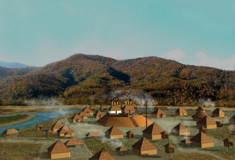
Capital of the Itza Mayas in the Nacoochee Valley of Northeast Georgia
(14) The Itza Mayas apparently spread across the lower Southeast and into Kansas at the large town of Edznoa, which means “Itza River,” and Spiro Mounds, Oklahoma on the Arkansas River. In the Southeast, their most powerful provinces were (1) at Ocmulgee Bottoms in Macon, GA, (2) the Chattahoochee River Headwaters in White, Habersham and Hall Counties, GA (3) the province of Chiaha on the Little Tennessee River in the North Carolina portion of the Great Smoky Mountains, (4) Itzate Gap and Dillard Valley on the Little Tennessee River in Rabun County, GA County, (5) and Track Rock Gap/Nottely River Headwaters in Blairsville, GA (6) Nashville, TN and (7) in the Lower Savannah River near the present-day City of Savannah.

The town of Tama on the Altamaha River
(15) Probably the most powerful Chontal Maya tribe, the Tamale, Tamate, Tamaute or Tamahiti maintained large provinces in the Coastal Plains of Tabasco and Tamaulipas States, Mexico. Their most powerful provinces in the Southeast were (1) Tama on the Upper Altamaha River, (2) Mapile on Mobile Bay and the Mobile River in Alabama , (3) Tamatli on the Hiawassee River in Cherokee County, NC (Nantahala Mountains) and (4) Tamahiti in the Shenandoah and Upper Holston River Valleys of Virginia.
(16) The Taino (Toa) utilized present-day Jekyll Island, GA as a ceremonial complex and perhaps, mother town, but by the time of the Hernando de Soto Expedition (1540) they were concentrated on the Lower Ocmulgee River in the province of Toa and on the Chattahoochee River in southern Fulton County, GA (Metro Atlanta).
(17) The Eufaule (Dog People) were a Uchee-Siouan People, who occupied a province south of Savannah, roughly where Fort Stewart is today. They also occupied (2) several towns on the Lower Hiawassee River near where it joins the Tennessee River in the Unaka Mountains of North Carolina. On early maps, the Lower Hiwassee River is labeled the Eufausee River, which means “Colony of the Eufaule.” In response to the aggression by the Spanish, the SE Georgia Eufaule moved to the Chattahoochee River in the 1600s and joined the Apalache Confederacy. They adopted Muskogean cultural traits and ultimately built their principal town, where Eufaula, Alabama now sits.
(18) The Santee were a people of Peruvian origin, who formerly occupied the Santee River Basin in South Carolina. Their name means “colonists.” (2) They also had a trading town in the Great Smoky Mountains, where Lake Santeetlah is now located.


Very interesting, Richard! I’m really enjoying your great work in this series. The true ancient history of our area is ever so much more complex than anyone has ever discovered or even considered.
LikeLiked by 1 person
Thank you Edna! I needed my retired English teacher in Oak Ridge to proof this one. I had some sort of stomach bug when I wrote the article and it showed it . I found the booboos this morning.
LikeLike
Well, thank goodness it’s never too late to fix our boo boos. Hummmm… sounds like the title of self-help book.
LikeLiked by 1 person
Excellent list, locations and description Richard! Rob in Fannin Co.
LikeLiked by 1 person
There were supposed to have been several mounds covered by Lake Blue Ridge. It was a rushed project because of World War II so no archaeological work was done before it was too late,
LikeLike