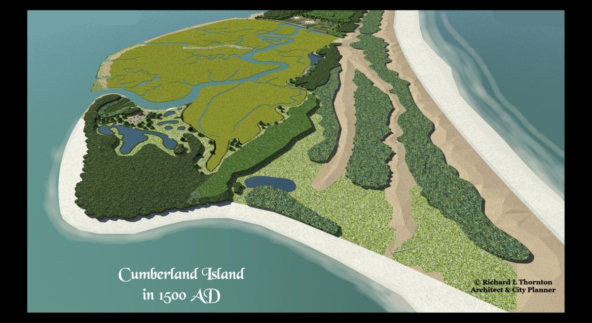
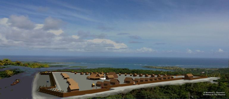
The product of three months work . . The . A three-dimensional computer model with a precision of 1/1000 meter!
I am currently installing the photo-realistic trees, shrubs and people on the computer model for close up views. The southern end of Cumberland Island contains all of the physical features, found along the South Atlantic Coast. In coming years, I will be using it as a “movie filming set” for portraying many types of Indigenous coastal communities.
The Many Peoples of the South Atlantic Coast Series
by Richard Thornton, Architect & City Planner
SLIDE SHOW
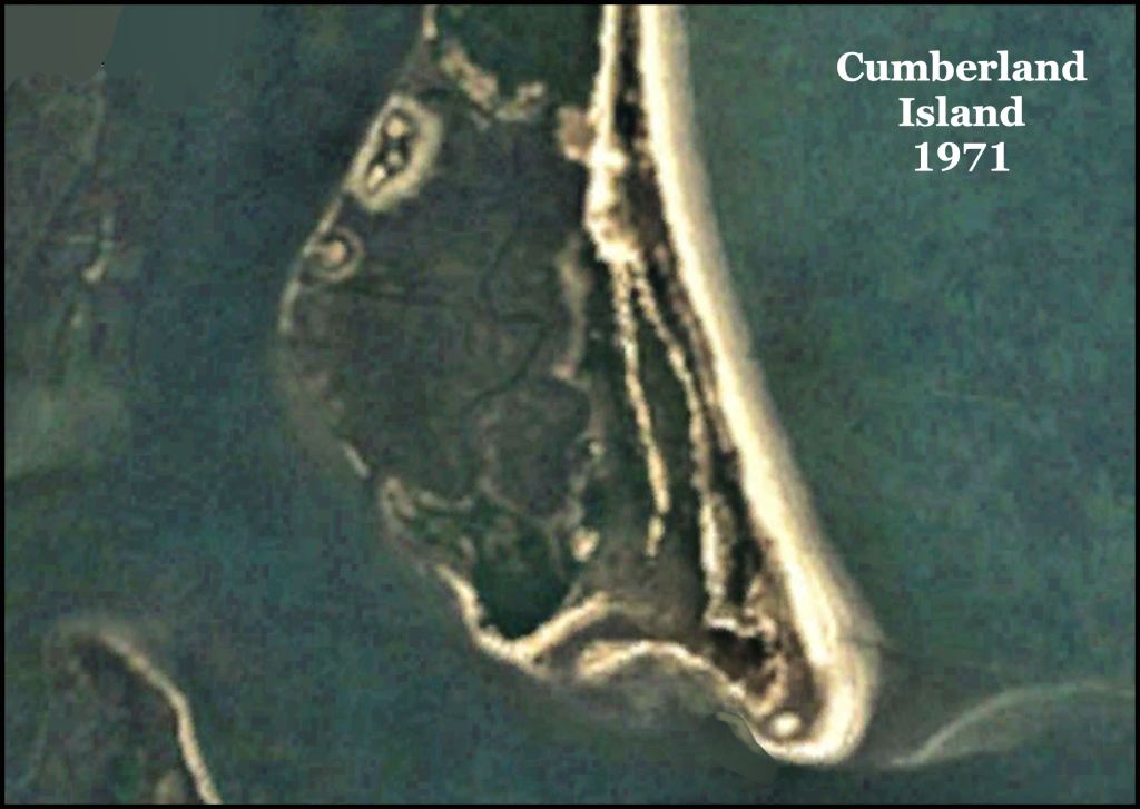
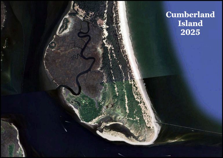
In August 1971, two Georgia Tech fraternity brothers and I were stranded on Cumberland Island for two weeks after a water spout-tornado wrecked our sail boat and marine radio. The island was uninhabited at that time. There was no such thing as a cellular phone in 1971. In the process, I gained an intimate knowledge of the terrain of the southern half of the island, where I now know that the two Native American villages were.

In November 1998, I attended a “Coastal Ecology” workshop on Cumberland Island for a week. We learned a great deal about the plants and animals on the South Atlantic Coast I was shocked how radically different the southern tip of the island looked. Cumberland Island was growing southward.
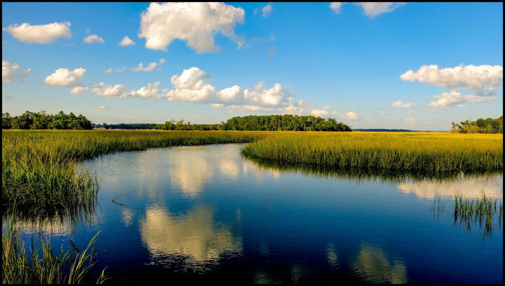
In the spring of 2004, Susan Karlson and I camped out near St. Marys, GA then explored by canoe the tidal marshes (plus fished) near Cumberland Island. The National Park Service would not let us take my dog and canoe on the ferry to Cumberland . . . hence, the reason that we camped on the mainland.

Jacques Le Moyne’s 1565 map of the South Atlantic shows two villages on the south end of Cumberland Island, exactly where we found potsherds in 1971. The French called these natives Sorrochos, whereas the Spanish called them, Mocamas. They called themselves Serashe – a Panoan (Peru) word. The French stated that the Sorrochos occupied the entire St. Marys River Basin and much of what is now called the Okefenokee Swamp, but then then was a lake called Serape. Generally, the French are much more reliable sources for information on indigenous peoples.

I used this precise land survey as the basis of my computer model, but trimmed some land off the southern tip. There were large sand islands in the tidal channels. which have been dredged away to improve navigation for ships and large fishing boats. The channel on the upper side of this map is part of the intercoastal waterway. I show the sand islands on the 1500 version of the island.
Cumberland Island is growing fast!
As you can see below, Cumberland Island has grown southward 2,240 ft (682.24 m) since 1971, when the satellite image was taken in preparation for the State of Georgia giving the island to the National Park Service. The cause or causes of the island’s rapid growth are not fully understood. Unlike the situation on the Florida Coast, Mother Nature seems to be adding more sand to Cumberland as the ocean level rises. Thus, over time. the island will move southward and westward as ocean levels rise.
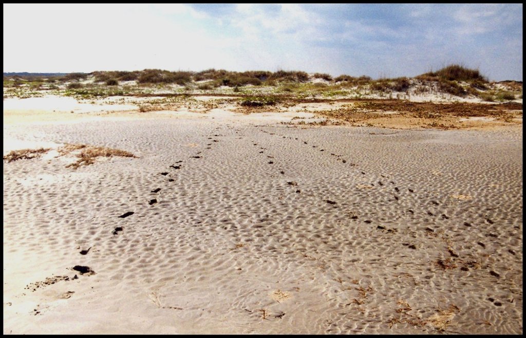
This is what the southern tip of Cumberland Island looked in 1971, when two Georgia Tech fraternity brothers and I camped there. At low tide, fish, crabs and shrimp would get trapped in the lagoon forming at the southern tip. This is what we mainly lived on during our two week stay. A water spout had wrecked our sailboat and dispatched our food coolers into the Atlantic Ocean.
The lagoon, which was beginning to form in 1971 has now been partially filled in with sand, which trees growing on it. The second lagoon had formed by the time I returned in 1998, but now it is being filled in with sand. Note that on the right, the late 18th century stone jetty has been reconstructed and extended.
The real Fort Caroline was 11 miles from St. Simons Island, Sapelo Island and the Atlantic, plus two miles west of enormous Altamaha Sound. There are no islands, no large sound and no two river channels, east of the fake location, even though these physical features were measured and described in detail by the French archives. Immediately west of Fort Caroline was an 85 feet tall ridge, where the French established a lookout station. There is no such feature in the Jacksonville Metro Area, but a a prominent landmark around Darien, GA.
The Fort Caroline Boondoggle
Much of the confusion now on Coastal Native Americans is that most locations are described by the French in cardinal directions and distance in terms of Fort Carolina’s real location at the mouth of the Altamaha River in Georgia , but Florida academicians continue to change their locations to match the fake location of Fort Caroline in Jacksonville . . . even though all historical maps show Fort Caroline to be on the Altamaha River in Georgia.
What one sees today in Jacksonville is a very inaccurate 1/12th scale model of Fort Caroline. constructed in 1961. The real fort was intended to hold at least 1,200 residents . . . much larger that the original Savannah! It stretched E-W about 2,200 feet!
Former National Park Service Director Roger Kennedy told me that when he attended a National French Huguenot Society ceremony at Fort Caroline, even his own staff lied to him . . . making him think that he was standing next to 430 year old earthworks. Perhaps the BIG LIE is so pervasive in Florida history textbooks, newspapers and a legion of archaeological reports that even the NPS staff by 1994, didn’t know that the earthworks were fake.
There was absolute nothing to support the current location of Fort Caroline National Monument . . . no historic maps, no ancient earthworks and no 16th century European artifacts. From 1565 until 1793, all maps labeled Georgia’s Altamaha River as the May River. If Fort Caroline was mentioned, it was placed on the south side of the Altamaha River. Both French and Spanish archives state that the latitude of Fort Caroline was the same as the mouth of the Altamaha River.
This myth was created by George R. Fairbanks. a transplanted New York real estate speculator to promote sales of land that he bought near the village of Jacksonville. The mouth of the St. Johns River was not even accessible to ocean-going vessels
The real estate speculator also created the myth of the Fountain of Youth in St. Augustine. FL where he had also invested in real estate. There was a vague myth of a Fountain of Youth in the Bahama Islands. but never in Florida, until Fairbanks put the spring on his lands for a real estate sales flyer, which he distributed in northern States. The flyer also contained the first mention of Fort Caroline being on his lands near Jacksonville.
Now you know!

The sand movement mostly has to do with nrar-shore currents that flow southward carrying sand with it. This creates lagoons. Some lagoons become lakes for some period of time. Eventually winds carry the sand westward during storms accumulates in the low lying areas creating swamps and meadows.
Sent from my Verizon, Samsung Galaxy smartphone
Get Outlook for Androidhttps://aka.ms/AAb9ysg
LikeLiked by 1 person
There has been more growth in the past 35 years than the previous 200 years. I have a copy of the 1802 survey. Something else is going on. I know this from being a Governors Intern during the period when Jimmy Carter arranged the transfer of the island to the National Park Service. I had a security clearance from being a Midshipman, who the previous summer had done some chores for Naval Intelligence in Central America.
Work for the King’s Island Nuclear Submarine Base to the west of Cumberland Island began simultaneously with the establishment of the National Seashore. The US Navy needed a deep water base that could be protected 360 degrees around. Cumberland acts as a shield for the base . . . but at the same time the channels have been dredged much deeper so the subs can go underwater immediately after leaving the base . . . for obvious reasons.
LikeLike