All beaches in the State of Georgia have remained in a natural state!
Readers may recall that in August 2025, a group of citizens in the Asheville, NC area asked me to examine flood damage in the Asheville Area to determine if their current state environmental laws and local government officials had any role in the extreme level of property destruction and loss of lives from Hurricane Helene.
The Many Peoples of the South Atlantic Coast Series
by Richard L. Thornton, Architect & City Planner
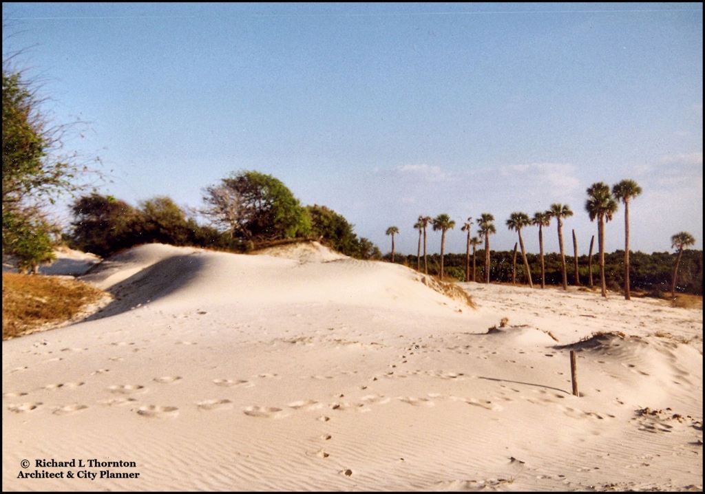
Georgia’s ban on beachfront construction became law before any serious damage occurred to beaches along the state’s pristine coastline. The dunes on Cumberland Island are up to 60 feet (18.3 m) in height and support a wide range of natural maritime vegetation.
What I discovered was that North Carolina was quite a bit more lax in the regulation of flood zone, beach front and mountainside housing, but outside Downtown Asheville, even those laws were not being enforced . . . whereas in the late 1970s and early 1980s, when I was a Senior Planner-Urban Designer for Asheville, they were enforced. Some time in the past, the NC General Assembly had passed a law making flood zone regulation a local responsibility.
However, I photographed numerous examples of where Buncombe County officials, where Asheville is located, were not even enforcing their lax laws . . . even after Hurricane Helene. The situation was getting worse, because their General Assembly was about to pass a law which prohibited regulation of buildings on steep mountain slopes by local governments, Houses are constantly sliding down mountainsides in Western North Carolina.
Most of the deaths in the Asheville Area would have been prevented by laws passed by Georgia five decades agothat included a 50 feet setback from designated trout streams.Creek-and-riverside home occupants in western North Carolina often had no time to escape, when waters rose rapidly.Most of the unpreventable deaths were due to motorists driving into flood waters or trees falling on vehicles and pedestrians.
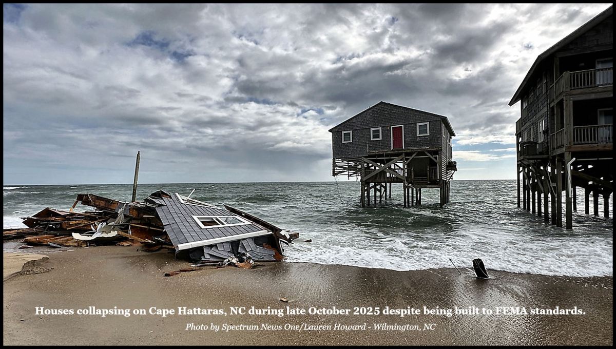
Investigative journalists have discovered that very few commercial and residential tenants in the Asheville Area were made aware that they were locating in a FEMA-designated Flood Hazard Zone, prior to signing leases . . . as mandated by Federal law. In contrast, homeowners, renters and tourists are quite aware of the dangers of being in houses next to the Atlantic Ocean, but continue to think that they will beat the odds.
Looking at the geographies of the GA coast and Asheville, NC, I feel compelled to comment that GA has made considerable efforts to protect its beaches. Asheville, NC is inland, at the confluence of rivers running downhill from the Appalachian and Blue Ridge mountains. Hurricane Helene dumped lots of water uphill from Asheville. As you have noted before, all that weight on river edges was prone to flooding, and construction of homes and buildings on unstable ground uphill is doomed to face the ravages of inclement weather. FEMA was enacted this century, so you can’t claim FEMA could have prevented the damage to buildings already constructed.
The point was that North Carolina, although progressive in other areas, has been lax in preventing storm damage everywhere in its state. When I worked for the City of Asheville between 1977 and 1982, we did not allow development of occupied buildings in the Swannanoa River Flood Plain. About 30 years ago, the local governments in Western North Carolina began looking the other way – then around 20 years ago, they persuaded the Bush Administration to remove several thousand acres of flood plains in western North Carolina from designated flood hazard status.
As for FEMA, it was created in 1979 – not recently as you said. Prior that date, flood hazard zones were the jurisdiction of the Federal Flood Insurance Program. The modern, systematic mapping of flood plains began with the creation of the National Flood Insurance Program (NFIP) in 1968, although earlier, less comprehensive flood-related studies were conducted by the U.S. Army Corps of Engineers starting in the mid-1960s. The National Flood Insurance Act of 1968 authorized the mapping of flood plains to support the new flood insurance program, and the first maps were developed shortly thereafter.

Looking at the geographies of the GA coast and Asheville, NC, I feel compelled to comment that GA has made considerable efforts to protect its beaches. Asheville, NC is inland, at the confluence of rivers running downhill from the Appalachian and Blue Ridge mountains. Hurricane Helene dumped lots of water uphill from Asheville. As you have noted before, all that weight on river edges was prone to flooding, and construction of homes and buildings on unstable ground uphill is doomed to face the ravages of inclement weather. FEMA was enacted this century, so you can’t claim FEMA could have prevented the damage to buildings already constructed.
LikeLike
The point was that North Carolina, although progressive in other areas, has been lax in preventing storm damage everywhere in its state. When I worked for the City of Asheville between 1977 and 1982, we did not allow development of occupied buildings in the Swannanoa River Flood Plain. About 30 years ago, the local governments in Western North Carolina began looking the other way – then around 20 years ago, they persuaded the Bush Administration to remove several thousand acres of flood plains in western North Carolina from designated flood hazard status.
As for FEMA, it was created in 1979 – not recently as you said. Prior that date, flood hazard zones were the jurisdiction of the Federal Flood Insurance Program. The modern, systematic mapping of flood plains began with the creation of the National Flood Insurance Program (NFIP) in 1968, although earlier, less comprehensive flood-related studies were conducted by the U.S. Army Corps of Engineers starting in the mid-1960s. The National Flood Insurance Act of 1968 authorized the mapping of flood plains to support the new flood insurance program, and the first maps were developed shortly thereafter.
LikeLiked by 1 person