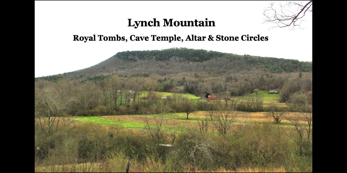
White County, Georgia
34°41’17.1″N 83°39’08.7″W
By Richard L. Thornton, Architect and City Planner
Lynch Mountain is either a collapsed volcanic crater or the site of a major meteor impact in the northeastern corner of White County, Georgia. It is located due east of the village of Sautee and south of the Sautee Creek Valley. The mountain is
1.45 mi (2.34 km) in diameter, while the crater is 3,117.12 ft (950.10 m) in diameter. All the rocks in the mountain are volcanic, mostly rhyolite, which are associated with a massive caldera that covered this section of Georgia about 160 million years ago. The crater is much younger than that, however. The north side of the mountain is a steep, vertical cliff, where Native Americans enlarged openings in volcanic vents to create burial tombs for the nobility of their communities.
It is obvious that the crater was a favorite place of mankind for thousands of years. There are extensive signs of intense foot traffic that created trails along its steep slopes. Several springs flow out its flanks, which join on the south side of the crater to form a creek, which flows into the nearby Chattahoochee River.

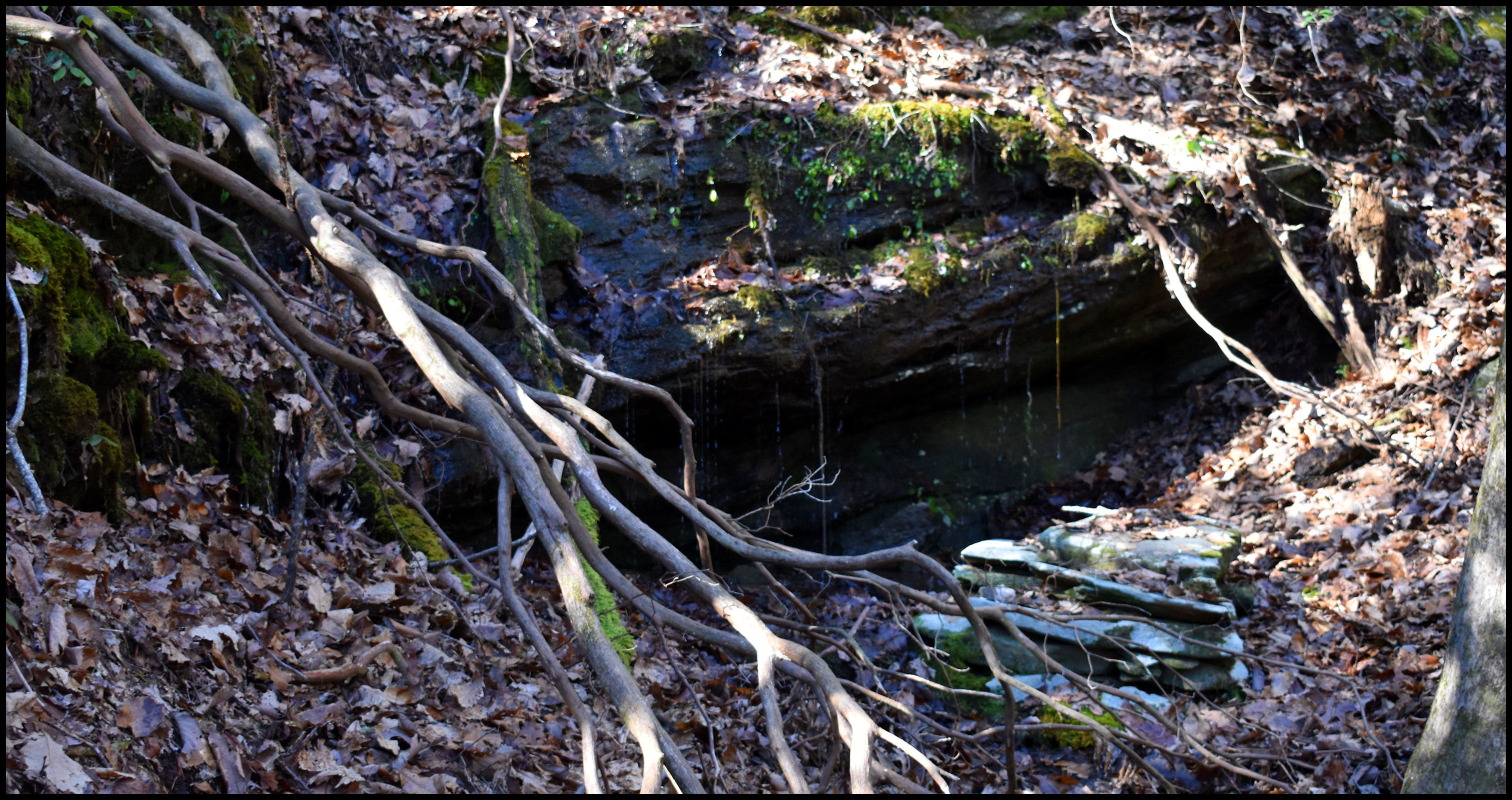
1 – Cave Temple and Stone Altar
34°41’17.1″N 83°39’08.7″W
At the head of a ravine on the northwest corner of the crater is a cave with a spring running out it. At the mouth of the cave is a quarried stone altar about 3 feet (1 m) square and 32 ” (.8 m) high. There appears to be more stone ruins to the north of the altar, but over the centuries soil has washed down the mountainside and covered most of the rocks. The site is difficult to photograph because the ravine is narrow and covered with fallen trees.
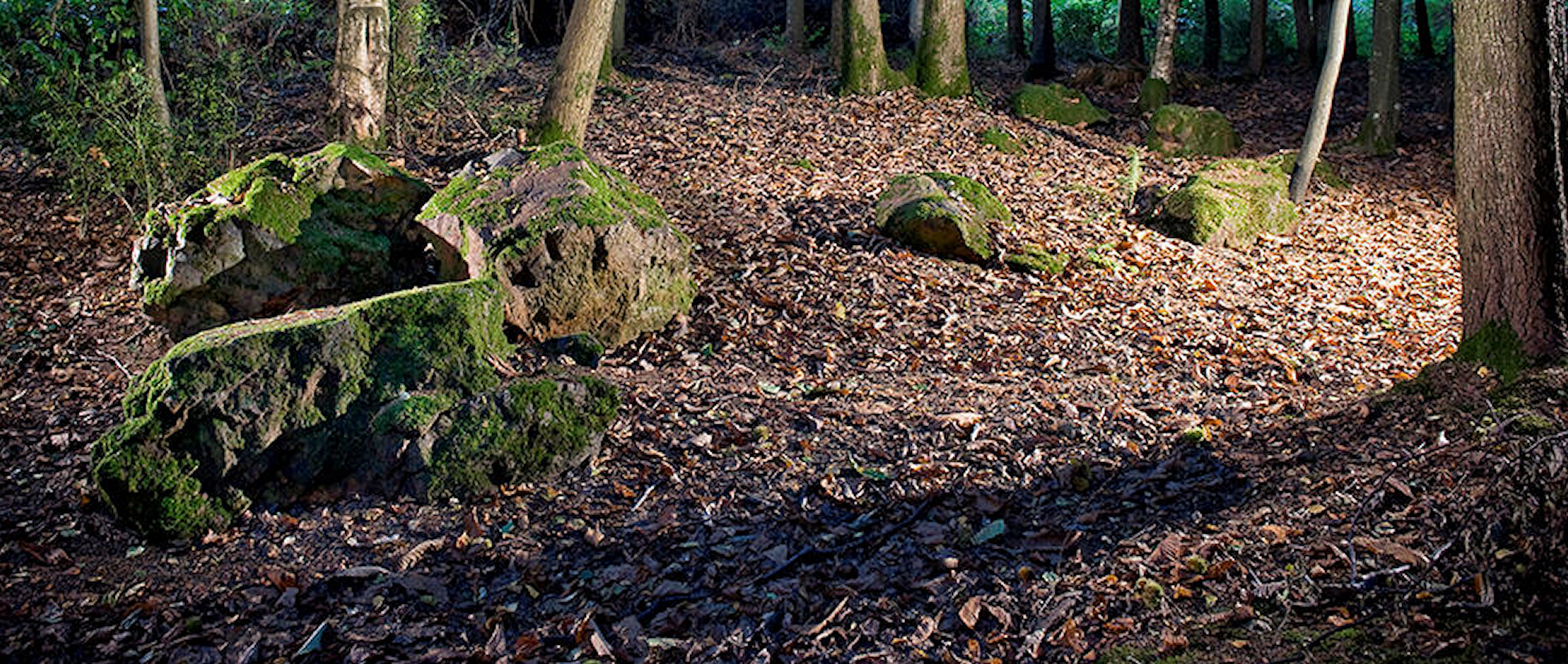
2 – Stone Circles
At several locations around the sides of the crater are circles of large rocks, varying from 6 to 15 feet (2-4.6 m) in diameter. From the heavy growth of most, it is obvious that they have been there for a long, long time. There seems to be no obvious reason for their particular location. In fact, the locations seem random and not having anything to do with astronomy or the lay of the land. Most can only be seen at close range in that they have no long distance views. A few circles and cairns are on the rim of the crater, but again do not seem oriented to the sun.

3- Royal tombs on Lynch Mountain
34°41’34.4″N 83°38’54.6″W
These tombs are located on the cliff at the north side of Lynch Mountain. A several locations in the Nacoochee Valley and in the vicinity of Track Rock Gap in Union County, GA, the Apalachete and Itzate excavated tombs in the rims of ancient volcanoes or conventional mountains for their nobility. Those tombs above the Track Rock Terrace Complex were sealed with quarried rocks and clay mortar then stuccoed with lime plaster. According to 17th century French ethnologist, Charles de Rochefort, the Apalachete mummified their deceased leaders and left them on display in temples until the mummies molded. The mummies were then placed in the tombs with grave offerings and then the tombs were sealed. This tradition apparently was brought from Peru to Georgia.

4 – Ruins of Early Colonial Period houses
At scattered sites along the rim of Lynch Mountain are the ruins of European-style houses. What distinguishes them from the ruins of Anglo-American frontier log cabins, is the ashlar stone masonry. The stone masonry is NOT made from the grainy volcanic stones on Lynch Mountain, but from basalt and metamorphic rocks quarried elsewhere. The stones were worked and squared off into the shape of flat bricks. The same style of ashlar masonry is seen at the ruins of 17th century European houses at Melilot Colony, which is now Little Mulberry River County Park in Gwinnett County, GA. Without professional archaeological investigation, it is impossible to determine who built these cabins, but it is known that the Melilot Colony was founded by French Huguenots and supplemented by English and Dutch Protestants.

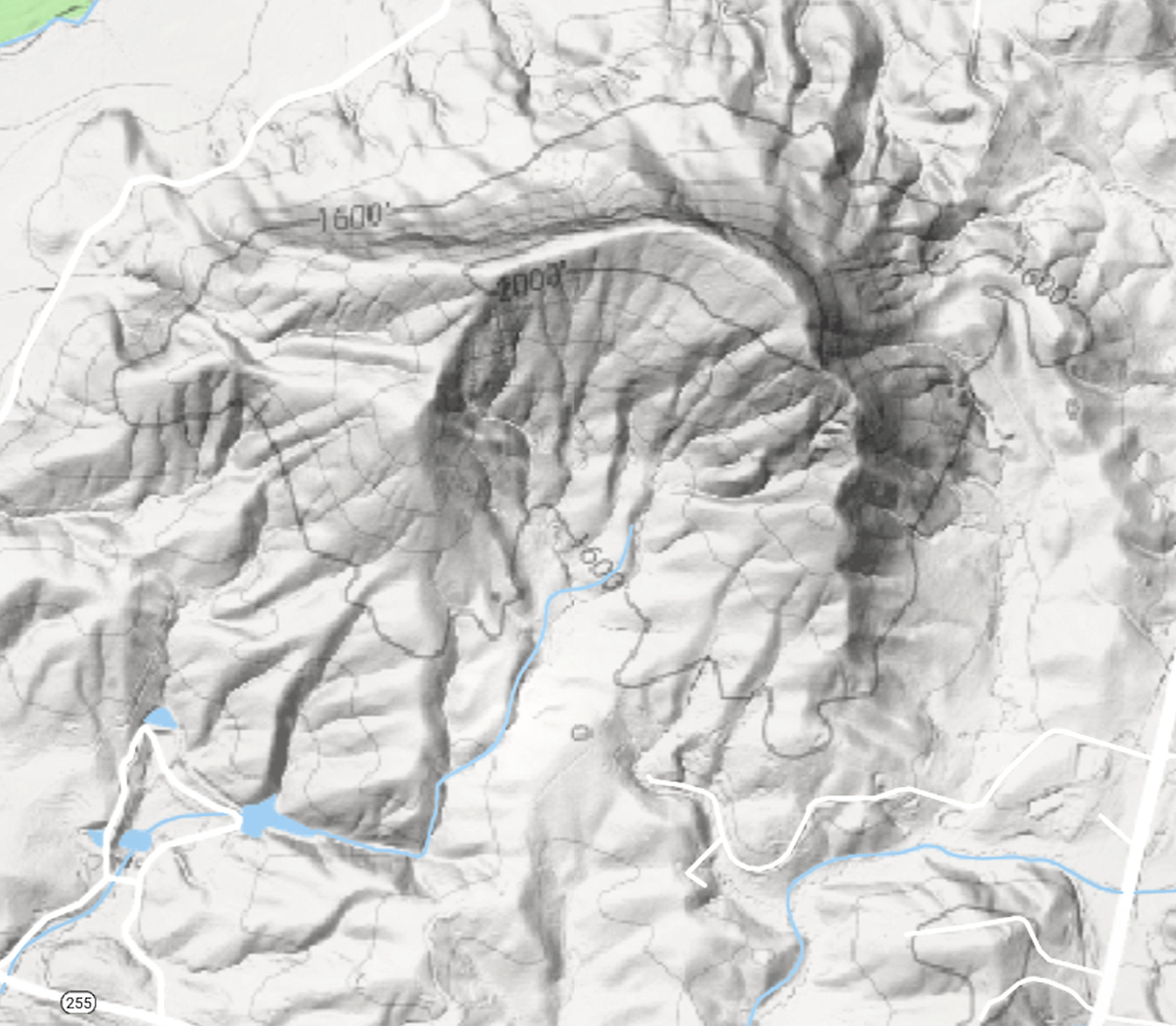
If you compare your relief map of Lynch Mountain with one of Mount Saint Helens (post-eruption), you will find strong topographical similarities suggestive of a volcanic origin. The hallmark of meteorite impact craters on the other hand are features called shatter cones. These are sometimes found at the sides but usually below the crater itself and are produced by the shockwave of the impact.
I believe we are looking at an ‘exticnt’ volcano here. Don’t get too comfortable with an extinct classification however. ‘Extinct’ volcanoes frequently come back to life with little warning. Recently a Chilean volcano classified as extinct with an eruption free span of 160,000 years is showing signs of coming back to life.
LikeLiked by 1 person
***DO NOT POST***
There was an interesting discovery made by some Rutger geologists back in 2017. They found a completely unexpected mantle plume (magma) rising under New England. Nothing to worry about for millions of years to come.
I noticed that there are multiple anomalous ‘hotspots’ deep underneath the Appalachians that have been detected during siemic S-wave testing. There is a small (but apparently hot) one in North Central Georgia, half way along the Carolinas border. No other heat anomalies were noted in Georgia.
If there is a fault in any area with one of these heat signatures below that experiences a deep earthquake the opportunity for an escape of high pressure steam exists.
If a 50M+ year old extinct volcano on the other hand is located directly above a mantle heat source with a porous (gassy) rhyolitic plug in it then its not entirely impossible that it may vent steam from time to time especially after earthquakes. Venting of carbon or sulphur dioxides or God forbid an eruption would be an extremely unlikely outcome however.
LikeLiked by 1 person