White County, Georgia
34°40’41.9″N 83°41’56.0″W
by Richard L. Thornton, Architect & City Planner
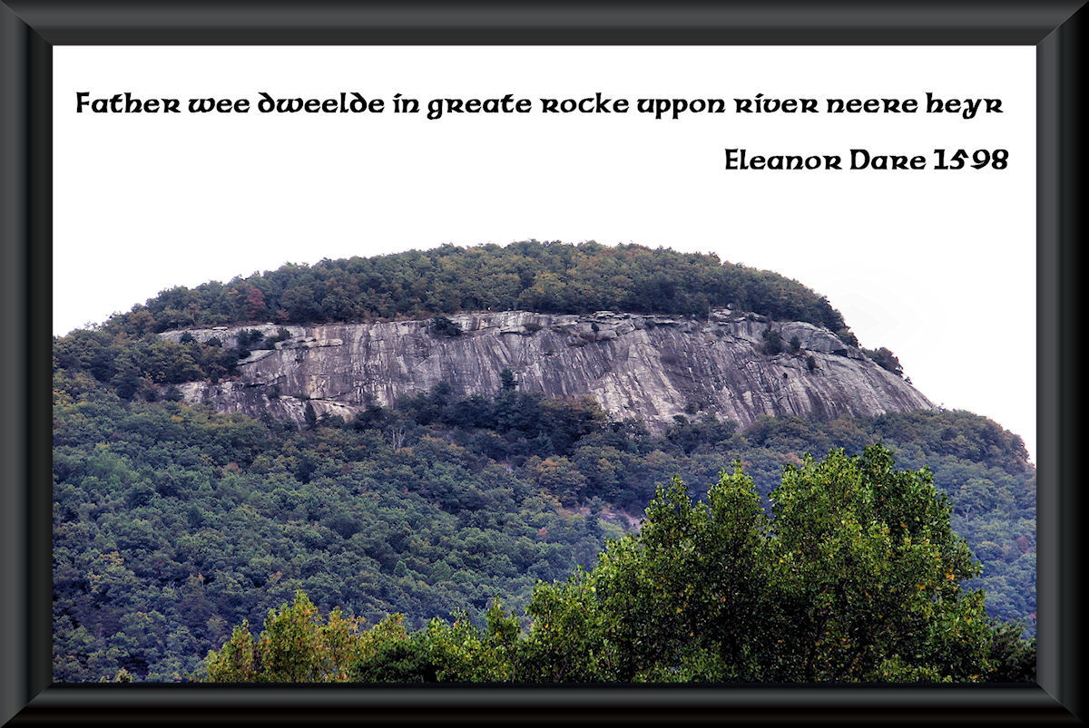
For almost two centuries residents of the Nacoochee Valley and the many tourists, who visited there, have pondered a cone-shaped hill, which is 3,500 feet (1 km) southeast of the famous Nacoochee Mound. It is shaped like an “Indian Mound” and had stone ruins and many Native American artifacts on it. However, it also seemed have natural stone boulders in it in some places. Some thought it to be a massive mound built by giants, who were able to lift large boulders. The real history of this ancient mini-volcano is extraordinary, but has completely been left out of the history books. It should be a national historic site, but is completely ignored by federal, state and local government officials. You will now learn its fascinating story.
To learn more about the late 16th century and 17th century colonization of the Southern Appalachians by Europeans and why it was left out of the history books, go to: A Spanish Fort and Trading Post in the Nacoochee Valley.
An English explorer erased out of the history books
A book, highly esteemed in Europe, l’Histoire naturelle et morale des îles Antilles de l’Amérique (1658) by Charles de Rochefort, contains ten chapters on the indigenous peoples and natural features of what is now the State of Georgia. An annotated translation of those chapters, The Apalache Chronicles, was published by Marilyn Rae and Richard Thornton in 2014. It is available on Amazon.com. De Rochefort is the primary source of information on Richard Briggstock’s journey. Several other late 17th and 18th century books, published in English, mention Briggstock’s journey in less detail.
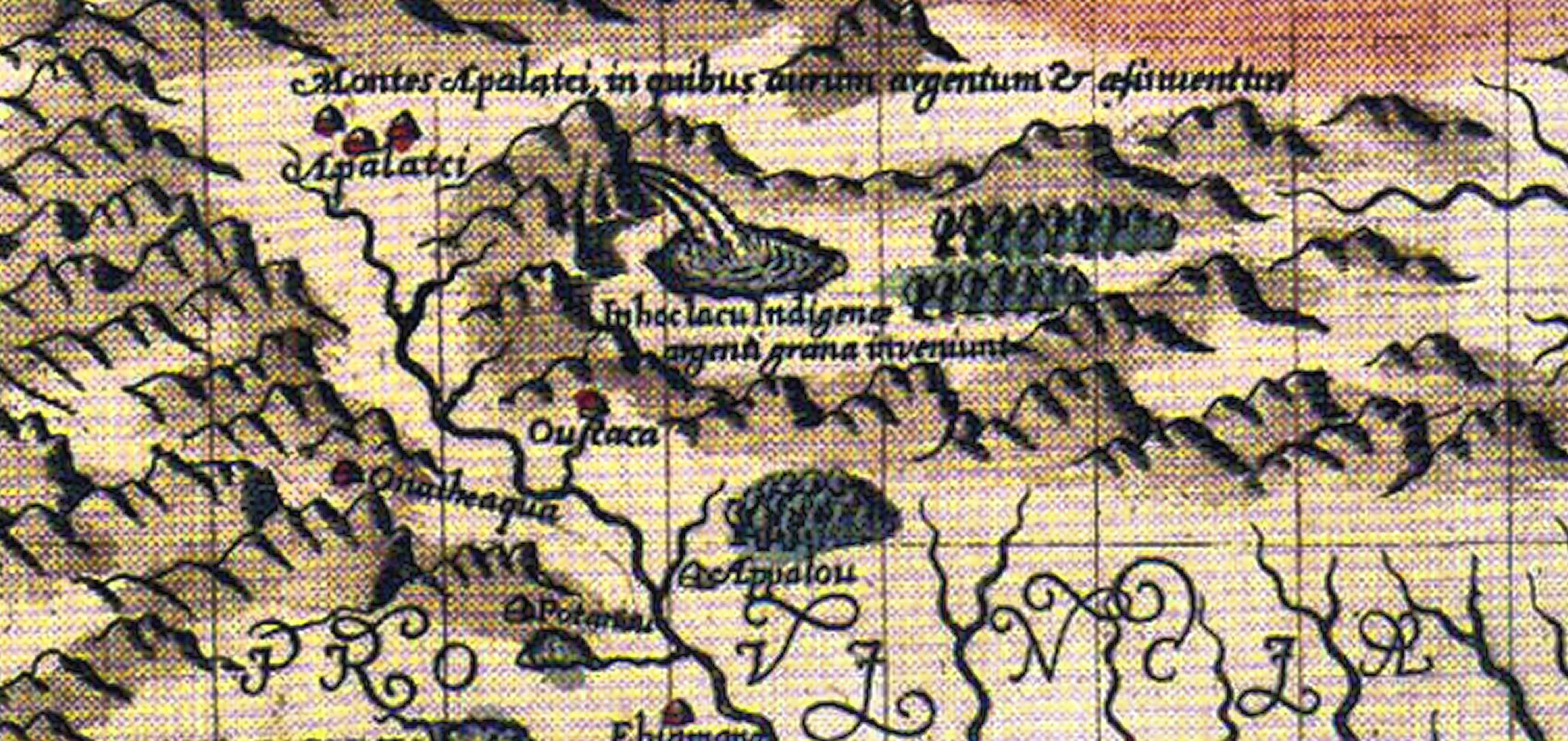
Why would an extremely popular book that went through six publications in multiple languages, be unknown in the United States? During the 1800s and early 1900s, the colleges of the Northeastern United States dominated the nation’s textbooks. Particularly, in the years leading up to the Civil War, Northeastern professors were extremely hostile to the South. De Rochefort described the Indians of Georgia as being the most advanced indigenous peoples in North America . . . being quite civilized with a writing system, planned towns, brightly patterned clothing and sophisticated, monotheistic religion.
The New England academicians couldn’t handle that since they knew for a fact that if the white race in the Southeast was dull-witted and culturally backward, certainly the Indians, who preceded them were the same way. De Rochefort’s book was banned from the curricula presented to students and soon forgotten in the United States. The book is considered a threat today to orthodoxy, because it, like ALL French, Spanish, English and Dutch maps, placed Fort Caroline at the mouth of the Altamaha River in Georgia. The book goes on to say that a handful of the ill-fated colony’s survivors settled among the Apalachete (Proto-Creeks) in Northeast Georgia. It also states that western North Carolina was occupied in 1653 by Apalachete and Spanish-speaking Sephardic colonists. There is absolutely no mention of the Cherokees anywhere in the book.
In 1653, the English Commonwealth fleet established a blockade around the Royalist island colony of Barbados. With the help of a Sephardic Jewish captain of a Dutch ship, Richard Briggstock was able to slip through the blockade and be transported to the coast of French Florida (Georgia). Once there, friendly Indians transported him up the May River (Altamaha and Oconee Rivers) to the Kingdom of Apalache.
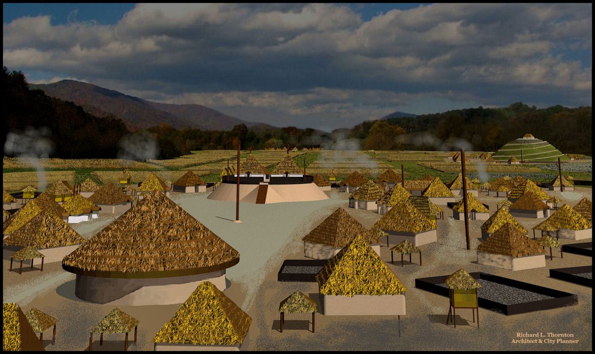
Briggstock visited the European colony of Melilot at what is now Little Mulberry River Park in Gwinnett County, GA then journeyed to the Nacoochee Valley, which was the capital of the Kingdom of Apalache. He was received warmly by its High King, who had the official title of Paracusite. Paracusate is the actual name of the long headed people of Peru, who created the Nazca Lines. Briggstock spent most of 1653 in Apalache and was allowed to travel freely . . . looking for a suitable valley to relocate the Barbados Colony. He also spent several weeks with Spanish-speaking gem miners in what is now North Carolina.
In Briggstock’s absence, the situation in Barbados had ended peacefully. After the colonists accepted a governor, appointed by Oliver Cromwell, the English fleet sailed away. The Briggstock family eventually moved to Virginia, where his cousin, Edward Bland, already had establish a large plantation. Before then, Briggstock provided all his notes and sketches to Charles de Rochefort, who was the French Huguenot minister assigned to be the pastor of French and Scottish Calvinists in the Caribbean Basin.
Dutch engraver and printer, Arnout Leers, published De Rochefort’s book in 1658. Leers’ engravings exaggerated the sketches by Richard Briggstock. On January 6, 1660, Edward Graeves, a director of the European colony at Melilot, wrote De Rochefort to tell him that although his book’s text was quite accurate, Arnout Leers’ engravings of the Apalache’s architecture and North Georgia’s landscape were not. Graeves enclosed sketches of their actual appearance, but no version of De Rochefort’s book has been found with the corrected engravings.
Identifying Eleanor Dare’s Homesite
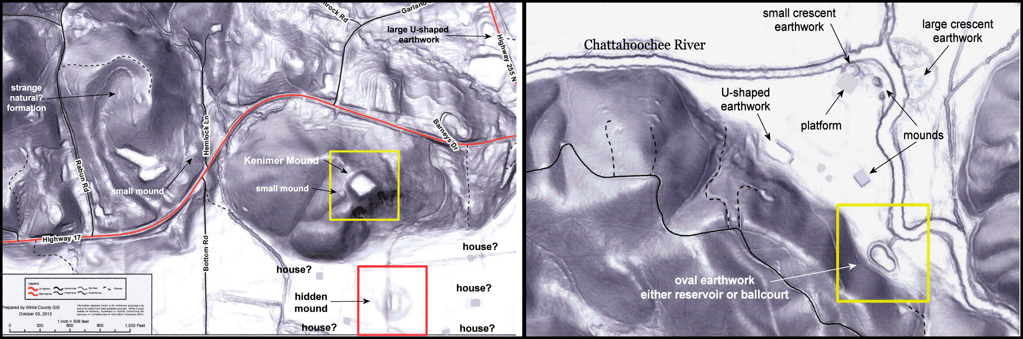
As stated in another America’s Revealed article about Eleanor Dare’s grave . . . while digging test pits to determine if Williams Hill was a mound or natural, Archaeologist Robert Wauchope unearthed a stone tablet at its base on the northeast side, which stated that the Eleanor Dare lived with her husband, the Indian chief of Hontaoase, on top of that hill. Williams Hill was described as being adjacent to the confluence of the Chattahoochee River and Duke’s Creek. It was that very same conical hill, which had puzzled locals and tourists alike for almost two centuries.
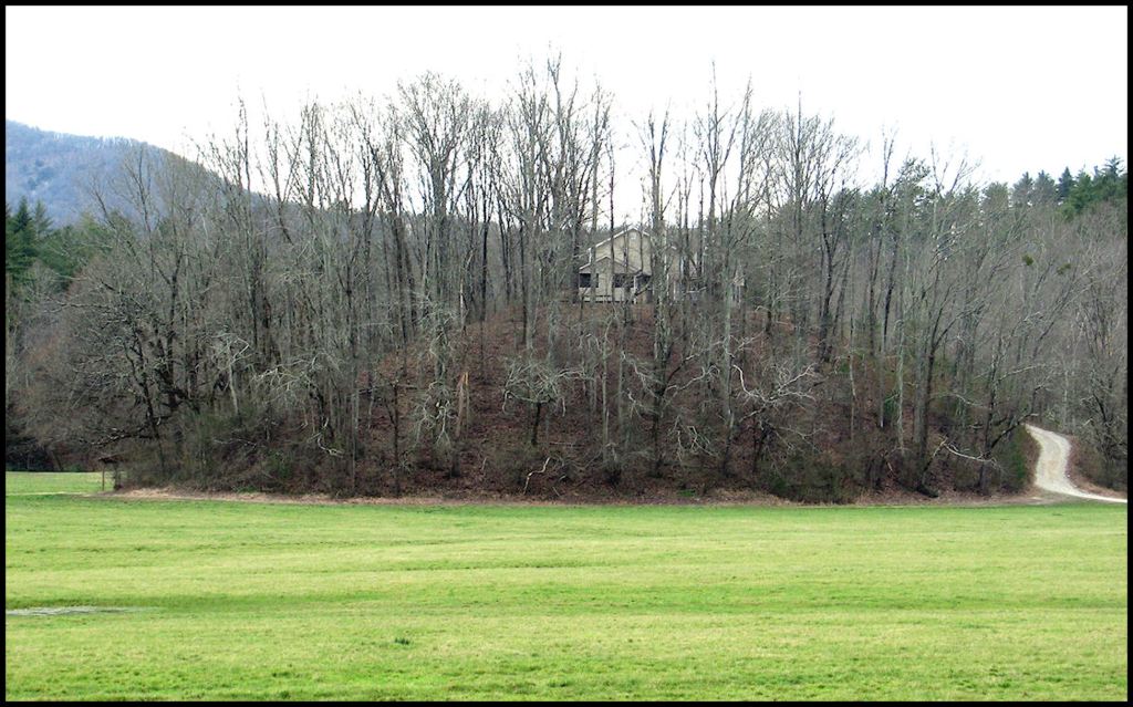
Was there any evidence of there being a structure of an important Native American chief . . . perhaps a king . . . on the conical hill? I was invited to visit the site by Curtis Dyar, whose father had purchased the farm, containing the hill. I didn’t expect to see any evidence since in recent years a modern home has been built on top of the hill by Curtis’s daughter and son-in-law. I was in for many surprises.
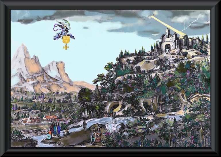
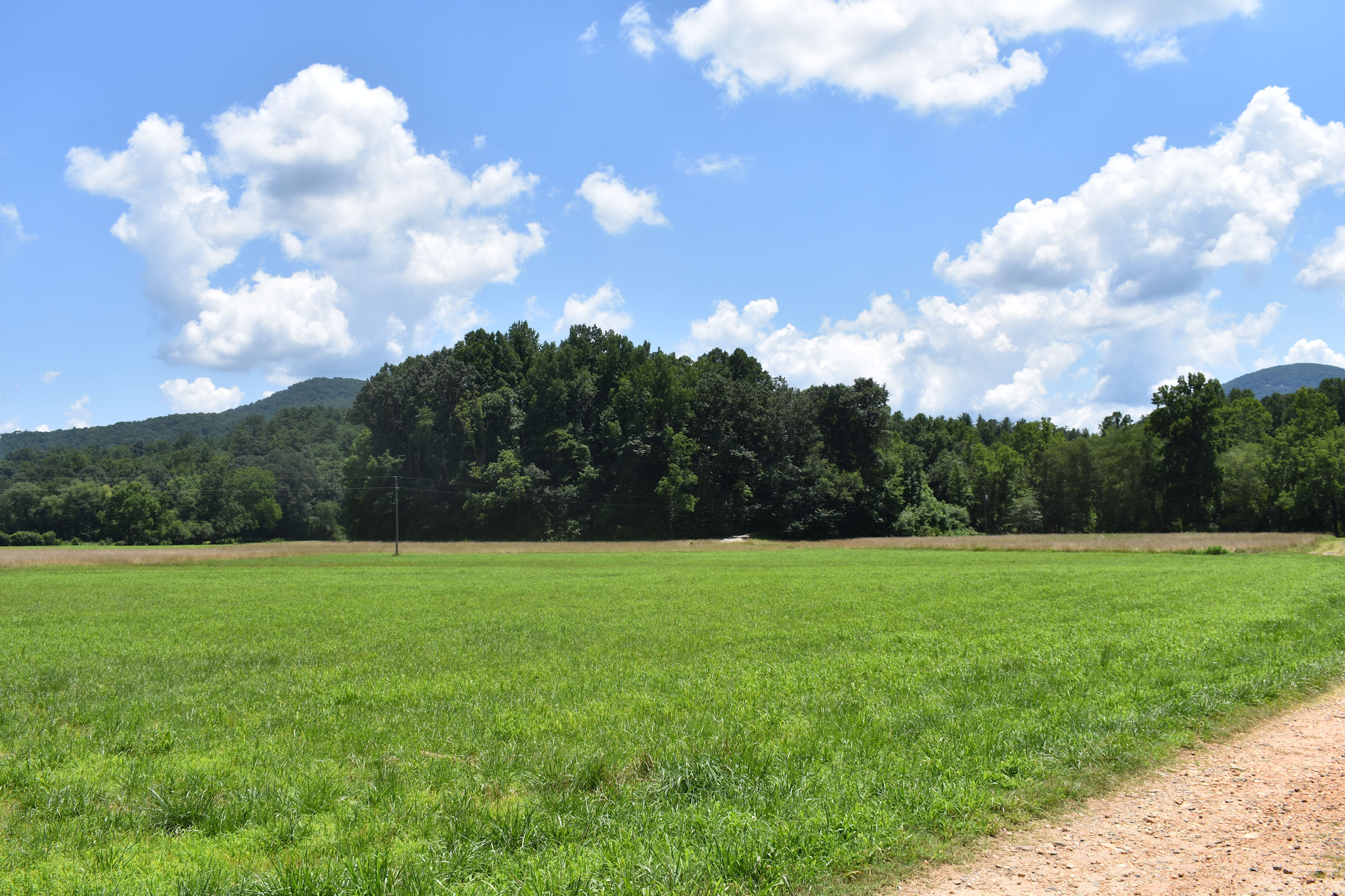
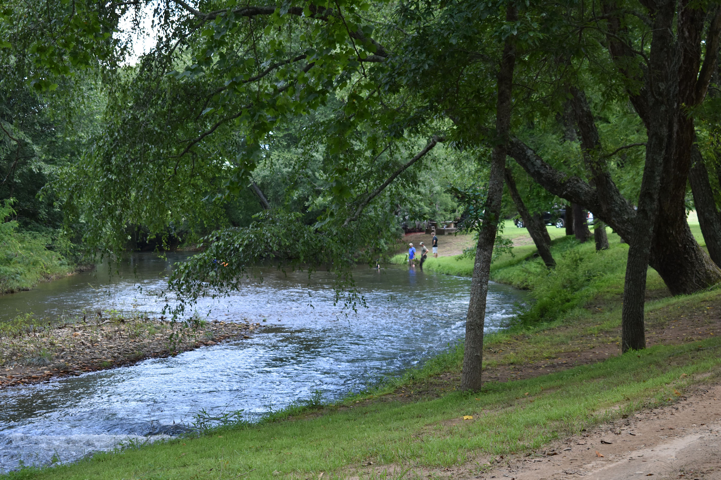
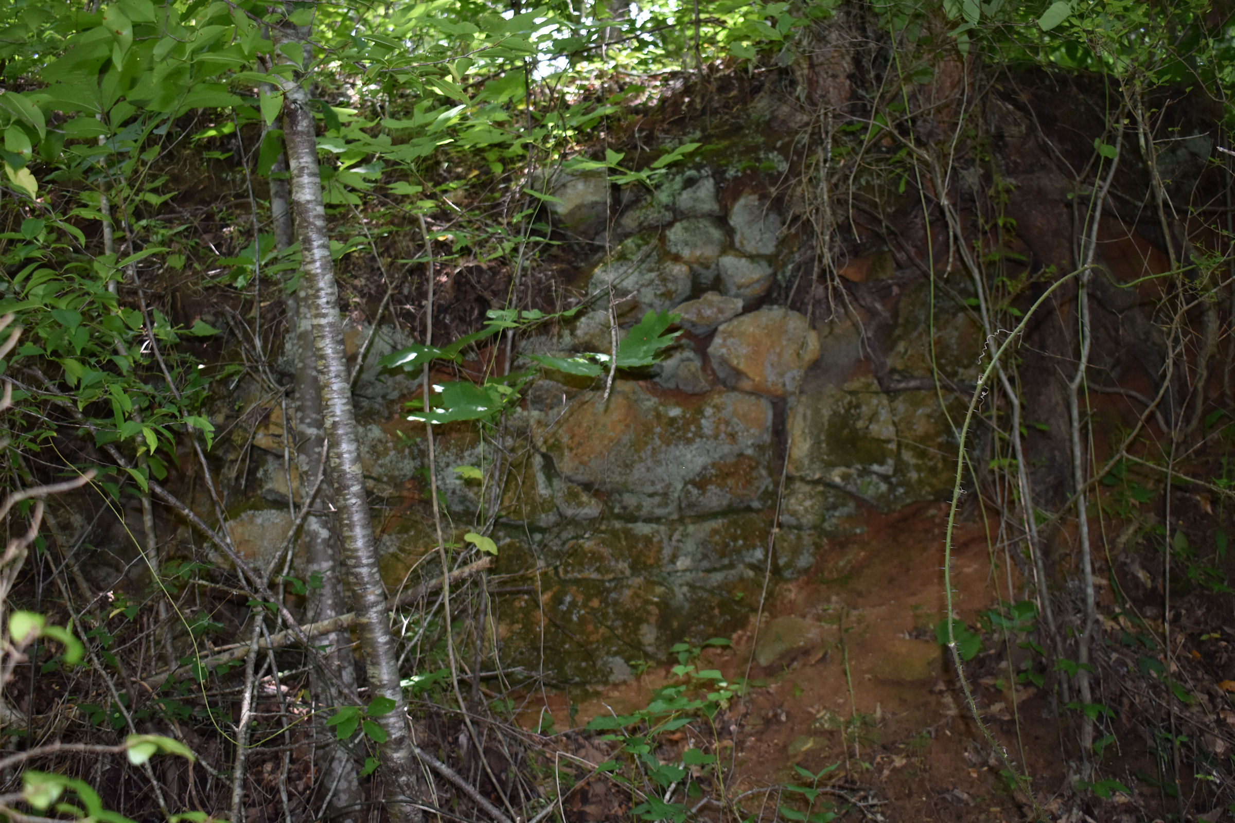
There WAS an ancient curving ramp going up the slope of the hill. Part of it had been widened to create a driveway, but other sections were intact as merely a 6-9 feet (2-2.4 m) pedestrian ramp. As we walked around the south side of the hill, I immediately recognized the scene above, created by Arnout Leers 360 years ago. A group of Apalache noble men and women are portrayed as lounging at the confluence of a fast-running mountain river and a large creek. It was like I had entered a time machine.
I realized what had happened back in the 1650s. Arnout Leers had confused the sketches made by Richard Briggstock of the Great Sun Temple and the hill on which the King of Apalache lived. The King and Queen are in the bottom center of the engraving. All of the Apalache elite wore brightly patterned tunics and conical woven hats. The tunics were the origin of the famous Creek/Seminole “long shirt.” Leers had placed an exaggerated Sun Temple on top of the conical hill, where the king lived.
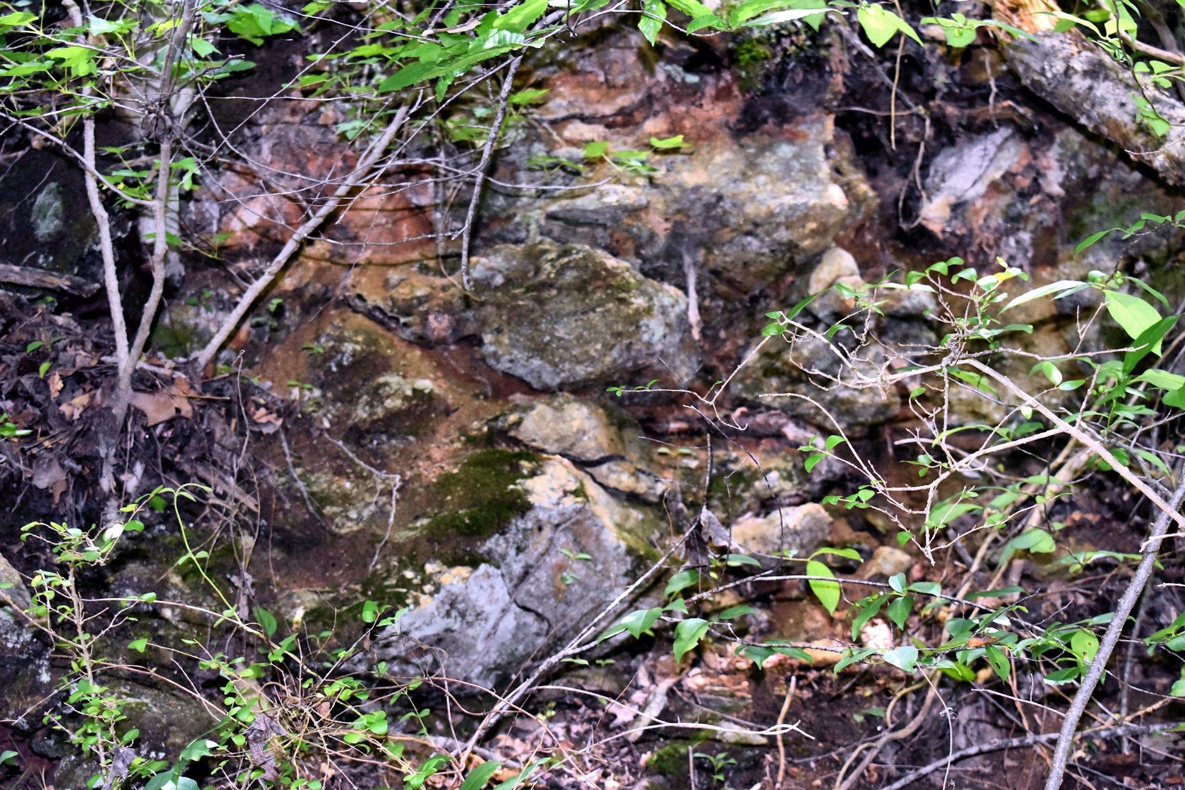
Even after all these years, the terrace and the ruins of a stone retaining wall, which is pictured in the center of the engraving above are still there. Curtis told me that through the years, his family has found hundreds of Native American and Early Colonial artifacts on their land, especially around the base of the hill. They are exposed every time the Chattahoochee River floods. There was no doubt that this location is an archaeological site of national significance. It has had an official archaeological site number since 1940, but in the 88 years since then has been completely ignored by Georgia’s archaeologists. Below are some of the views of this incredible vestige of North America’s history.
Identifying the site of the Great Temple of the Sun Goddess
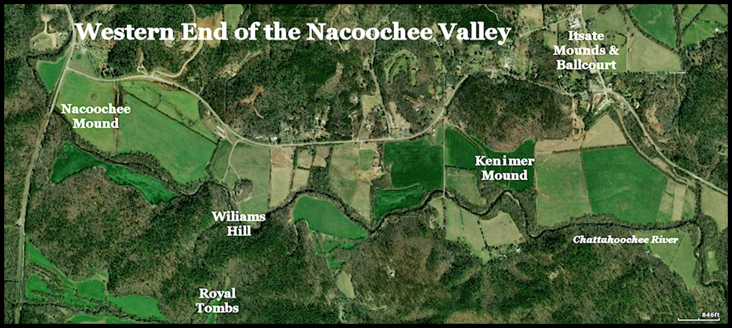
The profile of the hill portrayed by Leers in De Rochefort’s book matched the appearance of the conical hill that is a kilometer east of the Nacoochee Mound, where Eleanor Dare’s home was located, but Yonah Mountain, behind it, blocks the view of the sun in the early morning and afternoon. It was a very unlikely place for the great Sun Temple temple that Leers engraved at the top of a hill.
Until the 1830s, Yonah Mountain was called Nokoshe, which is Creek word for bear. Asturian gold miners in the valley, called the peak, Yeona, which was their word for a mountain lion. In the early 1830s, white settlers from North Carolina renamed the mountain, Yonah, which is the Cherokee word for a Grizzly Bear. There are no Grizzly Bears in the Southeast.
So where was the Great Temple of the Sun? It probably was not on the hill where Eleanor Dare lived. De Rochefort described the largest temple of the Apalachete Sun Goddess as being built out of stone and located at the top of a large hill with a ramp to its top. In the temple, its priests would start sacred fires magically by focusing the heat of the sun with crystals. One part of the temple contained nests for a flock of Painted Buntings, which flew south each autumn to Mexico, the home of the Sun Goddess, in order to bring her prayers from the Apalachete People. Another temple to the Sun Goddess was on Yonah Mountain.
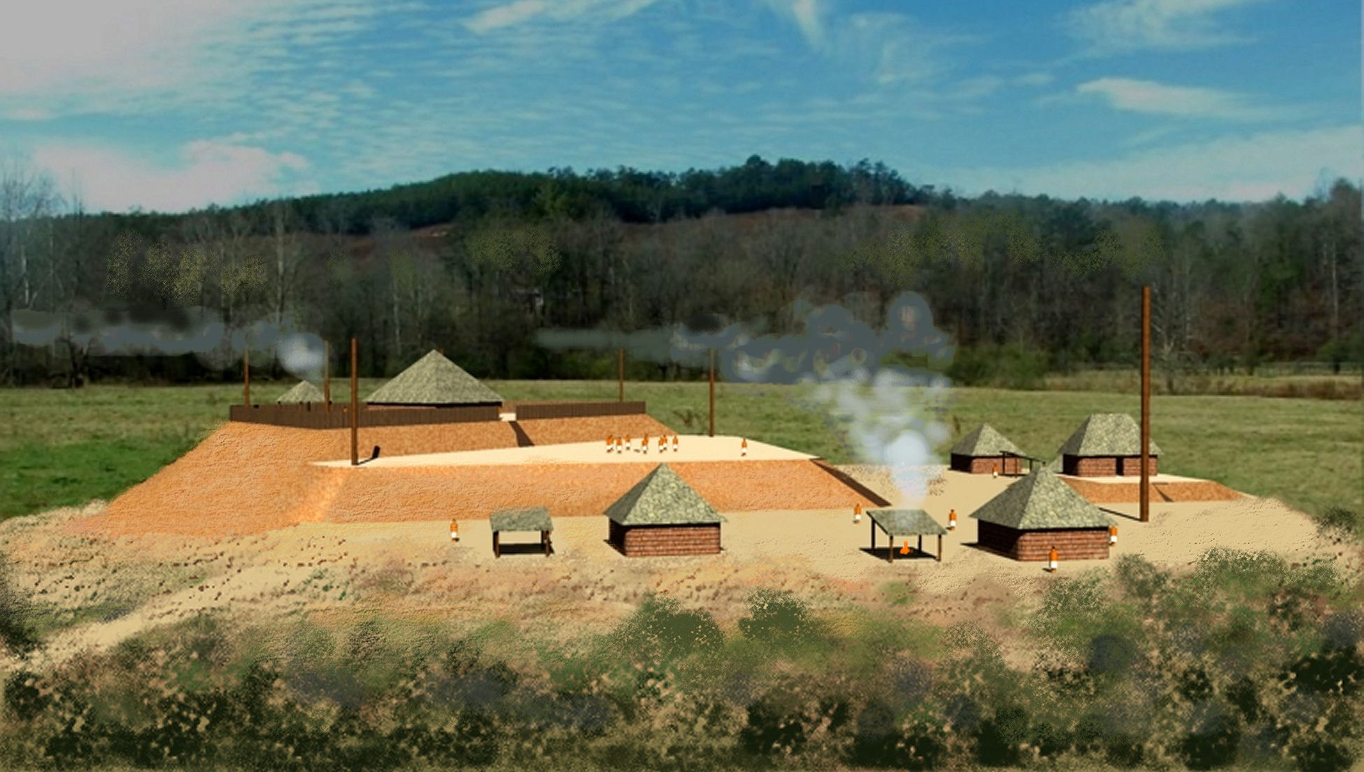
The most likely candidate for the Great Sun Temple is the massive, five-sided Kenimer Mound (see satellite photo above). It is slightly more than a mile east of Williams Hill. I had discounted this site initially because there is no evidence of a stone structure. It has never been thoroughly examined by archaeologists. However, several years ago a team of professors and students from the University of Georgia dug test pits on its cap. They found Napier Complicated Stamp potsherds, dating from the 600s AD . . . which means that the mound dates at least from that era. It may be much older. The archaeologists also determined that the mound had been sculptured from the existing contours of Kenimer Hill. Dirt was cut away from the crest of the hill and then piled on the original grade to create a large mound.
The Zoque of Tabasco State, Mexico, Itza Mayas of Chiapas State and the Kekchi Mayas of Guatemala traditionally sculptured five-sided mounds from large hills to create platforms, dedicated to their Sun God. The actual name of the modern village of Sautee, where the Kenimer Mound is located, was Itsate, which means “Itza People.” However, again there is no large stone temple on the Kenimer Mound.
The last part of the riddle was solved by Sylvia W., who grew up in the Nacoochee Valley. She said as a teen she remembered seeing the ruins of a large stone building on top of the Kenimer Mound. Some of the walls were partially standing. In the late 20th century, a family moved up to the Valley from Florida. They purchased the stone ruins for pocket change then paid a contractor to haul them to their land, where they were utilized in their dream house’s foundation and chimney. A National Historical Landmark is gone forever.