by Richard L. Thornton, Architect & City Planner
By 1776, much of Southeast was uninhabited, but the Creek population was rebounding – especially in Florida. There were multiple causes to the approximately 90-95% drop in the indigenous population of Southeastern North America between 1500 and 1763 AD. The story is not a simple explanation that “all the Injuns died after Hernando de Soto rampaged across the region’s landscape.”
Twenty-first century academicians and historians inevitably define the Colonial Era history of what is now the Southeastern United States in terms of European settlers and federally recognized Native American tribes. In fact, there were once over a hundred tribes and over two dozen distinct languages spoken. As a result, the majority of Native American word translations that you read in such sources as Wikipedia are bogus and the history can be highly skewed toward provincial perspectives.
The fact that the South Carolina Low Country was essentially an African country with a European elite is rarely discussed. The presence of perhaps over a thousand non-British settlers in the Appalachians is left out of the story entirely. The Cherokee have been assigned the vast territory, occupied by the Chickasaw. The Uchee are mentioned as an afterthought, if at all. You are not told that by the mid-1600s Dutch-Jewish traders had already reached the Mississippi River and were supplying iron pots, metal tools and firearms to tribes to much of the Upper South. You are not told that the French had a large fort and trading post on the upper Tennessee River near Lenoir, Tennessee, protected by two Upper Creek villages, until around 1720.
I am currently reading or re-reading the eyewitness journals of several 18th century explorers in order to create the most accurate possible interpretations of Native American place names in the Southeast. The explorers were John Lawson in the Carolinas (1700), James Adair among the Chickasaw, Creek and Cherokee (1735-1776), Lt. Henry Timberlake among the Cherokee (1762), William Bartram among the Creeks, Seminoles and Cherokee (1773-1776), Jean-Antoine Le Clerc Milfort among the Upper Creeks (1776-1794), John Tipton/John Sevier in SW Virginia and NE Tennessee (1780) and Professor Elias Cornelius at Etowah Mounds (1818).
The stages of genocide in eastern North America
Early Spanish explorers found the Gulf Coast region and the Atlantic Coast of Florida almost uninhabited, but dotted with the ruins of recently abandoned villages. However, the Hernando de Soto’s expedition found the interior of the Southeast thriving and populated in 1540. His chroniclers stated that the conquistadors never lost sight of houses or cultivated fields, while passing thought what is now Georgia. They also found dense populations along major rivers in South Carolina, eastern Tennessee, Alabama and the Mississippi River Basin.
Despite multiple epidemics and catastrophic deaths at the time of contact with the Spanish, the Native population rebounded in certain areas with advanced cultures. British explorer Richard Briggstock reported that the Kingdom of Apalache in northern Georgia was densely populated. There were also colonies of Europeans and mixed bloods living there. Its high king could summon over 7,000 warriors within two days walk of the capital in the Nacoochee Valley. Yet by 1776, much of the landscape of the Southeast was uninhabited and covered in mature trees. Anglo-American explorers could travel over a hundred miles without seeing a habitation. What happened?
The Little Ice Age-Phase One-1450-1585: Short summers caused the abandonment of agricultural towns of the French Broad River Valley and points northward in the Appalachians around 1500 AD. Although the Asheville Area currently has a climate little different than the Georgia Mountains, it can get much colder. In 1985, the temperature on Mount Mitchell, NC dropped to -43° F. on January 15. We had snow flurries on our farm in the Reems Creek Valley on June 6 and a hard frost on September 7. There was insufficient time for corn to grow to full maturity.
During the Little Ice Age from c. 1350 to 1750 AD, the mountains of Georgia and South Carolina received extremely heavy snowfall. In 1567, the Pardo Expedition had to stop at the foot of the Blue Ridge Mountains of South Carolina in mid-December because the heavy snow made travel impossible in the mountains. When the snow melted in the early spring, vast volumes of water would flow to the Atlantic, creating lakes just below the Fall Line. This is why the early colonial maps show large lakes and rivers in these states that are now either swamps or non-existent. Even as late as 1776, William Bartram reported that in the springtime the Okefenokee Swamp tripled in size to cover most of Southeast Georgia.
The southern edge of western North Carolina received heavy snow, but did not have as extreme cold weather during this period as the French Broad River Valley. Around 1375, the Cusate poured into the mountain valleys of western North Carolina and northeast Georgia. They were escaping a severe drought in Alabama, which caused the abandonment of Moundville, Alabama. North Carolina archaeologists label the new Cusate towns as being “Pisgah Phase” Cherokees, because all Indians in western North Carolina are by state law, Cherokees.
1500 AD – Smallpox: Multiple waves of smallpox epidemics began spreading from Hispaniola to Cuba, the coastal regions of Yucatan and then the coastal regions of the Southeastern United States. Very quickly all of the traders, who interlinked these regions and islands were killed. We now argue with archaeologists endlessly about the presence of Chontal Maya, Calusa and Arawak traders on the Southern coasts until the 1500’s.
1513-1539-Spanish explorers and colonists: Failed efforts to found a Spanish colony on the coasts of Georgia and Florida resulted in Eurasian pathogens being deposited on the coast then slowly working their way inland. The largest “pathogen bomb” was dropped by the failed San Miguel de Gualdape Colony. In 1526, over 600 Spanish colonists tried to establish a colony at the mouth of the Altamaha River in Georgia. Of these, over 450 died of disease or were African servants, who escaped into the interior. Most of the colonists died of a intestinal disorder. Since their remains have never been found, it is not known if an imported microbe or a local strain killed them with cholera like symptoms.
1539-1543-De Soto Expedition: Beginning in May 1539, the over 600 conquistadors and 300+ pigs of the Hernando de Soto Expedition began defecating Eurasian microbes as they wandered about the Southeast. The pigs later did the most damage. They escaped into the Alabama hinterlands during the Battle of Mabila in 1540. Two decades later when the Tristan de Luna Expedition tried to plant a colony in Pensacola, Florida they discovered that most of the population of southern Alabama had been killed by diseases, after De Soto’s pigs spread across the landscape.
1585-1620-The Great Drought: The end of the first phase of the Little Ice Age in 1585 was marked by the worst drought in thousands of years. The last part of the Creek Migration Legend is about this period. Most of the Creeks in western North Carolina migrated southward into Georgia in order to settle in areas with sufficient rainfall. From 1600 to 1720, most town sites in Western North Carolina were unoccupied. The great town of Kusa in northwest Georgia was abandoned between around 1585 and 1600.* It is not known if the weather or invading Europeans caused the abandonment.
*Members of the foraging party from the Tristan de Luna Expedition were quartered in the original Kusa village, which is now New Echota National Historic Landmark. That is why they thought that the capital of Kusa had shrunk form 3000 houses to 30 houses in 1560.
During the 1980s, geologists analyzed mining timbers at several ancient mines in western North Carolina and the Georgia Mountains. They determined that European or Sephardic Jewish miners had constructed these mines between around 1585 AD and 1620 AD. There is a strong possibility that the influx of miners brought in more European diseases to the region. There is also the possibility that the invaders attacked and enslaved local indigenous peoples to work in their mines and farms. That certainly was the practice of the Spaniards in Latin America.
1567-1705: Spanish missions and military reprisals: The initial Spanish missionary efforts were on the coast of Georgia, which had the only soil on the South Atlantic Coast, suitable for growing corn. Georgia’s Indians were viewed as serfs to feed the lazy Spaniards in St. Augustine. Later, the Spanish established missions in northern Florida. The end result was always the same. Mission Indian tribes steadily lost population due to exposure to European diseases, over work, lack of protein and military attacks when they rebelled. The mission Indians were discouraged from going on long hunting expeditions or even taking time out to fish, because they were needed as construction and agricultural laborers for St. Augustine. They were paid with religious trinkets, which would supposedly get them to heaven after they died young.
1646-1660-Beaver Wars: During this period, the Iroquois utilized firearms and steel weapons, obtained from Dutch traders to almost exterminate the other tribes in southern Quebec, the Great Lakes region and the Ohio River Basin. The objectives of these horrific raids was to obtain Native American slaves and expand their hunting territory for obtain beaver belts, other furs and deer skins. Until this time, the Cherokee were a small vassal tribe of the Tionontatecaga People, who were allied with the Hurons.
In 1649, the Iroquois Confederacy attacked the Tionontatecaga and Cherokee. Many people were killed and the survivors fled to southern West Virginia.
1660-1684 – Rickohocken Slave Raids: Armed with firearms with steel weapons GIVEN to them by the Colony of Virginia, the Rickohockens virtually exterminated the Native tribes of western Virginia and the Carolina Piedmont. It was the practice of the Rickohockens to kill all persons in a village that they did not take as captives. In the last phase, the Rickohockens established a cluster of villages in or near present-day Augusta, GA from which to exterminate many small tribes in Georgia and eastern Alabama. After the Southern Rickohockens aka Westos, began attacking tribes friendly to the English in the South Carolina Low County, the Savanos were given weapons to almost wipe out the Westos. The surviving Westos fled to the Chattahochee River and joined the Creek Confederacy.
1696 – the Great Appalachian Smallpox Epidemic: Entire tribes in the Southern Appalachians were almost exterminated by this epidemic. The Kingdom of Apalache, plus the European town of Melilot disappeared from the maps. This opened the door for Cherokee tribal bands to move into Western North Carolina and northeastern Tennessee.
1690-1730 – Carolina Sponsored Slave Raids: Armed by traders from Charleston the Cherokees launched slave raids which ranged from the Great Lakes to the tip of Florida and the banks of the Mississippi River. The Cherokees captured so many slaves for the Carolinian planters that the colonies of Virginia, North Carolina and South Carolina issued branding irons to each of the 14 tribes that made up the Cherokee Alliance.
Unfortunately, for the Cherokee, their wide ranging raids also brought home pathogens. They had missed out on the 1696 epidemic, which gave surviving Southern tribal members some immunity. There were several epidemics, mostly smallpox, in the 1730s which reduced the Cherokee population about about 2/3 or more. Several of the smaller bands, who didn’t speak a Cherokee language, became almost extinct. From then on, they Cherokee were on the defensive as the big indigenous tribes such as the Choctaw, Chickasaw, Creek and Catawba sought revenge for past slave raids.
With the blessing of British officials, Uchee, Creek and Yamasee slave raiders repeatedly attacked mission Indians and independent tribes in Spanish Florida. One raid, led by white soldiers under Governor James Moore captured or killed over 3,000 Christian Indians in Florida. By 1715, there were very few indigenous Indians left in Florida.
1700-John Lawson: Lawson paddled up the Santee River then one of its tributaries to reach the edge of the Blue Ridge Mountains. He reported numerous villages along these rivers that had recently lost most of their population to either disease or slave raids. He also stated that most of these villages spoke a language that was usually indiscernible to the villages nearest them.
It is important to note that Lawson reached the extreme northwestern tip of South Carolina, but never mentioned in his book the name Cherokee for any of the villages he passed though. It did mention individual tribes that were later called “Lower Cherokees,” but they spoke Itsate Creek words, not Cherokee and dressed exactly like the Creeks in Georgia. This is important information for interpreting geographical place names.
1762 – Henry Timberlake: Timberlake traveled on horseback or in a canoe from the southern Shenandoah Valley to the Little Tennessee River, a distance of 225 miles. He did not see a single Native American habitation on that journey. He did have some close calls with some hostile “Northern” Indians, who liked to hunt in that region, but did not live there.
The Overhill Cherokee villages were tightly clustered along the Little Tennessee River. Only large groups of warriors would venture much beyond eyesight of these village because of the danger from “Northern Indians.” Timberlake had nothing good to say about the Cherokee cuisine or sanitation practices, but did develop genuine friendship with several leaders. The Cherokees ate with their hands off of never-washed split cane trays. They liked the flavor of burned meat and over-cooked beans. Nevertheless, he soon became a major proponent for fomenting good relations between the Cherokees and the Crown.
1773-1776 – William Bartram: Although Bartram only spent two weeks in the southern edge of the Middle Cherokee territory, a folk song, a room in the Museum of the Cherokee Indian, a PBS documentary film and several books have been dedicated to those two weeks. He got along well with the Valley Cherokees around Franklin, NC but had to flee for his life when he heard that a Middle Cherokee war party was headed his way to torture and kill him. In his book, Bartram stated that he had twenty miles to travel until reaching the safety of the river, which marked the beginning of Creek Territory. That’s the Tallulah River. In Habersham County and southward the Creeks were at peace with the whites, but soon would be fighting the British Redcoats because the British encouraged the Cherokees to attack settlers and Indians on the frontier.
Bartram attended the treaty ceremony in 1773 in Augusta whereby a large chunk of NE Georgia was sold to the British Crown. Three of my ancestors were there too, signing for the Creeks. Bartram said that at the time, the Cherokee were deeply in debt to traders and so claimed Creek land in NE Georgia, where they never lived, in order to get some money to pay off creditors. The Creeks were not in debt and so were very haughty, to the point of being obnoxious, to the Cherokees.
Bartram later accompanied the surveying party to mark the new boundary line between the Creek Confederacy and Georgia. The Creeks became increasingly angered with the ineptitude of the British surveyors. Eventually, some of their talliyas (architects-engineers-surveyors) offered to complete the survey. If their work wasn’t more accurate, they didn’t have to get paid. No one understood the equipment or the math used by the Creek surveyors, but it was astonishingly more accurate so they got paid.
Bartram spent about 90% of his travel time in the lands of the Creeks, Seminoles and Chickasaws. He described the landscape as peaceful and prosperous, but that would soon change. A storm was blowing down from New England, known as the American Revolution. His favorite Creeks were in the town of Tuckabatchee, where he visited twice. It was on the Tallapoosa River in early 1776, but later that year moved to where Six Flags Over Georgia is on the Chattahoochee River, because of a schism between the pro-British and pro-Patriot factions. Tuckabachee was Pro-Patriot.
Unlike the situation with Cherokee, the Creek villages and farmsteads were scattered across a vast area than extended halfway down the Florida Peninsula. Bartram was never in danger, except the time that he joined a group of pro-Patriot Creeks in an ambush of British Rangers in deep southern Georgia. His side won the battle. By then, things were getting dangerous in along the coast because of the Revolution. It was time for him to head north to his home in Philadelphia.
Bartram also noticed the difference in sanitation practices between the Creeks and Cherokees. The Creeks washed their hands before eating and bathed every day. They ate from ceramic bowls, platters and mugs. They used knives, wooden spoons and something like a shish kabob spike as eating utensils. In addition to water, they drank watered down Yaupon tea, mint tea and fruit juice in season.
1776 – Jean-Antoine Le Clerc Milfort: Milfort was a French officer, who killed a member of the king’s household in a dual, so he had to flee France. He walked across Georgia to reach traditional Creek towns along the Chattahoochee River. He described the eastern Creeks as living in an almost identical manner to their white friends and neighbors. There was an over 100 mile stretch of un-occupied territory between the Eastern Creek farmsteads and the Traditional Creek villages. It was a harsh landscape, where dense pine trees had come up in what was formerly cultivated fields. Unlike Lt. Henry Timberlake, however, there was no danger from “Northern Indians.”
Milfort arrived on the Chattahoochee almost dead from dehydration and starvation. The Creeks nursed him back to health and treated him with great hospitality. This is really surprising, since Milfort was a French aristocrat, but he repeatedly raved about the Creek cuisine. He particularly liked the smoked turkey, deep oil fried, battered fish, meat & vegetable stews, flavored grits, plus the “French-fried” potatoes and hush puppies. He said that they also ate many vegetables, which he didn’t recognize. One wonders if, when he returned to France 20 years later, he introduced pommes-de-terre frites (French fried potatoes).
Milfort ended up marrying a beautiful Creek lass, who was of mixed French-Scottish-Creek ancestry and the sister of the Principal Chief of the Upper Creeks, Alexander McGillivray – whose white father was a raging Tory! The Upper Creeks in Alabama foolishly got involved in the American Revolution on the British side. Milfort led war parties on attacks against white settlements and pro-Patriot Creek towns/farmsteads in Georgia . . . which means he fought my ancestors, who cut off all ties with the Creek Confederacy in response.
The bad feelings that resulted from McGillivray’s 20-year war against the whites and Eastern Creeks destroyed a century of good relations between the whites and the Creeks. The Alabama Creeks fell behind technologically and economically because of attacking the Eastern Creeks, who were the direct descendants of the mound-builders and Maya immigrants. That in turn resulted in about 4,000 Red Stick Creeks, Friendly Creeks and non-combatants dying in the Red Stick War (1813-1814). However, Milfort returned to France to become a general in Napoleon’s Army in 1796. He missed out on the disaster, he helped cause.
1780-Tipton-Sevier wagon train: My former home in the Shenandoah Valley was built by Colonel John Tipton. Thinking that the American Revolution was in a stalemate or perhaps lost, Colonel Tipton and Colonel Sevier led 80 wagons of settlers from Shenandoah County to Northeastern Tennessee. Along the 325-mile route, they encountered no Native American villages. However, in southwestern Virginia and northeastern Tennessee (which was then in North Carolina) they passed through several “ancient” villages, occupied by Spanish-speaking Jews. Sevier also later visited such villages in the Holston River and Clinch River Valleys, farther west in Tennessee. Maps show this region as being the traditional home of the Cherokee Indians. Seventeenth century French maps show that region to be occupied by Indians with South American tribal names. Something is definitely missing in our history books.
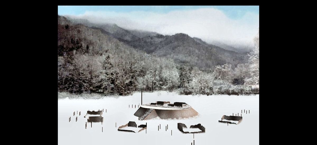
1818-Elias Cornelius: Cornelius studied and measured Etowah Mounds on behalf of Yale College in 1818. He was told by local Cherokees, living in a village, where the Roselawn Mansion sits today in Cartersville, that Cherokees arrived in the Etowah Valley around 1795 and they never went among the mounds because they were haunted.
Cornelius stated that hardwood trees up to about a century old grew on and among the mounds. That means that the town was abandoned right about the time of the 1696 Smallpox Plague – not in 1585 as you are told in the Etowah Mounds Museum. There was a fourth occupation of Etowah Mounds during the Early Colonial Period. Now you know!
