
by Richard L. Thornton, Architect & City Planner
During the past few months, I have received numerous emails inquiring about the books that have I written over the past 17 years. Some people just want to know where to buy them. Others want to know when I am going to write a book, which updates the knowledge now gained on the Mesoamerican emigrations into North America or on the discoveries that we are now making here in Northeast Georgia. Most of my outside income nowadays is from book sales, but on the other hand, I want to be honest about the books that you are buying. Several are in varying degrees . . . obsolescent . . . but still have lots of pretty pictures and useful information.
All of the books, published by Lulu, are available as PDF files. They are much cheaper and contain exactly the same pages.
These books really just mark where I was in a particular point in time, concerning understanding of the past. The problem is that I am gaining new knowledge at an accelerating rate, which affects the analysis of the Native American town sites and peoples in the Southeastern United States. If I took the enormous time required to rewrite a 10-12 year old book, I would have to drop all my current research. If you want the absolutely latest understanding of the past, go watch one of the videos on my People of One Fire Channel. With my new video editing software, I am able to update those videos very quickly.
SO . . . what I decided to do was give you an overview of each book that includes an honest appraisal of its accuracy and comprehensiveness. All but two of my books are available from my publisher, Lulu.com, which has several printing plants around the world. The other two, which were jointly authored by Marilyn Rae and myself, are published by Ancient Cypress Press near Fort Lauderdale, FL. All of my books, including those with Marilyn Rae, are also available from Amazon, Barnes & Noble, etc. However, I get a much larger royalty check, if you order from Lulu.com.
The Indigenous Population of the Southern Highlands (2005)

[B/W] Between 2002 and 2004, several Creek descendants, including one with the screen ID, PRoberts, subsidized my exploration by car of the regions, where the Hernando de Soto Expedition passed through. I immediately picked up major conflicts between what the professors said in the 1980s and the actual meanings of Creek words or the terrain. This is the report that I gave to my backers. It is extremely obsolescent, but cheap. Because my work then was solely based on analysis of archaeological reports, the book also contains a few major errors. It essentially tells you where I was, when I first started my journey.
Ancient Roots I – The Southern Highlands (2006)
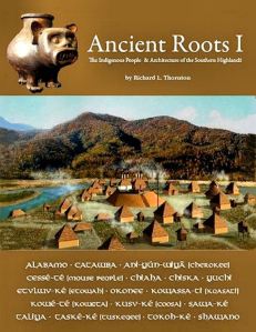
[Full Color] This book is a more comprehensive look at just the Southern Appalachians and does not include the Southern Piedmont. I prepared computer models of the best known archaeological sites in northern Alabama, northern Georgia, eastern Tennessee and western North Carolina. By this time I was becoming more skilled at creating virtual reality images of Native American town sites. It is less obsolescent than the first booklet, and contains beautiful photography and several virtual reality images. Again, it is a measure of where I was very early on the journey.
Ancient Roots II – The Indigenous People and Architecture of the Etowah River Valley in Georgia (2007)

[Full Color] The Muscogee-Creek Nation requested that I prepare a report on Etowah Mounds prior to issuing a contract for me to build a massive 6 ft. x 8 ft. model of how the town looked at its maximum population around 1375 AD. They wanted to be sure that I was qualified for the project. In addition, I hiked or canoed the full 164 mile length of the river, taking photos all the way. I was instructed by my main contact at the MCN, Judge Patrick Moore, to base all features of the model on archaeological reports or the ground radar study that the MCN was then funding. There were to be no speculations on the model. Archaeologist Adam King immediately gave me a photo of his ground radar work for Mound A, but the other firm refused to give me a copy of their survey, which covered the rest of the site. They claimed that it was their private property, not the property of their client, the MCN. Tribal officials then arranged for the US Geological Service to run infrared imagery for my work. A state park ranger let me glance at the forbidden ground radar photo. It matched my infrared, but my imagery also picked up some small mounds that they missed.
This book has hundreds of photos and illustrations, including detailed photos of the great model. It is an accurate description of the official archaeological knowledge of Etowah Mounds. However, in later years, I learned that it has some glaring errors, mainly because of the shenanigans of a few late 20th century archaeologists in Georgia. In 1818, Mound A was almost as tall as Monks Mound at Cahokia and shaped very differently. Its geometry was radically changed by amateur artifact collectors during the 1800s. In the 1990s, University of Georgia anthropology professors concealed the presence of a fourth Creek occupation in the 1600s, plus a Swift Creek and Woodstock villages that preceded the Mississippian town. The famous Etowah marble statues were found at the base of Mound C, not at the top. Furthermore, archaeologists Arthur Kelly and Lewis Larson found stone buildings at Etowah, which are not mentioned in the museum exhibits. The book is obsolescent, on occasion – inaccurate – but does have those “pretty pictures and photos.”
Ancient Roots III – The Indigenous People and Architecture of the Ocmulgee River Valley (2008)

[Full color] Like the Etowah Mounds book, this book began as a report to the Muscogee-Creek Nation. It also has hundreds of illustrations and photos, including many detailed shots of the Ocmulgee Acropolis Model and a massive 3D computer model of the entire Ocmulgee National Historical Park. The big difference is the quality of the archaeological reports available and the full cooperation of the National Park Service, plus by this time, I was much more knowledgeable about the Mesoamerican influence on the Southeastern United States.
There are two flaws in this book. In 2012, Dr. Danial Bigman carried out a remote sensing (ground radar) study of the acropolis at Ocmulgee for his doctoral dissertation. He discovered that for the first hundred years of its occupation, most of the houses were large, round conical structures, typical of northern South America. The original occupants of Ocmulgee were Arawaks. That would have not affected my model because I showed the appearance of the town, when most of the houses were rectangular. However, it would have affected the text in the book. I assumed that the Mesoamericans arrived around 900 AD, when they actually arrived in large numbers around 1000-1100 AD.
Secondly, a recent architectural analysis I did of a town site on the Ocmulgee River near Warner Robins, GA revealed that it contained earth lodges identical to those built by several Siouan tribes on the Missouri and Arkansas Rivers in the 1700s. There were also Siouans living at Ocmulgee. Overall, however, this book is an accurate understanding of Ocmulgee as we know today and is beautifully illustrated.
Ancient Roots IV – The Architectural Heritage of the Muskogean Peoples (2009)

[Full Color] This is a heavily illustrated, comprehensive architectural study of almost all the types of buildings constructed by the Choctaw, Chickasaw, Alabama, Creek and Seminole Peoples. I say “almost” because in 2009, I did not know that the early settlers of Georgia had torn down hundreds, if not several thousand Pre-Columbian stone buildings in order to use in foundations, chimneys, warehouses and mills. In fact, the ruins of a large stone temple were still on the Kenimer Mound in the Nacoochee Valley until the late 20th century. I also did not know that there were at least 16 stone-walled agricultural terrace complexes in eastern Alabama, west-central Georgia, northern Georgia and northwestern South Carolina.
Overall, this book is fairly up-to-date as a reference for Muskogean architecture. Just remember that there were also many stone buildings and stone terrace complexes that the archaeologists chose to ignore.
The Lord of Cumberland (2011)
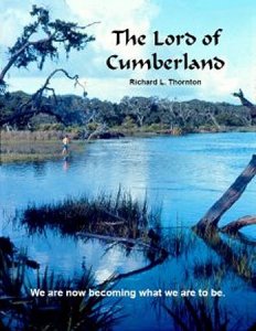
[Full Color] I wrote this book while living in the office of an abandoned chicken house and pondering my life. I had just discovered the Track Rock Terrace Complex. All those extraordinary experiences I had as a very young man were now weaving back into my life. The central event was being a castaway on an uninhabited island off the Georgia coast with two fraternity brothers. The three gals that we were supposed to meet elected not to take Daddy’s cabin cruiser over to the island, when the National Weather Service changed the path of a hurricane. We had to live off the land for 2 1/2 weeks until rescued.
The book is personal journal of someone being swept up in rapid social changes and still trying to have a normal life. I was at a ski resort with the daughter of a Army general in the I-Corps section of Vietnam when the Tet Offensive was announced on the TV. That instantly popped the balloon of romance. The Marines manned a machine gun nest in front of our fraternity house after Martin Luther King was assassinated. I was called to active duty to stop rampaging rioters coming down Techwood Drive, but never issued a rifle. A very popular guy in our fraternity, who was a Vietnam vet, suddenly decided to jump off the 14 story Techwood Hotel at dinner time. About 7,000 people, demonstrating against Vice President Spiro Agnew and the Vietnam War sweep past the Mousetrap restaurant as we are eating prime rib roast at the quarterly Fraternity Pledge Initiation Banquet.
A few weeks after I returned from working in Sweden, while actually (secretly) keeping watch on Black September terrorists, I was listening to Allman Brothers and Lynard Skynard albums with Jimmy Carter, Chip Carter and Karen Carter, when a very young Joe Biden stopped by with his nephew to ask Jimmy to run for president. At the end, the book jumps forward several decades to a gravel road in the Rich Mountain Wilderness Area of Gilmer County, GA. I didn’t know it, but in a few weeks, I would be homeless and “living off the land.” Suddenly, a chauffeur-driven Mercedes stops beside me. In the back is a Cuban-American gal that I had an afternoon fling with three decades before, while collecting Toys For Tots on behalf of the US Navy. She blows me a kiss and drives off. Life is indeed a box of chocolates.
Ancient Roots V – The Southern Highlands (2011)

[Full Color] This book is a beautiful photographic travelogue that I created while living in the office of an abandoned chicken house in Union County, GA. The photos were made both before and during my camping expedition across the region. It contains photographs of all the major mountains, rivers, lakes, waterfalls and valleys in the Southern Appalachians. The book is as current today as then, since it primarily focuses on Mother Nature.
Itsapa . . . The Itza Mayas in North America (2012)

[Full Color] This book began as a 32 page black & white booklet that I wrote to introduce the Track Rock Terrace complex to university anthropology departments. After a clique of archaeologists began slandering me in public talks and giving false information to the media, I figured I better get something in writing quickly or else my professional reputation would be dead on arrival. That book got me on several TV programs, but none of them even mentioned that their script was based entirely on my book.
The book is an accurate description of what I had figured out in early 2012, but is obsolete now. We had no clue that there were at least 16 terrace complexes in the Southern Highlands and Piedmont. I now know many more “Creek” words, which were derived from Itza Maya. Certainly, if I had known that the word Chattahoochee itself was an Itza Maya word, I would have jammed that fact down the throats of several people. Think of this book as a snapshot at a certain time period, but not the full story. It has many pretty pictures in it to compensate for being something from the past.
Earthfast . . . the Dawn of a New World (2012)

[Full Color] Earthfast is the only book ever published that is a comprehensive analysis of the 16th and early 17th century architecture and fortifications in eastern North America. It is an exceptional book that will never be obsolete. You will see three dimensional virtual reality images of Spanish, French and English villages and towns, plus extensive detailed drawings of the styles of fortifications built by these nations. I include several fortifications in Ireland, Scotland, England, France, the Philippine Islands, Holland and Sweden which were the inspiration for North American fortifications.
I have an extensive background in the restoration of colonial buildings. In addition, my work for the American Museum of Natural History in re-creating the buildings at Mission Santa Catalina de Guale were a great asset. The education that the United States Navy gave me at Georgia Tech enabled me to provide many details to the drawings of fortifications that a typical artist would miss.
Fort Caroline . . . the Search for America’s Lost Heritage (2013)
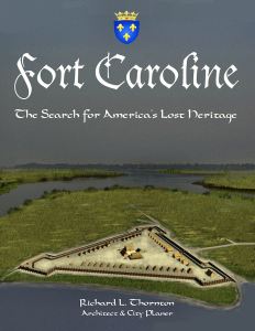
[Full Color] Life is like tapestry, where the threads of one’s life weave in and out at unexpected times. When I was a castaway on Cumberland Island, we camped near an ancient wood sign which denoted the graves of about a dozen 16th century Frenchmen under the command of Jean Ribaut, who had been executed by the Spanish after coming ashore from a shipwreck. That sign was still there when the Cumberland National Seashore was created a few years later, but was taken down by 1999. Someone realized at the National Park Service that if sailors associated with the massacre of Fort Caroline and the colonists sailing there to reinforce it were murdered on Cumberland Island, Fort Caroline couldn’t possibly be in Jacksonville, FL. Indeed, it wasn’t. The fort you see at Fort Caroline National Memorial is an inaccurate 1/12th scale model, built in 1962, because no French or Spanish fortifications or artifacts were ever found at that site.
Flash forward to 2007. The American Museum of Natural History sent me a box of Spanish archives to read before tackling the architectural re-creation of Mission Santa Catalina de Guale. Three different eyewitness accounts from the late 1500s and early 1600s placed the site of Fort Caroline about six miles up the south side of the Altamaha River. All Spanish, French and English maps placed the fort there. No map ever showed Fort Caroline in Florida until the late 20th century. Smithsonian Institute archaeologist, James Ford, found many 16th century French and Spanish artifacts at that location in 1935, but interpreted them as an old Spanish fort. Actually, For San Mateo was built there after Fort Caroline was demolished. In 1776, William Bartram visited the ruins of the old fort and described the fort in his famous book as “an ancient French or Spanish fort”, but apparently, no one today in the National Park Service has read William Bartram’s book. Clearly, Fort Caroline and Fort San Mateo were on the coast of Georgia.
This book examines the evidence and explains the history of the region , so the reader will understand why the current Fort Caroline National Memorial is one of the greatest scams of all time. It contains hundreds of photographs, drawings, virtual reality 3D images and satellite images, plus LIDAR and infrared scans furnished by the Glynn County, GA Department of Planning. The information is as fresh as it was in 2013.
The Apalache Chronicles (2013) by Marilyn Rae & Richard Thornton

[B/W] Marilyn Rae discovered an ancient, dusty copy of L’Histoire Naturelle et Morale des isles Antilles de l’Amérique in the Carter Brown Library’s “Fantasy and Utiopia” bin. Brown University’s professors had placed in there in the 1800s because ten chapters of the 1658 book describe an advanced indigenous civilization in Georgia that built large earthen pyramids, stone buildings and stone terraced towns on the sides of mountains. The professors knew for a fact that since white Southerners were backward and ignorant, the Indians who preceded them had to be the same.
Marilyn translated the French and I wrote annotated interpretations of the key sections to explain the significance of what De Rochefort was saying. No matter how fantastic his statements, we have been able to back them up with real archaeological sites on the ground since then. That is the only short-coming of the book. It does not include photos of ruins that validate De Rochefort’s statements. The book is sold by Ancient Cypress Press.
Nodoroc and the Bohurons (2013) by Marilyn Rae and Richard Thornton

[B/W] This book is an analysis of the first part of the book Early History of Jackson County, Georgia. It describes what is known today about the Native Americans of this county during the Colonial period and life on the early 19th century frontier. The fascinating stories include: (1) Nodoroc, a mud volcano in Winder, GA where the Creeks toasted criminals, convicted of heinous crimes . . . and where stood a quarried stone, 4,000 year old temple until the 1830s; (2) The Bohurons, who were a mixed-blood branch of the Creek Indians with Spanish, Portuguese, French, Jewish and Dutch names; (3) Yamacutah, an oval shaped stone shrine where an extraterrestrial disappeared into the sky; and (4) the Wog, an giant lizard that lived in Georgia until the buffalo died off. The book is up to date. It is published by Ancient Cypress Press.
The Forgotten History of North Georgia (2016 & 2017)

[B/W] This book is a comprehensive account of all the amazing history that I have found in northern Georgia during the past 20 years. It is one of my most popular books. It was updated in 2017, but needs updating again because of all the archaeological discoveries that I have made since moving to the Nacoochee Valley in 2018. The book contains many black & white photos, maps and drawings.
The Nacoochee Valley . . . Crossroads of the Americas (2017)
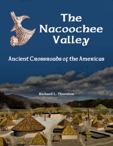
[Full Color] This is one of my most popular books. It describes in detail the archaeological work done in the Nacoochee Valley by archaeologists Charles C. Jones, Jr., George Gustavus Heye, Robert Wauchope and Mark Williams. Every archaeological site in the valley has an article and directions out to get there. There is also a chronological time line, which ties the past to the present.
The book is “timeless” because it solely focuses on discoveries made in the 19th, early 20th and mid-20th centuries. However, since moving to the Nacoochee Valley, I have discovered at least 38 mounds, petroglyphs and stone ruins to the east and northeast of the Nacoochee Valley. I have also discovered the stone retaining wall of the Great Sun Temple. These might be best covered by a new book since they were not known to the archaeologists, who worked here in the past.
The Nacoochee Valley . . . Guide to Archaeological Sites (2017)

[Full Color] This less expensive book contains the section of the book above, which provides articles on each archaeological site in the Nacoochee Valley and how to get there. This information is still valid. Another guide is needed for the many newly discovered sites east and northeast of the valley.
