
by Richard L. Thornton, Architect & City Planner
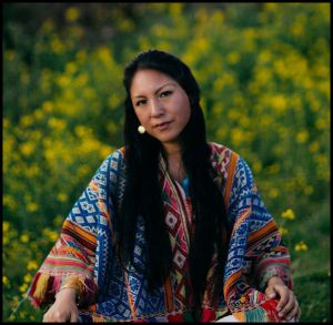
(Virtual Reality Image above) Until the late 1700s the Creek Indians occupied a secret town on an island in the center of the Okefenokee Swamp. At its heart was a temple to the Sun Goddess, Amana. She was served by priestesses, who botanist William Bartram described as “the most beautiful in the land.”
Walk through a time portal to the year 1776, and you would see a very different landscape in Southeast Georgia . . . one quite similar to that of the Amazon Basin. Botanist William Bartram, explored that environment and obtained the ancestors of some of America’s most beautiful flowering shrubs . . . several types of azaleas and magnolias, plus the hydrangea, Franklinia, an indigenous cinchona and the gordonia. Bartram described the Okefenokee as being in the dry season about 20% larger than today, having a water depth several feet deeper and having areas that were lakes, not swamps.
During the Colonial Period, the climate of South Carolina and Georgia were very different than in the 21st century. During the winter months, a constant flow of moist air collided with frigid air over the Blue Ridge Mountains to create a heavy snow pack. In 1567, Spanish explorer Juan Pardo found the Blue Ridge Mountains impassible from heavy snowfall in December! No wonder that the old Creek word for the Georgia Mountains was “the Snowy Mountains.”
When the snow melted in March and early April, vast torrents of water flowed southward underground and in rivers to the sea. The Altamaha River overflowed its banks, sometimes several miles outward and the Okefenokee tripled in size. Bartram stated that during the spring most of what is now Southeast Georgia was covered with water. Back then the Satilla River branched off the Altamaha River, south of Jesup then flowed southward to join the Atlantic at St. Andrew Sound.

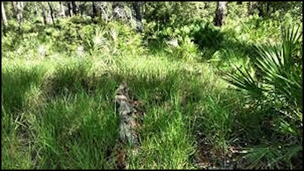
WAYCROSS, GA – The Okefenokee Swamp is a shallow, 438,000-acre, peat-filled wetland in extreme southeastern Georgia and northeastern Florida. Most of the swamp is in Georgia. The Okefenokee is the largest “blackwater” swamp in North America. It was designated a National Natural Landmark in 1974.
The Okefenokee Swamp was formed over the past 6,500 years by the accumulation of peat in a shallow fresh water basin on the edge of an ancient Atlantic coastal terrace, the geological relic of a Pleistocene estuary. The swamp is bordered by Trail Ridge, a strip of elevated land believed to have formed as coastal dunes or an offshore barrier island. The St. Marys River and the Suwannee River both originate in the swamp. The Satilla River skirts the eastern side of the swamp and also formerly drained it.
Geologists believe that the original lake formed at least 6-8,000 years ago when a sandy barrier island trapped water in a bay, as the South Atlantic coastline retreated eastward. Probably, for much of its existence, the swamp looked something like Lake Okeechobee in southern Florida. Over time, vegetation created islands in the shallow lake, upon which groves of trees could thrive; particular Bald Cypress. Even today, some of the vegetative islands are so thin that they vibrate when walked on.
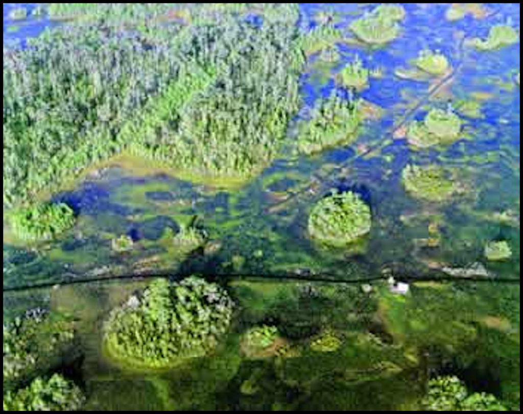
Some islands appear on a 16th century map of what is now South Carolina, Georgia and Florida. The Okefenokee contains numerous floating islands in which sufficient soil lays on top of dense dead vegetation to allow the growth of bald cypress and other wetland trees. The official explanation of these island is that they were the result of a natural process in which gas bubbles pushed peat up to the surface. However, given their extreme similarity to the floating islands of Lake Xochimilco in the Valley of Mexico and Lake Titicaca in Bolivia suggests to Native American scholars that the larger islands were originally man-made agricultural platforms.
A Florida academician has inserted a paragraph in the Wikipedia article on the Okefenokee, which states that “The earliest known inhabitants of the Okefenokee Swamp were the Timucua-speaking Oconi, who dwelt on the eastern side of the swamp.” This is a patently false statement. Professional archaeologists from the University of Georgia and the US Fish and Wildlife Service have unearthed mounds within and along the edges of the swamp, containing artifacts associated with the ancestors of the Creek People of Georgia going back to at least 1000 BC.
French explorers dispatched by Fort Caroline in 1564 encountered entirely different peoples than the Timucua, living on the islands and edges of the swamp, who were enemies of the tribes in the upper Florida Peninsula. Wikipedia’s etymology of the word, Okefenokee is also faulty. These facts will be elaborated on, further in the article.
Getting to know the Okefenokee, the old fashion way
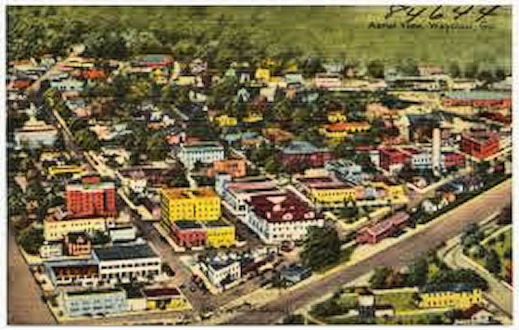
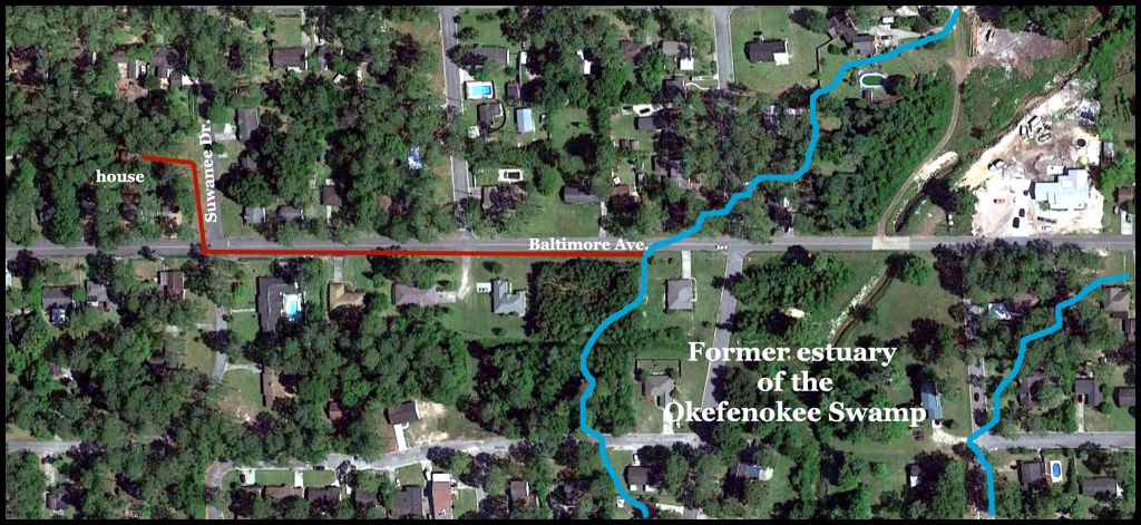
This was supposed to be the script for a documentary video, but due to the pandemic, it does not look I will be filming around Waycross this spring! Nevertheless, I originally got to know the Okefenokee Swamp the good ole fashion way. I was born there! In that era, an estuary of the swamp extended northward into the eastern edge of Waycross in a neighborhood known as Cherokee Heights. Suwanee Drive, where our house still stands, had a coating of tar and gravel then, but most residential streets in Waycross still were paved only with sand.
The origin for the name, Cherokee Heights, is interesting in itself. The Williams family traveled down from Burke County, NC to purchase a large tract of land in the western end of the Nacoochee Valley in northeast Georgia. Their tract included the Nacoochee Mound and the location of the Sun Temple atop a large hill groomed into the shape of the mound. Burke County, NC was the center of gold-mining activity in North Carolina and “shezam!” the Georgia Gold Rush just happened to begin on the Williams Family’s land. Apparently, some of the Williams men married local Native gals, who the whites called “Cherokees,” but who were really a mix of Sephardic Jewish and Itsate Creek. Their descendants show up as a mixture of Semetic, Iberian, North African and Southern Mesoamerican DNA markers. Most ancestors of the Creeks came from various parts of Mexico.
In 1860, the mouth of the St. Johns River was finally opened to sea-going vessels. Not being damaged by the Civil War, Jacksonville, FL began to boom after the Civil War. Several of the Williams families sold their land in the Nacoochee and took their gold wealth to Jacksonville, where they parlayed it into ownership of large tracts of land in the advance of new developments.
The son of one of those Williams families, Jack Williams, Sr.,took his share of the gold money and Florida real estate profits to the little, sleepy town of Waycross. He became the owner of the Waycross Journal-Herald newspaper and purchased a vast tract of land larger than Waycross. He started draining the portion of the Okefenokee Swamp, which once extended into that tract . . . then named his developments, Williams Heights and Cherokee Heights. Cherokee Heights was named after his presumed “Cherokee” ancestor in the Nacoochee Valley.
We now know that actor Burt Reynolds mysteriously spent two years with a “relative” in Cherokee Heights as a teenager. That is where Burt got the idea of calling himself a Cherokee Indian from Waycross. There were no Cherokees in Burt’s official ancestry, but we really don’t know who his relative was in Waycross. After Burt began playing football for the Florida State University Seminoles, Burt changed his story to being a Seminole from Waycross. Burt always idolized Pernell Roberts, who was a highly skilled actor and a real Creek Indian from Waycross. The real story will probably never be known.
Barefoot in the swamp
Beginning at age five, we would walk barefooted about 1200 feet to the edge of the swamp and then explore another world of exotic plants and animals. Our favorite games were feeding insects to carnivorous plants and paddling around the swamp in a pira (flat-bottomed canoe). The word is in the Creek languages, but came from the Panoan languages of Peru.
Looking back, it seems incredulous that at age six, I would be paddling around the Okefenokee Swamp alone, but apparently, I feared nothing at that tender age. One time, a large Water Moccasin dropped down into the canoe. I cut its head off with butcher knife, the shape and size of a Bowie knife, which I carried for protection. Yes, I was six years old!
Just like the Injun kids of an earlier era, except when in church or school, I only wore shorts for at least eight months a year . . . no shirt, no underwear, no shoes. That was typical for all the boys of Cherokee Heights. I instantly stopped that practice at age 10, after my family had moved to Gainesville, GA in the Blue Ridge Foothills. While picking blackberries in an abandoned cow pasture across the street from our house, I stepped on a broken Coca-Cola bottle. Over 100 stitches were required to sew up my foot!

Okefenokee National Wildlife Refuge
According to the U.S. Fish and Wildlife Service, over 400,000 visitors a year come to this exotic region in the southeastern tip of the State of Georgia. That is probably conservative. On the fringes of this boggy landscape that are outside federal property boundaries, there are farmsteads and hamlets, where residents have hunted and fished in the swamp for many generations. Most of the swamp was purchased by the Roosevelt Administration in 1936 to prevent extinction of its wildlife and remaining stands of virgin Bald Cypress trees.
Today, tourism is focused on the two state parks, so as to minimize disturbance of wildlife. Tourists come to the Okefenokee Swamp Park and Stephen C. Foster State Park from around the world to see the swamp’s famous alligators, snakes, aquatic birds, cypress trees, giant long leaf pines and Jurassic Period terrain. The combined visitation of the two parks is about 125,000 people per year.
The Swamp Park’s visitor’s center does have some exhibits related to the Native American occupation of the region, but presents an incomplete story, dwelling mainly on the Seminole-Creeks, but not telling people about the advanced culture that once occupied the islands or that many Creek families never left. Tourists do not see any evidence of Native American culture in the swamp as it appears today. They assume that its ancient inhabitants were few in number, primitive in culture and left the region as soon as Europeans arrived on the scene.
Original name of the Okefenokee Swamp
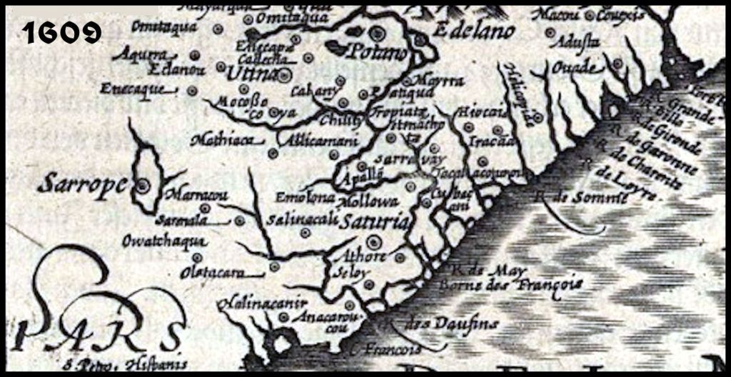
Lago Oconee was NOT the original name of the Okefenokee Swamp, recorded by 16th century French and Spanish explorers . . . as stated in Wikipedia and several Florida-published anthropology books. It was called Sarope, Saropo or Sarrope . . . depending on the author or mapmaker. Jacque Le Moyne, who was a resident of Fort Caroline and who prepared the first detailed map of the South Atlantic coast called the ethnic group Sorrochos. Their real name was probably Saroche. The Spanish labeled them the Sarroque.
Sarope/Sarapo is a Panoan word from Peru. It means “Place where the land shaves off into the water.”
Toward the end of the 16th century, trouble arose between the Sarroque and the Spaniards. The cause of the friction was entirely the Spaniards fault. They claimed the Lake Sarope region for the King of Spain. The Sarroque were of the opinion that it was not theirs to claim. In consequence, the Spanish governor led a small army of Spaniards to the swamp and attacked a Sarroque town, killing 60 persons and capturing 54. The Okonee (Oconi in Spanish) lived in the region east of the Sarroque province, along the St. Marys River (Rio Santa Maria).
Etymology of Okefenokee
Most books, magazine articles, TV documentaries, and even the official USFWS web site define the meaning of the Okefenokee Swamp as being a Muskogee Creek Indian word meaning, “The Land of the Trembling Earth.” That is not correct. The Muskogee-Creek Indian words for trembling (fekeketv) and earth/land (enkvnv) are entirely different.
The first map to display a name similar to Okefenokee was the 1763 Gibson Map, which labeled it “the Great Owaquaphenogaw Swamp.” Owaquaphenogaw is the Anglicization of the Muskogee-Creek word Owakuafenokaw, which means “Water People – shaking.” The 1810 Sturges Map of Georgia labels the swamp, the Oka – fe-no-kau.
Patricia Affable and Madison Beeler of the Smithsonian Institute wrote a book on Indian place names in 1996 that got closer to accuracy than anybody else. They stated that the word was Miccosukee-Seminole and was derived from okifanô:ki, meaning “bubbling water” or alternatively “trembling earth.” Water and earth are two entirely different words! Their book also states that the original name for the swamp was Lake Oconee, named after an extinct branch of the Arawak-speaking Timucua Indians. This interpretation was entirely wrong.
First of all, the language’s correct name in Creek/Maya is Itsate. Anthropology professors insist on using the frontier mispronunciation of the word, Hitchiti. The Florida Miccosukee are the descendants of the Sokee or Soque of Northeast Georgia, who originally were a different ethnic group than the Itsate Creeks, but over time absorbed much of their language.
The Muskogee-Creek word for bubble is pakke. Oka or oki is the Itsate-Creek word for water. The Itsate word, fanoke means “to move back and forth.”
The Oconi (actually Okani – now Okonee) Indians were one of the most important branches of the Creek Indian Confederacy. They originally spoke a dialect of Itsate and were major players in the mound-building business. Their name means “born of water.”
According to Georgia’s Colonial Secretary, Thomas Christie, the Okonee Creeks had an origin myth that they arose out from a watery Garden of Eden to the south of their later mound-studded centers in northeast Georgia. Unlike most Southeastern mound builders, most of the Okonee’s lived in dispersed farmsteads and hamlets. The elite lived in small, palisaded compounds, containing several large mounds and public buildings. Their original homeland was most likely the southern region of the St. Johns River Basin. This watery landscape contains several early Mississippian Period (900 AD-1200 AD) mound centers that were followed by Arawakan villages with quite different cultural traits.
The Okonee could well have had many cultural traits associated with the “Mississippian mound-builders by 700 AD. Their language contained many Maya Indian words It is probable that when Arawak invaders from the Oronoco River of Venezuela struck the Florida peninsula around 1150 AD, the Okonee were pushed northward. The majority settled on what is now the Oconee River in northeast Georgia. However, apparently one branch stayed in the relative security of the swampy basin of the St. Mary’s River, as much of the land to the south, east and west was occupied by a people, who the Spanish and contemporary academicians called the Timucua.
However, the Oconee were not the original mound builders of the Okefenokee Swamp. As will be explained in the final section of this article, many of the mounds in the Okefenokee Basin date from the Woodland or perhaps even the Late Archaic Period. Deptford, Checked Stamped and Swift Creek Stamped pottery is found these mounds. The oldest Checked and Swift Creek Stamped pottery is found in eastern Peru. To this day, the Conibo, a Panoan people, wear clothing with motifs identical to those of Georgia’s Swift Creek pottery.
The Wildes Massacre
There are numerous accounts of Native Americans, who were friendly with their white neighbors, who were brutally murdered, but their stories are never remembered in state historical markers of history text books. The last “Indian massacre” that occurred in Georgia happened in the northwest corner of the Okefenokee Swamp near Waycross, Georgia on July 22, 1838 in the midst of the Second Seminole War. What is odd about this story is that the Seminoles generally only killed uniformed white soldiers or whites, who had cheated them.
The story begins when Maximillan Wildes and his family are spending a sleepless night worrying about Seminole warriors from Florida, who had been watching them over a period of several days. Small objects pelted the house during the night, keeping the Wilde family awake.
The attack came early Saturday morning. Reports as to what happened vary, but during the attack the Seminole killed most of the family. Four Wildes boys and a neighbor’s daughter (who was one of four visiting the Wildes) survived. Two of the children stated that the Indians were really white men, dressed as Seminole Indians. This important information was intentionally left out of the inflammatory newspaper articles that followed in incident.
Neighbors heard the gunfire and headed to the farm with guns, but too late to help the family. Immediately, the settlers prepared for additional attacks. Women and children were sent to the fort in Waycross, and men began an armed search for the “Seminoles”, who had murdered the Wildes family to no avail.
In December, 1838, General Charles Floyd led Georgia militia against the Seminoles remaining in the Okefenokee Swamp, but by this time they had fled the swamp or perhaps were concealed on one of its islands. In the years that followed, “Friendly Creeks” from farther north, who were legally citizens of Georgia, filtered into the swamp or on unclaimed lands along its periphery
The first “Hollywood” movie filmed in Georgia

In 1941, 20th Century Fox came to Georgia to film one of the rare movies of that era, not filmed in Hollywood. The movie was “Swamp Water.” It was based on the novel of the same name by Georgia author Vereen Bell, who as a naval officer, would die in the Battle of Leyte Gulf three years later. The very successful movie stared Walter Brennan, Anne Baxter, Walter Huston, Dana Andrews and John Carradine. The success of the movie encouraged Hollywood studios to increasingly come to Georgia to film movies.
The eternally popular film, “I’d Climb the Highest Mountain” was filmed in the Nacoochee Valley and Tallulah Gorge of Georgia in 1951, followed by a Technicolor remake of “Swamp Water” in 1952. In 1955, the Walt Disney filmed “The Adventures of Davie Crockett” in the Smoky Mountains of North Carolina. In 1956, Disney filmed “The Great Locomotive Chase” in the same locale that “I’d Climb the Highest Mountain” had been filmed – using the same locomotives. Walt Disney seriously considered buy the Tallulah Falls Railroad in Northeast Georgia and making its entire length a Disney amusement park.
“Swamp Water” was the American film debut of French director, Jean Renoir. Renoir (15 September 1894 – 12 February 1979) was a French film director, screenwriter, actor, producer and author. As a film director and actor, he made more than forty films from the silent era to the end of the 1960’s. His films La Grande Illusion (1937) and The Rules of the Game (1939) are often cited by critics as among the greatest films ever made.
The film was remade in 1952 in full color and re-named “The Lure of the Wilderness.” Walter Brennan also acted in this film, but his role was not as prominent.

Because of his fondness for the film, “The Lure of the Wilderness” Elvis Presley chose the small city of Waycross as one of the shows for his first national tour in 1956. In the audience, was 10-year-old Gram Parsons, who a decade later would be a pioneer of modern folk-rock and a member of the Byrds rock group. Too young to be charged a ticket, I was allowed to peep at the show from the rear exit door. At the end of the show, Elvis was given a black eye by the jealous redneck boyfriend of a screaming teenage girl. I was in awe as Elvis crossed the street to buy a steak from my parent’s grill to put on the black eye.
A favorite son of Waycross presents the Okefenokee to the world
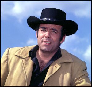
Despite being a national wildlife refuge and the locale of two popular movies of the mid-20th century, the Okefenokee Swamp was only vaguely known in the majority of people, living outside the Lower Southeast in the 1980s. The 1960s was a time when the South had gotten a very unsavory reputation because of the activities of its racists – thus erasing interest in the region, created by the two movies. That all changed due to television and one of television’s most respected actors . . . Pernell Roberts . . . Adam Cartwright on the blockbuster TV series, “Bonanza.”
Roberts hosted a primetime National Geographic TV special on the Okefenokee Swamp, called “The Realm of the Alligator.” Almost immediately, visitation to the Swamp soared and Congress began giving the wildlife refuge staff the funds they needed to adequately protect the animals, while enabling tourists to see the heart of this magnificent wilderness area. Until then most Americans didn’t know that Roberts was from Waycross, but he still did not reveal his biggest secret . . . the Roberts are mixed-blood Creek Indians.

Regional planner in Waycross uncovers lost history
While historic preservation planner for the Southeast Georgia Regional Development Commission in Waycross, Michael Jacobs poured through the forgotten archives of the region. Hailing from North Carolina, Michael has substantial Lumbee and Catawba Indian ancestry. He was particularly interested in uncovering the region’s forgotten Native American history. Michael’s discoveries of old Spanish maps, yellowed newspaper articles and forgotten archaeological studies electrified Native American scholars, but the information never made its way to academicians and federal agencies.
Michael found a long-forgotten file folder produced by professional archaeologists, who surveyed the Okefenokee Swamp for the federal government, just prior to the wetlands being named a National Natural Landmark. At the time, little was known about the advanced Southeastern Native Americans. The cursory information in the files about numerous mounds have far more significance today, than when they were typed. Back then, no one knew that the first pottery in the Western Hemisphere was made in southeastern Georgia, or that there are dozens of pyramidal temple mounds in Georgia that are 1000 to 150 years older than any mounds at Cahokia, Illinois.
The federal government archaeologists identified a presence of mankind going back to the Ice Age. Since at least 3500 BC, the swamp had been a fresh water lake, which began turning into a swamp with islands about 2000 years ago. The archaeologists investigated 74 mounds within the lake and on its periphery. Evidence of a large town site was found on Billy’s Island, which is shown on French maps of the 1600s. There were peak populations during the Middle Woodland Period (200 AD-550 AD ~ Swift Creek Culture) and Early Mississippian Period (900 AD-1200 AD). However, the archaeologists found artifacts from all indigenous cultural periods up into the mid-1800s. The Woodland, Mississippian, Lamar Culture and Colonial Period artifacts were all typical of the Creek Indians or their ancestors . . . not the Timucua of northeastern Florida.
The regional planner discovered an old Spanish map, which clearly described the construction of a road along the edge of the swamp that culminated at the Forks of the Altamaha River, where it is joined by the Ohoopee River. Small missions and forts were spaced along the road, while a major mission, Santa Isabel de Utinahica, was planned. None of the missions lasted very long, because repeated attacks by the Creek Indians to the north, who were bitter enemies of the Spanish.
Jacobs also found much evidence that the Creek Indians returned to southeast Georgia in the 1700s and lived there far beyond when official histories say they left. Official English and American maps show the Okefenokee Swamp and its environs occupied by the Tallassee Creeks, who were originally from the North Carolina Mountains, but were driven out by the Cherokees in the mid-1700s.
The last military action of the U. S. Army against Native Americans in Georgia occurred in 1843 along the eastern edge of the Okefenokee and the Altamaha River. As a result, peaceful Creek Indians, who were legally citizens of Georgia and had given considerable assistance to the United States during the War of 1812, were attacked without warning, and marched at bayonet point to Fort Mitchell in Alabama. From there, they were deported to Oklahoma.
Perhaps the most surprising of Jacobs’ discoveries were newspaper clippings from a Waycross newspaper in the 1860s. The articles complained that the “Ware County Indians” were moving out of the Okefenokee Swamp and establishing farmsteads on land claimed by nobody. The last article describes raids by vigilante groups, which attacked the Creek Indian farmsteads and burned their buildings.
Official Georgia history is silent on the presence of Creek Indians in the southeastern section of the state after 1867. However, they continued to live in the Okefenokee Swamp and along the Altamaha River until the mid-20th century, when most families immigrated to urban areas with more economic opportunities.
As a teenager, Bobby “Bearheart” Johns, the late Principal Chief of the Perdido Bay Muscogee-Creek Tribe was taken into the Okefenokee Swamp by his uncles, where he was taught the tribe’s traditions and survival techniques. Johns was born in a log cabin on the Altamaha River. His family later moved to the Macon, GA area.
Until a comprehensive archaeological study is carried out on the majority of Native American archaeological sites in the Okefenokee Swamp, much of its complete Native American history must remain in the realm of speculation. However, with so many mounds being located on the islands within the swamp, it is clear that at some time in the past, this was a major center of indigenous culture.

Richard, Fabulous article! Thanks
Sent from my iPad
>
LikeLiked by 1 person
As I said, I planned to make it a documentary and then have a video of the Native town of Sarrape, made with my new virtual reality software . . . but was not expecting a pandemic in March. By later April the swamp is alive with bugs.
LikeLiked by 1 person
My Thornton family was in Blackshear… We might be related.
LikeLike
My mother and step-father were from North Georgia. They moved down to Waycross after he graduated from law school at UGA. However, genetically, I am not a Thornton.
LikeLike
Hello RT,
Now that I’m half recovered from what ever I have because I tested “negative for covid-19 despite having all symptoms but fever”…im catching up on your posts starting Mon. I’d ask if you’re physical-distancing but LOL when aren’t you?
I used a bunch of natural stuff to try to obey “them” that said to until after 8 days past exposure. Heck I was thinking my immune system and herbs and stuff were likely the cause of a neg test result until I discovered that 1 in 3 neg tests were false negatives. Recuperating well but instead of my normal 6 hours of sleep to refresh nightly, I’m doing 14!
March I returned home from my daughter’s home in TX via DFW, DEN, PHX, without being near anyone hardlt, then my last leg of the trip required boarding a VAN with 2 college students headed back after spring break, 2 nurses heading to ER assignments and 2 pilots. We then boarded the tiny metal tube, aka 8 passenger jet and traveled like sardines for 45 min to arrive in Show Low, AZ then an hour to my home in my car! The day has cancelations, hours of waiting and started at AZ time 1:45 am and ended at 7 pm. What a day! The next 18 or so days have been tense but filled with little miracles. Life is good and…I am still here. Yes!
Enough complaining…
Hey, I enjoyed the gator video narrated by your daddy. I have a bit of history with a gator or 2. Amazing creatures. ❤
On Wed, Apr 1, 2020, 4:45 PM The Americas Revealed wrote:
> alekmountain posted: ” by Richard L. Thornton, Architect & City Planner > (Virtual Reality Image above) Until the late 1700s the Creek Indians > occupied a secret town on an island in the center of the Okefenokee Swamp. > At its heart was a temple to the Sun Goddess, Amana. S” >
LikeLiked by 1 person
Carol Joy . . . you do know that the novel corona virus is now mutating? The mutated versions do not test positive, but have the same symptoms . . . or worse. That sounded like the airplane flight from hell. That’s why I only use my “personal sized” flying saucer when traveling long distances.
LikeLike
Glad for your input about the mutating. That ‘splains a lot!
LikeLiked by 1 person
This is fascinating! I grew up in Gainesville, now live two miles from the Nacoochee Valley and have a mixture of Semitic, Iberian, North African and indeterminate Native American DNA markers plus European.
LikeLiked by 1 person
Would be willing to bet that you are descended from the 17th century Sephardic gold miners. We must live very close to each other! LOL
LikeLiked by 1 person
Wonderful article!!
My name is Rome Mubarak, a UCLA film graduate. I am working on a story and would love your input and feedback for accuracy sake and authenticity. My mother is an enrolled Muskogee Creek and relishes in the history of her peoples.
Please call me. 5107036653
Rome
LikeLiked by 1 person
Thank you,I found this to be very interesting. I was born is Waycross. My Grandfather on my Dads side worked on Billy’s Island for the Hubbertville cypress company. He was their Blacksmith and meat provider for the camp.( Ezra G Baxter ) My mother is a descendant of John Wilds one of the two surviving boys of the massacre. I was unaware of the claims of white men dressed as Indians in the massacre.
LikeLiked by 1 person
Thanks to Ron’s comments, I finally read this article after earmarking it months ago. Glad to see you mention Bobby Johns Bearheart. I’d like to add a little to what you wrote. First a small correction. As a teen he moved to Warner Robins, GA. That’s where we went to high school together in the 1950ies. Bobby spent his early days in south Georgia where his father worked in the turpentine and lumber industries in and around the swamp. They were one of many mixed Creek families that moved about frequently following the work. One of the stories he learned as a child was about his ancestors cutting and stacking wood along the banks of the Altamaha for the steam boats to pick up. Back in the late 1990ies Bobby and I worked together to tell many stories from his childhood in the 1930s and ’40s. One is called “Night of Passage” when his Uncle ‘Tone left him alone deep in the Okefenokee over night on his 12th birthday. I would love to share it if anyone is interested. This and the other stories give great insights into the lives of the natives in the early 20th Century.
LikeLiked by 2 people
PS, Just for the record, as a member of one of the Charter families of Warner Robins, we do not like to be relegated as an anex of Macon… though we love Macon too. You know, kind of a pride thing. As you have written about before, the area around WR where I grew up just a stones throw from the Ocmulgee River and the swamps thereabouts is full of evidence of ancient Native occupancy.
LikeLiked by 1 person
Hi. My name is Caleb Wildes. In my family history books the Seminoles did not use guns to attack the used bow and arrows. Maximilian Wildes was shot several time by arrows defending his family. 5 kids escaped through the back of the house 4 Wilde boys and the neighbors daughter. The kids then ran several miles to the neighbors house to get help. By the time they returned the Wildes family was dead and the homes were burning.
LikeLiked by 1 person
It was probably a case whereby the Creeks in the swamp (aka Seminoles) could not obtain an adequate amount of gunpowder and lead balls. It is well documented that in the Battle of the Flint River in 1703 (SW Georgia) the Creeks were primarily armed with muskets.
LikeLiked by 1 person
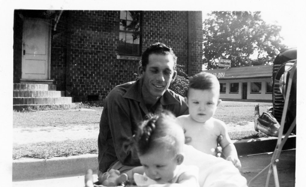
By the way, I spent the first four years of my life in the garage apartment of the Williams Mansion in Williams Heights (Waycross). My family then moved to a house on Suwanee Drive in Cherokee Heights. As a young kid, the “swamp rats” still came into Waycross in mule wagons with the women wearing clothes made out of flour sacks. It’s a time, gone with the wind.
LikeLiked by 1 person
Highly educational post. I do wish there had been a few more citations or a resources section at the end for folks hoping to follow your research. But still very helpful, so thank you for sharing.
LikeLiked by 1 person
Most of my essays are in a National Geographic format. This website originated when people were asking for updates on my research here in the Georgia Mountains. My books and professional papers have full Library of Congress citations.
LikeLike