by Richard L. Thornton, Architect & City Planner
Eyewitness accounts from the early 1730’s paint a different picture of Creek traditions than what Oklahoma Creeks and academicians think they were!
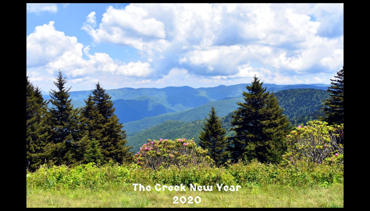
According to my GPS surveying device, I was at 6,104 feet at noon time yesterday in the Pisgah Mountains, when the sun was at its highest point in the Northern Hemisphere’s sky. I curious to see how far the 16th century conquistadors could have seen when crossing the North Carolina mountains. A good time was had by all.
I learned that the Nantahala Mountains blocked the view of Brasstown Bald Mountain in Georgia, which the Creeks used as a benchmark for establishing the sites of major towns. The photo above looked northward to another ridge line of the Pisgah Mountains, which blocked most of the view of the Great Smoky Mountains. To the south one could see all of the Upper French Broad River Basin in and the Blue Ridge Mountains beyond.
Both in the Southeastern Indians and Conversations with the High Priest of Coosa, the late Charles Hudson, an anthropology graduate from the University of North Carolina at Chapel Hill, described the Green Corn Festival and New Year’s Festival of the Creek People as one festival. This is the assumption today of Creeks in Oklahoma. They also assume that the chukorakko or “Creek Square” was an ancient tradition of the Creek People, which could only have certain geometry and dimensions.

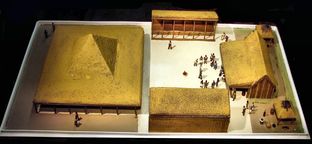
No evidence of a Creek Square has been found in a Pre-Columbian town site in the Southeastern United States. In fact, from the period of around 1375 AD to 1750 AD, most plazas were oval in shape. The Kansa People of Northeast Alabama and Northwest Georgia . . . now living on the Western Plains . . . did construct an earth-bermed, thatch roofed, council house with a central square bounded on four sides by terraced seating areas. The 18th century Cherokee town house (council house) was an exact copy of the earlier Kansa one. The two Creek squares, visited by William Bartram were not.

Bartram sketched two types of Creek squares in 1776. The one in Tuckabatchee, which by the way was on the Chattahoochee River in 1776, where Six Flags Over Georgia is now located, was tilted 45 degrees to the axis of the stickball court. The square at an Apalachicola town near Pensacola, Florida was a rectangle with its two main set of bleachers on the north and south sides.

Eyewitness accounts from the early and mid-1700s provide descriptions of Green Corn Festivals and New Year’s Festivals. They were separate events. The Green Corn Festival was held at the time when the first “roasting ears” were ripening. That varied according to latitude and longitude. Only around the latitudes of Ocmulgee National Historical Park, would the two events probably been simultaneous.
In April 2015, I discovered the location of the so-called “Lost Creek Migration Legend” in England. The 285 year old handwritten document was actually the migration legend of one branch of the Creek Confederacy, the Kaushete. However, in the same box were many other manuscripts, handwritten by Georgia’s Colonial Secretary, Thomas Christie. Out of intellectual curiosity that was sorely missing in most officials dispatched by European powers, Christie systematically interviewed leaders of many branches of the Creek Confederacy in order to learn their cultural traditions and religious practices.
Each province had differing traditions for celebrating the Green Corn Festival. It’s specific beginning date was determined by the progress of the corn crop. Since Appalachian winters were much colder during the Little Ice Age (1300 AD – 1870 AD), Upper Creek, Chickasaw and Cherokee farmers planted their corn at about the same time that corn plants on the Lower Savannah and Altamaha Rivers and in northern Florida had edible ears on them. When the Seminole Creeks moved down into southern Florida, they found that they could grow as much as three crops of corn a year,
It is quite likely that the custom of all Creeks celebrating the Green Corn Festival and New Years festivals together on the Summer Solstice began when all of the Georgia Creeks were forced in 1827 to relocate to a relatively confined section of east-central Alabama. Traditions blended. Perhaps tribal leaders set a single standard for the construction of a relatively new type of structure known as the chukorakko (Creek Square).
The assimilation process of different ethnic groups within the Creek Confederacy continued in the Indian Territory, now Oklahoma. Oklahoma Creeks should remember that the Creek Confederacy was formed in 1717. All traditionalist Creeks were forced out of the Southeast by 1836, That’s a 119 year history in the Southeast. They have been in Oklahoma for at least 184 years. Many changes can occur in 184 years.
