St. Catherines Island, Georgia
by Richard L. Thornton, Architect and City Planner
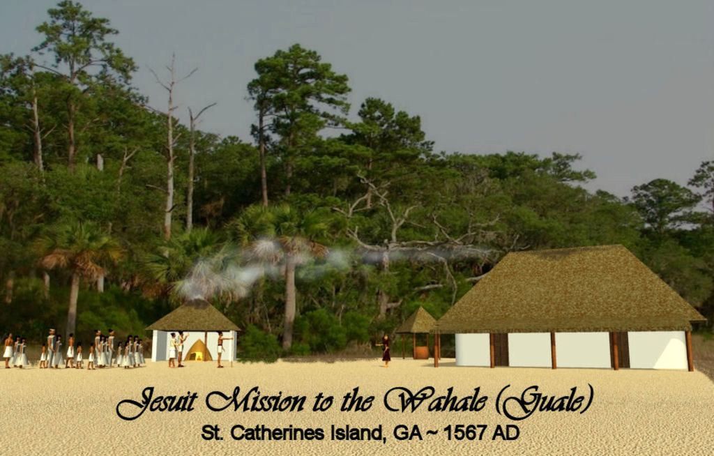
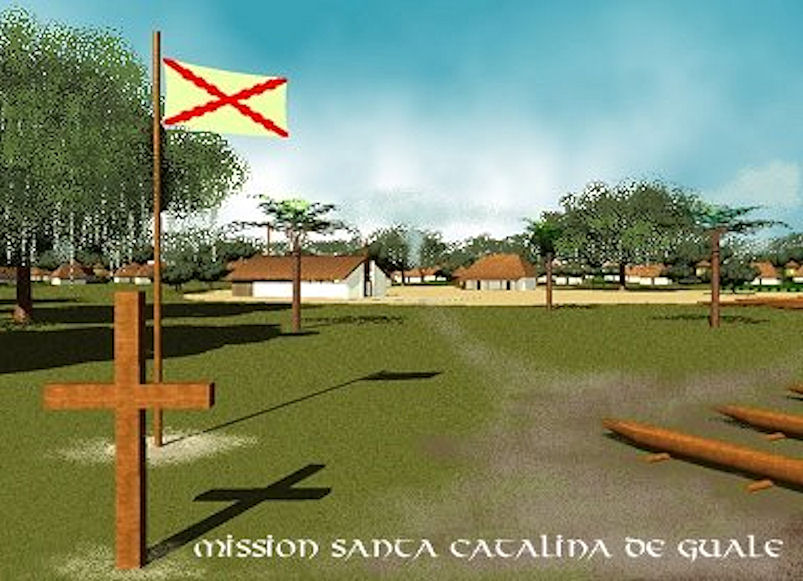
At the tail end of the 16th century and during the first 3/4ths of the 17th century, there were far more missions and mission Indians in southeastern Georgia than ever existed in California. Mission Santa Catalina de Guale was the headquarters of this mission system until so many of their converts had died or fled Spanish domination that the few remaining parishes were relocated to near St. Augustine, Florida.

In 2007, two archaeologists at the American Museum of Natural History in New York City asked me to apply my skills in historic preservation and architectural graphics to the creation of a three dimensional computer model of what was once the principal Spanish mission on the South Atlantic Coast. Former Director of the National Museum of American History and National Park Service Director, Roger Kennedy, had recommended me because I had studied Spanish Colonial architecture in Mexico, restored many Colonial Period buildings in Virginia and now was doing research for the Muscogee-Creek Nation on the architecture of my Creek ancestors.
This project turned out to be one of the most important professional experiences of my career. You see . . . in truth, I knew absolutely nothing about the Spanish colonial architecture on the South Atlantic Coast. It was different than in Mexico. There were no stones available for construction on the Georgia and South Carolina Coast. Thus, I started the research with no preconceptions.
The AMNH sent me a box full of photocopied archaeological reports and documents from the Spanish Colonial Archives in Seville, Spain to read. These documents opened up a world 400-500 years ago that I never knew existed. Quickly, I noticed stark contrasts between what the eyewitnesses of the 16th century described and what we today are taught in school and read in references, such as Wikipedia. The ruins of Forts Caroline and San Mateo were only a three to four hour canoe ride from the Mission Santa Catalina de Guale on an island NORTH of the Altamaha River. The site of the first St. Augustine had the same latitude as the southern tip of Jekyll Island, GA. All anthropologists labeled the Native peoples on the Georgia Coast as being Muskogeans or Creek Indians. Yet, they did not speak any Creek words and had very different religious traditions than the Creeks.
This paragraph appears over and over again in references and tourist brochures. It is totally false. “In the mid-2nd millennium, the island now known as Jekyll was part of a coastal Georgia Native American chiefdom called Guale. Muskogean tribes, who constituted a majority of the Creek Nation, were the inhabitants of this territory, extending from the mainland to the Sea Islands.”
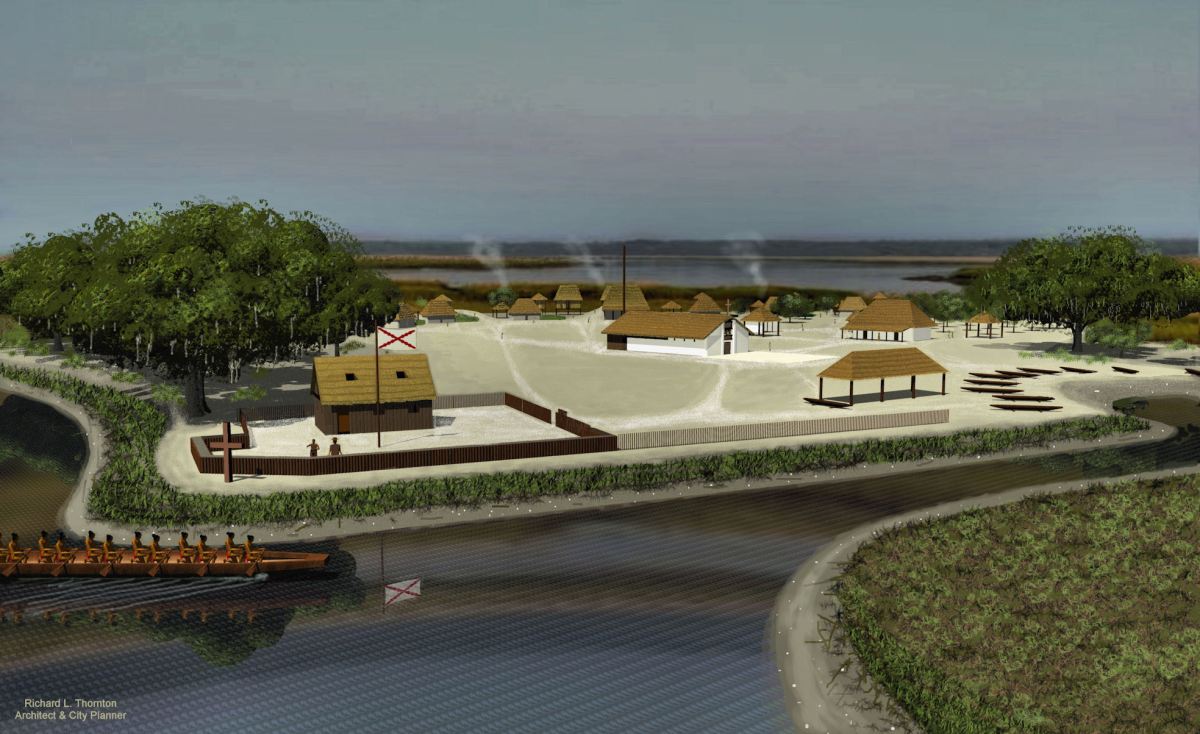
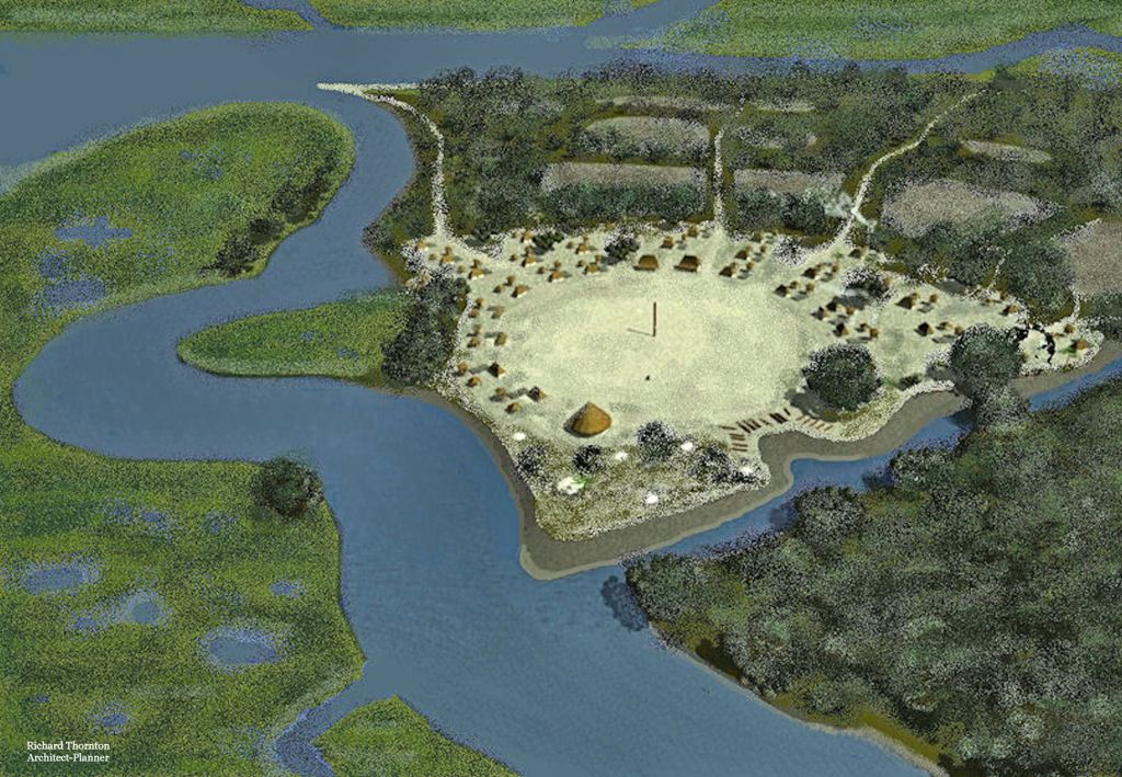
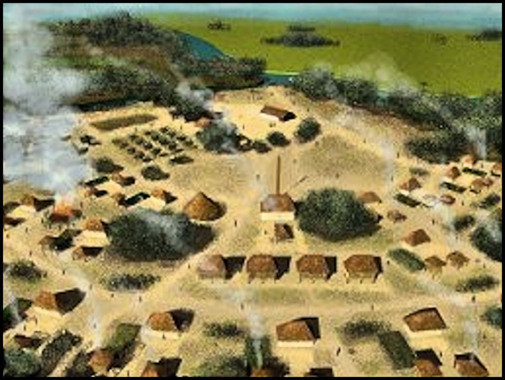
The Guale people did not call themselves Guale, speak a Creek language or practice Creek cultural traditions. They relocated southward from the area near Savannah and Ossabaw Island shortly before the arrival of the Spanish! They were never members of the Creek Confederacy because they were extinct, before it was even formed. Their language was a mixture of some Campeche Maya nouns with some other tongue. Their architecture was typical of the Campeche Maya. I eventually figured out that the other language was Taino Arawak. The original name for Jekyll Island was Guadauquini, which is the Taino word for a circular ceremonial ground. In the rendering below of the original village of Guale, there is a circular ceremonial ground.

I also quickly learned that there was NO reference books on the 16th and 17th century colonial architecture of North America. French, Spanish, British and Dutch colonists brought with them distinct architectural traditions, which were then blended with Native American traditions and pragmatic modifications to create forms of vernacular architecture, seldom accurately seen in history books. Archaeologists working at Santa Elena on Port Royal Sound, had done an excellent job of thoroughly investigating its architecture, but the ultimate product of their research were archaeological reports for their fellow archaeologists, not architectural references. Also, nobody had thoroughly studied the various types of fortifications, constructed during that period.
It took eight years of research and drawing to remedy the lack of a reference for North America’s earliest Colonial architecture and fortifications, but that problem has been finally remedied with the publication of Earthfast. It may be purchased in printed or Adobe PDF form at: https://www.lulu.com/shop/richard-thornton/ (The Adobe format is drastically less expensive)
Spanish attempts to control the Georgia Coast
The earliest attempts by Spain to colonize the coast of Georgia all ended in disaster. In 1526, Lucas Vazquez de Ayllon established the colony of San Miguel de Gualdape at the mouth of the Altamaha River in Georgia, with 600 settlers. The colony was probably constructed on Broughton Island, Sapelo Island or the land between the north and south channels of the river. Over half the colonists, including Vasquez died of an intestinal disease. There was a revolt by slaves from Morocco. Survivors fled the colony after about six months. The pathogen was probably vibrio bacteria, which is related to cholera bacteria. They thrive during the late summer in the waters where fresh water mingles with brine water from the ocean.
In September of 1565, the fortified Spanish colony of San Augustine was established near the mouth of the Sapelo River on St. Andrews Sound, Georgia. Governor Pedro Menendez clearly described the latitude and terrain of this location in his letter to the Spanish king. It has the deepest harbor on the South Atlantic Coast and was one of the few sounds, where the largest Spanish galleons could anchor. Governor Pedro Menendez’s flagship could easily enter the harbor of the first St. Augustine, but not present day St. Augustine Bay, Florida. That’s a dead giveaway that the current official history of St. Augustine is wrong.
After the initial rush from murdering hundreds of French Protestants, the Spanish colonists at the first Fort Augustine found themselves in a dismal situation. Disease was rampant. The local Satile People greatly outnumbered the Spanish and were sophisticated warriors. Any foraging party that left the walls of the fort to find firewood, potable water, wild game or fish were subject to sudden surprise attacks. Week by week the number of live soldiers, fit for duty, dwindled. Eventually, the soldiers staged a mutiny and planned to sail to Cuba or Hispaniola.
In March 1566, Governor Menendez ordered the original St. Augustine to be dismantled, so that the surviving colonists could relocate about 100 miles farther south to the current location of Fort Augustine. There were few Natives near that location and they were far more primitive than the Satile. The Spanish had already constructed a small fort and “coast guard station” at the mouth of the St. Augustine River.
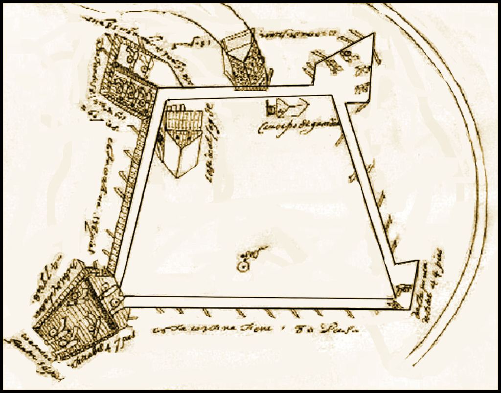
In the autumn of 1565, Fort San Mateo was built near the ruins of the much larger Fort Caroline on the South Channel of the Altamaha, plus two smaller forts were constructed at the mouths of the North and South Channels. A Jesuit mission was constructed in a Satile village to the east of Fort San Mateo.
From 1566 all Spanish, French, English and Dutch maps and writings placed Fort Caroline on the Altamaha River until the 1840s, when a real estate speculator from New York, George R. Fairbanks, wrote a booklet on the history of Florida, which placed Fort Caroline on his land near Jacksonville and a fictional Fountain of Youth on his land near St. Augustine.
In early April 1567, a combined French and Native American army attacked the Spanish forts and mission at the mouth of the Altamaha River. Virtually all of the Spanish soldiers and colonists were massacred in revenge for the massacre of Fort Caroline’s colonists in October 1565.
Several Jesuit missions were established on islands near the mouth of the Altamaha River around 1567-1571. These lasted only a few years before the missionaries were either killed or driven off. Dozens, if not hundreds of Spaniards were killed on the Georgia Coast between 1567 and 1590. Almost all shipwrecked sailors were tortured and killed. Several small military expeditions were massacred. Companies of Spanish soldiers could expect several casualties, if trying to cross overland from what is now South Carolina to Florida.
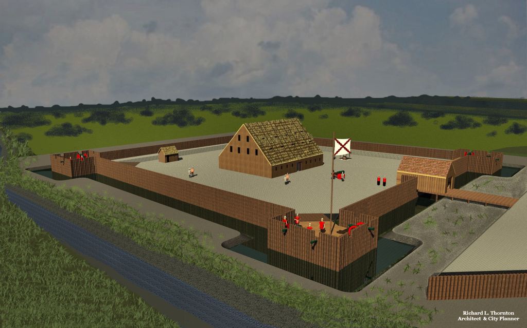
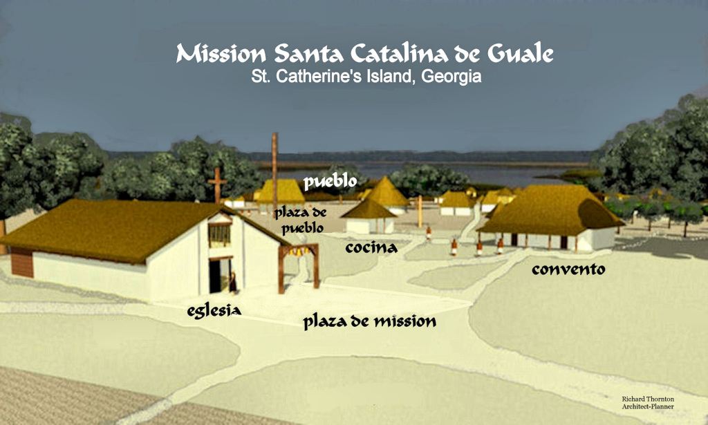
After an uprising in 1587 forced the complete abandonment of the Santa Elena Colony in present day South Carolina, the Spanish Army and Navy launched several punitive expeditions against the major Native provinces of the Georgia Coast. These were essentially ethnic cleansings. These operations cleared the way for the establishment of Franciscan missions on the Georgia coast, beginning around 1597. Construction of a church was underway at Santa Catalina by around 1602.
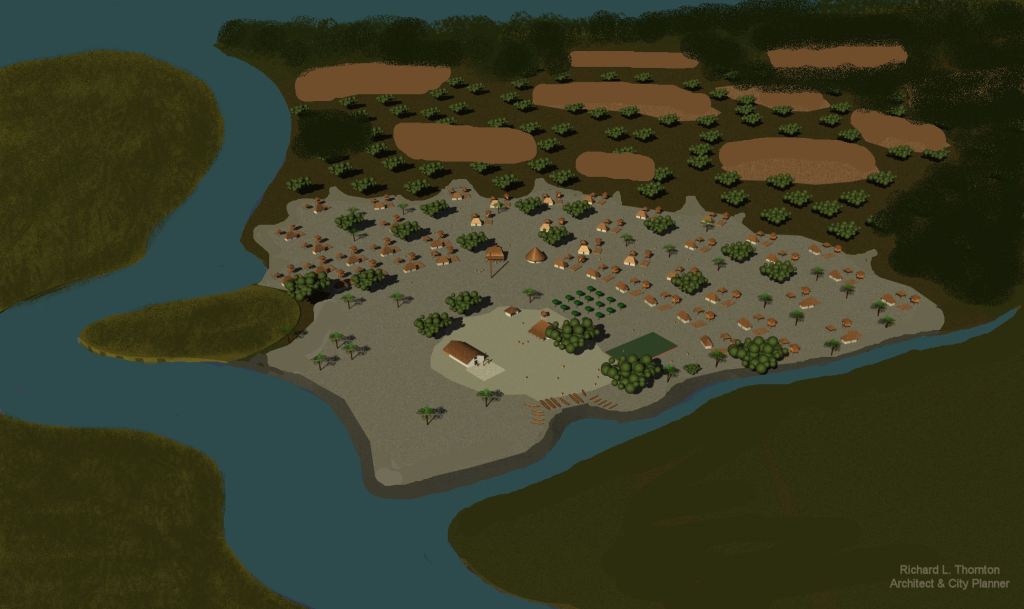
Initially, the population of the mission village of Santa Catalina grew, due to the consolidation of several outlying hamlets in order to put them under the “thumb” of the friars. However, in reality, the provincial population was already plummeting due to European diseases, malnutrition and overwork. Between the first arrival of the Spanish Jesuits in 1567 and 1684, when the mission was relocated to Amelia Island, Florida, the Wahale population dropped from around 20,000 to 52 survivors.
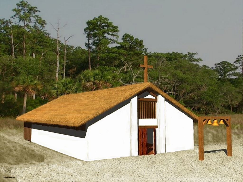
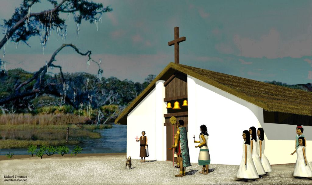
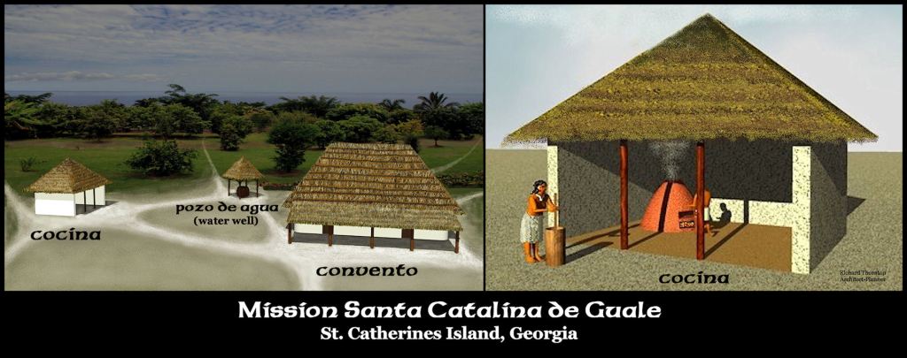
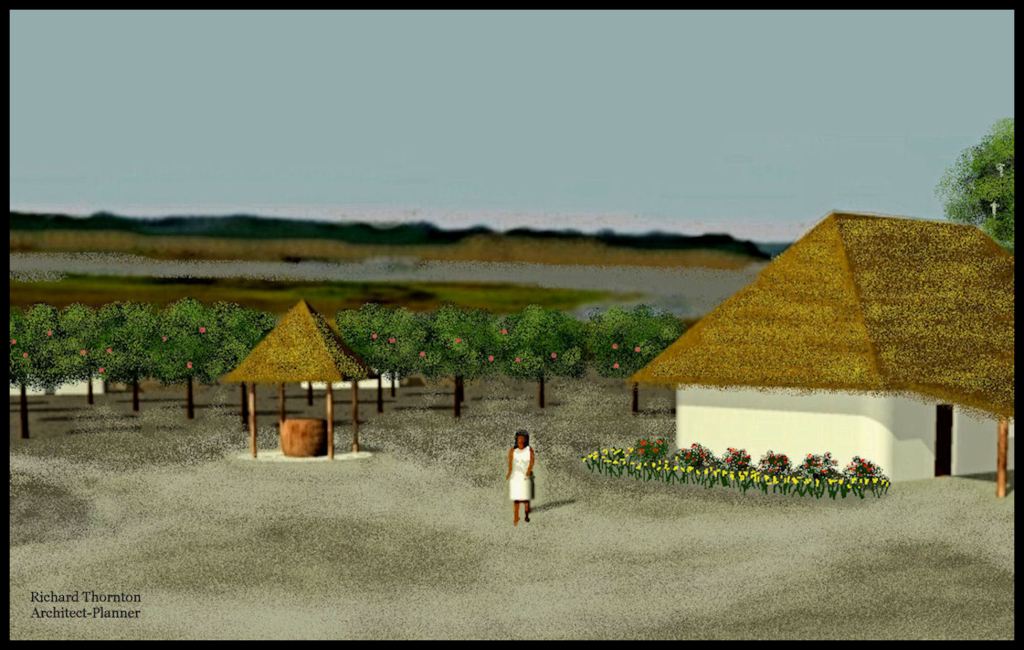
In looking closely at the archaeological reports from Santa Catalina, I realized that all of the buildings erected by the Wahale laborers for their new Spanish masters used traditional Mesoamerican and Creek construction techniques. The eglesia (chapel) was a simplified version of Iberian architecture, but built with timber frames, infilled with waddle and daub – just like Native building in the Lower Southeastern United States. It was plastered with a lime stucco composed of burned seashells (hydrated lime) and crushed seashells and sand. This is the origin of the Georgia Coast’s famous Tabby Architecture.
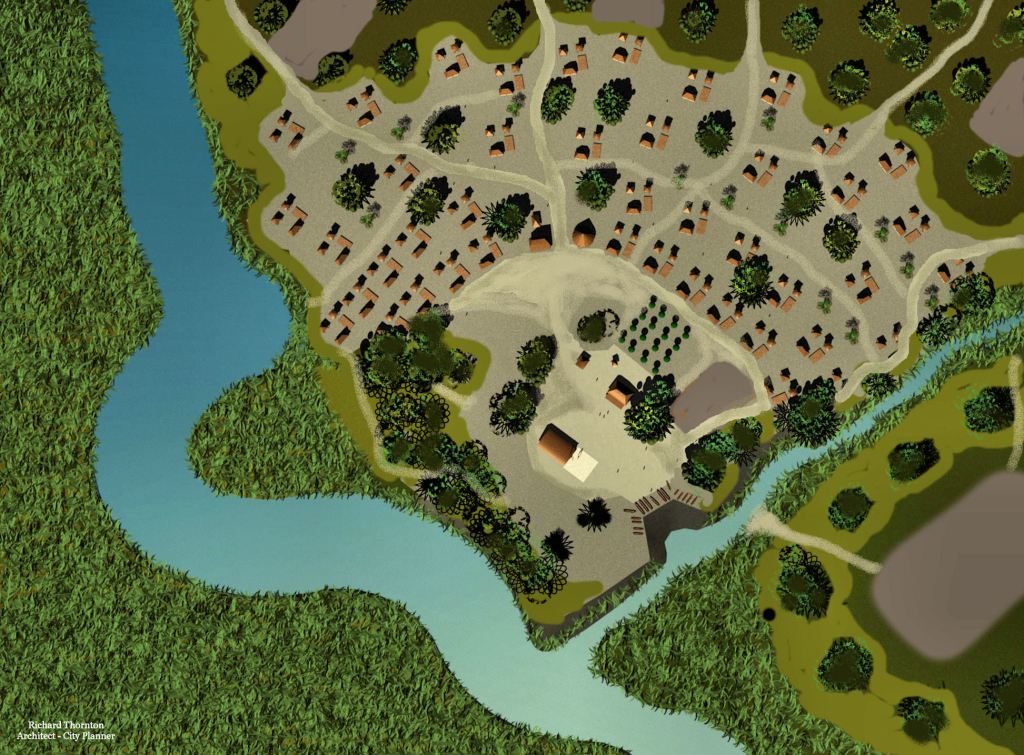
The convento or friars residence contained three rooms and had a portico. It was exactly like the home of the chief of this village. Identical buildings have been unearthed at Ocmulgee National Park near Macon, GA and date from around 1000 AD to 1150 AD. They were the homes of neighborhood chiefs. However, identical buildings have also been found in the suburbs of the Maya city of Chichen Itza in northern Yucatan. They are also believed to be the homes of neighborhood chiefs.
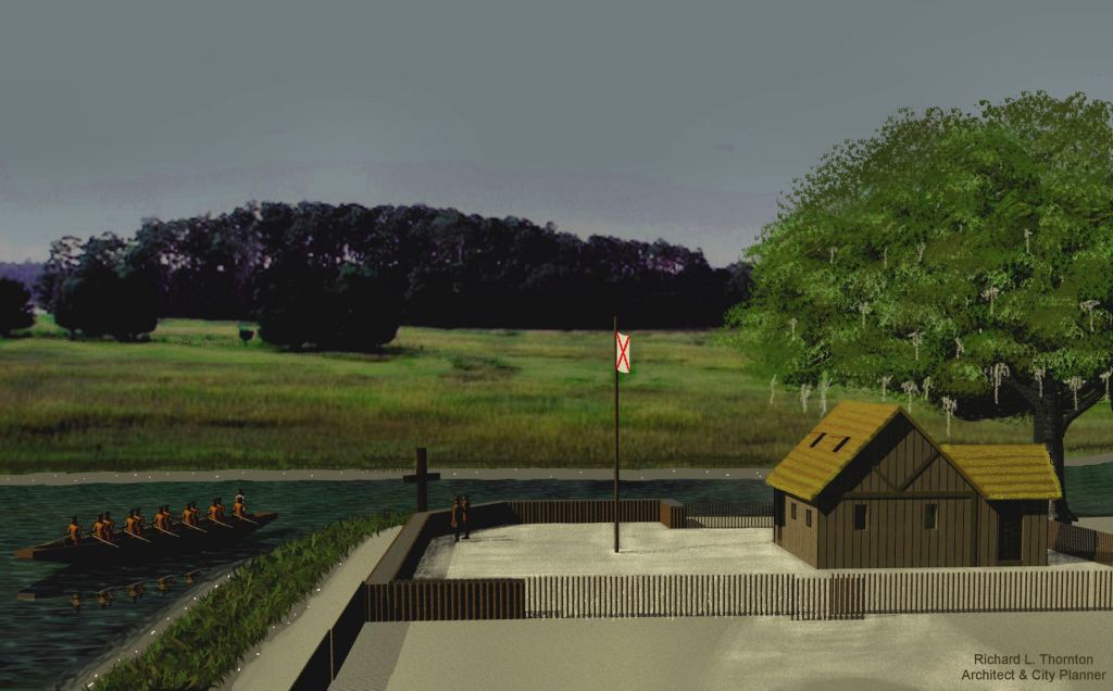
The Spanish colonists in St. Augustine thought it demeaning to do physical work . . . in particular, public works construction and growing food. The latter activities were assigned to the Wahale. Instead of fishing and hunting, the men had to grow corn and vegetables for the colonists 100 miles to the south. The men also had to haul the corn and vegetable in dugout canoes to St. Augustine then frequently spend several months laboring at construction sites. They were compensated by cheap religious trinkets.
The situation was vastly worsened because the Catholic friars intentionally created an Indian nobility class to mirror “Christian” society in Spain in order to keep the remainder of the population under their control. The synthetic noble families did not have to work and were rewarded with Spanish type clothes to mark their higher station in life. The noble families had a much lower death rate because of this VIP treatment. Over time, an increasing percentage of the steadily declining Wahale population did no agricultural work, fishing or hunting, thus putting a greater load on the surviving commoners.
After the mid-1600s, raids by pirates and English-sponsored Native American slave raiders ravaged the mission provinces on the coast of Georgia into near extinction. The few survivors were relocated to the region around St. Augustine and disappeared from history.
Readers wanting to learn detailed accounts on the tragic history of the Spanish mission Indians on the coasts of Georgia and Florida can find accounts both online and in the library. What you will not see in these articles is what a mission village actually looked like. That follows!


Howdy, Do you sometimes amaze yourself?
On Wed, Feb 10, 2021 at 10:34 AM The Americas Revealed wrote:
> alekmountain posted: ” St. Catherines Island, Georgia by Richard L. > Thornton, Architect and City Planner At the tail end of the 16th century > and during the first 3/4ths of the 17th century, there were far more > missions and mission Indians in southeastern Georgia than eve” >
LikeLiked by 1 person
The only time I really amazed myself was when at 8:23 AM on December 21, 2009 I was handed an eviction notice to be out of my house by Christmas Eve – three days later. I showed the deputies that I had a FannieMae mitigation loan closing, scheduled for mid-January 2010. The deputies said that the letter was irrelevant. Well, I did move all my belongings out of the house by Christmas Eve. As my three dogs and I listened to sleet and freezing rain patter on the sides of my tent on Christmas Eve at a Chattahoochee National Forest campsite, I did say, “Geez, I actually pulled this stunt off. Well, here we are noble dogs . . . homeless and living in the National Forest. Almost every man’s secret dream.
LikeLiked by 1 person