
by Richard L. Thornton, Architect & City Planner
One Summer in Mexico – Part 53
When I was doing graphics work for Dr. Arthur Kelly, during my Sophomore year at Georgia Tech, he never mentioned that he had discovered two stone-walled agricultural terrace complexes on the Chattahoochee River near Roswell, GA. Kelly had dug test pits that determined they were constructed by indigenous Americans. Nearby, he excavated a stone boat burial and stone rings typical of Bronze Age Sweden. He mentioned these sites in a report to the US Army Corps of Engineers, but they are not mentioned in booklets on the archaeological sites of Georgia, published by the University of Georgia.
Kelly also thoroughly excavated a stone walled terrace complex northeast of Macon, GA and confirmed it indigenous origin. It is labeled “a peculiar religious shrine” in the state’s archaeological inventory with no discussion of the significance of stone retaining walls on a hillside.

Agricultural terrace complexes were never mentioned in the Introductory Anthropology course, taught by Dr. Lewis Larson at Georgia Tech, nor any of the Mesoamerican Archaeology textbooks that I was required to read prior to flying to Mexico for the fellowship. Furthermore, my fellowship coordinator at the Museo Nacional de Antropologia, Dr. Román Piña Chán, only assigned me to visit one terrace complex, which was beneath what then was considered a minor, but picturesque Maya town site . . . Tonina.


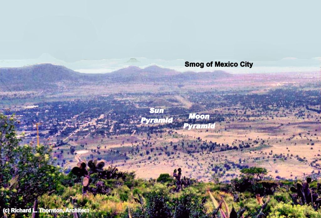

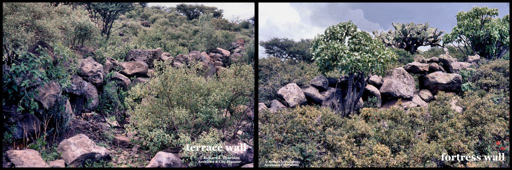
I hiked from Teotihuacan to Cerro Gordo and then up the slopes of the mountain to its peak, while studying the archaeological zone as part of my fellowship in 1970. I was stunned to confront one stone wall after another while ascending the mountain.
A few days after this extraordinary experience, I gave a slide show at a lunch session to Dr. Piña Chán and his graduate interns in his office at the museum. No one was particularly interested in the terrace walls or the ancient stone ruins of an acropolis that I found on top of the mountain. However, all were impressed by the photos I took from the top of the mountain, looking down at Teotihuacan. Apparently, no Mexican or Gringo archaeologist had ever thought of doing this. Dr. Piña Chán requested copies of all the slides that I took, while on the top of the mountain.
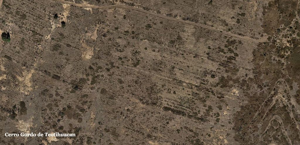
In 1970, when I climbed Cerro Gordo, none of the terraces were in active cultivation. Most were overgrown with scrub vegetation. In fact, until Google Maps published new, high resolution satellite imagery in 2018, very few of the terrace walls were even visible from above. The archaeology profession, even in Mexico, seems to be still generally unaware of the massive scale of the Cerro Gordo Terrace Complex. Cerro Gordo radically changes our understanding of how large cities in Mexico fed themselves.


Monte Alban, Oaxaca
It is now known that several thousand acres of agricultural terraces fed the Zapotec city of Monte Alban near the contemporary city of Oaxaca. Their existence was completely unrecognized by the archaeology profession until the 21st century. However, my French architecture student girlfriend, Yvette DeVeaux, stumbled upon a terrace complex, while taking a hike away from our campsite. She was mainly interested in the sheep grazing nearby, but went back to the camp to grab me to be her bodyguard, when hiking down to the sheep farm. I took a photo of this baranca, not realizing the significance of the terraces.

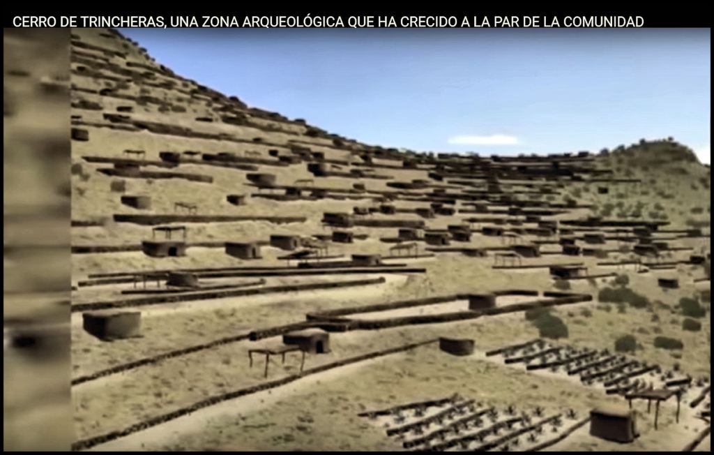
Trinchera, Sonora
Indigenous Americans of uncertain tribal identity

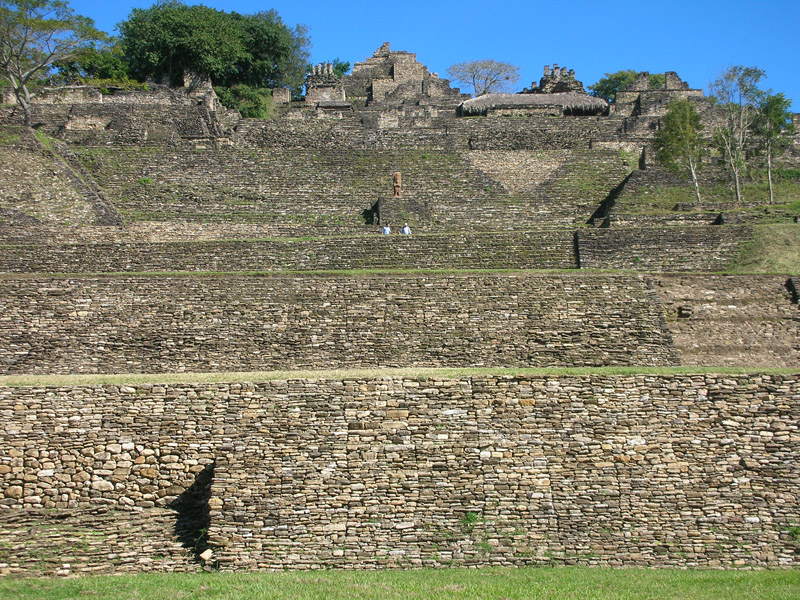
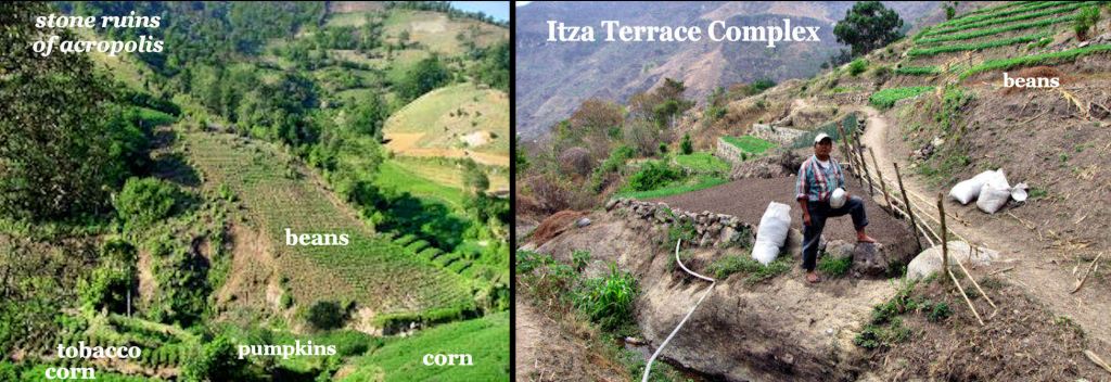
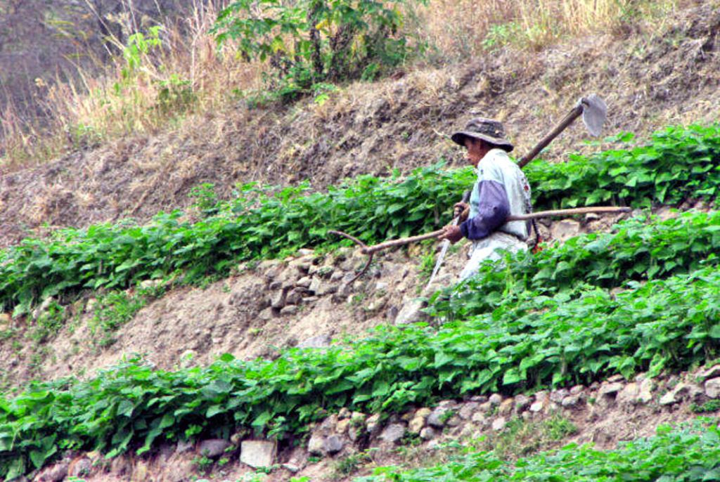
Tonina, Chiapas – Itza Mayas

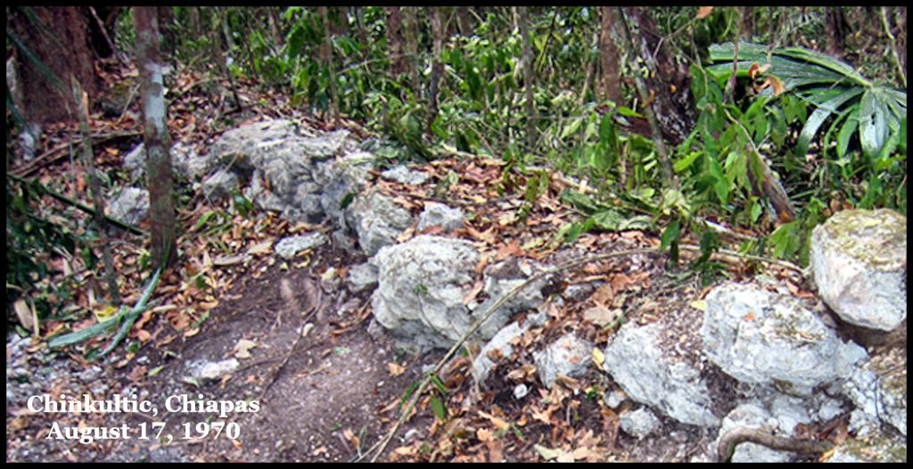
FLN (Zapatista) Chinkultik Guerilla Base in Chiapas


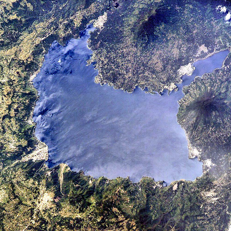
Lago Atitlan, Guatemala – Itza Mayas


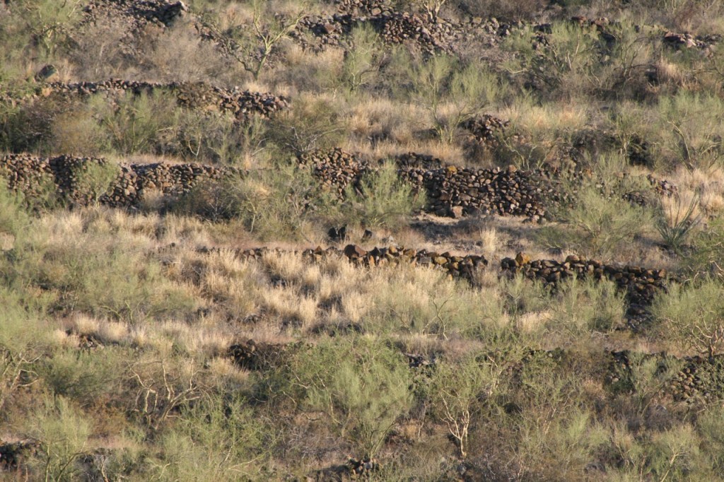
Georgia – Southeastern United States
In early 2012, when I was writing the book on the Track Rock Terrace Complex, I assumed that Track Rock was the only terrace complex in the United States . . . because that is what the Old Guard of the Georgia archaeologists said. Very limited archeological survey work had obtained a radiocarbon date of 1018 AD for the oldest soil in one terrace . . . which matched the diaspora of Itza Commoners from NW Yucatan. However, as I observed them display in public virtually no knowledge of either Creek or Maya cultural history before 1776, I shifted to approaching the research with an open mind with that radiocarbon date was one of the few scientific pieces of the puzzle. Unfortunately, it was too late for the book or the filming of the premier of America Unearthed.
In 2012, the Georgia Council of Professional Archaeologists endorsed and re-published an archaeological report, which interpreted the 200+ stone walled terraces at Track Rock Gap as being platforms, where Cherokees performed sacred dances. The ancient stone cairns at Track Rock were interpreted as the burial markers for “Great Cherokee Chiefs.” The Track Rock petroglyphs were interpreted as “graffiti made by bored Cherokee hunters.”
FACT CHECK: The earliest map of the Lower Southeast to even mention the Cherokees, was published in 1715. French and Dutch archives and maps state that the Cherokees lived in Quebec as vassals of the Hurons until 1650. They then were forced southward to West Virginia by the Iroquois Confederacy. Track Rock Gap was in the territory of the Creek Confederacy until 1785. All but two of the symbols on the six boulders of the Track Rock Gap Petroglyphs can be found on the Nyköping Petroglyphs near Nyköping, Sweden. Swedish geologists have dated those rock carvings to about 2000 BC!

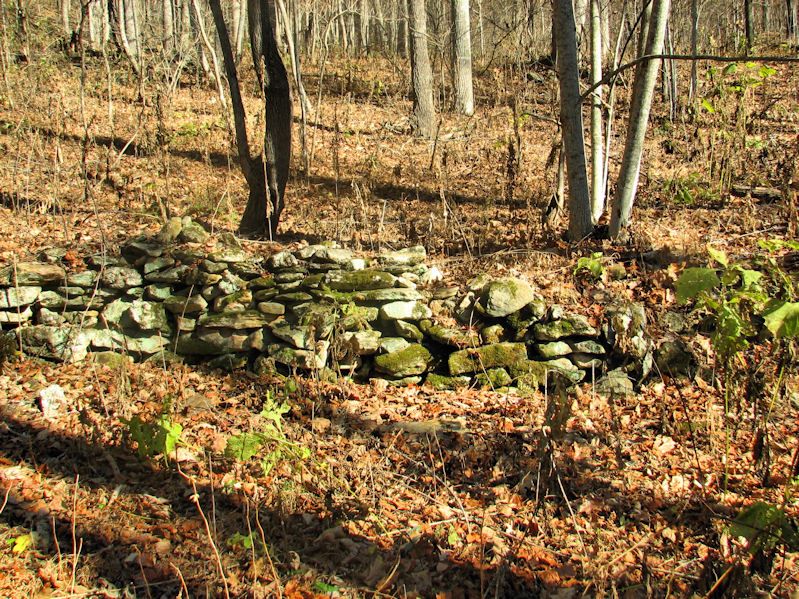
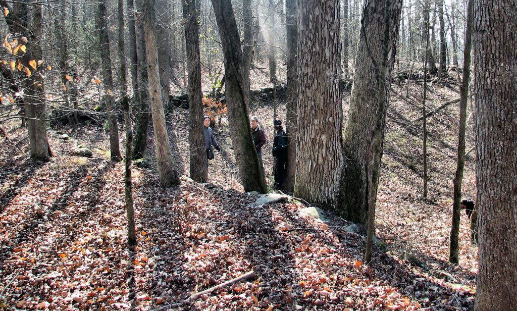
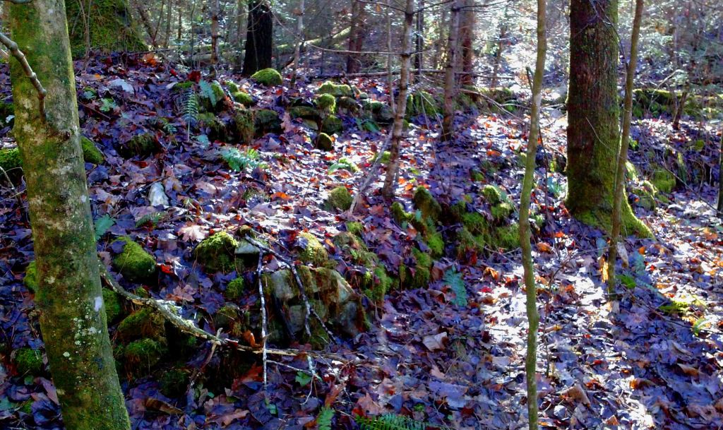
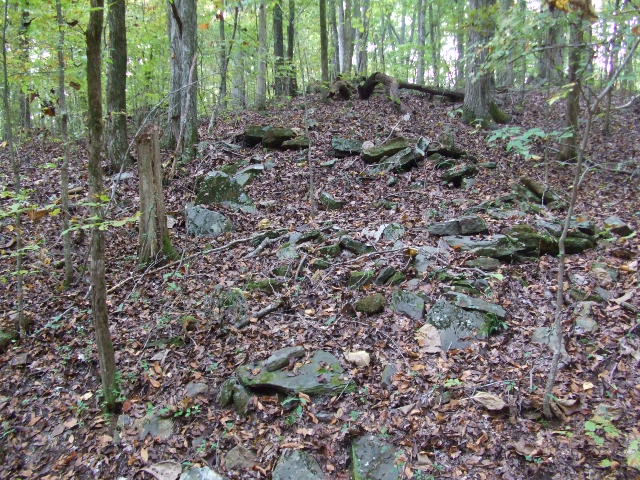
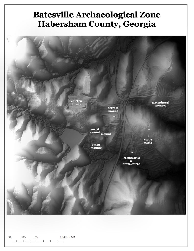
At the moment we are aware of 27 terrace complexes in northern Georgia, two in extreme northwestern South Carolina and four in east-central Alabama. There are at least four terrace complexes in Union County alone, where Track Rock is located. There are at least seven still visible in Metropolitan Atlanta. One is at Little Mulberry River Park in Gwinnett County. The others are along the North Oconee, Apalachee and Chattahoochee Rivers in Metro Atlanta.
The four in Union County, are the most northerly terrace complexes in the state. The remainder can be found near rivers or major streams all the way down to the Fall Line near Columbus, GA. Most, but not all, are also in the Georgia Gold Belt. Most, but not all, contain stone cairns, which seem to be much older than the agricultural retaining walls. Some also contain stone circles, which seem to predate the terraces. These unique archaeological zones are places, where humans were coming for ceremonies or to mine soapstone, long before the builders of the terraces arrived.
The identification of terrace complexes in Georgia is accelerating as people visit Track Rock Gap then began surveying their own neck of the woods. I just found one a half mile from my home in December, near the very ancient Alec Mountain Oval Stone Circle. I strongly suspect that the total number of surviving terrace complexes in Georgia will eventually exceed a hundred!


Who would have thought that an indigenous terrace farming culture would have completely been “under the radar” of historians and archaeologists for over two centuries . . . but as the readers can see . . . it’s for real.

Hello Richard,
Congratulations on all of this, and for making the many Ph.D. cronies look like cracker fools. This is a real shame and they don’t even seem to care. (Piled high and deep…!) And using state money to cover up the facts and the truth, while not wanting to understand “the Maya thing”. No wonder the world is so messed up. Based on experience, the ugly smell of small c christianity is a big part of this. Some of my “relatives” in NE Georgia were really awful people…evil really. The brutal oppression of the indigenous peoples around the world is not a great look, along with the sad abuse of children, so cover-ups are just part of the business model. I hope to meet you at Track Rock someday…there is something you need to see. Another foolish shame: No time or money to build a proper shelter over such priceless and important artifacts… We should petition them to do this…or do it ourselves.
Kind regards,
Bill
LikeLiked by 2 people
Hello Bill. My wife and I recently purchased a property on Lower Track Rock Rd. 100 year old home. My wife has 7 generations of kin in union county and I have been coming up here for 30+ years. My interest in the area peeked several years ago when I realized this area of the country has evidence of human survivors and soil of the last solar disaster. Mayan culture and history suggest they knew and recorded the Nova cycles of the solar system. Also they knew of the earth magnetic excursion cycles that repeat every 12 – 14 k years. These cyclical disasters are what I believe petroglyphs origins. These are observatories or monitoring stations (notice they face east on sunrise at winter solstice.) During an excursion such as that we are now in the midst, when the alignments drift and the warnings to others are to seek solid shelter and prepare for a solar nova. Track Rock petroglyphs may even come with a set of dates suggesting when this will next happen. Hence the Mayan calendar debate. So to me Track Rock is much more than archeology and artifacts or even cultural preservation. I believe it is a road map to our survival when the next solar natural disaster event occurs. The ultimate prepper knowledge so to speak.
I will be back in Blairsville late March. Would like to meet with you and or Richard at Trackrock. (My house if you like.) Email me at charlieharner@comcast.net We can exchange further information and contacts once we get to know each other. I have some ideas concerning preservation of the glyphs. (They were recently vandalized) Also maybe some way of getting local historical society more accurate information about the area. Thanks Charlie Harner
LikeLiked by 1 person
Hi Charlie,
Thanks for your comment, and I’m sorry about the vandals. Not sure of a word for dogs like that. Sent you an e-mail and look forward to meeting you and Richard…
Something needs to be done.
Kind regards,
Bill
LikeLiked by 1 person