
Edisto Island ~ Beaufort County ~ South Carolina
by Richard L. Thornton, Architect and City Planner
Site No. 38CH42
Longitude: 80°12’50″W ~ Latitude: 32°34’17″N
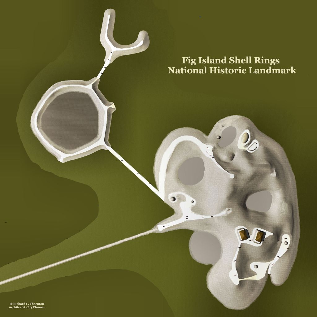
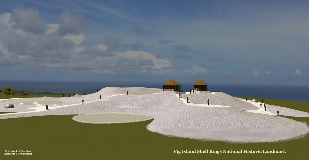
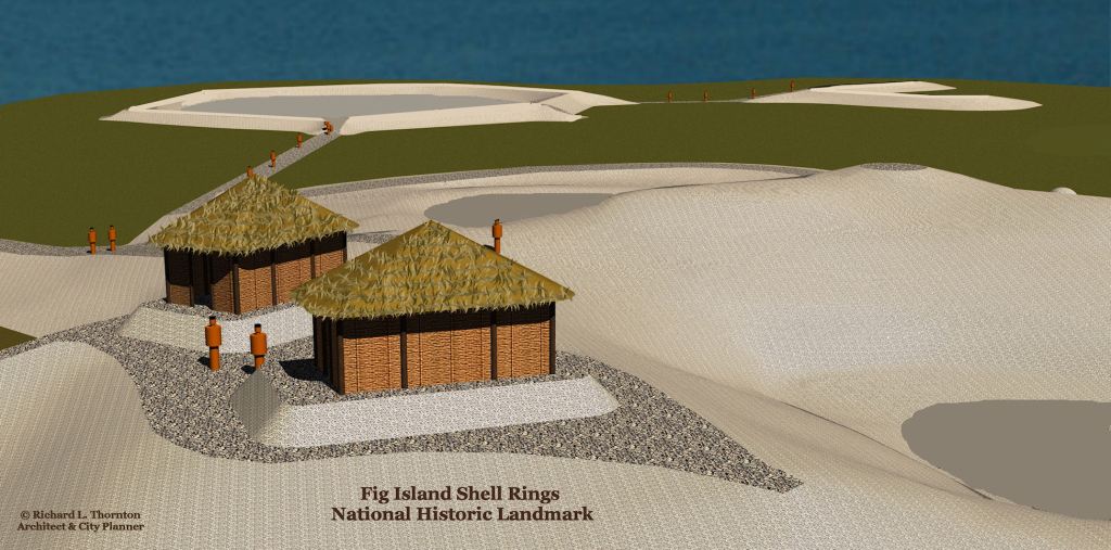
The Fig Island Shell Ring Complex is most complex shell-ring site known. As a result, it was the most complex virtual reality computer model that I ever attempted. In computer modeling, each point on the structure and terrain is defined by a mathematical formula with x, y and z coordinates. When almost every feature is an asymmetrical curve, one has some very complex mathematics. The are third degree calculus formulae!
The Fig Island Complex is true architecture, not random deposits of refuse from ceremonial feasts, as many shell rings are described. The site is owned by the State of South Carolina and has been designated a National Historic Landmark.
Geographical Location: The site is on the northeastern tip of Edisto Island, facing Edisto Sound. The location is not a true island or the original Fig Island in Beaufort County. Because of the steadily rising level of the Atlantic Ocean, this shell ring complex is surrounded by tidal marshes. When originally constructed the rings would have been on dry land.
Geology/Ecology: Edisto Island is classified as a South Atlantic sea island, not a barrier Island. Unlike barrier islands, which are Holocene deposits of shifting sands, sea islands are remnants of the seaward side of the continent that were created by tidal and wind erosion. During periods of lower sea level these Pleistocene deposits were conjoined with the mainland. Because relative sea level has risen dramatically in the past 18,000 years, the lower eroded areas have become marsh or open water.
Undeveloped sections of the island are covered with a South Atlantic maritime forest. The forests consist of mixed pines and hardwoods with Live Oaks being dominate species.
Climate: Atlantic Coastal Maritime Climate – Subtropical in the late spring and summer – The region is generally hot and humid from mid-May to mid-September.
Ethnicity: Unknown . . . according to 16th century French ethnologist, Charles de Rochefort, the shell rings on the South Atlantic Coast were built by ancestors of the Arawak People, who after their abandonment migrated southward as far as Peru in South America and then began migrating northward again. By the time that, Charleston was settled in 1670, there was a substantial population of Toa and Taino Arawaks living in what is now Georgia, Alabama and Tennessee . . . but they appear to have arrived no more than 500 years earlier.
Archaeological Surveys and Excavation
1. Gene Waddell and Thomas Hemmings (1971-72) – Hemmings and Waddell, under the auspices of the newly-created South Carolina Institute of Archaeology and Anthropology (SCIAA), surveyed for Late Archaic sites along 150 miles of Georgia and South Carolina coast in the spring of 1970. Eighteen shell ring sites were recorded, and nine of the sites in South Carolina were nominated to the National Register (Cable and Williams 1993). Hemmings followed up this research with excavations at Fig Island Shell Ring the following July and August. Those excavations have not been fully reported, though. Hemmings published a short synopsis of results.
2. Michael Russo and Rebecca Saunders (2001) – This archaeological site received far more comprehensive and detailed investigation than any of other shell rings in Russo’s and Saunders’ survey of the South Atlantic Coast. Numerous test pits and sectional ditches were excavated to determine more precisely the chronology and construction methodology.
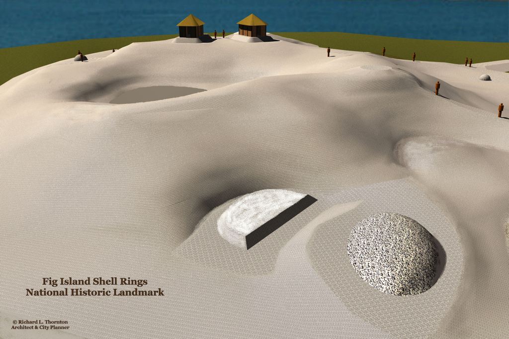
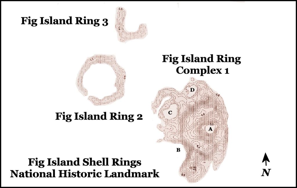
Fig Island Shell Ring Complex 1
Structures: Fig Island Shell Ring Complex 1 consists of a large shell ring about 20 feet in height above the surrounding marsh, four or more lower-lying attached rings, including a concentric configuration containing a ring within a ring, and a mound with a shell causeway linking it to the primary ring.
Occupation Period: Late Archaic – The radiocarbon dates obtained by the archaeologists were: 3950+/-50 years BP or 1950 BC; 3860+/-50 years BP or 1860 BC; and 3820+/-50 years BP or 1820 BC.

Fig Island Shell Ring 2
GIS Coordinates: Longitude: 80°12’57″W ~ Latitude: 32°34’19″N
Description: The archaeological report on Ring 2 states that it is a closed circle. In an amendment to the report, archaeologist Michael Russo suggested that it really appears to be more of a hexagonal shape. That it does. However, there is an important detail that both commentaries missed. There is a gap in the ring, which coincides with the azimuth of the sunset on the Summer Solstice. This is an astronomical structure.
Structure: Fig Island Shell Ring 2 is composed primarily of oyster shells. It is about 170 feet in diameter and 7 feet tall.
Occupation Period: Late Archaic – The radiocarbon dates obtained by the archaeologists were: 4010+/-55 years BP and 4110+/-50 years BP.
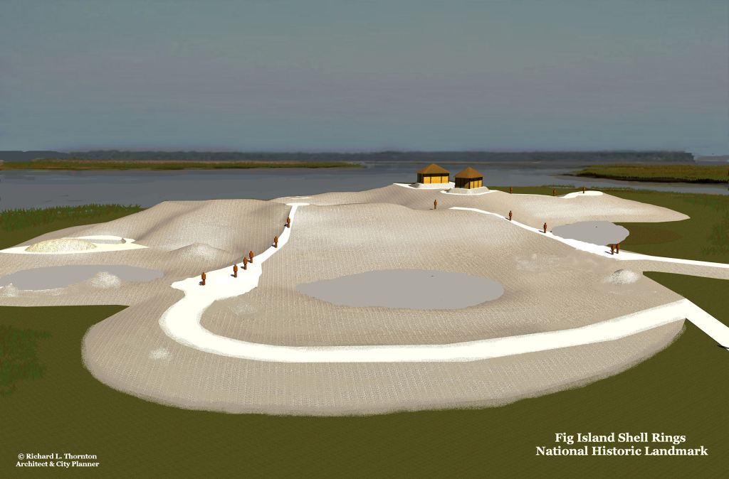
Fig Island Shell Ring 3
GIS Coordinates: Longitude: 80°12’55″W ~ Latitude: 32°34’22″N
Description: It is not clear if Fig Island Shell Ring 3 was originally a full circle or was always roughly a U shape. It contains a ramp on the southeast corner that, like Ring 2, aligns with the azimuth of the sunset on the Summer Solstice.
Structures: Fig Island Shell Ring 2 is approximately 161 feet in diameter and 6’-2” tall. It is composed of earth and mixed sea shells.
Occupation Period: Late Archaic – The radiocarbon dates obtained by the archaeologists were: 3990+/-50 years BP; 4030+/-50 years BP and 4070+/-50 years BP.

Certainly looks complicated Richard. Interesting post Thank you.
LikeLiked by 1 person
Howdy, Interesting…kept thinking of Skara Brae while reading your post.
On Tue, Mar 29, 2022 at 6:52 AM The Americas Revealed wrote:
> alekmountain posted: ” Edisto Island ~ Beaufort County ~ South Carolina by > Richard L. Thornton, Architect and City Planner Site No. 38CH42 Longitude: > 80°12’50″W ~ Latitude: 32°34’17″N The Fig Island Shell Ring Complex is most > complex shell-ring site known. As a res” >
LikeLiked by 1 person