
Part Eleven of the Americas Connected series
by Richard L. Thornton, Architect and City Planner
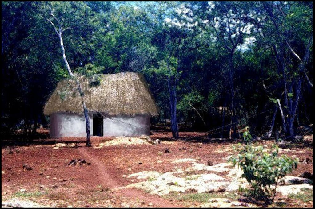
If you were a subscriber in 2021, you probably remember the Love Hut in the ruins of the Maya city of Labna. It was where the author and Ana, a future Mexican anthropologist, were based while exploring the little-known western region of Campeche State, Mexico. The hut was oval-shaped, unlike the vast majority of houses in Southern Mexico.
A large meteor hit the Caribbean Sea off the coast of Cape Canaveral, FL in 539 AD, creating a 120 feet+ tidal wave that wiped out much of northeastern Florida and southern Georgia. Instantly the Swift Creek culture communities in the region were abandoned.
Soon, there was a sudden drop in the population of Campeche. Northeastern Campeche apparently was at that time occupied by Itza Mayas, although their main population was still in the highlands of Chiapas and Guatemala. About a third of the population migrated away from the region. Mexican archaeologists have never agreed where the immigrants resettled.
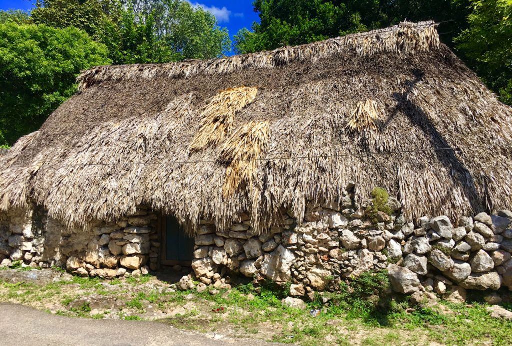
In 1939, archaeologist Robert Wauchope discovered a large village with mounds on the western base of Kenimer Hill in the Nacoochee Valley of Northeast Georgia. This is the oldest know example of traditional Chickasaw architecture. Wauchope was never aware of the massive Kenimer Mound that looked down on this village site. He also was never aware that the houses at village were identical to those solely found in eastern Campeche. Soon villages with oval post-ditch construction begin developing in Northeast Georgia, northwestern South Carolina and ultimately in northern Alabama.
Which one these statements are true?
(1) The first lesson that Ana the Tour Guide (and future anthropologist) taught Richard was that the “real Mayas” never built towns close to the Gulf of Mexico because of their fear of hurricanes. Other ethnic groups occupied the coastal plain up to 25 miles (40 km) inland.
This stone structure is the only known Campeche Maya structure on the coast of Campeche. No one knows why its builders cut into solid limestone rock to create a basement for it. In 1837, it was the site of a diplomatic conference in which the leaders of the Republic of Texas and the Republic of Yucatan formed a single, confederated nation. Today, it is known as “La Casa de Tejas.”
(2) This stone structure is located on the crest of a volcano in the Mexican state of Tlaxcala and is the most northerly example of Maya architecture in Mexico. It is best know as the “Banco de Santa Ana,” because when Generalissimo Antonio Lopez de Santa Ana was fleeing the United States Army, he his his gold, silver and jewels in the basement, hewn out of volcanic rock, and covered the treasure with banana leaves.
(3) This strange stone structure, with a basement hewn out of solid limeston, is located under Lake Seminole in Decatur County, GA . . . near where the waters of the Chattahoochee and Flint River met. It was known as General Jackson’s Oven by locals in the 1800s and early 1900s, and thus was ignored by archaeologists who surveyed the proposed basin of Lake Seminole in the 1960s.
It was still mostly intact, when the army of General Andrew Jackson camped here for several days, prior to invading the territory of the Kingdom of Spain, La Florida. It was adapted to function as an oven to bake bread for the army. This caused the remaining stone shingle slabs to collapse. Thereafter, the structure deteriorated rapidly due to locals and tourists grabbing stones as souvenirs.
In 2013, controversial, self-styled historian Richard Thornton wrote an article about the structure in the National Examiner, after obtaining descriptions and sketches of the intact structure from the late 1700s. He claimed that it was a Campeche Maya structure that was perhaps used as a warehouse for nearby attapulgate mines. Attapulgite is a type of clay, used to make Maya Blue pigment.
The Georgia Council of Professional Archaeologists issued a response, which was published in the Atlanta-Constitution: “Mr. Thornton is yet again trying to foist on the public delusional tripe. From where he gets these bizarre ideas, no one knows. The Eastern Band of Cherokees investigated him and determined that he had never been in Mexico, knows nothing about the Aztecs or Mayas and is not a member of any federally-recognized tribe. Creeks in Oklahoma tell us that he is considered a nutcase out there and never worked for the Muskogee Nation. They resent him trying to label himself of Creek heritage and urge people not to pay any attention to what he says.”
Georgia archaeologists refused to investigate the archaeological site, but amateur archaeologists from nearby Bainbridge, GA, obtained the help of professional divers from Florida, who were able to identify the stone ruins underneath the water’s surface.
(4) The strange structure above was discovered on May 8, 2022 at a newly-identified archaeological zone in Batesville, GA – Habersham County. Most of the stone slab roof has collapsed into the hewn basement below, but some remains. It is not known for certain, who built this structure, but it is the size and shape of Campeche Maya houses.
