It is a thoroughly mixed quagmire of racism, regional prejudice, short-sighted politics, greed and down-right ignorance among certain academicians.
Part 32 of The Americas Connected series
by Richard L. Thornton, Architect and City Planner
The Creek Indians are a stubborn and backward people. They are so ignorant that they refuse to acknowledge the natural superiority of White people. Georgia is blessed to be rid of them!
The Rev. George G. Smith (History of Methodism in Georgia) [1877]
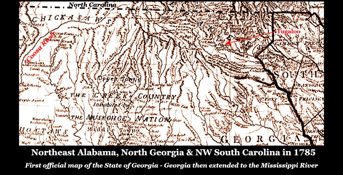
(Image Above) – The first official map of the State of Georgia in 1785 showed virtually all of what is now northern Georgia and Alabama to be occupied by the Creek Confederacy and Chickasaw Tribe. Georgia’s western boundary at that time was the Mississippi River. Rabun County in extreme NE Georgia was occupied by Uchee, living on land controlled by the Cherokee Tribe. There were Chickasaw and Shawnee villages in Northeast Georgia also, but they were allied with the Creek Confederacy. Yet today, all counties in northern Alabama, plus those in Georgia from central Metro Atlanta northward to the state line, describe themselves as “being formerly the home of the Cherokee People for hundreds of years.”

In recent years, Virginia has done a much better job of educating its students about the Native American tribes, east of the Blue Ridge Mountains. However, it is still maintaining the myth that the Shenandoah Valley and northern Virginia were “uninhabited” when Jamestown was founded. Captain John Smith wrote on his map of Virginia that this region was actually the most densely populated and culturally advanced.
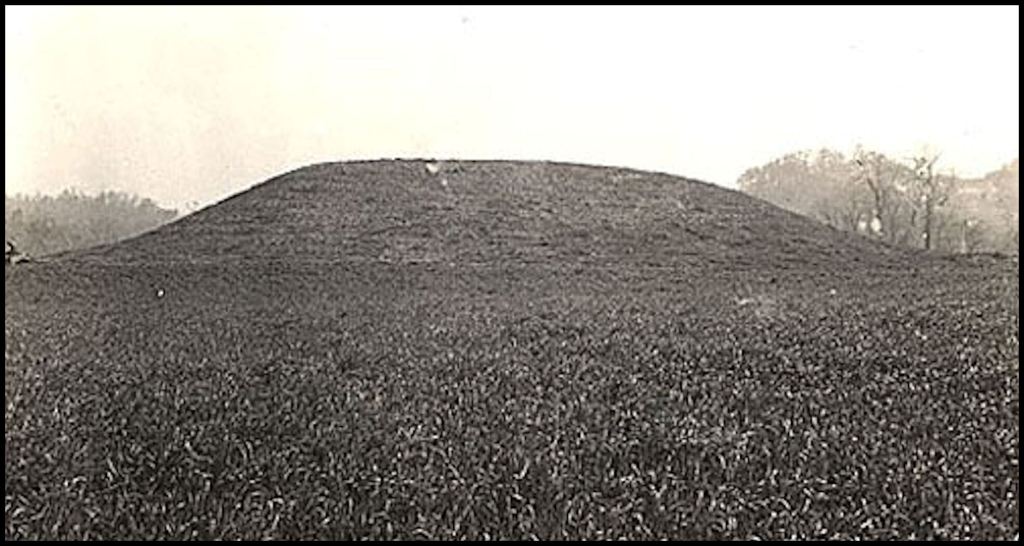
Late 18th and early 19th century Virginia historian Samuel Kercheval provided eyewitness accounts of hundreds of mounds and “Mexican style” artifacts in the Shenandoah Valley. He said that almost every farm in the northern half of the valley contained either mounds, earthworks, village sites or all of the above. My farm contained at least one visible burial mound (cremated human remains) and two Native American village sites. On several occasions, I encountered Mesoamerican style artifacts, such as painted pottery and stone metates, while supervising construction projects in the Seven Bends Area of the Shenandoah River Valley.
Louisiana and Mississippi do an excellent job of presenting a comprehensive discussion of the Native Americans, who once lived or currently lived in their state. Here is something odd. The largest tribes in Mississippi and Louisiana were the Choctaw, Chickasaw, Natchez, Chitimacha and Tunica. However, the official Dept. of Interior NAGPRA map, adopted by Congress, labels those states as being occupied by “unknown tribes.” Of course, the Choctaws are one of the largest federally recognized tribes and have a reservation in Mississippi. This same map labels all of the traditional Chickasaw territory in Alabama, Georgia, Tennessee and Kentucky as being “Cherokee.”
Florida also does a good job, except in the northeastern part of the state. They have a major booboo to conceal. The tribes mentioned by the occupants of Fort Caroline as being their neighbors, never lived in Florida. They were Georgia tribes, which either moved up the Altamaha-Oconee-Ocmulgee River system or westward to the Chattahoochee River . . . in both cases becoming members of the Creek Confederacy. They massacred the entire garrison of Fort San Mateo in 1567 then several crews of ships that wrecked on the coast of Georgia islands in the late 1500s, but were not living anywhere in Florida after St. Augustine was relocated to Florida in 1566. Florida solves the problem by saying that they became extinct between 1565 and 1567.
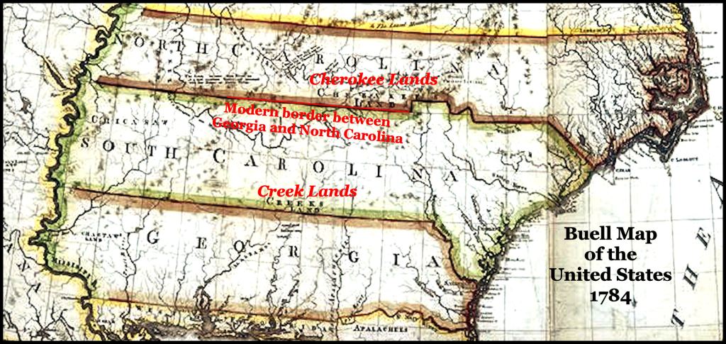
There were never more than 1200 “Cherokees” in extreme NW South Carolina. They lived in villages with either Creek or Uchee names and spoke a dialect of Itstate Creek – not Cherokee. Yet, the South Carolina History text devotes most of its discussion to the Cherokees.
Over 80% of the sections of the official Georgia History textbook addressing Native American history are about the Cherokees, even though the Cherokees never occupied more than 20% of the state and then only for about two generations. In fact, most Georgia’s textbook discussion is about Cherokees, who lived in North Carolina or Tennessee and goes on ad nauseum to describe how the Cherokees lived, when De Soto came through Georgia in 1540 . . . when they were actually in Canada at the time. LOL Georgia’s textbook makes no mention of the Kingdom of Apalache, which gave the Appalachian Mountains and Apalachee River in NE Georgia their name nor does it mention the Uchee, Panoan, Taino and Arawak provinces, which occupied much of southern and southeastern Georgia.
Alabama’s textbook also ignores the substantial presence of Chickasaws in the northern third of their state, Choctaws, who occupied the southwest quarter of their state and Tainos, who occupied the Birmingham area. Tennessee devotes virtually all of its Native American history pages to the Cherokees, while the Chickasaws, Creeks, Uchees, Koasati and Chiskas occupied almost all the future state of Tennessee until the early 1700s.
What is going on here?
A natural place to start in our journey into the labyrinth of fake Native American history was Methodist church history. Until the late 19th century, over half of all United States citizens were Methodists. The United Methodist Church was still by far, the largest Protestant denomination in the United States until the early 1960s, when it officially opened attendance in all its churches to people of all races, while the Southern Baptist Convention remained segregated for an additional three decades . . . resulting in an explosion of membership.
1 – Racism
Reverend Smith’s 1877 discussion of slavery was rather amusing. He admitted that Methodists in England and Wales were directly responsible for the abolition of slavery in the British Empire in 1833. He also admitted that originally, Methodists in both the North and South generally opposed slavery, but those in the South opposed emancipation, because it would create social discord and widespread crime! (the original Orwellian doublespeak!) Smith blamed English abolitionists for stirring up trouble and causing the 1844 breakup of the Methodist Episcopal Church into separate denominations in the North and South.
It reading through Smith’s descriptions of Native Americans, became crystal clear that preservation of the institution of slavery played a major role in the early stages of fake history. The Creeks were “bad Indians” because they opposed slavery and gave sanctuary to runaway slaves, while the Cherokees were “good Indians” because they had African slaves and returned slaves to their rightful owners (for handsome cash bounties). In truth, there were some mixed blood Creek elites in West Central Georgia, who owned slaves, but many other divisions of the Creek Confederacy continued to give sanctuary to escaped slaves.
2 – Confusion caused by contested state boundaries
Until 1794, South Carolina claimed all of present-day Georgia from Augusta and Macon northward, even though Georgia’s Royal Charter placed its northern boundary at the source of the Savannah River and included all of the Savannah Rivers’ tributaries. The first official map of the United States agreed with South Carolina’s claim. However, Georgia’s colonial leaders had made this claim unenforceable by issuing land patents to thousands of settlers, which would be worthless, if South Carolina gained official title. Georgia also provided the only law enforcement in the contested region via the Georgia Rangers and then the creation of county governments.

3 – Newcomers
Georgia’s population DOUBLED between 1770 and 1780 (23,375 to 56,071) In 1790, it was 82,548 and by 1800, it almost doubled again to 162,686. In 1785, the US Government and Georgia secretly gave all of what is now NW and North-Central Georgia to the Cherokees. Thus, by 1800, at least 80% of Georgia’s population had never lived in the state, when the Creeks and Chickasaws occupied most of northern Georgia and Alabama. Almost no whites were living in Alabama in 1785. Its white and black population was only 1,250 in 1800! Thus, the fictitious local history accounts in this region can be partially attributed to the cultural memory of early white settlers.
4 – Disdain for of Native Americans by William Bacon Stevens
In 1838, Maine Native, William B. Stevens, moved to Savannah, GA after graduating from medical college. Yes, he arrived as the last Cherokees were being marched out. He found that he didn’t like being a medical doctor. Apparently, he had plenty of “family money” to live on, so he devoted his time to creating the first Georgia history book. That year, he also joined with a hardware store owner from New York to form the Georgia Historical Society.
Stevens said very little about either Georgia’s Native American history or the presence of French and Spanish colonists long before Englishmen arrived. He literally described the Indian Removal program, just completed, as “the triumph of Anglo-Saxon civilization over a savage wilderness.”

5 – Prejudice against French authors and maps
French Huguenot author, Charles de Rochefort devoted 10 chapters of a book, written in 1658, to the advanced Native American peoples of what is now Georgia. He presented the Kingdom of Apalache as the most advanced indigenous civilization, north of Mexico. These chapters were based on an eyewitness account and sketches by English explorer, Richard Brigstock, who spent most of 1653 in northern Georgia and the area around Franklin, NC.
De Rochefort provided detailed information about the construction details of various types of houses and town fortifications . . . town planning traditions . . . mound construction details . . . burial traditions . . . religious beliefs, etc. . . . information that was not rediscovered by archaeologists until the late 20th century. His book is still considered by European universities to be a reliable account of the peoples in the Caribbean Basin and Southeastern North America during the 1600s.
After the independence of the United States, the so-called Ivy League colleges of the Northeast dominated the publishing and accreditation of history textbooks in the United States. The book by Charles de Rochefort was very popular in Europe (six major reprintings) and still is used as a reference in European history courses. However, New England officially banned it as being a “fantasy” because it described an advanced Native American civilization in Georgia, which constructed hundreds (perhaps thousands) of mounds and stone structures. They stated that “French sources are unreliable (not true) and that the South was always a back water of culture.”
6 – Prejudice against Southern researchers – Charles C. Jones, Jr.
Charles C. Jones, Jr. was the son and namesake of a nationally-respected Presbyterian minister. He grew up in Camden, SC and Philadelphia, PA. After graduating from what is now, Princeton University and Harvard University, he established a law practice in Savannah, GA. While at Princeton, Jones enrolled in the only archaeology classes being taught in the United States. History and archaeology became the passion of his life. Thus, while supporting himself as a lawyer or Mayor of Savannah, his primary interests were always Native American and Colonial Period history. In the years leading up to the American Civil War, he spent much of his spare time, studying and excavating test holes in the major mound centers in Georgia. He personally paid for a professional civil engineer to survey and prepare accurate site plans of these archaeological sites.
Even though he was a Lt. Colonel in the Confederate Army, Jones lived in New York City during the Reconstruction Era in order to recoup his wealth, lost during the Civil War. He began self-publishing books on archaeology at this time.
Ultimately, Jones published almost one hundred books, pamphlets, and articles, most of them privately printed at his own expense. A keen interest in the culture and history of the Southeastern Indian tribes led to Jones’s first published work in 1859 and eventually resulted in his acquisition of more than 20,000 prehistoric artifacts. His archaeological interests reached fullest and finest expression with Antiquities of the Southern Indians, Particularly of the Georgia Tribes (1873), which gained international renown and remains an acknowledged classic in its field. Very little information, if any, in this book has been refuted by professional archaeological excavations.
With a quivering sneer, contemporary academicians label Jones “an amateur archaeologist” – in order to dismiss his discussions of ancient stone structures once being endemic on northern Georgia’s landscape. The fact that he was a graduate of the two top universities in the United States in his era is also conveniently forgotten.
The truth is that Jones was the only person, with formal college classwork in archaeology, to study Native American sites in Georgia until Margaret Ashley of Atlanta was hired in 1925 to assist Warren K. Moorehead by surveying archaeological sites downstream from Etowah Mounds. This was while Moorehead worked on Mound C at Etowah.
At the time, Ashley had completed everything, but her dissertation, for a PhD in Anthropology from the University of South Carolina. Like most “professional archaeologists and anthropologists” in the United States until the 1930s, Moorehead had never taken a single class in archaeology.
The first archaeologist with a PhD in Anthropology to work in the Southeast was Dr. Arthur Kelly from eastern Texas. He was hired to supervise the excavations at Ocmulgee in 1932. Because he was from Texas, Kelly initially believed that Ocmulgee was constructed by the Caddo Indians. LOL By the time I met him in 1969, he was convinced that the Creeks were the true descendants of the Mississippian Culture mound builders in the eastern Southeast.
Thus, when the Smithsonian Institute sent truly amateur archaeologists to work at Etowah and other sites in northern Georgia in the mid-1880s, they ignored everything that Charles Jones discovered and wrote . . . because he was a Confederate veteran and a Southerner. The same thing happened when truly amateur archaeologist, George Heye, excavated the Nacoochee Mound, near my house, in 1915.
7 – Hordes of Northern amateur archaeologists, labeling everything Cherokee
Cyrus Thomas was a Union veteran and a self-taught expert on the insects of Indiana, when selected to direct the archaeological program of the Bureau of American Ethnology, Smithsonian Institute. He never studied anthropology or archaeology and only had marginal college education. Thomas hired unemployed Union veterans to do his archaeological work around the Southeast. None of them had any education in American Indian history, anthropology or archaeology.

Although another division of the Bureau of American Ethnology began producing precise, full-color maps of Indian land cessions in the 1880s, Cyrus Thomas and his staff were notorious for ignoring historical maps. Original copies of the detailed 17th century French maps were available at the nearby Library of Congress. I have never run across any 19th century or early 20th century Smithsonian report, which cites a French language reference . . . and just a few Spanish sources.
For unknown reasons, Thomas believed that all the mounds in the eastern United States were built by the Cherokees. He wrote several articles in the forerunner of Smithsonian Magazine, trying to prove this theory. As a result, all Native American sites, excavated by the Smithsonian in Tennessee and Georgia were labeled “Cherokee.” Contemporary Cherokees and their Quislings in the archaeology profession quote these late 19th century reports as proof that they were “full participants in the Mississippian Mound Culture,” when in fact, the reports were written by grossly unqualified authors.
This is odd, since even as late as 1977, when I did consulting work for the Eastern Band of Cherokees in North Carolina, their tourist brochure specifically stated that the Cherokees never built any mounds. Of course, 20 years later, the tribe began buying privately-owned Indian mounds in Georgia so they could be declared to be “Cherokee Sacred Heritage Sites.” They even tried to buy the massive Kenimer Mound in the Nacoochee Valley.
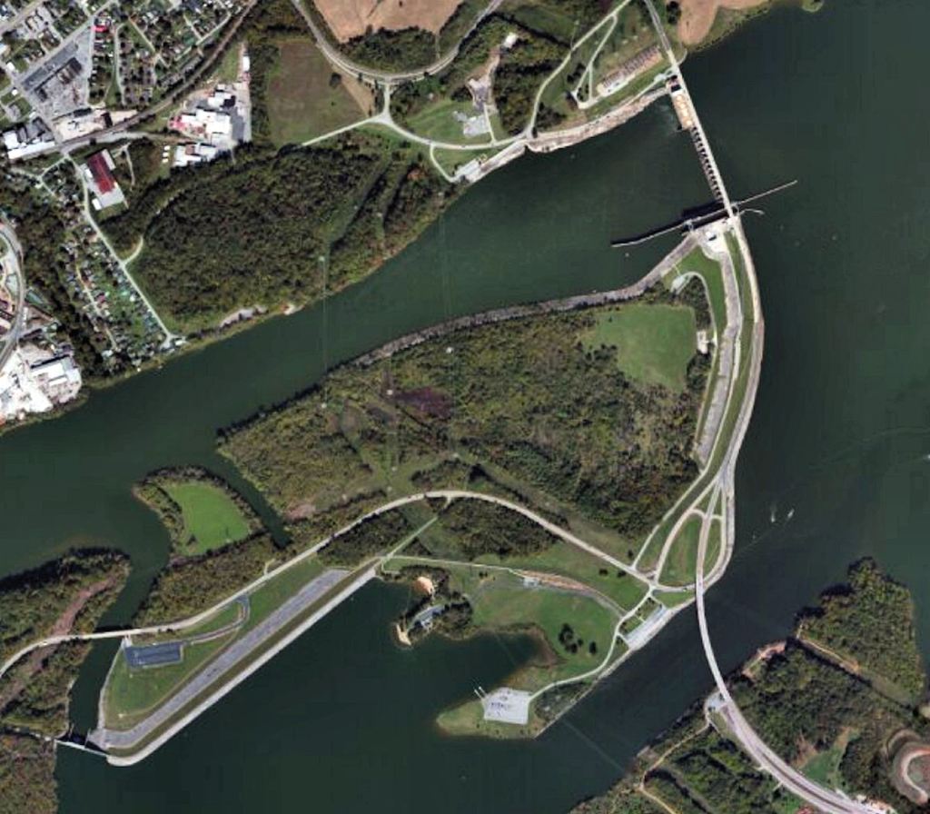
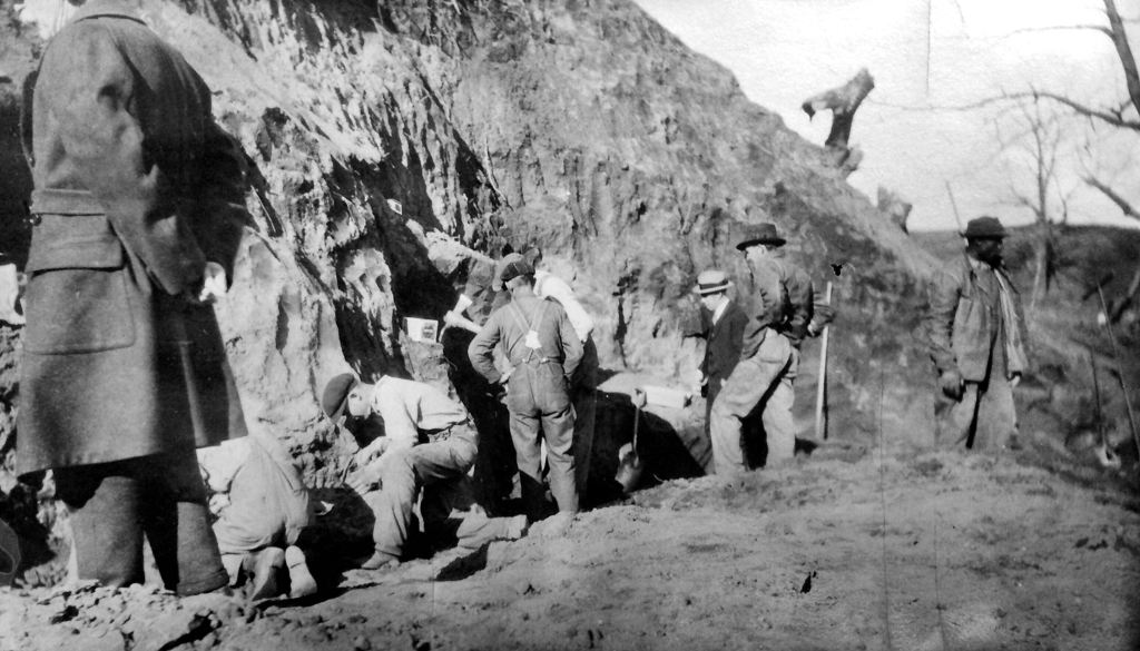
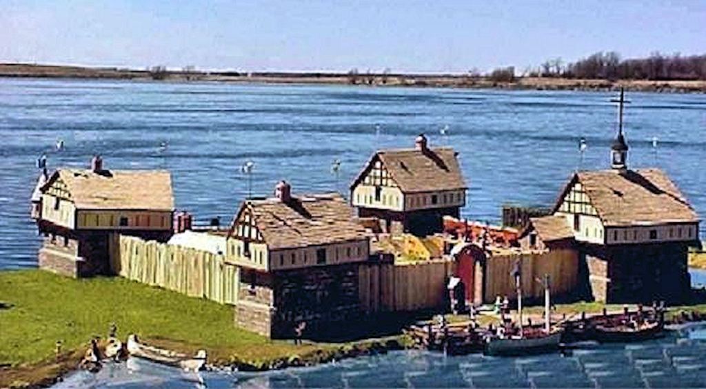
The worst case of misidentification of archaeological sites occurred on Bussell Island, Tennessee. It is located where the Little Tennessee River meets the Tennessee River. In 1887 Smithsonian Institute (amateur) archaeologist, J.W. Emmert, was excavating Native American mounds on Bussell Island, where the Tennessee and Little Tennessee Rivers converge. He was surprised to find what he called “a third diamond-shaped mound” superimposed on the mounds containing Native American artifacts. He published his findings in the 12th Annual Report of the U. S. Bureau of American Ethnology. I will publish a full report on that project in a couple of weeks.
On top of two Native American mounds, Emmert found a “diamond shaped mound or man-made terrace 570 feet north to south and 384 feet east to west.” It was surrounded by a stout timber palisade with blockhouses on the corner . . . a standard 17th century or 18th century European fortification. In the terrace, Emmert found a round hole in which numerous, broken Native American artifacts had been dumped along with loose dirt and refuse. Beneath the top soil, but on the surface of the man-made plaza, Emmert found hundreds of European artifacts, including firearms, knives, broken china, cast iron pots, copper pots and metal eating-cooking utensils.

Had Emmert or his supervisors at the Smithsonian looked at any late 17th century-early 18th century French or British maps, they would have known that Emmert had unearthed a large French fort and trading post next to two Upper Creek villages. No one in Tennessee has since then. Tennessee students are taught that this was an important Cherokee town, discovered by the Smithsonian in 1887.
Emmert interpreted the final occupation of Bussell Island as a fortified Cherokee village on top of older Cherokee mound. The Cherokees NEVER built a single fortified village. The European artifacts were interpreted as a late 18th or early 19th century Cherokee garbage dump and were tossed into the river without be analyzed by professionals at the Smithsonian Institute. The archaeological site was bulldozed without further archaeological study during the construction of Fort Loudon (TVA) dam in 1943.
8 – Downright lies told by amateur archaeologists
Wealthy mining magnate, George Gustavus Heye, loved to dig up Southeastern mounds and then show off his trophy artifacts in his New York City mansion. That’s where all of the artifacts that he retrieved from the famous Nacoochee Mound went. Heye also believed that the mounds were built by Cherokees, but would even lie to back up his faith based history.
First, Heye stated as fact that the Nacoochee Mound was the location of the Guaxule, a Cherokee town visited by De Soto in 1540. His reference was non other than Cyrus Thomas. No Spanish or Cherokee artifacts have ever been found in or near the Nacoochee Mound.

In 1915, none of Heye’s team had prior experience in either Georgia or the Southern Appalachians, yet Heye then made this blanket statement: “This ware is of the typical Southern Appalachian form and style, in no particular respect different from that of other pottery made by the Cherokee in early times. 19 ”
The reference citation was for: Holmes, “Aboriginal Pottery of Eastern United States, Fifteenth Annual Report of the Bureau of American Ethnology, Washington, 1903.”
I became the first person in the world to fact check George Heye. Others before me believed in their hearts that since he was rich, he must be always right. Holmes actually stated just the opposite, when discussing Southern Appalachian pottery: “Of these groups the Muskogeans probably have the best claim to authorship of this ware. There is no similarity between 18th century Cherokee pottery and the ceramics found in Southern Appalachian mounds. ” p. 151

9 – Reservoirs cover hundreds of Native American town sites
Most “Mississippian Period” towns were constructed in flood plains, next to rivers or large creeks. Throughout the Southeast, dams were constructed prior to the Roosevelt Administration (1932) or during World War II (1941-1945) whose proposed reservoirs were not studied in advance by archaeologists. This is particularly a problem in western North Carolina, northeastern Tennessee and the portion of Georgia, north of the Blue Ridge Mountains. None of the reservoirs in western North Carolina were surveyed by archaeologists prior to being filled with water.

This problem created an opportunity for the self-appointed team of professors, who researched the route of the Hernando de Soto Expedition during the 1980s. They had a problem. The Biltmore Estate and Asheville Area Chamber of Commerce had given them a considerable amount of money to encourage them to have De Soto spend the night in Asheville.
The solution was to declare Zimmerman Island, Tennessee under Lake Douglas to be the location of Chiaha, even though there was nothing about the environs of Chiaha, which matched descriptions in the chronicles of the De Soto and Pardo Expeditions. The dam and reservoir were constructed in 1943, so there were no TVA-funded archaeological studies. Prior to World War II an archaeologist had photographed mounds on Zimmerman, but no archaeological report or artifacts survived. However, contemporary reports on nearby location seem to say that the mounds on Zimmerman were from the Woodland and Early Mississippian Periods. No problem . . . all the professors had to do was to control the dialogue and suppress any knowledge that nothing was known about the site, which would link it to the 1500s or Spanish explorers. That they did.
10 – Cherokee casino greed
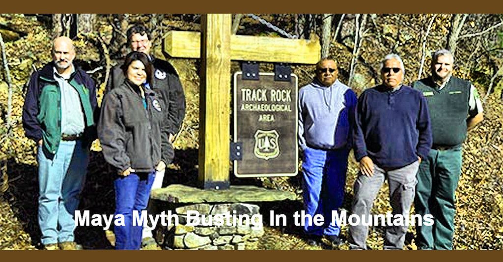
One of many facts that Chicagoan writer for the Atlanta Journal-Constitution, Bill Torpy, didn’t tell you when working as the publicist for Maya-Myth-Busting-In-The-Mountains exactly 10 years ago . . . ALL of the archaeologists who spoke in public on behalf of the US Forest Service propaganda campaign, formerly were employed by the Eastern Band of Cherokee Indians, Keetoowah Band of Cherokees or private developers in their multiple efforts to build Cherokee gambling casinos in northern Georgia. One of the proposed casinos would have been near Track Rock Gap.
Some of these archaeologists and a retired University of Georgia archaeologist, working with them behind the scenes, were directly responsible for the exhibits being altered at the Etowah Mounds Museum in 1995. Both the exhibits and an accompanying film, hosted by Oklahoma Cherokee actor, Wes Studi, make visitors to the museum think that the large town was captured and burned by the Cherokees around 1585. No Cherokees ever lived in or adjacent to Etowah Mounds. They arrived in the region around 1795. A Cherokee mission was established about one mile north of the mounds in 1818.
Between 1990 and 2015, there are repeated examples of Georgia archaeologists being pressured to label Creek, Chickasaw or Uchee town sites in northern Georgia as being Cherokee. However, the Eastern Band of Cherokees did not get their money’s worth, when hiring the talking heads, mentioned above, as consultants for selecting a new casino site near Helen, GA. The EBCI purchased about 500 acres on the south side of Yonah Mountain in order to build a casino there when politically feasible.
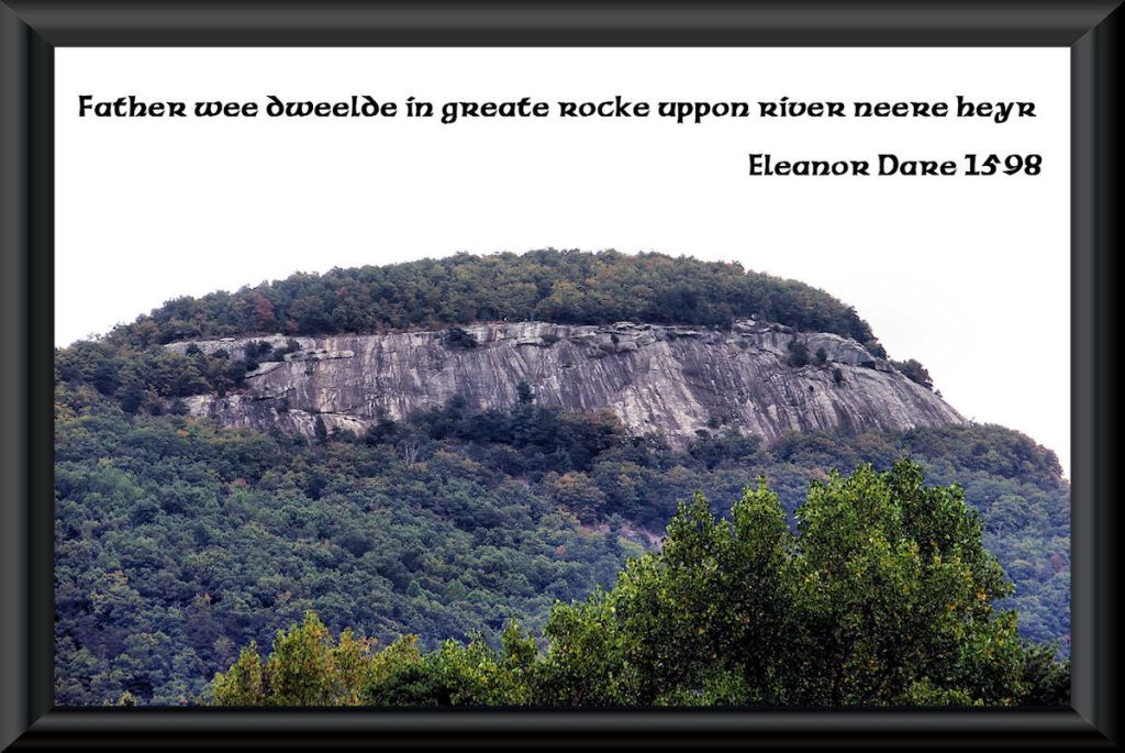
The joke’s on them. Yonah Mountain had a Creek name until the late 1830s . . . Nocosee. The south side of this mountain was always in Creek Confederacy territory until 1818, when it was ceded to the State of Georgia. The Cherokees will never be able to establish a federally-recognized reservation or build a casino at that location.
Now you know!

OMG ! Richard Why do some of these people tell so many lies…..What is to be gained from it and ,also what can be done about it. Does it still happen or when the truth is out is it ever put in the correct prospective. ?
LikeLiked by 1 person
Historians. geneticists and anthropologists behaving badly is as much a feature of North American academia as ever. At least some of the situation can be explained by the isolation of anthropologists and geneticists here from other professions and the public at large. This contrasts starkly with the positive relationships between anthropologists and the public in many European countries. I know that English, Scottish, Irish and Scandinavian archaeologists frequently invite the public to help out on digs. This is probably the situation in many other European countries, but I don’t have personal knowledge of it.
LikeLiked by 1 person