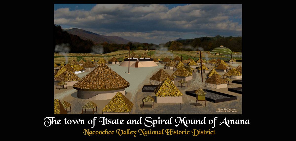
Archaeologist Robert Wauchope described this 12 mile long (19.3 km) beautiful valley in the Georgia Mountains as the largest and densest concentration of American Indian settlement sites in North America. Sounds far-fetched? In the foreground is an architectural rendering of the town of Itsate. Itsate means “Itza Maya People.” in their language and the dialects spoken by most Creek People in Georgia. On the upper right is a spiral-ramped mound and temple to the South American goddess, Amana . . . also known as the “Spiral Goddess.” The mound is remarkably similar to Huaca Montegrande, featured recently on a PBS Nova documentary about the Amazon Basin.
In the background is Alec Mountain. On its crest is a large, oval fieldstone shrine is pristine condition. It is identical in every detail to the oval fieldstone enclosures built by the people of the eastern Scottish Highlands around 3000 BC! At its foot is a massive mound that is identical in every detail to Mound A at Kolomoki Mounds National Historic Landmark, 300 miles to the south in Southwest Georgia.
About a mile to the west is the footprint of a mound so large that some of the most famous archaeologists of the 19th and 20th century ignored as they traveled to the Alec Mountain Stone Oval. Locals just assumed that it was a big hill. Unfortunately, so did the Georgia Department of Transportation, which scooped up the massive structure in 1993 to obtain top soil for highway construction projects. It violated both state and federal laws by not first sending archaeologists to survey the site.

Artlantis architectural rendering of the Kenimer Mounds from 2012
(I have made some refinements in the new 2023 computer model of this large structure)
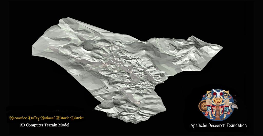
The Chattahoochee Headwaters Computer Model
It took me over a year of working almost day to program this computer model. Throughout 2023, it will provide readers with a virtual drone that will take them back in time to the archaeological sites, which I am discussing. You see, Artlantis now is an animated virtual reality program that does much more than create realistic architectural models. I am currently working out the bugs in the model with CADD.
Because of the rough mountain terrain and numerous streams, the model is extremely complex and was a daunting task to complete. The computer model covers the first 12 miles (19.3 km) of the Chattahoochee River’s drainage basin.
The Nacoochee Valley was created by two parallel lines of ancient volcanoes.

This model contains extremely detailed images of all the known town sites, plus all streams, bottomland cultivated fields, meadows (where small gardens, berry patches and orchards were located) and steep terrain that was probably always forested.
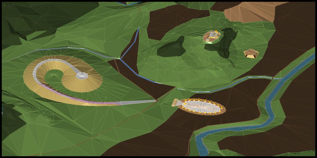
This is a Test 3D image on CADD that I used for finding bugs in the program. Pictured are (left to right) (1) the Sky Serpent Earthwork, (2) Eastwood Village, (3) Kenimer Mounds and (4) Chattahoochee Stables Mound. The Artlantis 3D images and videos will be much more realistic.
Books that accompany this series on The Americas Revealed
In 2016, I wrote two books for those persons, who live in Georgia or plan to visit the Georgia Mountains. At the time, I had no clue that the only house I would be able to afford in 2018 would be on the eastern end of the Nacoochee Valley. It was an extreme fixer-upper on a mountain ridge extending westward from Alec Mountain that nevertheless includes several acres of rugged mountainside woods. The house was cheap because of being in wretched condition and having seven large trees about to fall on it. A 120 feet tall crane was required to lift the massive trees over the house and onto the edge of the street.
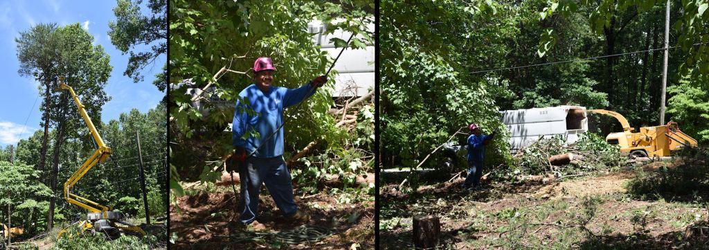
Unfortunately, my camera battery was charging when the 120 feet tall crane lifted a 32″ diameter trunk of a huge oak tree over my house. Pictured is a “smaller” crane used for trimming trees, prior to removal.

The Nacoochee Valley . . . Crossroads of the Americas [$48] is a 104 page, full color book that is a comprehensive history of the Nacoochee Valley in Georgia, It includes (1) detailed accounts of the work done in the Valley by pioneer archaeologists Charles C. Jones, Jr. [1860], George Gustaf Heye [1915] and Robert Wauchope [1939] . . . (2) photographs of the Heye Expedition and the artifacts it unearthed . . . (3) Briefer accounts of work done in the Valley by archaeologists Cyrus Thomas [1886] and Mark Williams [2001-2004] . . . (4) A comprehensive history timeline from the Ice Age to the present . . . (5) Detailed descriptions of the 38 sites examined by Robert Wauchope and instructions of how to reach them. Robert Wauchope was the first anthropology/archeology professor in Georgia. He created the state’s archaeological site index.
To purchase this book:
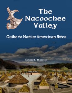
The Nacoochee Valley . . . Guide to Native American Sites [$18] is a 48 page, full color book that provides detailed accounts of the work done in the Valley by pioneer archaeologists Charles C. Jones, Jr. [1860], George Gustaf Heye [1915] and Robert Wauchope [1939], plus (2) detailed descriptions of the 38 sites examined by Robert Wauchope and instructions of how to reach them. Robert Wauchope was the first anthropology/archeology professor in Georgia. He created the state’s archaeological site index.
To purchase this book:
This video describes the archaeological sites at the foot of the mountain, where I live.
