
A series of books, published in the late 20th century by Tennessee and Georgia academicians, told us that almost nothing is known about the interior of the Southeast from 1568 to around 1713. That is pure malarkey! There is a wealth of information in Virginia – books that tell a very different history.
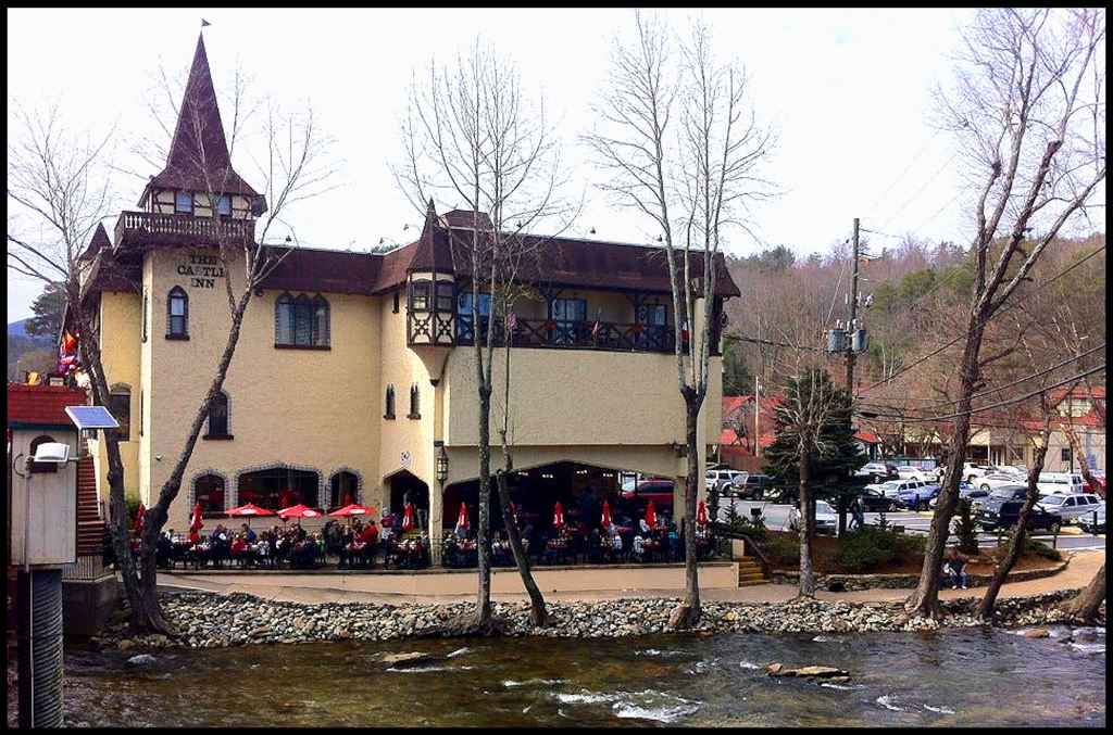
Beneath the Alpine-style buildings, plazas, gardens and streets of Georgia’s number three tourist attraction, is a remarkable chapter of North America’s history that is virtually unknown. Humans have occupied this beautiful valley at least since the Ice Age. The sites of Helen and neighboring Robertstown have almost continuously contained permanent settlements for at least 3,000 years.
Robert Wauchope included detailed descriptions of his excavations in the Nacoochee Valley during 1939, but the book, ARCHAEOLOGICAL SURVEY OF NORTHERN GEORGIA, was not published until 1966. It was printed as a report to the Society For American Archaeology, so few people among the general public even knew it existed.
Three years later, construction work was going at a feverish rate to convert an easily forgotten mountain hamlet, named Helen, into an Alpine village. There was some legitimacy in the make-over. A colony of Swiss immigrants had settled there in the late 1800s and terraced the mountainsides to make wine, while pasturing the rich bottomlands to make cheese.
Later this week, you will see what Helen and Robertstown probably looked like in 1500 AD via the virtual reality computer model. However, it will seem like my version of Fantasyland, unless readers learn what Wauchope’s report, eyewitness accounts and colonial archives tell us about that valley’s real history. From perhaps as early as 1200 AD to its sacking in 1751, the large, multi-ethnic town of Chote underneath Helen, was a major regional center of commerce.
by Richard L. Thornton, Architect & City Planner
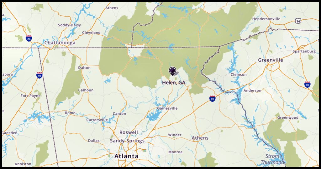
Helen, Georgia is approximately 90 miles (145 km) northeast of Atlanta.
Etymologies
Chote (from Choi-te) – A Maya tribe in Tabasco State, Mexico, which also settled in the Nacoochee Valley.
Chota – That’s just a mispronunciation by frontier settlers and later generations of Cherokees.
Echote (Echota) – Itza Maya word meaning “Capital of the Chote Province.”
Chattahoochee (Cha’ta – Hawche) An Itza Maya word that means “Carved Stone (stela) – Shallow River.”
Itsate – What the Itza Mayas call themselves. Also, it is the name of the largest Indigenous town in the Nacoochee Valley and a major branch of the Creek Indians. In English they are called Hitchiti.
Soque (Sokee, Zoque) – A large non-Maya tribe in Oaxaca, Tabasco, Chiapas and Veracruz states, Mexico, plus northeastern Georgia. It is now also the name of a river in NE Georgia.
Sautee (Sutee/Sote) – Itsate Creek name for the Sokee.
Nacoochee (Nokose) – Creek and Chickasaw word for a bear . . . the name of Yonah Mountain, until changed by white settlers from North Carolina to Yonah in 1832.

Main Street in Helen during early 1969
The secret history of the author
My life has been so weird since 1990, very little of what I say in the remainder of this article will have credibility without the reader knowing what was going on in my life back then. Why would this architect have extensive knowledge of events that are not even mentioned in Wikipedia? LOL
The truth is that most of my knowledge of Virginia and Southeastern colonial era history was acquired, after I was stranded in Georgia. While living in Virginia, I was too busy designing new buildings . . . restoring Colonial and Federal Period buildings . . . plus running a dairy farm . . . to take time to do research. Also, back then the internet was not available to the general public.
With the encouragement of a Virginia Tech professor, who hoped to become my father-in-law, I planned to return to Virginia ASAP, as an established expert on Colonial Era history and architectural history, so I would instantly be considered for architectural services in historic cities or be hired as a professor.
I repeatedly read vague 17th century accounts of bands of starving Virginia Indians, runaway English bond servants, runaway African slaves . . . even star-crossed lovers, escaping their unwanted spouses . . . fleeing to a mysterious “City of Refuge” in the southern tip of the Appalachian Mountains, where the Christian Indian king would protect them.
That place turned out to be now called Helen! The religion of Apalache was already monotheistic. However, the King of Apalache (ruling from the Nacoochee Valley) was converted to Protestant Christianity by the six French Huguenots, he gave sanctuary to. They intermarried into the royal family.
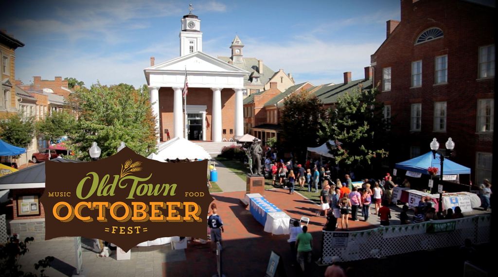
Almost all of my income in Georgia came from projects in Virginia until 1995, so I made several trips up Interstate 81 to meet with clients or study construction sites in Northern Virginia. I was always based in Winchester, where most of my projects were. At the 1993 Winchester Oldtown Octoberfest, I ran into a pretty face from the past.

Cindy was the Virginia Tech senior and cheerleader, who spontaneously kissed me in January 1988 inside my house, while it was being restored. At the same time, her Veterinary Science Professor father was examining my goats in the barn.
She later apologized that her inappropriate behavior with a married man was because I was the first man, other than her father, who had ever talked with her like she had a brain. Cindy and her mother were part Saponi Indian. There was a definite spiritual connection with both of them.
Shortly after Cindy and I met in the street, her mother called on the cell phone, while we were eating lunch at a sidewalk restaurant. She literally urged Cindy to invite me to spend the weekend with her! Her father then came on the phone and invited us to be their guests for Sunday dinner at the Wayside Inn in Middletown, VA. Indeed the times had changed!
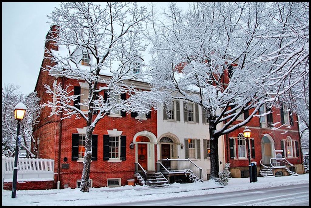
Historic houses after restoration in Winchester, VA
On my next visit to Virginia, her father then broached the idea with me of getting book knowledge of American history to augment my extensive practical knowledge of historic buildings, so I could get at least a part-time professor’s position in Virginia. He used his contacts for me to write articles in Virginia publications on Early Colonial History, Native American slavery, frontier houses and the Civil War in the Shenandoah Valley.
My former farm in the Shenandoah Valley was the site of the third largest cavalry battle of the Civil War, but had also seen actions in the French and Indian War and the American Revolution. The original owner of the farm had been George Washington, who built the first section of the home as a fortified blockhouse!
The long distance relationship didn’t last – not my fault. Cindy had quit her job and was working on a masters program at Georgetown University . . . lots of dating opportunities. She went on to get a PhD in International Affairs at Johns Hopkins University . . . marrying her divorced favorite professor with three children in the process.
After Cindy realized that their marriage was just a cover for her husband’s preferred homosexual lifestyle, her parents urged her to get a divorce and contact me . . . but she had become deeply fond of the children. She told me in 2021 that because she worked for the World Bank and was constantly traveling overseas, she could have an open marriage lifestyle. She did not get an official divorce until the children went off to college.
Several of these old articles about Virginia’s history, inspired by wannabe in-laws, can be found online. When Virginians contact me about those articles, they are always shocked that I have not lived in Virginia for a long, long time.
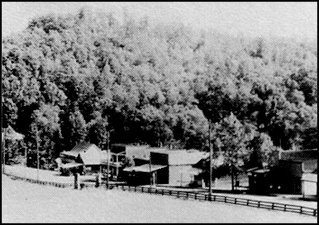
Helen, Georgia around 1939
Discoveries by Robert Wauchope
Robertstown and Helen are on the ancient trade path that passed through Unicoi Gap to connect the Chattahoochee and Hiwassee Rivers. One branch went to present day Batesville and the Unicoi Trail to the headwaters of the Savannah River then continued to the Atlantic Ocean. The other path followed the Chattahoochee River all the way to the Gulf of Mexico.
Wauchope was first attracted to two large mounds on the Chattahoochee River in Robertstown. This is where the highway to Unicoi State Park joins GA Hwy. 75. To the east of the mounds, Wauchope identified a large village occupation zone that contained artifacts going back to the Archaic Period (> 3,000 years). and continuing to the early Colonial. The oldest layer of occupation was also its largest occupation.
The smaller mound had only been used for burials. The larger mound, an oval shape, had post holes, indicating that structures had been erected on it, but there were also some burials.
Both mounds were completely destroyed a few years ago by a construction crew from the City of Helen. They leveled the site and covered it with gravel to make a picnic ground and parking lot for tourists, who ride inner tubes and rafts down the Chattahoochee River.
Wauchope could not get permission to excavate any mounds in Helen. However, he was allowed to walk recently plowed fields and dig a few small test pits. There were then several modest burial mounds along the river in Helen, plus a much larger platform mound in a horseshoe bend south of its commercial buildings.
Readers may recall that Wauchope only found a thin scattering of 18th century European artifacts in most of the Nacoochee Valley over a deep later of alluvial sand. That was not the case in Helen. A very large town had existed there in the 1500s, 1600s and early 1700s.
All of the Native American artifacts were clearly made by ancestors of the Creek Indians. Creek pottery and copperwork were much more sophisticated than Cherokee pottery. However, the volume of European artifacts suggested that this town had become a major point of contact between Native Americans and Europeans.
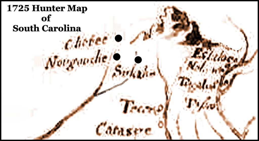
Whereas earlier maps had merely labeled extreme Northeast Georgia as being occupied by Apalachete and Itsate Creek villages, the 1725 Herbert Map of South Carolina specifically mentioned the towns of Chote, Nocose and Sokohi in the Upper Chattahoochee-Soque River Basin. All three words are either Itza Maya or Creek in origin. There was no Chote in Tennessee until 1751. It was abandoned a few decades later. People continue live at the original Georgia Chote to this day . . . now called Helen.
Colonial history of the Nacoochee Valley and Chote
In the interest of brevity, the lessons I learned between 1994 and 2013, while researching Virginia’s and Georgia’s early Colonial History, will be presented in outline form. It is ironic that so many of the lessons about Virginia’s secret history directly applied to Helen and the Nacoochee Valley, for that is where I live today.
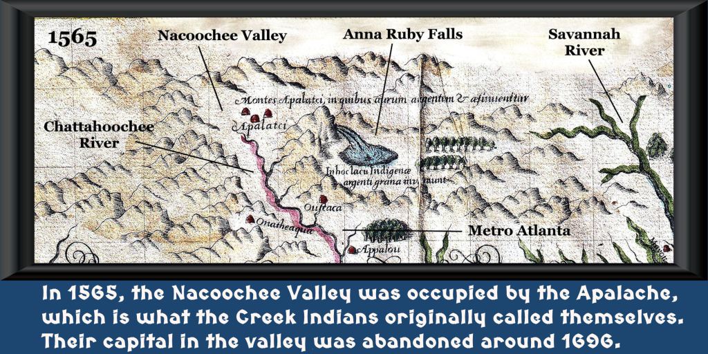
1564-1565 – Lieutenant La Roche Ferrière from Fort Caroline spent six months exploring the future State of Georgia. He initially paddled up the Savannah River from Chicora (Savannah) to Potafa (Augusta) to Ustanauli (Tugaloo Island) then took the path that is now GA Hwy. 17 to the Nacoochee Valley (Capital of Apalache). He did extensive exploring within the Kingdom of Apalache, observing the mining of yellow gold in the Nacoochee Valley, red gold near present-day Gainesville, GA plus white gold and natural brass near Dahlonega, GA . . . copper near Copper Hill, TN, silver in Nantahala Gorge, NC and many types of gems near Franklin, NC.
After La Roche Ferrière returned back to Fort Caroline via the Oconee and Altamaha Rivers, he presented his sketch map to Jacques Le Moynes, who painted the water color map above. His explorations are the reason that late 16th and 17th century French maps contain very accurate descriptions of the Savannah, Altamaha and Chattahoochee River Basins, while the English and Spanish didn’t have a clue of the specific geography of the Lower Southeast’s interior until the mid-1700s.
Based on La Roche Ferrière’s report, his boss, Captain René de Laudonnière, named the mountains 250 miles (402 km) to the northwest, Les Montagnes Apalachen. Apalachen is the plural of Apalache in the Creek languages.
De Laudonnière also decided to form an alliance with the King of Apalache and build the capital of New France, where the University of Georgia is now located. He instructed Ferrière to return ASAP to Apalache to negotiate this alliance. Ferrière and his companions were probably en route to the Nacoochee Valley, when Fort Caroline was massacred by the Spanish on September 20, 1565.
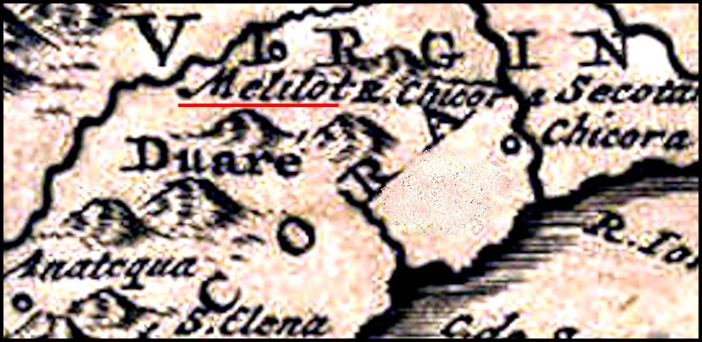
1566 – Six survivors of the Fort Caroline Massacre were given asylum by the King of Apalache on the condition that they marry Apalachen gals. They established the European town of Melilot, which immediately began to attract more Protestants and Jews from Europe. All single adults were required to marry Native American spouses. Melilot appears on many maps until after the Great Smallpox Plague of 1696. According to these maps, Melilot was probably located where Little Mulberry River Park now exists in Gwinnett County Georgia.
1569 – Covert trade began between the Colony of Santa Elena and the Kingdom of Apalache. Spanish traders were allowed to go to one location to trade European goods for Georgia gold and gems. The trading center was definitely in the Nacoochee Valley . . . probably at Chote. The King of Spain wanted the knowledge of gold, silver and gems kept a secret from other European powers.
Most traders, who attempted illegally to follow Dukes Creek over Testnatee Gap to reach the ancient, mountainside capital of Copal to trade for diamonds, were killed. This might explain the discovery of 16th century Spanish armor at Dukes Creek Falls near the Richard B. Russell Highway. Copal is the Apalache (Creek) name for the Track Rock Gap Terrace Complex.
According to English historian Richard Hakluyt (1588), some Spanish traders did find favor with the King of Apalache and were allowed to reach Copal. He sold the diamond that he obtained to the Governor of La Florida for 5000 crowns – the equivalent of about $450,000 today.

Copal – the Track Rock Terrace Complex
1585 – After Santa Elena was abandoned, the leaders of Apalache began allowing Dutch and Sephardic Jewish colonist to settle in their kingdom. Their houses were concentrated in Chote, Melilot, northeastern Tennessee and western North Carolina. The artifacts of a gem-mining and gold mining villages have been found in the Nacoochee Valley of Georgia and the Toe River Valley of North Carolina. Geologists have dated mining timbers in western North Carolina and northern Georgia to the period between 1585 and 1615. Nodoroc, a dormant mud volcano in NE Metro Atlanta is a Dutch word, meaning “Swamp Smoking.”
1589 – A party of survivors from the Roanoke Colony arrived at the large town of Wahasi on the Savannah River, the eastern frontier of the Kingdom of Apalache. They were protected from a band of hostile Native Americans, pursuing them, then escorted to the old capital on the headwaters of the Oconee and then to the new capital in the Nacoochee Valley. With the condition that all single adults marry Native spouses, they were given sanctuary.
The refugees were given fine homes in the elite village of Hontaoase. Eleanor Dare, the widowed daughter of Roanoke governor John White, was taken as a wife by a local leader. The stone tablets unearthed by archaeologist Robert Wachope call him a chief. Did they mean the High King of Apalache or some nobleman or perhaps, a priest? Eleanor eventually birthed a daughter, who looked 100% English. That made her husband a very unhappy camper. Eleanor’s health soon began slowly deteriorating (poison?) She died in 1599. Her daughter did not live much longer.
1600 – The Governor of La Florida received reports of a troop of over a hundred non-Spanish-speaking horsemen being seen on patrols along the the Fall Line of Georgia . . . which runs from present-day Columbus, GA to Augusta, GA. By the 1700s these horsemen had become a mixed-blood tribe and members of the Creek Confederacy, living in what is now southern White and Habersham Counties, GA. They were then called the Bohurons, which is the Spanish Sephardic (Ladino) for “nobles”.
The names of their leaders were recorded by white settlers after the American Revolution. The names were of Spanish, French, Dutch, English and Hebrew origin. The Bohurons soon moved to Sandtown on the Chattahoochee River near present-day Six Flags Over Georgia. After all Creek lands in Georgia were ceded in 1717, most of the Bohurons apparently moved to Texas, where they became ranchers, cowboys and Texas Rangers.
1610 – Dutch traders, primarily of Jewish ethnicity, began a trade network that ran from New Amsterdam to Chotee. . . along the western flank of the Southern Appalachians. In the same year, they transported over 3,000 Sephardic Jews, fleeing the Inquisition in Cartagena, Colombia to the interior of North America.
They had obtained the seeds of an especially high quality “sweet” tobacco on the coast of Brazil, called petun. Seeds were given to advanced (mound builder) societies in the Shenandoah Valley of Virginia and the Nacoochee Valley of Georgia. The recipients were encouraged to grow the crop on a large scale. Productivity was much higher in the Nacoochee Valley, where the growing season is much longer and annual rainfall over double that of the Shenandoah. The Dutch traders then distributed the upscale tobacco to Native American tribes throughout eastern North American and exported it back to Europe.
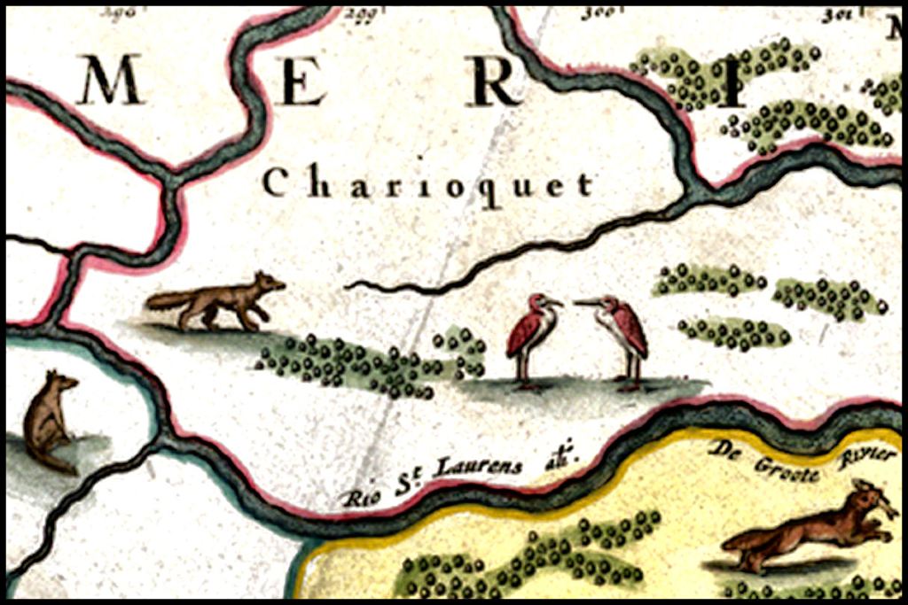
1615 – While exploring what is now southern Ontario and conducting an alliance with the Huron, Samuel Champlain encountered a small tribe, which was a vassal of the Tiononateca, who were a vassal of the Huron, which intrigued him. They specialized in portaging canoes over the Great Falls of the St. Lawrence River, rather than putting much effort into hunting. They used single axle, wheeled carts to accomplish this. Champlain had never heard of any Indian tribe that knew how to make wheels or build carts. Most references tell us today that none did.
In the dialect of French, used around Rochelle, France, where Champlain grew up, the two-wheeled work cart was called a chario. Champlain added the suffix used by the Algonquins (and Irish) for “people or tribe” and came up with tribal name Charioquet. The name stuck.
1620 – Opechancanough became principal chief of the Powhatan Confederacy in 1618. As a child he had been abducted by Spanish sailors then given a nobleman’s education in Spain, in anticipation of him becoming a priest-missionary. In 1670, he was sent as an altar boy with a group of Jesuit friars seeking to establish a mission on Chesapeake Bay. As in the case with the Native American altar boys on the many missions on the coast of Georgia, he was viewed as a concubine. Having been sodomized repeatedly on the voyage and at the new mission, he killed the Jesuits at the first opportunity and fled back to his people, with a searing hatred for Europeans.
Opechancanough was soon approached by Spanish-speaking Dutch agents from New Amsterdam, who offered covert assistance in driving out the English settlements.
1622 – On March 22, 1622, Opechancanough led a series of coordinated surprise attacks that concentrated on settlements upriver from Jamestown and succeeded in killing nearly a third of the English population. Perhaps assuming that the English were sufficiently humiliated, he did not pursue a final destruction of the colony. A band of Rickohocken warriors assisted the Powhatan Confederacy in its sudden attack on the Virginia colonists. The Rickohockans actually reached the palisades of Jamestown, but then withdrew due to lack of arrows and food.
What followed, then, was a ten-year war in which the English repeatedly attacked the indigenous people’s food supply. Bands of Native American refugees began fleeing southward from Virginia. They were given sanctuary in the Kingdom of Apalache, because the agriculture skills of the Apalache and cultivable lands were sufficient to support a much large population. Chote became known as a “place of sanctuary” for all peoples.
1621-1622 – A shipload of English colonists by-passed Jamestown because their was a smallpox epidemic and Indian war underway. The Dutch captain suggested settling in the Kingdom of Apalache. The king of Apalache allowed them to settled amongst his people, plu build an Anglican Church. They probably either settled in Melilot or Chote.
1646 – Spanish Florida Governor Benito Ruíz de Salazar Vallecilla ordered the construction of a mule pack train road between St. Augustine and the headwaters of the Chattahoochee River. A fortified trading post was built there with the permission of the King of Apalache. Much of the route is now US Hwy. 129.
A few years later, the trail was extended to the Little Tennessee River on a route that followed the Chattahoochee River, Hiwassee River and other stream valleys. It became known as the Unicoi Trail. Unicoi is the Europeanization of the Creek words, which mean “Major path (road) along water.”
After construction of the road and trading post, maps began to show a specific town named Apalache in the Nacoochee Valley. The entire route is now known as the Unicoi Turnpike. A portion of this route is now known in North Carolina as the Joe Brown Highway.
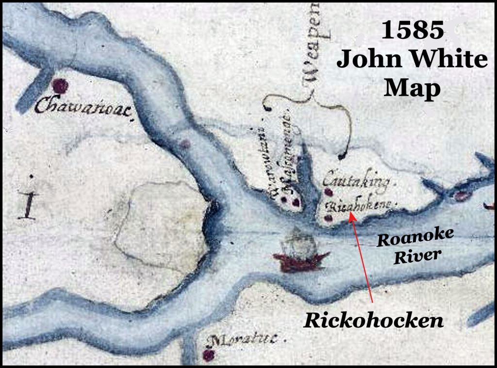
1646 – Virginia’s Royalist Governor, William Berkeley, made secret contact and trade agreements with a warlike tribe, named the Rickohocken. In 1585, they composed a single village on the north side of the Roanoke River. In 1646, they occupied several villages on the Otter River in the Blue Ridge Mountains. Berkeley wished to trade European goods for Native American slaves, deer skins and furs.
1646 – English Royalist Edward Bland from Brigstock, England had spent five years in exile in Spain and the Canary Islands, working as an international wine merchant. In this year, he and his wife immigrated to Virginia, where he immediately had a private conference with Royalist governor, William Berkeley.
According to the Virginia State history text, Bland then traveled to the southern tip of the Appalachians, probably the Nacoochee Valley, to examine the potential for commerce. He then returned to Virginia and only discussed the trip with Berkeley. It is obvious that Bland and Berkeley had a covert involvements with the Spanish trading post in the Nacoochee Valley.
1650 – French and Dutch Colonial archives reported that a massive invasion across the St. Lawrence River by the six members of the Iroquois Confederacy had decimated the Huron. The Huron were force to flee westward, while their vassals the Tiononateca and Charioquet had fled southward to below the Ohio River. The Xuale did not let them settle in what is now northern West Virginia so the refugees settled in southern West Virginia. These two tribes would merge and suddenly appear on a 1717 map, both in West Virginia and NE Tennessee with the name Charoqui . . . a more modern spelling of the French syllable, “quet.”
1653 – While the English Commonwealth fleet was besieging the island of Barbados, Royalist planter, Richard Brigstock, originally from Brigstock, England, went on a long journey from Barbados to the Kingdom of Apalache. He was a cousin of Edward Bland. His purpose was to determine if the Apalachen Mountains were a suitable place for his family to relocate.
The King of Apalache treated Brigstock with great hospitality. There were a considerable number of Dutch. English, French Huguenot, Sephardic Jewish or mixed-blood persons in the kingdom. They were being allowed to settle in what is now Northeast Georgia, Western North Carolina and Northeastern Tennessee. Spanish-speaking settlers, of mixed ancestry lived in hamlets scattered through the higher mountains.
Brigstock visited a village of Spanish speaking gem miners in what was probably the Franklin, NC area. He also visited a small mission and trading post, run by the Spaniards, several times. This was in the Nacoochee Valley, probably at Chote.
Briggstock returned to Barbados to discover that the Commonwealth Navy and the Royalist government on Barbados had come to an amenable agreement. There was no need to immediately flee the island. However, the Brigstocks did soon immigrate to Virginia.
Prior to immigrating to Virginia, Brigstock had lengthy conversations with the Rev. Charles de Rochefort, who was a Huguenot pastor assigned to minister to the French, Dutch and Scottish Calvinists (Presbyterians) in the Caribbean Islands. Brigstock provided De Rochefort detailed information about the indigenous inhabitants, geography, plants and animals of what is now Georgia. The most detailed information was about the Northeast Georgia Mountains.
1654 – Rickohocken War – The Rickohockens were business partners of former Royalist governor, William Berkeley,yet they staged a bloody war down the James River, killing all “common folks” whites, but sparing large plantations, such as the one belonging to William Berkely. The Rickohockens defeated a militia army, dispatched by the commonwealth colonial army then camped on an island near present-day Richmond.
In retrospect, this was clearly an extension of the English Civil War. Berkeley was behind it. He wanted to clear middle class whites from the frontier, so large plantations could be expanded, plus make the Anti-Royalist colonial government look so weak that it could not protect the populace.
1658 – Charles de Rochefort published a second edition of L’Histoire Naturelle et Morale des isles Antilles de l’Amérique, which included 10 new chapters on the native inhabitants and natural environment of what is now the State of Georgia. The text contains much detailed information on the architecture and town plans of the Apalachete (Creek Indians) which archaeologists didn’t learn until the late 20th century.
One of the most interesting aspects of De Rochefort’;s book was Apalachete religion. It had evolved from the worship of a Sun Goddess at Teotihuacan into a universal creator deity similar to YHWH in the Hebrew religion . . . except that human or animal sacrifices were forbidden. Around 1575, the royal family converted to Protestant Christianity, but still believed that God was a female deity.
This 1658 engraving shows the spot, where gold would “officially” be discovered in 1828.
1660 – Edward Graeves, one of the directors of the Melilot Colony, wrote Charles de Rochefort a letter on January 6, 1660 in French. The letter was quite complementary on the text, written by de Rochefort, but said that the engravings, prepared by the printer, portrayed the architecture and natural environment of the Apalachen Mountains inaccurately. His letter states that sketches that accurately describe the architecture and vegetation were enclosed. De Rochefort included a transcript of the letter in future French language editions of the book, but never updated the engravings.
1660-1665 – After the British monarchy was reinstated by the coronation of King Charles II, Governor William Berkeley was reappointed Royal Governor of Virginia. He immediately began pushing through a series of bills through the Virginia House of Burgesses, which institutionalized the slavery of Africans and Native Americans. Caucasians could not be enslaved permanently, but only could be bond servants for limited periods of time.
The Colony of Virginia then contracted with the Rickohockens to purchase an unlimited number of Native American slaves. Virginia furnished the Rickhockens fire arms, gun powder, knives and tomahawks. Native American slave raiders typically only kept youth and young women. Everybody else was tortured and killed. Thus, the real impact of slave raids was to depopulate vast areas of the regions, west of the British settlements.
Jamestown leader, John Smith, described the Shenandoah Valley as the most densely populated and culturally advanced section of Virginia. This confirmed by the observations of early settlers in the Shenandoah County. In his book, Early History of the Shenandoah Valley, Samuel Kercheval’ wrote that almost every 18th century farm in the valley contained Indian mounds and village sites that seemed only recently abandoned.
He added that the entire Native population seems to have been wiped out at one time around 1665. A few survivors, seen wandering around the countryside said that a large army of Natives, armed with muskets, appeared suddenly and killed almost everyone except the young women, youth and older children, who they marched away as slaves. As in the case of the three Powhatan Wars, survivors headed south to Chote, where they would be given sanctuary and protected by the soldiers of Apalache.
1663 – Province of Carolina – On March 24, 1663, Charles II issued a new charter to a group of eight English noblemen, granting them the land of Carolina, as a reward for their faithful support of his efforts to regain the throne of England. The eight were called Lords Proprietors or simply Proprietors. The first settlers did not arrive until 1670. The province was divided into North and South Carolina in 1721.
The Kingdom of Apalache and the Nacoochee Valley was included in this territory, even though it contained an advanced culture and had been in existence for many centuries. Until the mid-1790s, northern Georgia was considered part of South Carolina by every one, except Georgia. However, Georgia was much more aggressive in settling the region and providing government, so its claim was eventually recognized as being an accomplished fact.
1668 – A large portion of the Rickohocken Tribe began relocating from Virginia to where Augusta, GA is now located. They were called the Oueste by the Creeks, which means “Water People.” This label means that the Creeks thought that the Rickohockens arrived from the ocean. Oueste evolved to Westo among Carolinians. The Rickohockens immediately began depopulating the interior of South Carolina in order to sell Native American slaves to markets in Virginia, later Charleston.
1679-1680 – War broke out between the Carolina colonists and the Rickohockens. The Savano (Shawnee) on the Savannah River sided with the colonists and utterly destroyed the cluster of Rickohocken villages on the Savannah River. Surviving Rickohockens moved initially to the Ocmulgee River and became associated with the Creeks there. Later they moved to the Lower Chattahoochee River and were members of the 1717 Creek Confederacy.
1690 – James Moore and Maurice Mathews attempted to prospect for gold in the Nacoochee Valley of Georgia, but were turned away by what they thought were hostile Native Americans. More likely they were mestizos . . . the result of a century of mixing Native American, Jewish and Iberian genes.
The two men then took the Unicoi Trail northward into what is now Clay and Cherokee Counties, North Carolina. Here they observed white men mining, probably in the Andrews Valley, where there were silver deposits. All the men wore long beards. Moore eventually became governor of Carolina. It is interesting that in the 1700s, Carolinians were aware of gold being in the Nacoochee Valley.
1690: French engineers, marines and traders explored and mapped the Southern Appalachians. They encountered a village that they said had to be seen to be believed. It was a town of log cabins. It occupants had European beards, hair color and eyes. They spoke a broken form of Elizabethan English. This may be the town settled by the Englishmen who decided in 1622 to settle in Apalache rather than Virginia.
The olive complexion of these mountaineers and past experience with Mediterranean traders led the explorers to conclude they had found a colony of “Moors” in the New World. Because of the English language being spoke, it is more likely that the skin color was from 70 years of intermarriage with Native women and nearby Sephardic Jewish miners.
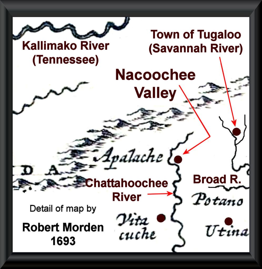
1693 – The last map to show the Apalache capital was published by English cartographer, Robert Morden, in 1693.

1694 – An exploration party composed of British soldiers and their Native American guides from the Savannah Headwaters towns followed a trail to a vantage point overlooking the Nacoochee Valley. Presumably, this was on Tray Mountain overlooking present day Helen. The British observed many columns of smoke.
They were told by their native guides that the smoke was produced by the gold smelters, being operated by Spanish gold miners. The British soldiers turned around and reported their discovery to government officials in Charleston. This report was left out of the history textbooks.
1696 – A smallpox epidemic swept through eastern North America in 1696. It is known to have almost wiped out the indigenous population of the South Carolina Low Country and Piedmont. Its impact on the Southern Appalachians is not known, but could well have been equally or more severe. Many Native towns on French maps of the Appalachians in late 1600s had completely disappeared by 1715.

c. 1700 AD – There is a cultural memory of a powerful eruption of the Chimney Mountain volcano, east of Helen and immediately west of Batesville. It caused most of the Creek population in the region to move southward. I live seven miles south of Chimney Mountain on an extension of Alec Mountain. He has found young lava bombs and volcanic ash in my top soil.
As mentioned earlier, Robert Wauchope encountered 5-15 feet (1.5-4.8 m) of alluvial sand on top of the last layer of soil, occupied by traditional Creek villages. This sand may be volcanic ash or it may have been created by a massive flood. Whatever the case, after this catastrophe only the three towns at higher elevations . . . Chote, Itsate and Nocose (Nacoochee) were reoccupied . . . by people utilizing only European style tools, weapons and household items.
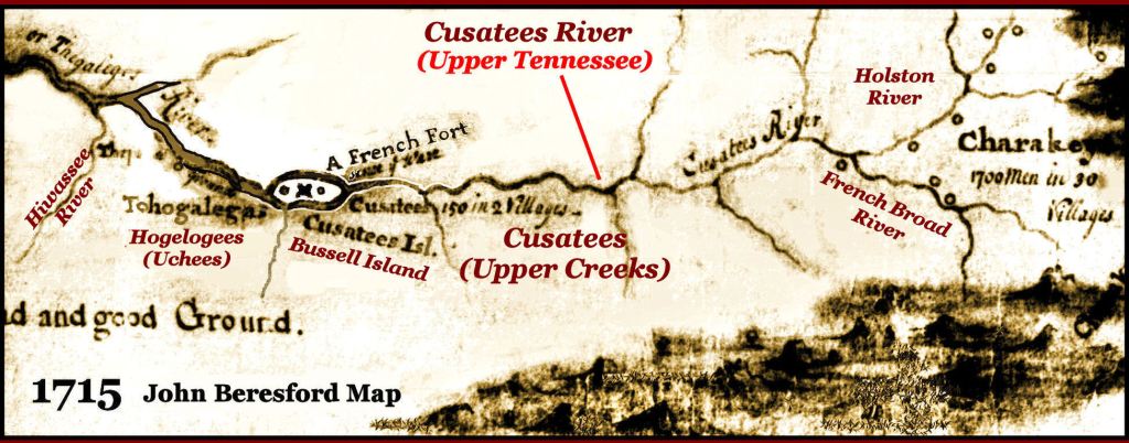
1715 – The John and Richard Beresford Map became the first European document to show the Cherokees living in the Southeast. That same year was the first time that the word Cherokee was used in the official records of the Virginia House of Burgesses.
1715 – In December 1715, a diplomatic conference, composed of former members of the Apalachen Confederacy, met at the Uchee village of Tugaloo to discuss joint participation in Yamasee War against the colonists of Carolina. During the night, Cherokee delegates murdered 32 Creek mikkos (chiefs) in their sleep. They then sent word to Charleston that the Cherokees were switching sides and would fight for the British. This act of treachery started the 40-year long Creek-Cherokee War.
Apparently, the Creek and Uchee towns in Northeast Georgia attempted to stay neutral by forming the Elate (Foothill People) Confederacy, which sought to stay on good terms with the Cherokees, Creeks and British colonists. Officially, all villages south of the Hiwassee and Tallulah Rivers were in Creek territory, but being so close to the Cherokees, they would have born the brunt of the bloodshed.
Several Creek towns on the Hiwassee River in Towns County moved to southwest Georgia for the duration of the war. On the other hand, the large town of Cusate at the confluence of Coosa Creek and the Nottely River in present-day Blairsville built heavy fortifications and wreaked havoc on the Valley Cherokee villages in North Carolina. By the end of the war, the Hiwassee River Valley was almost uninhabited and the Valley Cherokee language was extinct.
The Creeks in the Blairsville Area were not on the soldiers’ “arrest list” during the Trail of Tears era, so many avoided deportation by hiding out in the higher mountains. Their tall, lanky descendants still live in the region. Upper Creek women can be up to six feet tall.
1730s – Several smallpox epidemics swept through the Southern Appalachians . . . wiping out about half of the Cherokee, Itsate Creek and Uchee populations, but were not as lethal to the descendants of mixed-race marriages. After then, the Creek inhabitants of the Georgia Mountains were mostly mestizos . . . looking like tall Mexicans.
1751 – Most people have never heard of Malachi Bemarin, who became the new High King of the Creek Confederacy around 1750. It was he, who coined the term, Maskogi (Muskogee in English). Masko is Spanish Sephardic Jewish (Ladino) for “mixed ethnicity,” while “gi” is the Muskogee-Creek and Irish Gaelic suffix for “people or tribe.” My branch of the Creeks used “te” . . . the Itza Maya suffix for “people or tribe.”
Why a Ladino root for the modern name of the Creek People? This High King had a Hebrew first name and a French Sephardic family name. He probably was more Semitic, French, Spanish and Dutch than he was Native American. He was descended from the nobility of the Nacoochee Valley.
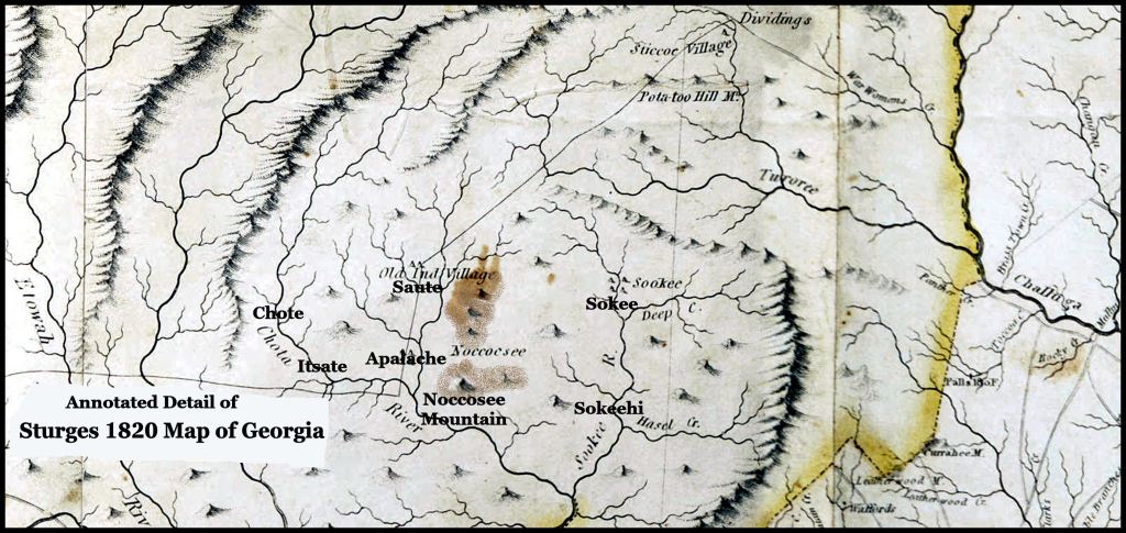
For some unknown reason, Malachi had a vendetta against certain people in Chote. Perhaps it was because they refused to join the Creek Confederacy. He launched a surprise attack against Chote in 1751 that turned into a massacre. The survivors fled either to nearby Itsate or to the Overhill Cherokees and re-established their town on the Little Tennessee River. It was then that a Chotee appears on maps of the Tennessee Valley.
Malachi’s army did not bother Itsate or Nocose (Nacoochee), even though they were only 2-3 miles away. They marched right through Nocose to get home. The survivors in Itsate returned home and rebuilt the town. Perhaps, they were “good guys,” who were warned in advance to get out of Chote.
1754 – The French and Indian War broke out suddenly, after the Mingo Indian scouts for Colonel George Washington of the Virginia Colonial Militia murdered two French officers, after they had surrendered. Soon thereafter, Washington purchased 55 acres from the owners of Toms Brook Plantation to build a fortified blockhouse.
In 1770, that blockhouse and farm were purchased by Colonel John Tipton of the Virginia Colonial Militia to be rebuilt as a house, which I would buy in 1987. In 1780, Tipton and his friend, Captain John Sevier led wagon trains to NE Tennessee to found settlements that would become the core of the State of Tennessee. Tipton built a copy of the Shenandoah Valley house, which is now the Tipton-Haynes State Historic Site.
Meanwhile, Georgia colonial leaders were freaking out. Because of its small population, Georgia expected to be attacked at any moment. If the Creeks joined the French cause, the young colony was DOA. South Carolina was not much better off in their vulnerability to the Cherokees. Up until the late 1780s, there were more Itsate Creek speakers within the current boundaries of Georgia than English speakers. Second place was Muskogee Creek. Third place was English.
In June of 1754, Georgia and South Carolina leaders made all sorts of promises to the Cherokees and Creeks to persuade them to sign a peace treaty, ending their four-decade long war. All Cherokee chiefs and all but one of the Creek tribal members, signed the treaty. The one exception was Coweta . . . which happened to be tribe of Malachi Bemarin.
After the crops were harvested, an army composed mostly of Coweta soldiers marched up the Chattahoochee River Valley from present-day Columbus, GA. Eyewitness accounts tell us that it was followed by a large body of Creek teenage girls. At the edge of the mountains, they were joined by the Bemarin cavalry.
At that point in history neither the Cherokees nor white colonial militias had any experience in fighting horse-mounted soldiers. The Cherokees were at a distinct disadvantage because they never built fortifications around their villages, whereas Creeks always did.
The Coweta infantry would surround a Cherokee village and then the Bemarins would charge in, making it impossible for the Cherokees to form a defensive line. The Cherokees in Quanasee (Hayesville, NC) fled in terror, when the teenage girls appeared on the edge of the woods near village. The men were actually many miles away, attacking another town. Eventually, all of the Cherokee villages south of the Snowbird Mountains.
Six Cherokee chiefs were burned alive near the banks of the Chattahoochee River. When a delegation of Cherokee chiefs traveled to Charleston to beg for help in saving, what was left of their tribe, a Special Ops squad of mixed-blood Creeks traveled to Charleston in European clothing then murdered 25 of them on the streets of Charleston.
The Cherokees signed a surrender treaty on the 40th anniversary of the Tugaloo Massacre in December 1754. The Coweta Creeks were originally from the North Carolina Mountains. The treaty ceded back to them all lands in North Carolina that had been taken since 1715.
In other words, all these stories on state historic markers about the Cherokees capturing all of North Georgia in a battle or a stickball game are pure malarkey. The myth about Nancy Ward winning a great victory for the Cherokees at age 16 is also malarkey. It was based on the actual fact that Creek teenage girls captured the important town of Quanasee.
Speaking of Nancy Ward . . . she was born in Helen, GA (then Chote) around 1754-1758. She was 9-13 years older and grew up about 20 miles south of Cherokee Principal Chief Charles Hicks birth place. Until 1795, she lived in either Chote, Fort James (Elberton, GA), Fort Clarke (near Lake Burton) or in the southern (Creek) part of Stephens County, GA. She lived with a series of white men throughout her life. Her fictional Cherokee husband, Kingfisher, who in the fictional version died in 1754 at the non-existent Creek town and battle of Taliwa, actually died in 1793 at the Battle of Etowah Cliffs in Rome, GA.
No Creek town has ever been named Taliwa and the Cherokees were catastrophically defeated in the same year as the fictional Battle of Taliwa.
In Hick’s History of the Cherokee People, he makes no mention of Nancy Ward. She was not the great heroine of the Cherokee People that current literature and two dramas make of her. However, she was well-liked and admired for her intelligence by both Native Americans and whites in Northeast Georgia. She played a key role during the American Revolution in persuading both Creeks and Cherokees not to join the British cause. At the time, her common law husband, Brian Ward, was stationed in one of the forts along the Tallulah River, protecting the Georgia frontier.
We know that because the only factual information on her comes from newspaper articles and county history books in Northeast Georgia. We know that after 1795, she frequently returned to visit kin and old friends in what is now Stephens County, GA. Her visits would be announced in local newspapers.
Many of her direct descendants still live in either Stephens or Lumpkin County, GA. A few years ago, DNA Consultants, Inc. analyzed the DNA of Nancy Ward’s real descendants in Georgia, living on streams named Ward Creek in Stephens County and Lumpkin County. Most, if not all people in Tennessee claiming her are actually descended from a John Ward or Bryan Ward, who were cousins of her first common law husband that lived in Tennessee. Nancy’s heritage was a mixture of Sephardic Jewish, Southern Mesoamerican from Mexico and the British Isles.
This was exactly the same ancestry as Principal Chief Charles Hicks. Even though living on the extreme edge of Creek Territory, most of Hicks’ childhood friends were either Cherokees living on the opposite side of the Hiwassee River or mixed-blood whites in Chote. He and his next oldest brother came to view themselves as Cherokee. His other siblings moved to Creek Confederacy lands along the Oconee River in Georgia. Many took Georgia citizenship, when these lands were ceded, but other siblings went to Oklahoma and their descendants are citizens of the Muscogee-Creek Nation. The Georgia Hicks tombstones may be found in Washington and Laurens Counties, GA. His father is buried in Washington County in a marked grave.
Nevertheless, the nearest big town to Hicks’s home was Chote. This is probably the reason that he named the new capital of the Cherokees, New Echote. Chote, Tennessee had been long abandoned by then.
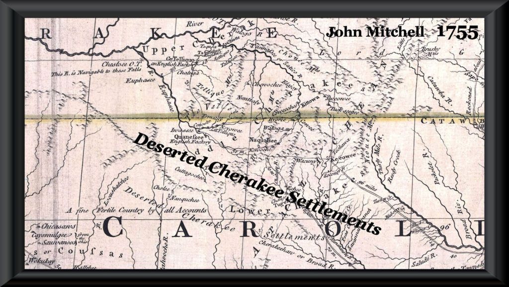
1763 – At the end of the French and Indian War, the Creek Confederacy agreed to cede back its recently regained lands in western North Carolina in return for a vast area of what is now Alabama. The mestizo towns in the Nacoochee Valley . . . Chote, Itsate, Nokose, Saute, Soque and Sokohi continued membership in the Elate Confederacy. The Georgia-North Carolina State Line or the Tallulah River marked their frontier with the Cherokee Nation.
1776 – Chote had over 300 adult residents by this time. That was much larger than virtually all the Cherokee villages, but on the scale of many Creek towns. Like other Georgia Creek towns, its leaders refused to join the Cherokees in their surprise attack on the South Carolina frontier in behalf of the British. Chote remained either neutral or mildly pro-American throughout the Revolutionary War.

1784 – The secret 1784 Treaty of Augusta with the Cherokees gave them all of the land of the Elate and Creek Confederacy, north of Nocose Mountain (now Yonah Mountain) and west of the Chattahoochee River down to the Etowah River. The names of two Elate town chiefs, but not Chote’s, do appear on this treaty. The Creeks were left with a narrow strip of land, on the east side of the Chattahoochee River, running from near present-day Clarkesville, southward to present-day Metro Atlanta.
The Creek version of this treaty did not mention this huge land cession. Creek leaders did not learn of this deceit until 1790. The Creek Confederacy declared war on the State of Georgia, while professing continued loyalty to the United States. Creek leaders were eventually persuaded that war against Georgia in the new United States meant war against the United States. However, guerilla attacks, not sanctioned by tribal leaders, against white farmsteads by Upper Creeks and Uchees in Georgia continued until around 1795.
The towns of the Elate Confederacy were now under the ownership of the Cherokee Tribe, even though they spoke another language and had a very different cultural tradition. From 1776 until around 1800, the change was meaningless, since the Cherokee Tribe was in a state of anarchy. However, as peace returned, the Elate found themselves to have no role in Cherokee Council decision-making and no property rights.
There are documented cases of wealthy Cherokees, who were 7/8 or 15/16th white, trying to steal the communal lands of Chote, Itsate, Sautee and Sokehi in order to develop plantations with African slaves. The only reason, these schemes did not succeed is that the rightful owners threatened to kill them, while the tribal government was too weak to carry out a war against its own citizens . . . albeit, disenfranchised ones.
1817 – The Creek Confederacy sold its remaining land in Northeast Georgia. What is now Rabun and Habersham Counties was designated to be Habersham County. The location of Fort Clarke on the Tallulah River, near Batesville, was designated to be Clarkesville, the county seat. The southern half of what is now White County, was initially made part of Hall County.
1821 – A group of North Carolina real estate speculators from the gold-mining region in Burke County, NC, bought most of the Nacoochee Valley and Tesnatee Valley from its Mestizo owners. Daniel Brown, one of those speculators, bought 2000 acres of land from the Elati in the Nacoochee Valley area. He paid $200.00 for the entire acreage. (about $5,215.54 in 2023).
Even today, Burke County, NC is gold mining area. It contains at least 26 known gold mining areas, which are being worked by part time miners.
Brown apparently had no further involvement with the valley, but Benjamin Cleveland did become a major land speculator in the Upper Chattahoochee Valley. It is difficult to determine what land transactions occurred during that era, because many deeds were never registered.
This was not a forced removal of Native Americans, so the occupants were free to move, where they pleased. Some moved other parts of Georgia. Some moved to the portion of the Creek Nation in Alabama. Several families in Habersham County always thought that they were Cherokee, but have recently learned that their “Cherokee Princess” ancestor was actually Itza Maya/Creek, Asturian, Jewish or Portuguese.
The official history of the Georgia Gold Rush was that in 1828, a farmer “happened” to find a gold nugget on the banks of the Chattahoochee River, where it is joined by Duke’s Creek. Would you believe that this particular location was designated the location of the Rabun County Courthouse in 1822? It is also the location of the Temple of Amana, featured in the 1658 book by Charles de Rochefort! The property stayed in the ownership of the county government until the early 21st century.
This land sale is strong evidence that even the Cherokees recognized that the Elati were not ethnic Cherokees. There was law in place that forbade anyone in the Cherokee Nation, but its National Council from selling land, yet the money from the land sales went straight to the Mestizo occupants of the valley.

1822 – The northern half of what is now White County (location of Helen), the southern half of what is now White County and a portion of Towns along the Hiwassee River were merged to create Rabun County, with its county seat being the land around the former Temple of the Sun Goddess Amana.

1830 – The portion of Habersham County, north of the Tallulah River was designated to be Rabun County. What was formerly Rabun County was added to Habersham County. Clarkesville was relocated to its current location.

1857 – The portion of Habersham County, where Helen is located, plus the section of Habersham, west of the Chattahoochee River, was named White County. The location of a county seat was moved from the Temple of Amana to its current location in Cleveland, GA.
1913 – Always a rural hamlet since 1822, Helen was renamed and incorporated as a city.

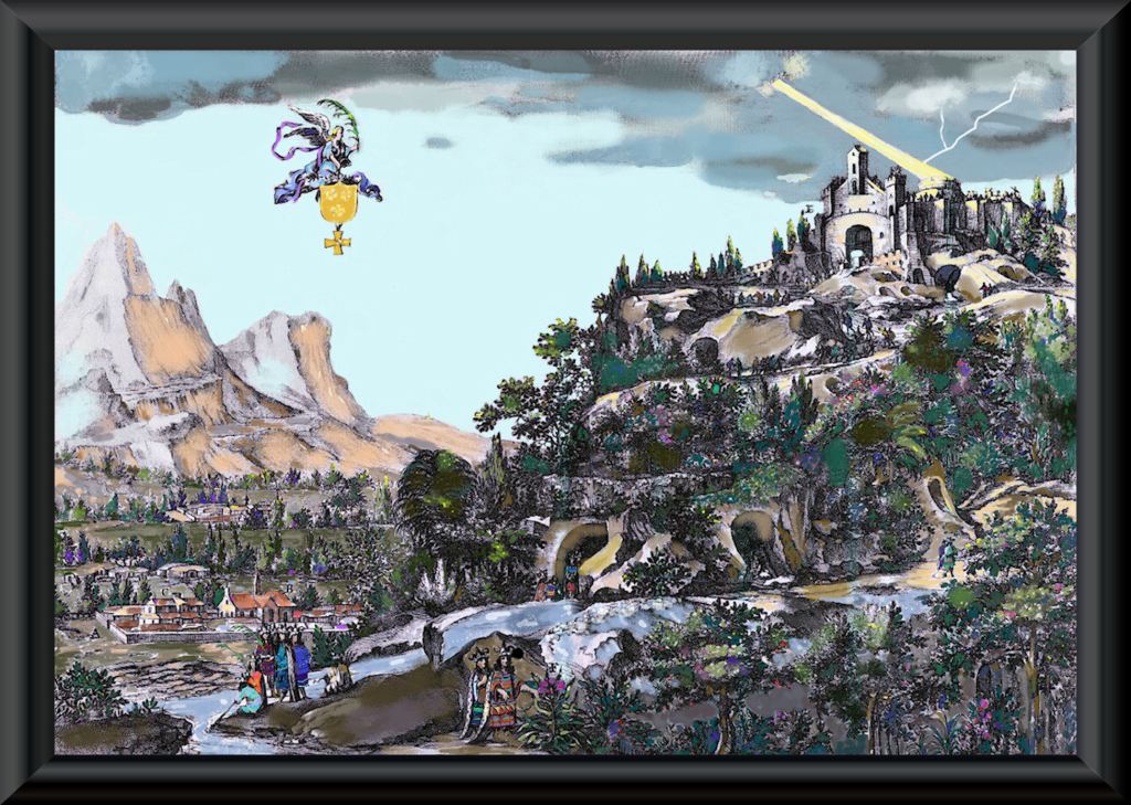
How the location, where gold was officially discovered in 1828 . . . looked around 1500 AD
Now you know!
PS: An expanded version of this article will be published as a book in Fall 2023!

I have a lot of Spanish ancestry, DNA markers for Sephardic Jewish ancestry, and thanks to your earlier posts, I now know that I have DNA markers for Uchee ancestry. My ancestors were in Winchester, VA and in Western NC and GA. Interesting…
LikeLiked by 1 person
Well, my friend, I have lived in all the lands of your ancestors. I wonder if some of your ancestors were those, who escaped the restrictions of aristocratic Tidewater Virginia, by taking refuge in Chote?
LikeLike