What History texts and documentary videos never tell you!
Cofetachequi is the Spanish spelling of a Muskogee-Creek word!
Up until the mid-1600s, an alliance of Muskogee-speaking provinces, plus their vassals, stretched from the mouth of the Santee River in South Carolina northward to the Town Creek Mound Village in in the Carolina Piedmont and westward to the present-day city of Franklin, NC on the Little Tennessee River.
The Peopling of Eastern North America Series
by Richard L. Thornton, Architect & City Planner
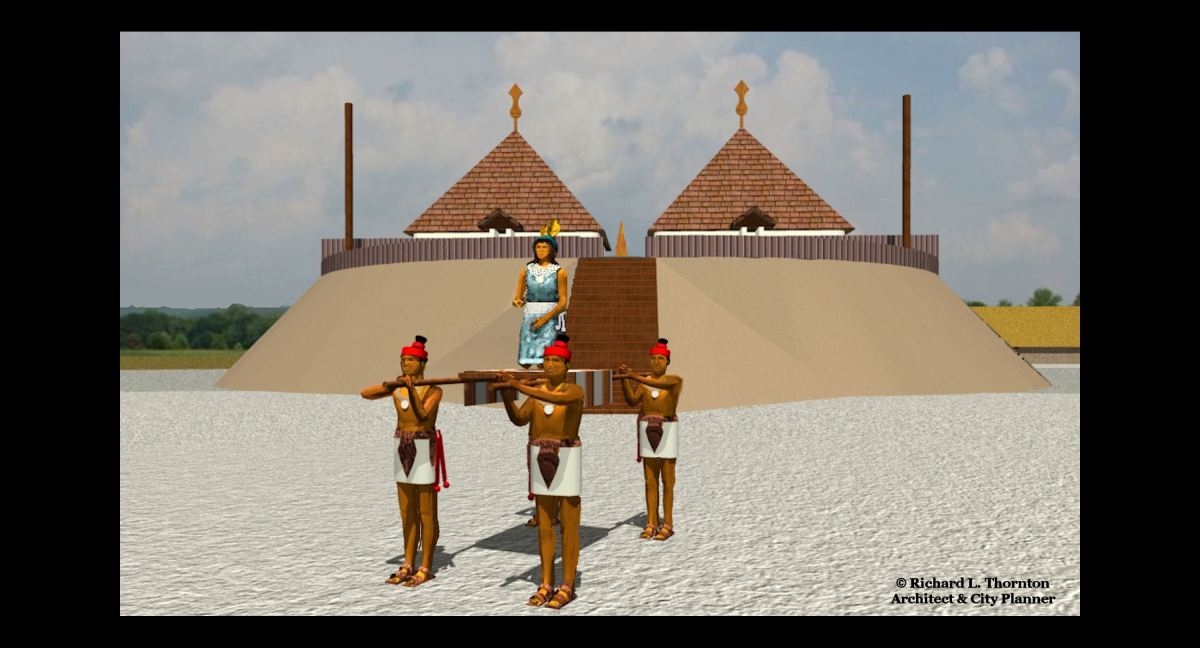
Birdseye view of the town, based on eyewitness Spanish accounts
American History made into a fairy tale
Cofitachequi was the Spanish name of a Native American town, visited by Hernando de Soto’s Expedition in the late spring of 1540. The story has been romanticized to the point that what most people think they know about Cofitachequi was that it was a Native American town in central South Carolina, ruled by a queen, who greeted De Soto as he approached her town.
It was located in present-day South Carolina, but beyond that, what references and academicians tell you today about Cofitachequi has very little relevance to what is actually said about the town in the De Soto Chronicles. The “experts” are merely regurgitating poorly researched speculations made by earlier generations of academicians in the 20th century.
In the meantime, 21st century academicians have taken the story out into lala land. None of them even know what the word means. Well, that is, unless they read this article! LOL
Where I was in 2004
Readers should know where I was in my learning process in 2004. Basically, I was acquiring knowledge recorded by others. In 2004, it did not cross my mind that I would someday be making major archaeological discoveries on my own. I assumed that everything in the Southeastern United States had already been discovered. During the past 20 years my knowledge of the Southeast’s past has exploded exponentially.
In Spring 1969, I had been introduced to Southeastern Native American archaeology, when I prepared the site plan of Site 9FU14 for Dr. Arthur Kelly. Prior to going on the fellowship in Mexico in June 1970, I took courses at Georgia Tech in Pre-Columbian Architectural History (taught by the architecture professor, who designed the Etowah Mounds Museum) and “Introduction to Anthropology” (taught by Dr. Lewis Larson). Dr. Kelly and Dr. Lewis Larsen led our architectural history class on a thorough tour of Etowah Mounds. The famous archaeologists handed out copies of their Etowah Mounds report, which I still have today, but the public is told, “Never existed.”
Throughout the 1970s, 1980s and early 1990s, I stayed on top on what was being discovered in Mexico . . . returned there several times. However, I was not to visit a major Southeastern site again until 1995, when I found myself stuck in Georgia during a drawn-out divorce ordeal and rented a townhouse near Etowah Mounds.
As Principal Planner of Cobb County, GA I was personally responsible for protection of designated historic and prehistoric sites. I had possession of the Georgia State Archaeological Index book. I learned a lot from browsing through it. That assignment included administration of all contracts with archaeological firms.
Shortly after I rented the townhouse in Cartersville, the Etowah Mounds Museum reopened after remodeling. I was shocked that the University of Georgia archaeology professors had intentionally installed some very expensive exhibits, which conflicted 100% with what Drs. Kelly and Larsen had discovered there. Nevertheless, I visited Etowah Mounds repeatedly and bought every book that the museum shop sold on Southeastern archaeology.
Then in November 2001, just two weeks after the creation of Homeland Security, someone from Homeland Security called all seven of my major local government clients and told them that I was an agent for Al–Qaeda! My clients were told that they would have troubles with the Bush Administration, if continued to pay me for architectural and planning services.
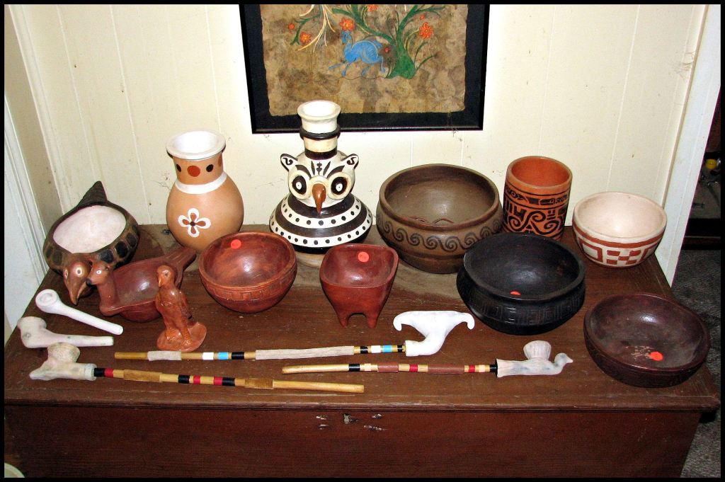
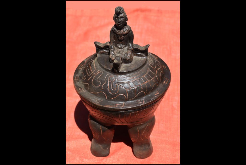
I went seven months with no professional income. In order to survive I started hand-making replicas of Creek and Mesoamerican style pottery. Prior the fellowship, I had been required to take several courses that taught just how to do that. In the process of designing and creating hundreds of statues and pottery, I went through many archaeological texts.
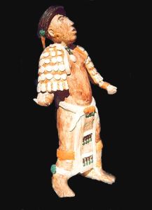
Dang! I was good at it. That hollow statue on the upper left is 21 inches (53 cm) tall. All my colors were natural minerals in the Georgia Mountains. I think that it safe to say that I was a professional on the subject.
The credentials that both the Colombian archaeologist and I had in analyzing Indigenous American ceramics would have great significance, when we visited the McClung Museum. However, it would get us in Big Trouble with a nationally prominent female archaeologist at the University of Tennessee. We were ordered to never come back to the museum. That story is in the next TAR article.
I had been in a secret, almost mystical, relationship with Federal Counter-Intelligence Agent Susan Karlson, since the summer of 1991. She had performed a ancient Hebrew marriage ceremony for us out in the middle of the front pasture on my Virginia farm. However, until 2005, she pretended that we were merely friends with benefits. Our times together were intermittent. Some years, I didn’t see her at all. She had become a female James Bond!
Susan encouraged me to “date around” so that no one would suspect that we had something special between us . . . including two children. The weekend trips to Native American arts festivals proved a boon to my official social life. I would offer a deal to women on the internet dating sites. They could pick out up to $100 of my pottery in return for helping me sell my ceramics at Native American festivals around the Southeast. I paid for all the meals and entertainment. Most were of some Native American descent and so also dressed like their Native ancestors.
The first virtual reality models of Native American towns
In May 2003, I took several boxes of my ceramics to the Native American festival in Sparta, GA. I sold every piece and walked away with all the prizes. At least 3/4 of the population of surrounding Hancock County has substantial Creek or Uchee ancestry. That goes both those citizens, who are nominally African or nominally European.
The good people of Sparta and I really connected. Within a few months, I was an architectural and planning consultant. The county government planned to renovate a 1960s brick school building into an archaeological and history museum. I prepared a (now crude looking) 3D rendering of the proposed project with IntelliCAD. The County Commission asked if my software could create such images for Native American towns, such as Shoulderbone Mounds in their county.
I said yes, but quickly found out that the software for creating 3D images of modern buildings was woefully inadequate for historic and prehistoric towns. Many weeks of searching eventually revealed a software being sold in France, Artlantis, which included a new concept in which the authentic color and texture of historic or prehistoric buildings could be added to a CADD 3D drawing. Their only vender in the Americas was in Montreal.
I gave Artlantis to myself as a Christmas gift in December 2003. By March, I was able to produce (according to the Architecture Channel in the UK) the first ever virtual reality CADD image of a prehistoric American town.

I also bought a Muskogee-Creek dictionary and started learning the language. My ancestors spoke Itsate-Creek (Hitchiti). There was no Itsate dictionary, but Miccosukee was very close, plus I obtained Itza Maya and Chickasaw dictionaries. The two languages mixed to become Itsate.,
+
The shouting match between academicians
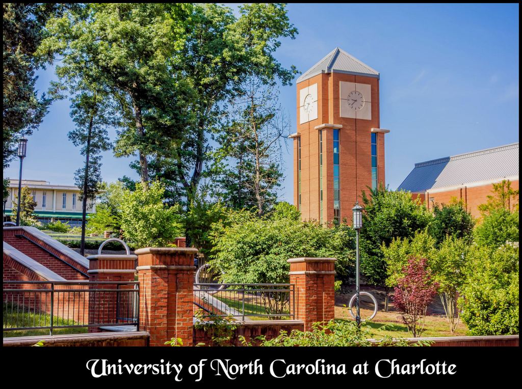
About 20 years ago, I attended a conference sponsored by the Southeastern Archaeological Conference at the University of North Carolina at Charlotte. Its theme was “Spanish Colonial Activities in 16th century Carolina.”
Such things were still a hobby with me in 2004. I was back at work in my architecture practice and very busy, preparing the architectural drawings for the revitalization of several blocks in downtown Rome, GA. I could only afford the time for the Saturday morning speakers.
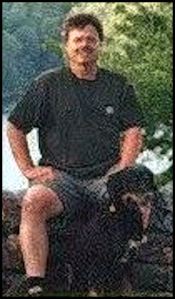
The main recreational activity that day was to be taking my herd dog, Laird Rob Roy, on a hike along the Chattooga River between South Carolina and Georgia. As you can see, I dressed extremely casually for the conference. I was not expecting to have any interactions with those attending the conference. Sorry about the poor exposure. Pilar didn’t focus my camera properly.
I planned to leave Charlotte immediately after the last morning session. I had found the archaeologists in Georgia to be very different that the nationally known archaeologists, who had been my closest friends in Virginia . . . not nearly as extroverted. The new generation of archaeologists in the Southeast seemed to think that they were the elite of academia. The reality was that they weren’t in the same league as Arthur Kelly and Lewis Larsen.
About a minute into the session on Cofitachequi, a lovely, smartly dressed señorita walked down the aisle and asked permission to sit in the empty seat next to me. I thought to myself . . . “Lordamercy, her expensive perfume would drive a man wild . . . and here I am, dressed like Crocodile Dundee!”
OH MY GOSH! None of the professors among the panel on the stage, who were supposedly experts on Spanish and Native American interactions, could pronounce either Spanish or Native words properly! They’re using the complex grammatical syntax of 16th century Anglican priests to make people think that they are authority figures on the subject,
Suddenly, the perfume-laden señorita wrote a note. Her name was Pilar. She asked . . .
- Who are these idiots? These people can’t pronounce Spanish words! Why are no professors on the stage?
- I flew all the way from Colombia, thinking I would hear experts from the best universities in the USA.
- Why are there no Latin American speakers?
- Why are there no Indios (Native American) on the stage?
I wrote on the back of her note. “Disculpe señorita, soy un pobrecito cabrero indio y no sé nada.” (Excuse me lady, I am a poor little Native American goatherd and know nothing.)
She slammed her right knee against my left thigh and giggled . . .then wrote me another note: “You are not little! You are a very tall cabrero and at least you know Spanish . . . but I think that you know more than these people. Maybe we should demand to be on the stage!
She wrote another note, “What is your name and what is your profession? Are you a tour guide?” I whispered back to her, “Soy Ricardo el arquitecto.”
The session devolved into angry arguments between North Carolina and South Carolina anthropologists as to whether Cofitachequi was a Cherokee town or a Catawba town. None of the professors seemed to know either the Cherokee or Catawba languages. They were merely supporting their state’s football teams. This shouting match went on and on and on – ad nauseum.
Cofitacheki is the Hispanization of the Muskogee-Creek word, Kofitacheki . . . which means, “Mixed Race People – Descendants of.” All of the town names and political titles, mentioned by the De Soto Chronicles in that part of the journey were also Muskogee words.
Pilar was getting quite angry and antsy. Around 9:40 AM , she wrote me another note: “Funny Ricardo . . . I am wasting my time here, My guidebook says that the McClung Museum in Knoxville, Tennessee is one of the best American Indian museums in the Estados Unidos. Do you know how far it is?”
I whispered back, “A little over 4 hours. You will have to drive through Asheville, North Carolina then over the Smoky Mountains.”
She gave an apologetic look and whispered, “Are you married or living with a woman?” I said no. She responded that was hard to believe. I responded, “I was divorced and have often dated women, but there are no single women in the town where I lived, who share any interests with me. They also tended to be extremely conservative, politically.”
Then I hesitated . . . she frowned, expecting to be rejected. I continued, “My herd dog, Rob Roy, is in the back of my Ford Explorer. I didn’t want to leave him inside the house all day. Is that a problem?”
She laughed and said, “You really are a cabrero! Any man who would bring his beloved shepherd dog to an archaeological conference is a man I can trust. I don’t think that you planned to have a girl leave the conference with you . . . did you Ricardo! However, I don’t know if the Norteamericana women would like riding in a car with a big dog. Maybe that is why you are not married?”
She continued, “There is not enough dinero in my grant to pay you architect’s salary, but my university will pay for all of our travel expenses. Maybe having a pretty Colombian girl, who shares many interests with you, will be your salary.” She winked.
Pilar said “Vamos!” She made an insulting gesture with her hand to the unimpressive professors on the stage and grabbed my arm, as we walked out together.
I was soon to learn that Pilar was a rather youngish-looking, senior anthropology professor at the University of Colombia. She was divorced with two children. Her specialties were the indigenous peoples of Northwestern Colombia, Central America and the Maya Civilization. Like me, Pilar was a mestizo, but I don’t remember the name of the Indian tribe from which she was partially descended.
In our next article, I will describe our visits to the McClung Museum, Etowah Mounds and Ocmulgee Mounds. She made some very interesting observations at those locations, which in the years since then have proved to be right on target.
About the Muskogee-Creeks
Until age 25, I thought that the Muskogees were the arch-enemies of the Creek people. Family lore remembered a bloody period, probably in the 1600s, in which the Muskogees invaded present day Georgia and initiated a three-way war between the Upper Creeks, Muskogee-speakers and Apalachete-Itstate Creeks. The latter alliance were my ancestors.
The Muskogee speakers won a series of victories, destroying several major towns, until the South Carolina Creeks joined with their brethren on the west side of the Savannah River to fight an apocalyptic battle in Northern Georgia. The South Carolina Creeks brought muskets, which they obtained from the English. It was a draw, but resulted in catastrophic casualties on all sides.
In my family’s folklore, the Muskogee speakers were assigned a region to settle in and all parties agreed to be members of a confederacy that would prevent future wars. Eight small bands of Georgia Creeks refused to join the alliance with the hated Muskogees and so migrated to the tributaries of the Savannah River. Several decades later they formed an alliance with the Cherokees. Today, they are known as Lower Cherokees, but they always spoke a dialect of Creek.

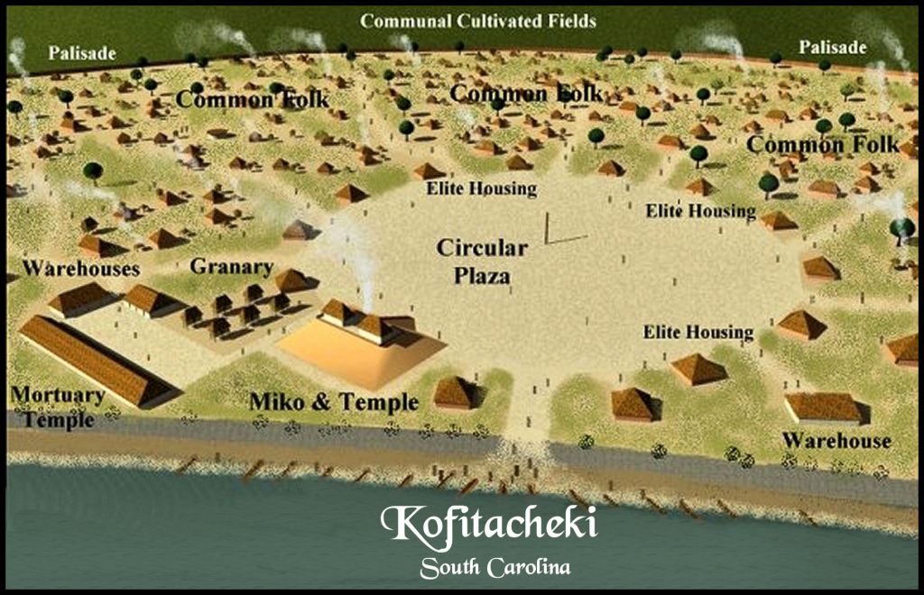
The Santee Mound on the Santee River in South Carolina, matches the location described in the De Soto Chronicles for the town of Cofitachequi.
What the De Soto Chronicles actually said
If one browses the internet and references, you will see Cofitachequi as a province visited by Hernando de Soto, which was ruled by a queen. WRONG! First . . . the chronicles state that de Soto was greeted by a relative of the queen of the province, not the queen herself, who lived in a town called Talimiko. That is the Muskogee for a provincial capital.
Cofitachequi was described as being two days walk from the sea. The Mulberry Archaeological Site, the town site that Wikipedia tells you is the former location of Cofitachequi is 110 miles from the Atlantic Ocean.
The queen described Cofitachequi as an enemy town that had recently been abandoned because of plague. She said that several towns and villages in the region had been abandoned because of a plague. She invited the Spaniards to dig up the graves of the enemy dead to rob their pearls.
Subsequent generations of PhD candidates and academicians have written a legion of dissertations, academic papers and books, whose starting point was based on the faulty speculations of those professors. Most of the papers and books try to answer the question, “What happened to the province of Cofitachequi? It was there when South Carolina was first settled, then it disappeared.”
Actually, the academicians equate a single town visited by De Soto, named Cofitachequi, with a province . . . not knowing the generic meaning of the word. Kofitachete means “mixed race or mixed ethnic group people.” There was a province by that name in the mountains of North Carolina, south of present-day Asheville, NC. You will see it on the map below. Cofitachequi could have merely been colonists from this province.
All four of the original Muscogee-speaking tribes . . . the Koweta, Tuskegee, Tokahsi and Kulasi . . . could be found today in the place names of the region between Franklin, Hendersonville, Brevard and Highland, NC. There is even a community named Etowah there. These Muskogee speakers were known for being tall and brawny. The Tokahsi and Kulasi had freckles and sometimes, brown or red hair. They used the Irish Gaelic suffix, gi, for “people or tribe.”
Factual archaeological information is limited for this region, but is described comprehensively in Benny Keel’s 1976 book, Cherokee Archaeology: A Study of the Appalachian Summit. The only three professional archaeological digs on the Tuckasegee River found that the Muskogean towns were suddenly depopulated in the early to mid-1600s then gradually repopulated, beginning around 1720 by Cherokees.
Of course, North Carolina archeologists now label both the formally planned towns with rectangular houses and the random layout of crude round huts, a hundred year later as Cherokee. They also unknowingly used an Itsate-Creek word, Connestee. for the “Cherokees” who lived in Western North Carolina during the earlier Woodland Period.

Map by French royal cartographer Guillaume de L’Isle – Note that no word, similar to Cherokee, appears on this 1703 map. At the time, France claimed all the land west of the Blue Ridge Mountains. During the 1680s, expeditions composed of French engineers, marines and traders had explored most of that region. They had built a large fort on Bussell Island near Venore, Tennessee. It makes one suspect that most of official Cherokee history is highly contrived and of fairly recent date.
Early Colonial Period maps are not detailed enough to precisely show who lived there, but beginning in 1684, French maps did provide the names and accurate locations of the Native tribes and towns. The 1703 Map of North America by Guillaume De L”Islae shows that exact same area . . . between the Apalachen Mountains of Georgia, the Okonaluftee-Tennessee River and the French Broad River . . . occupied by the Cofitachete. Cofitachete is the name that their neighbors, the Apalachete, called the Cofitachequi.
De L’Isle also correctly placed De Soto’s Cofitachequi about a two days walk from the Atlantic Ocean. Well, the truth is out there somewhere, concerning the ethnic identity of the Cofitachete, but now you know the truth about where De Soto’s men robbed graves to steal pearls.

Quite enlightening and educational, Richard! As I drove through central Illinois amd across Ohio on the way back to Savannah, I thought of your writings and sighted 2-3 mounds, 2 appearing to be central to farm properties, 1 other near the Fort Ancient and the Morehead Circle. Unfortunately did not have time to stop but hope to go back.
LikeLiked by 1 person
Yes, that is the Fort Ancient Culture, who I am quite convinced were Chickasaws! In one of those trips back home, you will have to visit the Devil’s Backbone near Charlestown, Indiana. It is amazing!
LikeLike