Some Mesoamerican style towns were still occupied by the Creeks in 1776.
While the public is given the impression that the Coastal indigenous peoples lived in small, simple villages, Bartram described ruins of large towns with earthen or shell pyramids, plazas and even Mesoamerican-style ball courts.
The town ruins with mounds were located on major Georgia rivers at sites that were protected from hurricane tidal surges, the northern end of Amelia Island, FL, plus along the middle and southern sections of the St, Johns River in Florida.
Apparently, all of the large mounds were destroyed during the rapid growth of population along the coast and Coastal Plain rivers after the American Revolution in Georgia and the acquisition of Florida by the United States in 1821.
The Many Peoples of the South Atlantic Coast series
by Richard L. Thornton, Architect & City Planner
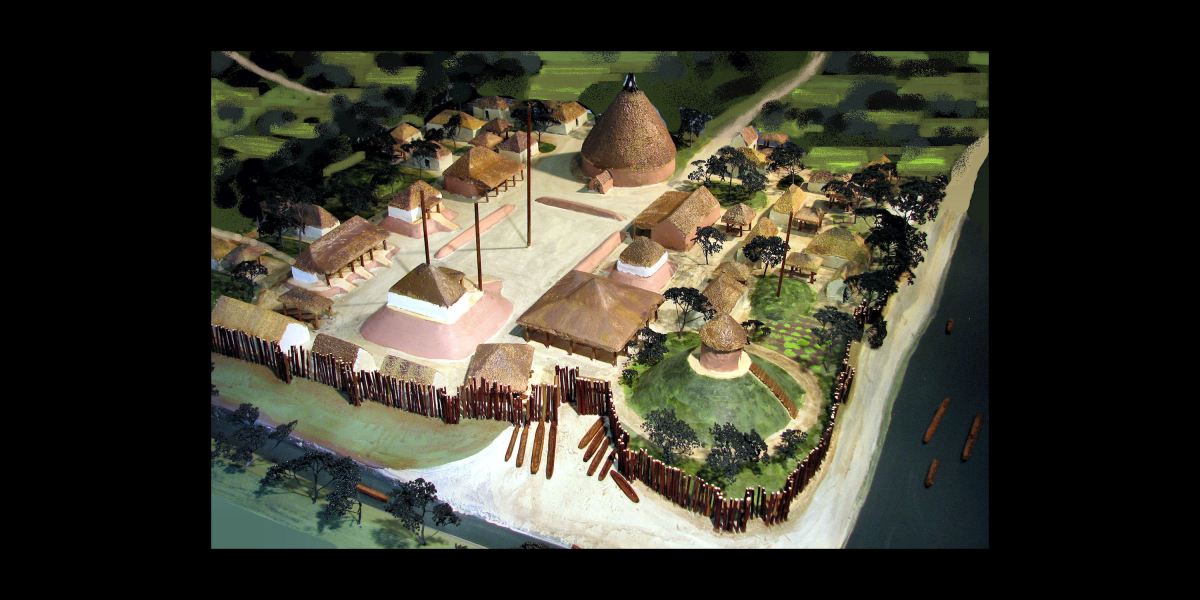
Sketch of occupied Creek town in the SE Georgia Coastal Plain by William Bartram (1776)
Forgotten towns on the South Atlantic Coast
Some of the Mesoamerican-like towns in Georgia were still occupied in 1776. The general public or even most Creek descendants don’t seem to be aware of this fact. He prepared measured drawings and sketches of them.
I based the model at the top of this article for the Muscogee-Creek Nation on one of those drawings. Most of those ruins have now disappeared. The people living along the coasts of South Carolina, Georgia and northern Florida are generally unaware that such large indigenous American towns ever existed.
Although a PBS documentary was filmed about the two weeks that Bartram spent on the edge of western North Carolina, he actually spent over three of his total five years in the Southeast, exploring the coastal regions of Georgia and Florida.
The North Carolina-sponsored museum exhibits and documentary films fail to mention that on short notice, Bartram had to flee for to his life over the Tallulah River in extreme Northeast Georgia to the safety of the Creek Nation, because the Cherokees planned to kill him! LOL
Bartram in the South Atlantic Coastal Plain
1765-1766
In 1766 on the banks of the St. Johns River at Little Florence Cove, William Bartram attempted to farm a 500-acre land grant. Bartram had spent much of the previous year exploring the Georgia Coast and new British colony of East Florida with his father, John Bartram, the Royal Botanist for America under King George III. When John Bartram returned home, near Philadelphia, the younger Bartram stayed in Florida. He hoped like many other settlers to make a fortune exporting cash crops such as indigo and rice. Using six enslaved Africans, Bartram cleared the forest and planted, but within a year he abandoned his farm and returned home.
Bartram’s book enabled me to penpoint with LIDAR major Native American earthwork locations around St. Marys Sound in Georgia and Florida, plus along the St. Johns River. The towns with mounds near St. Marys Sound were still occupied when visited by French explorers from Fort Caroline in 1564 and 1565. However, those along the St. Johns River had been abandoned for several centuries due to the arrive of Timucuan invaders.
1773-1777
Several of Bartram’s most famous botanical discoveries were made during the extensive period that he spent in Georgia’s Coastal Plain, but he also visited, measured and described the earthworks of Fort San Mateo, which was built on top of the ruins of Fort Caroline. This was done, while Bartram was a guest of a plantation on Broughton. His book gave the specific location and distance from the plantation. This information allowed me to quickly find the still-existing ruins with LIDAR in 2012. I subsequently discovered that Smithsonian archaeologist James Ford had unearthed numerous 16th century French and Spanish artifacts at that location in 1934!
This section of his famous book was ignored in 1951, when Congress was pressured into labeling an empty 25-acre lot on the St. johns River, near Jacksonville, as the “Fort Caroline National Memorial.” No 16th century artifacts have been discovered by archaeologists in the vicinity of the fake Fort Caroline . . . despite well over a million dollars in archaeological work during the past 70 years.

Hi Richard
I found Bartrams book on the Project Guttenburg web site. They have books that have no copyright or the copyright ran out. I have found several very interesting older books on this site.
His writing, like most older books is a bit of a tough read. He lists the scientific names of the plants he found, sometimes listing 10 or more, in the chapters. His descriptions of the people and landscapes are very eloquent and seem accurate.
I’m only up to chapter 10 so I have quite a bit to go to finish it. If any of your other readers are interested the books on Project Guttenburg are free, and they have a large selection of historical books.
Thank you and keep up the great work.
LikeLiked by 2 people
You are right. The old type style and 18th century syntax makes for hard reading at times . . . which causes most readers, me included, to jump ahead in hope of finding something more interesting. However, this is exactly how I missed the first time, his comments about visiting the real site of Forts Caroline and San Mateo. Just bear with it. There will be some OMG moments, like when he described the domesticated King Vultures that Creeks and Seminoles formerly raised.
LikeLiked by 1 person
Hi Richard,
I believe this is the passage you were referring to about Fort Caroline in Bartrams book.
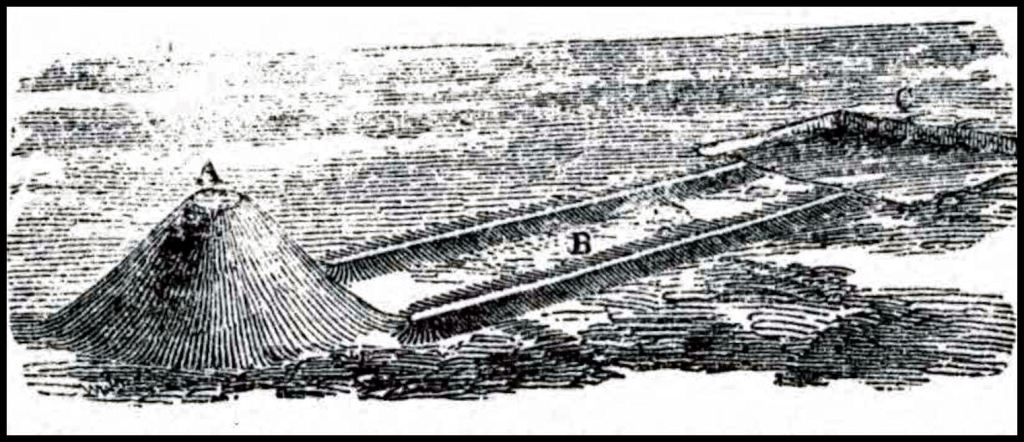
On the west banks of the south channel, ten or twelve miles above its mouth, and nearly opposite Darien, are to be seen, the remains of an ancient fort, or fortification; it is now a regular tetragon terrace, about four feet high, with bastions at each angle; the area may contain about an acre of ground, but the fosse which surrounded it is nearly filled up. There are large Live Oaks, Pines, and other trees, growing upon it, and in the old fields adjoining. It is supposed to have been the work of the French or Spaniards. A large swamp lies betwixt it and the river, and a considerable creek runs close by the works, and enters the river through the swamp, a small distance above Broughton Island.
You are right about this being easy to overlook in his book. Reading 18th century literature will exercise your vocabulary and comprehension of the English language, i really like Bartrams descriptive language, I have had to look up a lot of the words he uses to make sure I understand what he means.
LikeLiked by 2 people
Nevertheless, this is exactly where a Smithsonian archaeologist, James Ford, found many 16th century Spanish and French artifacts in 1934 – plus the earthworks were still there. There is really no excuse for Georgia officials and archaeologists remaining silent in 1951, when Congress approved an act designating a vacant lot in Jacksonville with no artifacts or earthworks as the Fort Caroline National Memorial.
LikeLike
Those were the artifacts that got “lost” by the state of Georgia if I remember right. It is crazy that so much stuff like this is swept under the rug.
I also found Gaschet’s book on the Creek migration legend. I have almost finished the first volume. One of the things that stand out is the very diffrent spelling they used for the tribes, than we use today.
LikeLiked by 2 people
IF you are interested, I can email you the real Creek Migration Legend. Remember I found the original manuscript at Lambeth Palace in 2015. It had been “lost” for 280 years. The original handwriting was hard to read, so I transcribed it both verbatim and in modern English.
LikeLike
I would like a copy of the legend. I ve been following you since the People of One Fire days and have read about you finding the legend in England. A really good piece of detective work. I would like to compare Gashet’s copies of the legend and see how close they are. What i have read of Gashet (sp) they are generally similar to each other. He describes them coming across villages and shooting white arrows into them and they got red arrows back, they mentioned a red river and a mountain that made a loud noise. Described the types of fire they had etc. One of the biggest things is the description of exactly what you found in the box at Lambreth. A scroll with Creek and English writing on a white buffalo vellum.
Do you what has happened to the scroll since it was found? It would be nice if HRM King Charles would return it to Savannah to be displayed in a museum. Things like this should see the light of days so everyone can see it.
Thanks for all your hard work.
LikeLike
Hey! Send me a comment from the “Contact” button on the TAR webpage. That will tell me your email address. In regard to the Bison Velum . . . The contents of the Georgia Office in Westminster Palace were put into storage, after the peace treaty was signed, ending the American Revolution. I received no cooperation from the UK National Archives about searching for the painted bison velum. Subsequently, my sister lived for three years near Godalming, Surrey, where the James Oglethorpe Museum is. She also received no cooperation from the museum or the UK National Archives. In fact most British were extremely hostile to her – this was during the first Trump Administration – even though she is a Democrat. Things are much, much worse now in regard to British government attitudes toward US Citizens. Richard T.
LikeLike
If this does not give me my e mail let me know.
I sometimes think the British are still upset over the revolution!
LikeLike
You have to write a note on the CONTACT window.
LikeLike