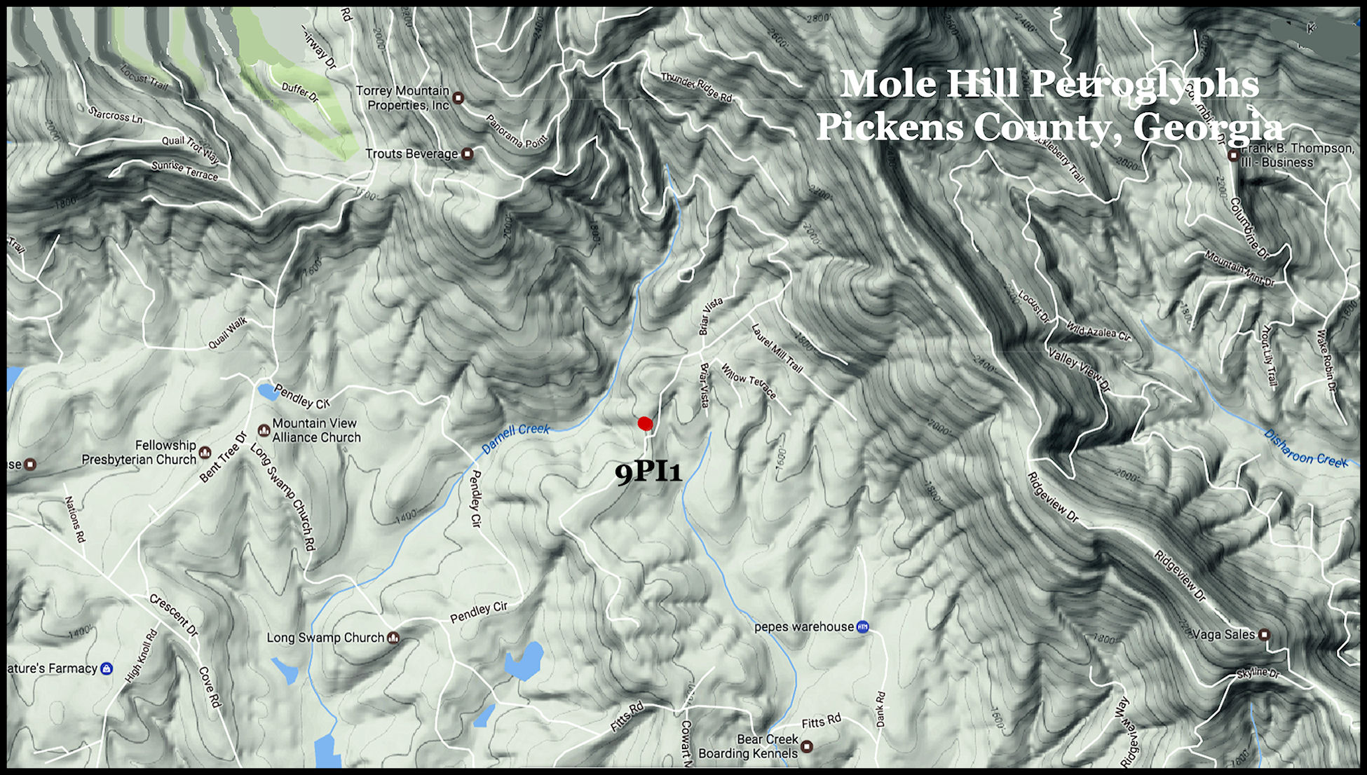
Site No. 9Pi1 ~ Pickens County, Georgia
34°28’05.4″N 84°20’26.7″W
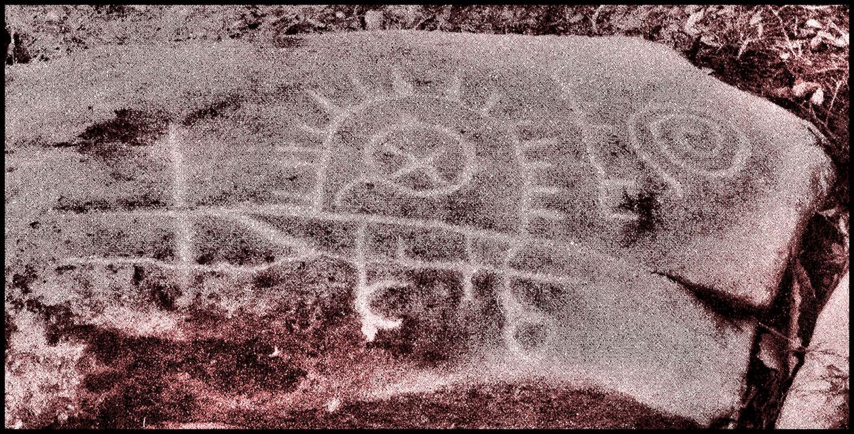
This boulder is located on a knoll overlooking Long Swamp Creek near the Bent Tree Community. It was discovered in 1939 by Archaeologist Robert Wauchope. This grainy photo by Wauchope is the only known image of the petroglyphs. These petroglyphs are located over the largest known deposit of marble in the world. The marble for most of the public buildings and monuments in Washington, DC was quarried nearby.
The engraving faces True South. At first glance the stone appears to be some type of calendar. However, a circle with an X in it was a Scandinavian Bronze Age symbol for gold. Immediately north and east of here is the Georgia Gold Belt.