The Byzantine politics, which caused the weird events surrounding the premier of “America Unearthed” on the History Channel in 2012
34°52’57.1″N 83°52’39.8″W
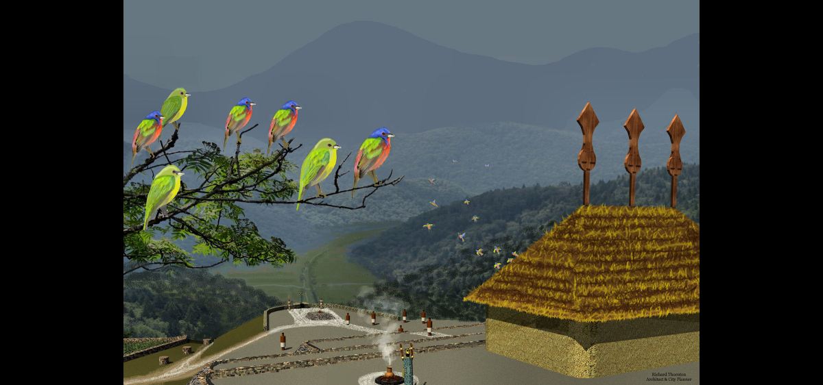
by Richard L. Thornton, Architect & City Planner
Georgia Institute of Technology ~ Georgia State University
“If you tell a big enough lie and tell it frequently enough, it will be believed.” – Adolf Hitler
“If you tell a lie big enough and keep repeating it, people will eventually come to believe it. The lie can be maintained only for such time as the State can shield the people from the political, economic and/or military consequences of the lie. It thus becomes vitally important for the State to use all of its powers to repress dissent, for the truth is the mortal enemy of the lie, and thus by extension, the truth is the greatest enemy of the State.” – Joseph Goebbels
Paving paths for Cherokee casinos
While federal and state economic development activities in the Georgia Mountains during the 1970s, were characterized by local infrastructure improvements and the enhancement of tourist attractions, the 1980s were characterized by the planning for regional expressways and a major resort near Track Rock Gap. It was anticipated that Cherokee gambling casinos would be located near Track Rock Gap and Helen, GA , which would attract tourists from around the nation. Casinos, nominally owned by Native American tribes, appealed to Southern politicians, because they could claim to be opposed to gambling, but helpless to stop Indian tribes from sponsoring casinos. In fact, the creation of casinos always involved state politicians and bureaucrats for years before their public announcements.
The Georgia 400 Expressway was originally planned as an interstate highway that would interconnect Atlanta, Dahlonega, Helen, Hiawassee, the Cherokee Reservation and Asheville, NC by cutting a major gash through the Georgia Mountains at Unicoi Gap. The plan was conceived while I was a planning official in Asheville. By the mid-1980s, the plan was shifted to the creation of Interstate 575 between Northwest Metro Atlanta and Jasper, GA. Beyond there its extension, the Appalachian Developmental Freeway would continue on to Young Harris, the home town of Lieutenant Governor Zell Miller. Its route generally followed existing highways through a natural valley between the cities of Ellijay and Blue Ridge. This route was politically acceptable to the majority of mountain residents.
While reading the remainder of this article, keep in mind the following facts. (1) Until 1716, all of the lands within the present boundaries of Georgia were occupied by members of the Creek Indian Confederacy. (2) In 1776, the British Army estimated that there were about 100 adult Cherokee males in the entire Province of Georgia . . . which then stretched to the Mississippi River. (3) In 1785, much of the lands in the Georgia Mountains of the Elate (aka Elasi) an independent Creek-speaking alliance and those of the Creek Confederacy were given to the Cherokee Tribe. (4) Up until 1818, all of Habersham and White Counties were occupied by Creek or Chickasaw speaking peoples. Those in the northern half of these counties had been “given” to the Cherokees in 1785. (5) The Soque in northern Habersham County were the ancestors of the Miccosukee People of southern Florida, who speak a Creek language.
When the federal government finalized laws and bureaucracies for the legalization of Native American casinos in the mid-1980s, Georgia appeared to be left out. It had no federally-recognized tribes and only one state-recognized tribal reservation, the Tama Creeks near the Florida line in southwest Georgia. State politicians and bureaucrats conceived plans for enabling the North Carolina Cherokees to establish reservations in Georgia on which casinos could be built. This is exactly when several anthropology, history and education professors became complicit with the scheme.
Planning for a series of state-owned resorts had occurred in the 1960s and 1970s. The first one completed was at Unicoi State Park, near Helen, which was renamed Unicoi Station by Governor Jimmy Carter. State officials thought that they had chosen a Cherokee name for the resort, but actually the word has no meaning in Cherokee, but is derived from the Creek word Uenenekoi, which means “Path that follows streams.” Lt. Gov. Zell Miller pushed through plans for the biggest resort to be located near his home in Young Harris. The land between this resort and Track Rock Gap was to be given to the North Carolina Cherokees for a reservation and casino.
The University of Georgia established a Department of Native American Studies. Even though this university was built on land that had contained the Creek town of Talassee the year before, the department was totally focused on Cherokee culture and history. Its logo (at right) contained the Cherokee syllabary. It offered full scholarships for out-of-state Cherokee students only. It only taught the Cherokee language. Obviously, its degrees were totally worthless in Georgia’s job market. Today, the remnant of that department is labeled an “institute,” which awards post-graduate certificates, not degrees.
A semi-secret cult, composed of affluent, politically-connected, bisexual, white women from Northside Atlanta, who believed that they were “reincarnated Cherokee princesses,” pushed through radical changes in the state history curriculum. My Creek mother was selected State Teacher of the Year during this period and, as such, served on the state history curriculum advisory council! The state history syllabus was changed to only include 1/2 chapter on the Creek Indians, but 4 1/2 chapters on the Cherokees.

Magical mystery archaeology
Zell Miller went on to become a very popular Governor in the 1990s and US Senator in the 21st century. Three former presidents and Vice President Pence gave eulogies at his funeral in March 2018. Both he and his wife believed that they were part Cherokee. Zell actually grew up in Union County near Track Rock Gap. Much of the bureaucrats’ and archaeologists’ “behaving badly” can be explained by their desire to flatter a politically powerful person, who wished to honor the people, whom he thought were his ancestors.

While living in Union County, GA I ran into Zell and his wife on numerous occasions at either the Ingles Supermarket or Walmart in Blairsville. In fact, I had a long conversation with them at Walmart about Track Rock Gap, a couple of days after I first realized that the stone ruins there were Pre-Columbian, not the vestiges of a Sephardic gem mining village. However, it is quite likely that Jewish gem and gold miners were living there or nearby in the 1600s. In Part Four, we will explain the evidence.
It was Zell Miller, who told me that young people and families in Union and Towns Counties had been picnicking at Track Rock Gap for a long, long time. The rough trail, which one sees today was formerly a wagon road that Model T’s could also traverse. When Mrs. Miller walked away to buy some batteries, Zell told me about going up there with girlfriends from Young Harris College to make out.
Every other sentence in Zell’s conversation about Track Rock Gap was interspersed with the words, “Cherokee” or “Cherokees.” It was clear that he believed that the Cherokees carved the petroglyphs and built the mountainside town at Track Rock. Zell stated that he had persuaded the Bush Administration to donate Track Rock Gap to the Eastern Band of Cherokees, but “the mess at the US Forest Service Office in Gainesville, GA had stalled things and then that Barack Obama had been elected.”
Knowing that Late Woodland and Mississippian Period pottery was found there and the radiocarbon date of 1018 AD, I knew the Cherokees couldn’t have possibly built the Track Rock Terrace Complex, but didn’t argue with Zell. He did not look very robust. Seven years later he would die of Parkinson’s Disease. We will explain the “mess” at the US Forest Service in Gainesville in Part Four. I never told Zell and his wife that I was Creek and they didn’t guess it.* Like many mountaineers, they thought that real Indians look like the Italian, Greek and Jewish actors that Hollywood hired for many decades to play Wild West Injuns.
*In contrast . . . in 2004, I was selling booklets on the architecture and planning at Ocmulgee National Monument during its annual Southeastern American Indian Festival. Six members of the Muscogee-Creek National Council observed my booth at a distance and walked straight toward me. The first thing that the council member from Tulsa said was, “You’re Creek! Are you a citizen of the Muscogee Nation?”
Neither Zell nor his wife had Native American physical features. Neither does their son, who was judge for a trial in Dahlonega for which I was called to jury duty. Native American skulls are quite different than either European or Middle Eastern skulls. Zell Miller was obviously of Dutch Jewish descent, mixed with the local British/Scots Irish people of the Georgia Mountains. Miller is a common Jewish name.
This is typical of the many North Georgians, who claim Cherokee descent. When their DNA is tested, they show up with high levels of Semitic and Iberian DNA markers . . . generally NO Native American ancestry. They are descended from 17th century gold miners or 18th century Indian traders, whose descendants became Christians. To explain their dark hair and tan skin, they claimed a “full-blooded Cherokee princess” as their grandmother. The big exception are the Towns County Indians, who are either of Peruvian Native descent or a mix of Peruvian and Maya.

Between 1989 and 1991, the State of Georgia funded large scale archaeological digs in the tracts of land associated with the development of the Brasstown Valley Resort and its golf course-country club. This was quite unusual and in fact, the last time that the state has funded Native American archaeology at such a scale. Three firms were hired. They were under extreme pressure to label all the village sites and artifacts, “Cherokee,” in order to facilitate approval of a Cherokee casino between the golf course and Track Rock Gap.
All of the village sites had initially been examined in the mid-20th century by the famous archaeologist, Dr. Arthur Kelly. They had been determined to be culturally related to Etowah Mounds and thus, Proto-Creek. Two of the firms, after fully excavating village sites, completely concurred with Arthur Kelly. One of the firms, who was hired by the Georgia Department of Transportation, complained about political pressure to label their artifacts as being Cherokee, but refused to do so.
The third firm was based in Atlanta, but hired recent graduates from the University of North Carolina at Chapel Hill on a temporary basis to excavate a Mississippian Period village with a mound, which was clearly a colony of Etowah Mounds in Northwest Georgia. Chapel Hill is 285 miles east of the Brasstown Valley Resort. The North Carolina archaeologists labeled the Mississippian Period village as “Cherokee.” Here was their “reasoning.” The mound was three miles from the North Carolina State Line. Six miles away in Brasstown, NC a mound had been labeled Cherokee, therefore the Pre-Columbian village in Georgia was Cherokee.
The State of Georgia then issued a national press release announcing that archaeologists working in Young Harris had proven that Cherokees had lived in Georgia for at least 1000 years. The press release was accompanied by a map showing all the land in Georgia from Savannah northward as always being occupied by the Cherokees.
My grandmother and mother had “flying fits” when they saw the maps and accompanying article in the Atlanta Journal-Constitution. My grandmother wrote to me up in Virginia and asked me to do something about it. However, at the time I thought that I would be living on my Colonial farm in the Shenandoah Valley, happily married, for the rest of my life. I wrote back that there was nothing I could do.
Three years later, I was “suddenly single” and Principal Planner of Cobb County, GA. There is justice in the world. My ex-wife’s married school principal lover dumped her as soon as she was divorced from me. I was also Historic Preservation Planner for Cobb County and so had access to many archaeological files and reports.
The Brasstown, NC mound contained the same artifacts as the Peachtree Mound downstream a few miles. However, by then there was a law in North Carolina that required all Native American artifacts in the mountain counties to be labeled “Cherokee.” The Peachtree Mound was excavated in 1916 by archaeologists, employed by the Heye Foundation. It contained the same style artifacts as those in the Nacoochee Mound in Georgia, which had been excavated the previous year by the Heye Foundation. The Nacoochee Mound contained the same style artifacts that had been found around Macon and Columbus, GA . . . always Creek territory. Are the readers seeing a pattern here?
Zell Miller was elected Governor of Georgia the same year that the Brasstown Archaeological Reports were being written. As the Brasstown Valley Resort was being completed in 1994, he authorized a $250,000 expenditure to build a small archaeological museum within the main building to house the best artifacts unearthed by the three archaeological firms. It was named, “10,000 Years of Cherokee History.” Everything from Clovis points to Swift Creek and Lamar pottery were labeled “Cherokee.”
That same year, the State of Georgia rehabilitated an old house, next to the golf course, into a retail shop. They gave a free lease for the property to a Native American couple in order for them to open up a Native American crafts store. He was Ojibwe from Wisconsin. She was Eastern Cherokee from North Carolina. They only sold Ojibwe and Cherokee crafts. There was a problem. Most of the guests at the resort were from south of North Carolina. They were primarily interested in Creek and Seminole arts and crafts from Georgia and Florida. The couple abandoned the store, after the lease expired. It was eventually torn down and replaced by a spa in 2008.
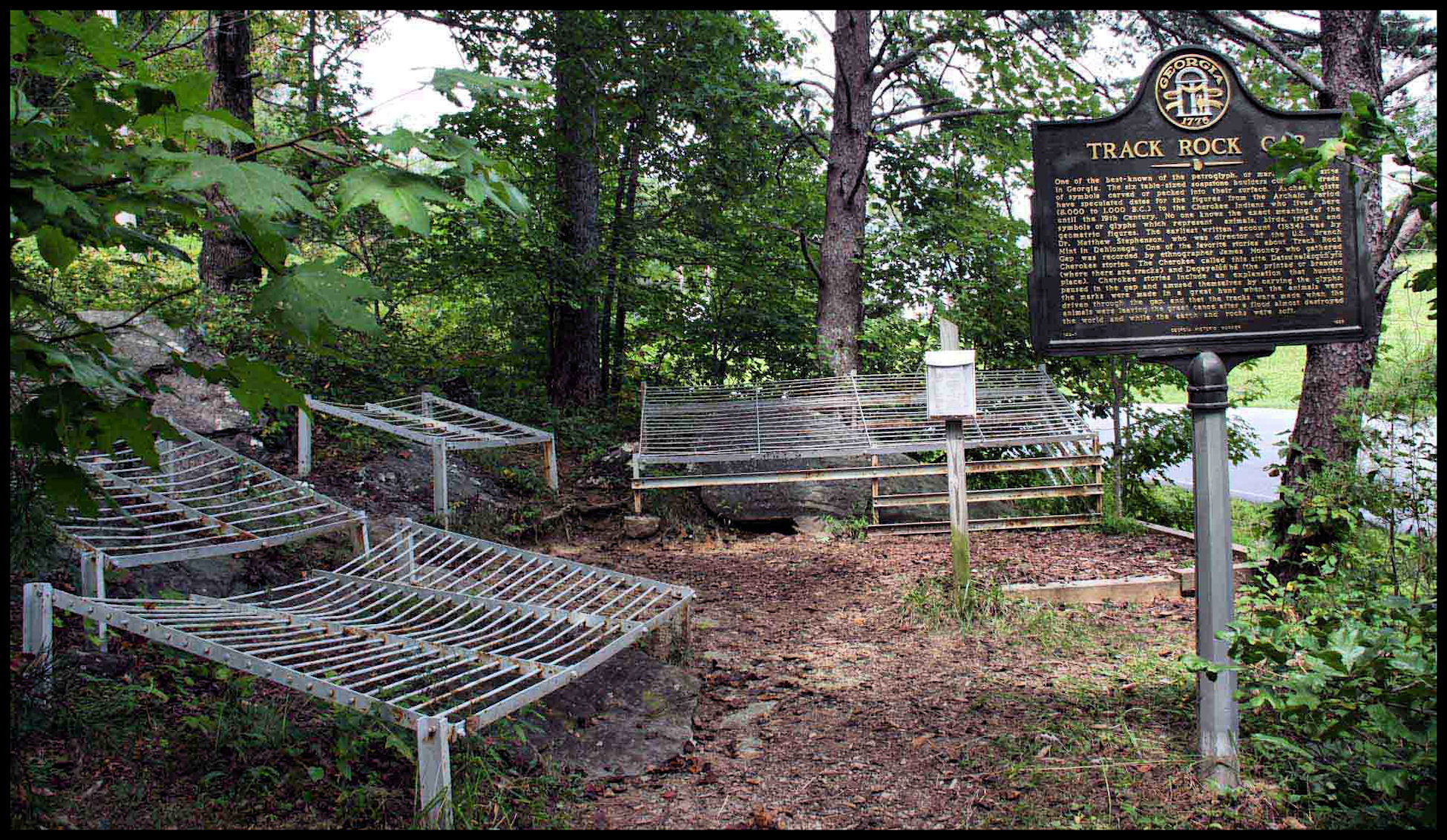
Archaeological work at Track Rock Gap
In 2000, the US Forest Service hired Johannes Loubser, a South African archaeologist, who was supposedly a expert on African Rock Art, to study the Track Rock petroglyphs. The following year, he was paid by a community group, the Eastern Band of Cherokees and the US Forest Service to carry out an initial survey of the terrace complex. Loubser had never been in Mexico and knew nothing about the indigenous Creek People of Georgia. He has done some work, however, for the Eastern Band of Cherokees.
Loubser’s reports failed to mention that there were large proto-Creek towns, north and south of Track Rock Gap, before and during its occupation. There was an Upper Creek town, named Kusa (Coosa) in Blairsville until after the American Revolution. Coosa Creek is named after it. There was another large terrace complex seven miles southwest of Track Rock Gap. It can be seen from the top of Track Rock’s ruins. There are also several smaller terrace complexes in the county. I was living 500 feet from one of them, when I wrote the book, Itsapa, the Itza Mayas in North America. The premier of America Unearthed was completely based on that book, but viewers were not told that. Worst of all . . . Loubser did not notice four Itza Maya glyphs on Boulder Six or that several of the symbols on the six boulders were very much part of the Creek artistic tradition.
Loubser’s report on the petroglyphs was seen by very few people at the time. His report on the Track Rock Terrace Complex was kept a secret by the US Forest Service until I obtained a copy from a resident living near the ruins in 2011 then publicized the ruins in my Architecture column in the National Examiner on December 21, 2011.
During late 2011 and much of 2012, I took Loubser’s report on the petroglyphs at face value . . . an analysis of the glyphs by an international rock art expert, who knew virtually nothing about Georgia’s indigenous heritage. Then I began to examine the contents more closely. His astute interpretation of the six boulders was lifted directly from the speculations in 1834 by the new head of the Dahlonega Branch Mint, Mathew Stephenson, which were published in 1855. Repeating Stephenson’s statement, Loubser described the symbols as almost meaningless graffiti, carved by bored Cherokee hunters.
Large portions of Loubser’s reports are verbatim copies of a document distributed earlier by the Eastern Band of Cherokees Cultural Preservation Office. It explains Track Rock Gap as the burial place of thousands of Creek warriors, who had been killed when the Cherokees conquered all of North Georgia in 1754.* The stone cairns are the burial places of great Cherokee chiefs and the 200+ stone walled terraces were where the Cherokees danced sacred dances.
*It is thoroughly recorded by colonial archives that the Cherokees were catastrophically defeated in the fall of 1754 in the blood soaked valleys of North Carolina, by an invading army from the Creek town of Koweta. Thirty-two Cherokee chiefs were killed, including six, who were burned at the stake on the banks of the Chattahoochee River in Georgia for being “devil worshipers.” The Cherokees surrendered and signed a peace treaty in December 1754 . . . thus ending the 40 year long Creek-Cherokee War.
Zell Miller served as Georgia’s Lt. Govenor from 1975 to 1991 and Governor from 1991 to 1999. It is now obvious that from at least back in the 1980s, there was a plan to give the Eastern Band of Cherokees Track Rock Gap along with a large tract of land in the valley below for their casino and shops. Track Rock Gap would be a spectacular place for tourists to go after gambling in the casino or playing golf at the Brasstown Valley Resort. That is a sound marketing concept, except for one thing . . . the Cherokees had nothing to do with the construction or occupation of Track Rock Gap.
Several of the key personnel in the US Forest Service, who were involved with the obstruction of TV film crews or actual participation in the “Maya Myth Busting in the Mountains” campaign were from Western North Carolina. Perhaps in their minds, they were protecting an extension of North Carolina until the Cherokees could be given the land. However, the Gainesville US Forest Service had recently been involved in a major corruption scandal. Your will learn about it in Part Four.
In 2012, the Georgia Council of Professional Archaeologists endorsed Loubser’s reports as the only reliable information on Track Rock Gap. That was a terrible mistake, which they will not be able to erase. You will learn in Part Five that all the symbols on the Track Rock Boulders, except three of the Itza Maya glyphs, can be found on a granite face in Nyköping, Sweden. The Nyköping Petroglyphs have been dated to 2000 BC!
