Native American traders & European explorers
by Richard L. Thornton, Architect and City Planner

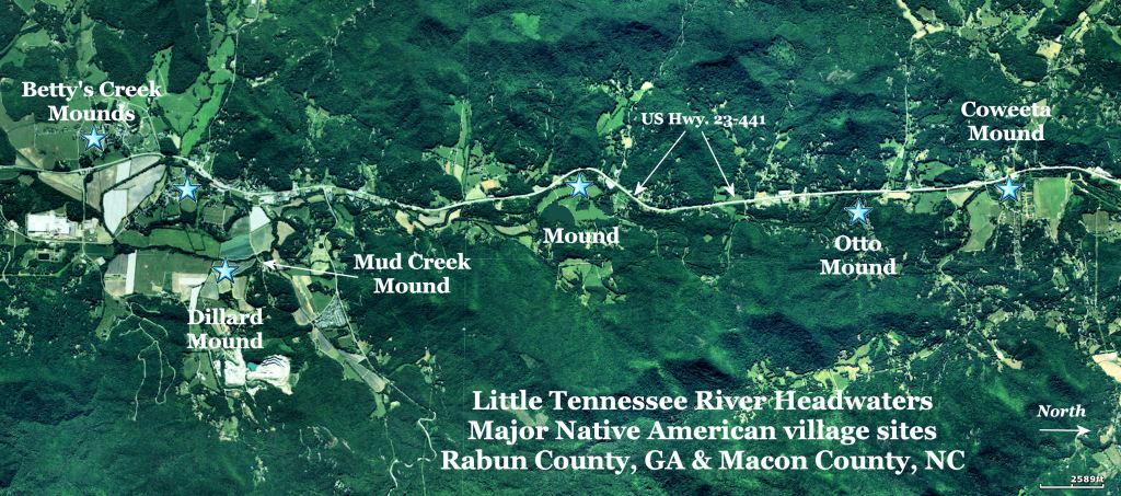
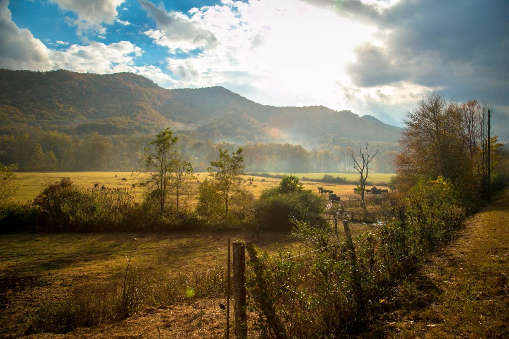
In 1500 AD, the Nikwasi Mound sat adjacent to one of the most important trade paths in Southeastern North America. It connected the South Atlantic Coast and the Florida Peninsula with the Tennessee River Valley and the heart of North America. That is one of several reasons that it is probable that Spanish explorers, Hernando de Soto (1540) and Juan Pardo (1567), plus French explorer, La Roche Ferrière (1564-1565) passed by this Native American landmark. As mentioned in Part One, we know that English explorer, Richard Brigstock, spent at least a couple of weeks in the vicinity of the Nikwasi Mound in 1653.
By far, the most detailed information about the region around present-day Franklin, NC comes from Ferrière and Brigstock. Ferrière spent six months exploring what is now Georgia and western North Carolina, while Brigstock spent almost a year in northeastern Georgia and surrounding areas. For unknown reasons, late 20th century academicians ignored the French and English explorers and instead focused on the vague and somewhat conflicting accounts by the De Soto Expedition. We will get back to the European explorers after examining the Southeastern Native American trade network.
The Savannah-Little Tennessee River Trade Corridor
Not only was Nikwasi at the intersection of several important trade paths, it was a node on what perhaps the most important trade corridor in Southeastern North America . . . because it was the shortest route between the South Atlantic Coast and the Mississippi-Ohio River Basin. This is the very same reason that the Port of Savannah is booming today. Even with modern rail transportation, goods loaded at the Savannah docks will reach the heart of North America 1-3 days earlier than those unloaded at the ports of northeastern United States.
The reason? Savannah is substantially farther west than the Northeastern ports and there are few natural barriers. In terms of Native American trade canoe commerce, the Savannah River was the shortest route to the Appalachian Mountains and it was navigable by canoe all the way to the mountains.
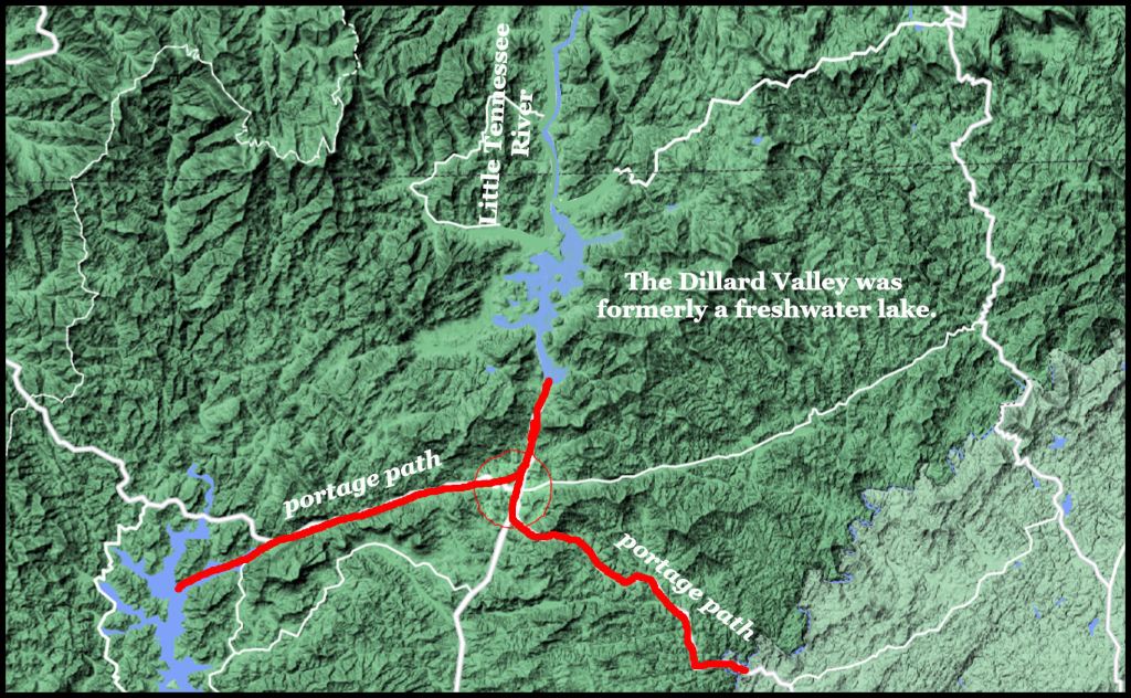
Then what do have near the northern point of canoe navigation on the Savannah River? Traders would only have to carry the goods of the South Atlantic Coast as little as 10 miles (16 km) to reach the source of the Little Tennessee River. Until the 1700s that was a lake then in the 1700s and early 1800s, it was a swamp. Farmers dug drainage ditches in the swamp to create the rich black soil that we see today in the Dillard Valley.

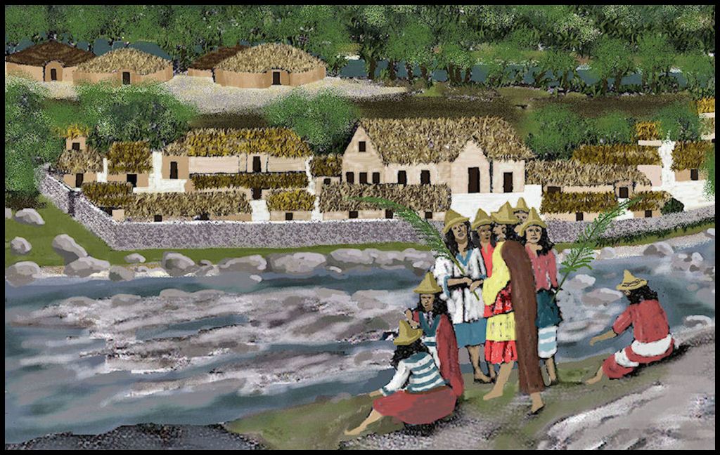
The combination of multiple trade paths, temperate climate and fertile bottomland soils attracted many distinct Indigenous American peoples from many parts of the Americas into the region. Itsate (often written as Etchete by frontiersmen) is a Itza Maya word meaning “Itza People.” However, the earliest maps of the region also show towns with South American (Satikoa), Caribbean (Tanasi), Creek (Coweta and Cowee), Watari (Uchee) and Polynesian (Wasali) names.
Undoubtedly, since the villages were fairly close to other, the peoples intermarried over time and became hybrids. An example of a hybrid village would be Itzao (Etcheo). The root is of course, Itza Maya, but the suffix is Southern Arawak from Peru and means “Principal.” The “o” suffix was typically used for the village where the local king or principal chief lived.

Hernando de Soto Expedition
The terrain of the South Carolina Up Country and North Carolina Blue Ridge Mountains perfectly match the descriptions of terrain in the De Soto Chronicles. The De Soto Expedition departed Kofitacheki in the South Carolina Coastal Plain on May 13, 1540 and headed generally northwestward. Once the expedition reached the Blue Ridge escarpment at Xuale.
The Southern university professors, who published, The De Soto Chronicles, didn’t know this, but the Xuale were once a very powerful tribe of mound builders in northern West Virginia and the Jocasee River Basin of South Carolina. Suale is a Spanish spelling of a word that was pronounced Jzhō : ä : rē . . . with the R rolled so hard that it sounded like an L to many Europeans. Thus, Xuale is the same as the province, known as Joara, to the Pardo Expedition.
The Joara or Xuale were made almost extinct by massacres committed by the Iroquois Confederacy, Native American slave raiders from SW Virginia and finally the Cherokees. Some of the Southern “De Soto Route” professors mistakenly equated the Xuales to the Cherokees.
Upon leaving Xuale, the De Soto Expedition crossed over a mountain ridge that separates the French Broad River Basin from the Saluda River Basin. Saluda is derived from the Creek name for Joara . . . Sualate. The Spaniards then climbed the escarpment in a western direction, first entering Sapphire Valley then climbing the higher mountains until reaching what is now Highlands, NC and then Franklin, NC.
*Charles Hudson and company designated a three feet high mound and handful of Native house footprints in Burke County, NC as the site of the great town of Joara, Spanish fort, plus a short-lived mission. Juan de la Bandera, the chronicler of the Pardo expedition, only used the Spanish word for a town, pueblo, once. This was to describe the capital of Joara. He said that it was a large town with many plazas, streets and temples. Surviving place names in South Carolina all point to the area between the Saluda and Jocassee Rivers in South Carolina. Burke was originally the land of the Wataree, a branch of the Uchee. Pardo built a fort and established a mission for the Wataree. Thus, Hudson had nothing to support this claim. The Uchee continued to occupy the Morganton, Lenoir and Old Fort, NC area until after the French and Indian War. They were never officially evicted.

La Roche Ferrière (1564-1565)
It is probably the biggest historical scam ever foisted on the American taxpayers. All French, Spanish, English and Dutch maps place Fort Caroline on the south side of the mouth of the Altamaha River in Georgia. Both the commander of Fort Caroline and the commander of the Spanish forces that massacred it in October 1565 give the latitude of the mouth of the Altamaha River as the doomed fort’s location.
Fort Caroline’s commander, Captain René de Laudonnière, specifically stated at several points in his memoir that the May River began about 15 leagues (30 miles) south of the Apalachen Mountains and then flowed generally southeastward to the Atlantic Ocean. That could only be the Altamaha River. The earthworks of the Spanish fort, built on top of Fort Caroline were visited and described as such by William Bartram in his book. They are still visible today.
Yet, in the 1930s, the Jacksonville, FL Chamber of Commerce began labeling some Confederate artillery redans as Fort Caroline. In 1950, Congress reluctantly went along with naming a 25-acre tract of land donated by the Jacksonville Chamber as Fort Caroline National Memorial – since there were no 16th century artifacts at the site. Then in 1962, President Lyndon Johnson agreed to fund construction of an inaccurate 1/12th scale replica of Fort Caroline on that tract as a reward for most Florida congressmen voting for the Civil Rights Act. Most visitors assume that it is the real fort. Since then, the US Government has spent many millions of dollars, expanding that hoax into 46,000 acres (19,000 ha) national park.
At any rate . . . in 1564 Lt. La Roche Ferrière led a small party in canoes up the Altamaha River to the Kingdom of Apalache in northeast Georgia. After first getting samples of the three types of gold mined there, plus the region’s most valuable exports, greenstone and mica, the Frenchmen traveled on foot into what is now western North Carolina, where they discovered rich deposits of gems and crystals, plus some gold and silver ore. He described all of the Southern Mountains to be part of the Kingdom of Apalache. Apalachen is the plural of Apalache in both the Creek and Itza Maya languages.
Ferrière’s party apparently returned south via the Little Tennessee and Savannah Rivers. They stayed for awhile in the Province of Ustanauli, which appears to have included the tributaries of the Savannah River and the Upper Savannah River. The Ustanauli were arch-enemies of the Apalache. Their king invited the French to join them in a war against the Apalache. However, when Ferrière returned to Fort Caroline, he recommended against waging war against Apalache, since Apalache controlled the Georgia and North Carolina gold belts, plus had a much larger army.
After learning the details of Ferrière’s six-month journey and looking at his maps, De Laudonnière began making plans to build the capital of Florida Française, approximately where the University of Georgia is now located in Athens, GA. Laudonnière was expecting the arrival of a thousand new colonists to occupy both Fort Caroline and the new capital. Most of these colonists were ultimately drowned at sea in a hurricane off the coast of Georgia or summarily executed by the Spanish.
Juan Pardo Expeditions
There were several expeditions by Juan Pardo and his band of soldiers. The first went to Joara then stayed there for the winter. The third expedition paralleled the Savannah River then crossed into Georgia over the Upper Savannah River. It then went to the Nacoochee Valley and followed the Upper Chattahoochee River Valley before crossing over Unicoi Gap to reach the Hiwassee River. The Hiwassee was paralleled all the way to Hiwassee Island in the Tennessee River. Pardo then followed the Little Tennessee River upstream to Chiaha then zig-zagged his way around western North Carolina until heading for home via the Little Tennessee River in early 1568. He would have passed the Nikwasi Mound on this journey.
Richard Brigstock (1653)
Brigstock stayed in the Kingdom of Apalache for almost a year. By that time, the kingdom spanned a vast distance from Southwest Virginia to Southwest Georgia . . . but French ethnologist Brigstock’s experiences in what would become Georgia and western North Carolina were described in ten chapters of book, written by French Natural Scientist and Ethnologist, the Rev. Charles de Rochefort . . . L’Histoire Naturelle et Morale des isles Antilles de l’Amérique. The English translation of those ten chapters may be found in The Apalache Chronicles by Marilyn Rae and Richard Thornton. Charles de Rochefort stated that it was really a confederacy by then. The High King functioned as the ceremonial head of state, but really had little power to force any particular province to do anything.
De Rochefort had some very interesting comments about the Native American cultural history of western North Carolina. He said that the Carib People originated on the South Atlantic Coast in ancient times. Most had eventually migrated southward, but one band migrated northward to the region where western North Carolina is today. In earlier times (the Woodland Period from 1000 BC to 900 AD) they represented the majority of people in that region. After the “Apalachete” (Creeks and Itza Mayas) immigrated into the Southern Appalachian Mountains, most Carib had moved elsewhere, but there still some Carib towns and villages in the region.
In Part Three, we will examine Colonial Period maps and fact-check some “New Cherokee History,” found on the web.

Howdy, Two thumbs up.
On Tue, Dec 28, 2021 at 1:32 PM The Americas Revealed wrote:
> alekmountain posted: ” Native American traders & European explorers by > Richard L. Thornton, Architect and City Planner Itsate Gap in Rabun County > Georgia, where the Little Tennessee River begins. The Little Tennessee > River is the only river in the Southeastern United” >
LikeLiked by 1 person
This is very interesting! The word Xuale sounds like something that would be found in Mexico, they use the “ X” a lot in the names given to places. I also was speechless because I thought Fort Caroline was attacked by surrounding Natives or that they had fled. The mounds, how did the surrounding natives of the mounds feel towards the mound builders. I recently heard that they were feared by many and other things I won’t repeat. It’s what has been passed down. Why do you think the Cherokees feared those mounds? It is said it was a place many would not dare to go on top of it, even to this day. What is your opinion? I apologize for the questions, just trying to understand both sides. Thank you for sharing!
LikeLiked by 1 person
My you Tainos are inquisitive. Your ancestors should have asked Cristobal Colon more questions, before letting him stay on the island. Xuale is probably hybrid word, combining the Nordic word for “sea or ocean” with the archaic Northern European root word for a kingdom, “re”. Southeastern Native Americans would have rolled the R so hard that most Europeans thought it was an “l” sound. It would mean “Sea Kingdom.” The large mounds required large numbers of workers and so were always associated with provinces, which had enough population to support mound construction. In essence, all of the towns and villages in a province that built large mounds were mound builders. As for the Cherokees, they built their council houses on top of mounds that had been constructed by other peoples. So, I don’t know where the story of them being afraid of standing on mounds came from. There is one exception to this general rule, however. It is true that the Cherokees would not live within a mile of Etowah Mounds in Cartersville, GA. Perhaps it was because the mounds were so large there. They told whites, who visited them, that the Etowah town site was haunted with many ghosts.
LikeLiked by 1 person
Also, are these mound builders the same “ tall people” that were feared also for their practices in precolonial times?
LikeLiked by 1 person
The Creeks were the “tall” people. The elite of the Creeks were especially tall because they were fed a high protein diet from the time they were babies.
LikeLiked by 1 person
Haha I think if they would have known what the outcome would be Cristobal Colon would have not lived long after setting foot on the Islands. They did what they called themselves “good people “ Tai-no”, the correct thing to do if people visit your home, without knowing the consequences of that. About the mounds, yes Etowah is the one I hear about or sometimes just mounds but wasn’t sure if they are referring to all mounds or just Etowah.
LikeLiked by 1 person