A story told with virtual reality images
by Richard L. Thornton, Architect and City Planner
We will start with the probable beginning of the mound as the burial of an important person . . . most likely the leader of the town when it was founded . . . then go forward in time. As the town site was occupied by different ethnic groups, the architectural form of the mound changed.
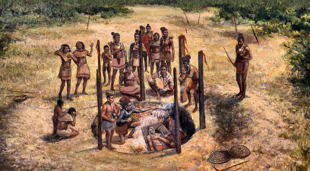
During the mid-twentieth century, Archaeologists Arthur Kelly and Joseph Caldwell discovered that almost all the large mounds, immediately south of Franklin in Georgia, began either as a Deptford Culture burial or as an Etowah I stone sepulcher burial of an important person. In the years that followed, descendants of the leader would be buried on top of the original burial.

The Deptford Culture began in Savannah, GA around 1200 BC then spread northward, westward and southward over the centuries. It has traditionally been associated with the Uchee People, who are the oldest ethnic group to continuously occupy the region.
The Etowah I Culture began a little before 1000 AD . . . simultaneously at Itzasi near Macon, GA and Etula near Cartersville, GA. It then spread as far north as the Smoky Mountains. They were Itza Maya colonists from Yucatan and Campeche States, Mexico . The original Itza colonists came from Chiapas State, Mexico around 600-800 AD and ultimately founded the province of Itsate (Itza People) in the Nacoochee Valley (Georgia) and the province of Chiaha (Salvia River) in western North Carolina.
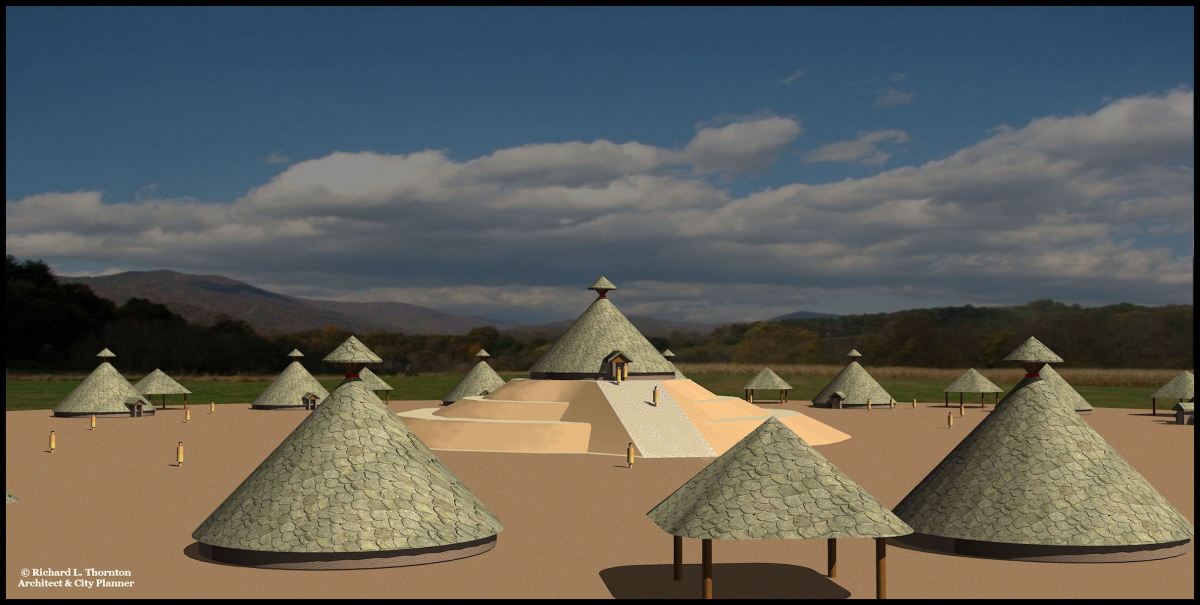
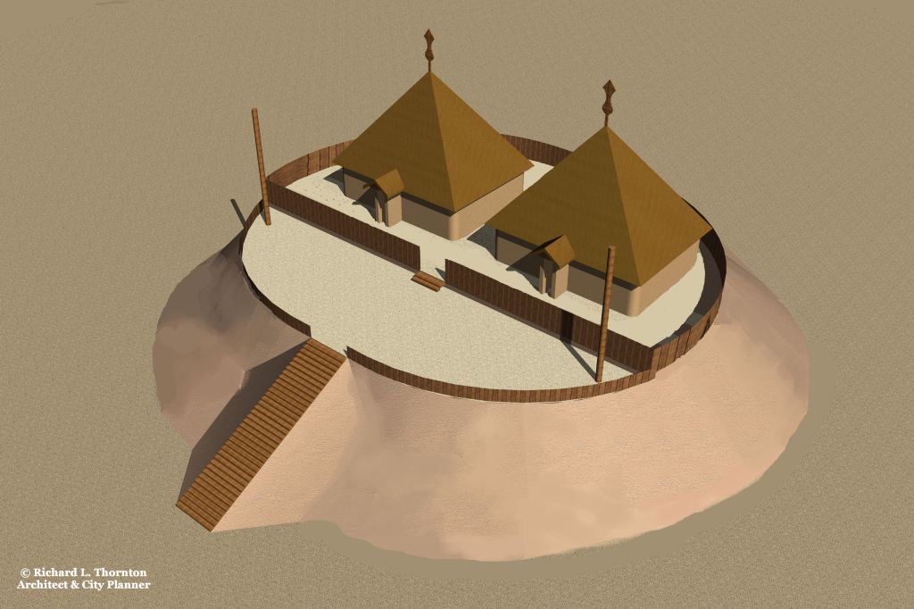
Either the Taenasi or Wasaw People resettled the town site in present day Franklin, NC. Both built round mound platforms. Both lived in large, South American style cone-shaped houses. The Wasaw developed a large capital on the Savannah River near present day Elberton, GA with multiple terrace mounds like the Nikwasi Mound. However, Tanasi Creek does flow into the Little Tennessee River across from the town site.


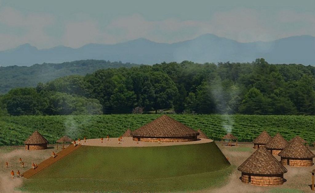
Beginning around 1400 AD, the Lamar (Proto-Creek) Culture arrived in northern Georgia and western North Carolina. Most mounds in the Chattahoochee, Hiwassee and Little Tennessee River Valleys were modified to an oval shape, with an upper terrace for a temple and royal residence, plus a ramp on the southwest side aligned to the Winter Solstice Sunset. Virtually, identical mounds could have been seen in present-day Macon, GA . . . Carrollton, GA . . . Columbus, GA . . . Augusta, GA . . . Franklin, NC . . . Otto, NC . . . Dillard, GA . . . Murphy, NC . . . Peachtree, NC . . . the Nacoochee Valley, GA . . . Helen, GA . . . and now under water in Fontana Lake, NC and Carters Lake, GA.
Non-ethnic Cherokee tribes were living in the Franklin, NC area, when British traders and envoys first started making contact with villages on the Little Tennessee River. Some joined the Cherokee Alliance, which was essentially created by the British in 1727 to thwart the further expansion of French influence. The majority of residents in the Coweta Creek towns such as Coweta, Nikasee and Cowee, plus some of the Itza villages, moved southward and joined the Creek Confederacy. In the 1738 map of the new Province of Georgia, you can see their names on Creek villages in NE Georgia and the Macon, GA area.
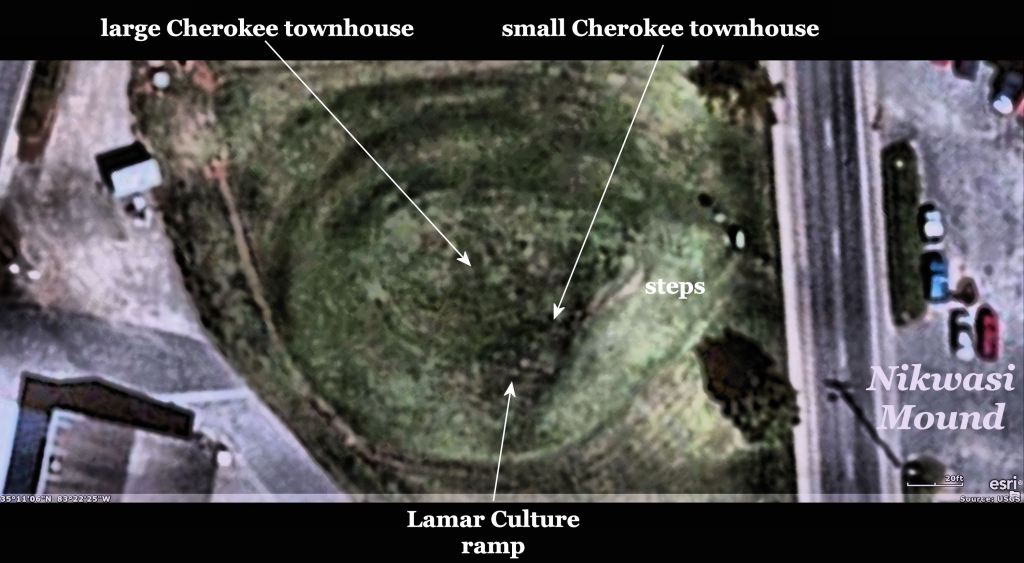
It is probable that after the remaining occupants of Nikasee changed to from the Creek monotheistic religion to the Cherokee conjuring and animism religion, they torn down or burned the Creek buildings on the top of the mound then dumped the soil from the upper terrace to create a long ramp on the southeast side of the oval. However, with infrared, once can see that the ramp originally had steps.
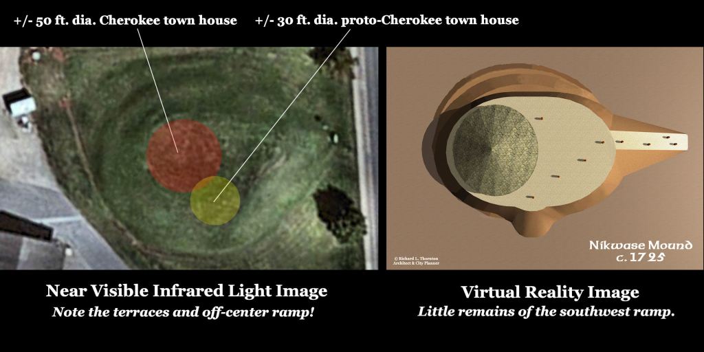
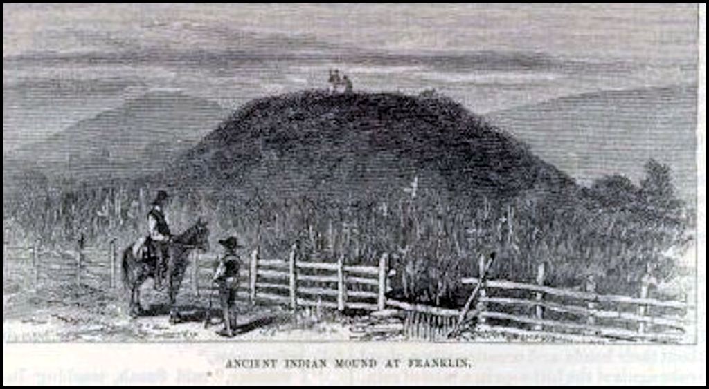
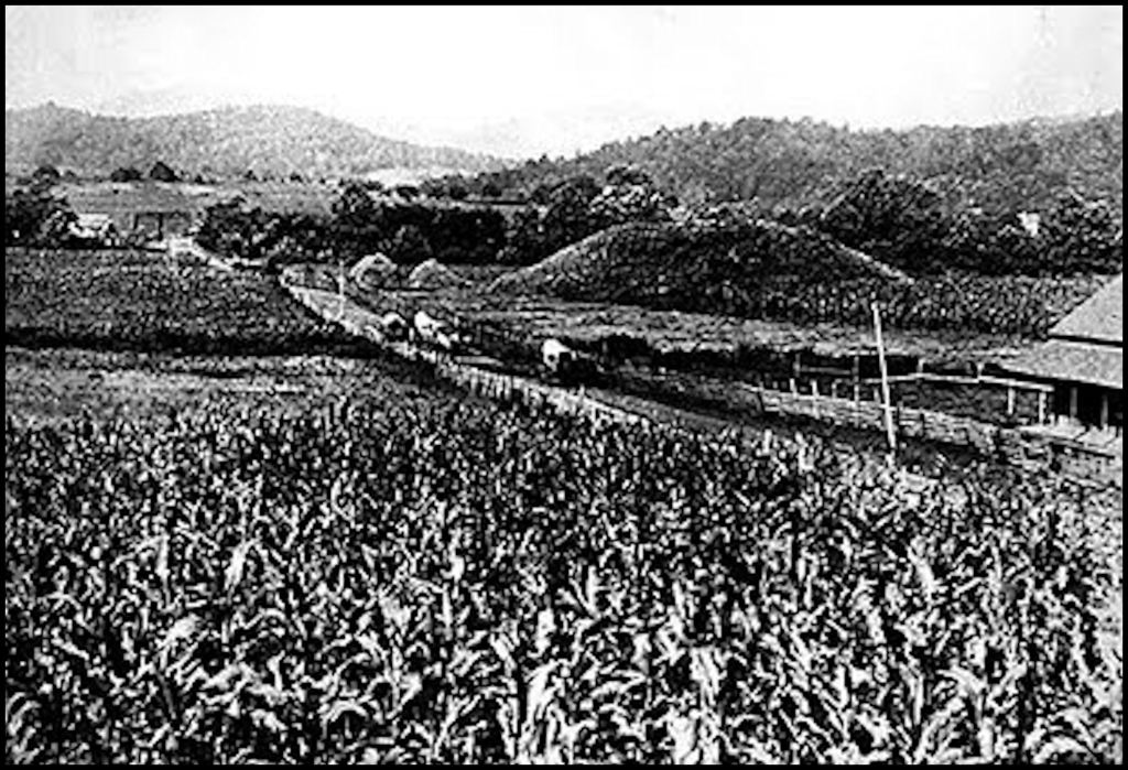
Over time, the long Southeast ramp and the vestige of the Southwest ramp have eroded . . . leaving only a short Southeast ramp and a Southwest ramp, which is only visible with infrared imagery. These changes probably occurred in the period prior to 1947, when the city of Franklin took ownership of the mound. Old photos suggest that it was mostly raw dirt and weeds in the 1800s.
The softer earth of the later phases of mound construction have slowly been removed over the past two centuries. The changes have been imperceptible to Franklin residents, but with infrared one can see that the outer skin of the mound has been “pealed” away to reveal the structure’s history. The mound was at least 10 feet taller in 1653, when it was visited by English explorer, Richard Brigstock.


Now you know!

Howdy, Top notch professional presentation!!!!!!!!!!!!!!!!!!!!
On Thu, Jan 6, 2022 at 7:29 AM The Americas Revealed wrote:
> alekmountain posted: ” A story told with virtual reality images by Richard > L. Thornton, Architect and City Planner We will start with the probable > beginning of the mound as the burial of an important person . . . most > likely the leader of the town when it was founded . .” >
LikeLiked by 1 person