This month marks the 20th anniversary of my marriage to Artlantis Software from Paris, France. I am showcasing some of my favorite architectural renderings of French Colonial architecture. I originally purchased Artlantis because it was the only VR software in the world that was capable of rendering Colonial Era, Medieval, Ancient and Prehistoric architecture. I had to contact a software dealer in Montreal to obtain it, but now it is carried by several dealers in the USA.
It is a way of saying “Merci beaucoup” to Artlantis creator, Camille Sarrut, who took time out from her busy schedule this morning to fix a glitch in my computer . . . long distance from Paris, The newest version of Artlantis will be used to produced animated films of historic and ancient towns. Artlantis will soon be marketed by a new distributor, Studio Base 2. Camille is already working at that office. She is a graduate of the prestigious Université Pierre Et Marie Curie in Paris.
Readers of “The America Revealed” are already aware about my work to incorporate the observations of French explorers and colonists into our history books and archaeological studies. Many French explorers and colonial leaders had a genuine empathy with Native Americans. The information from French observers is much more detailed and reliable than those from Spanish sources. A 1658 book by French natural scientist, Charles de Rochefort, had ten chapters on what is now Georgia. Meanwhile, several late 20th century American anthropology professors, such as Charles Hudson, wrote books that stated that there was no information about the interior of the Southeast during 1600s.
One French soldier, Jean-Antoine Le Clerc, walked from Savannah to the Chattahoochee River in 1775 to literally become a member of the Creek Confederacy. Through bravery in combat, he rose up the ranks to become Tuskamako (Commanding General) of the Creek Army then married the sister of Principal Chief McGillivray. Upon returning to Revolutionary France in 1795, Le Clerc was made a general in Napoleon’s army.
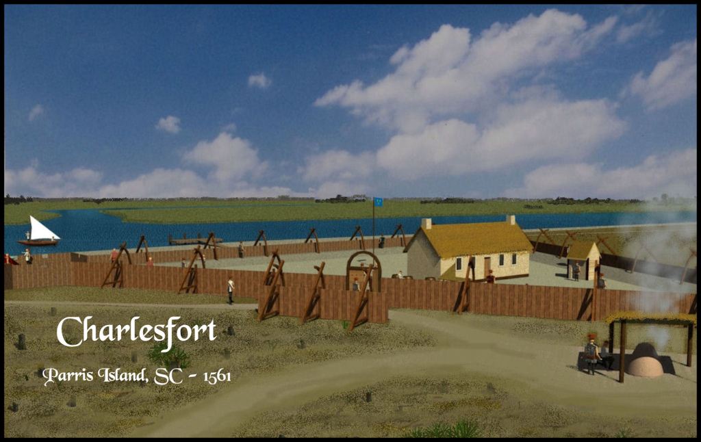
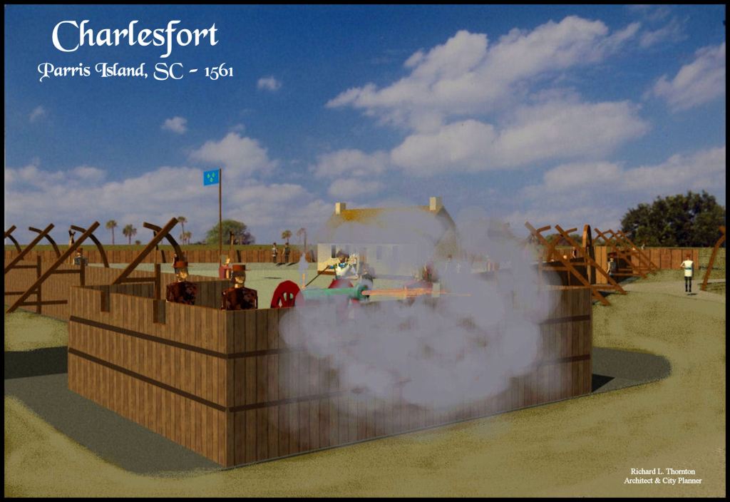
Charlesfort (1561-1562)
Parris Island, South Carolina

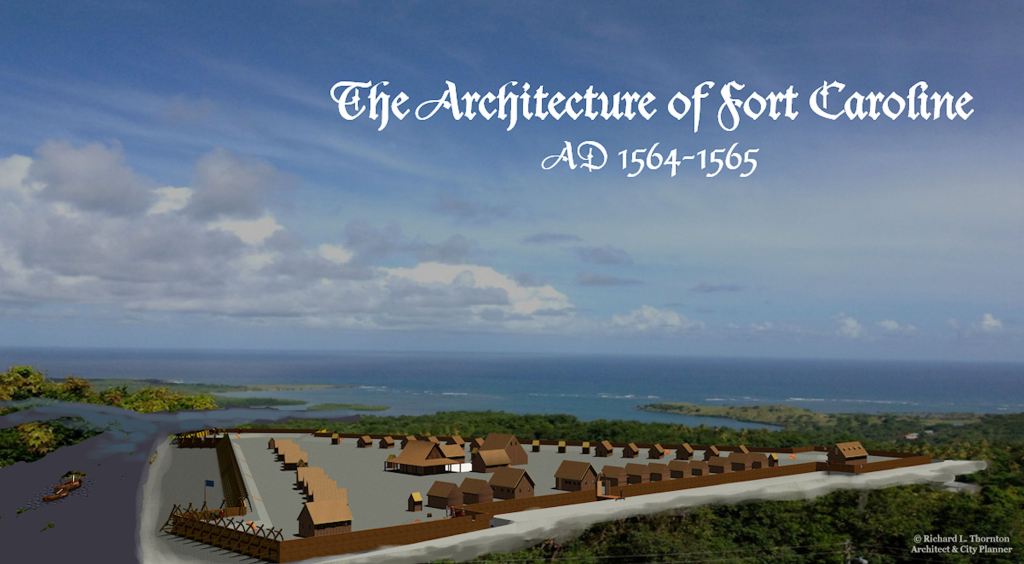
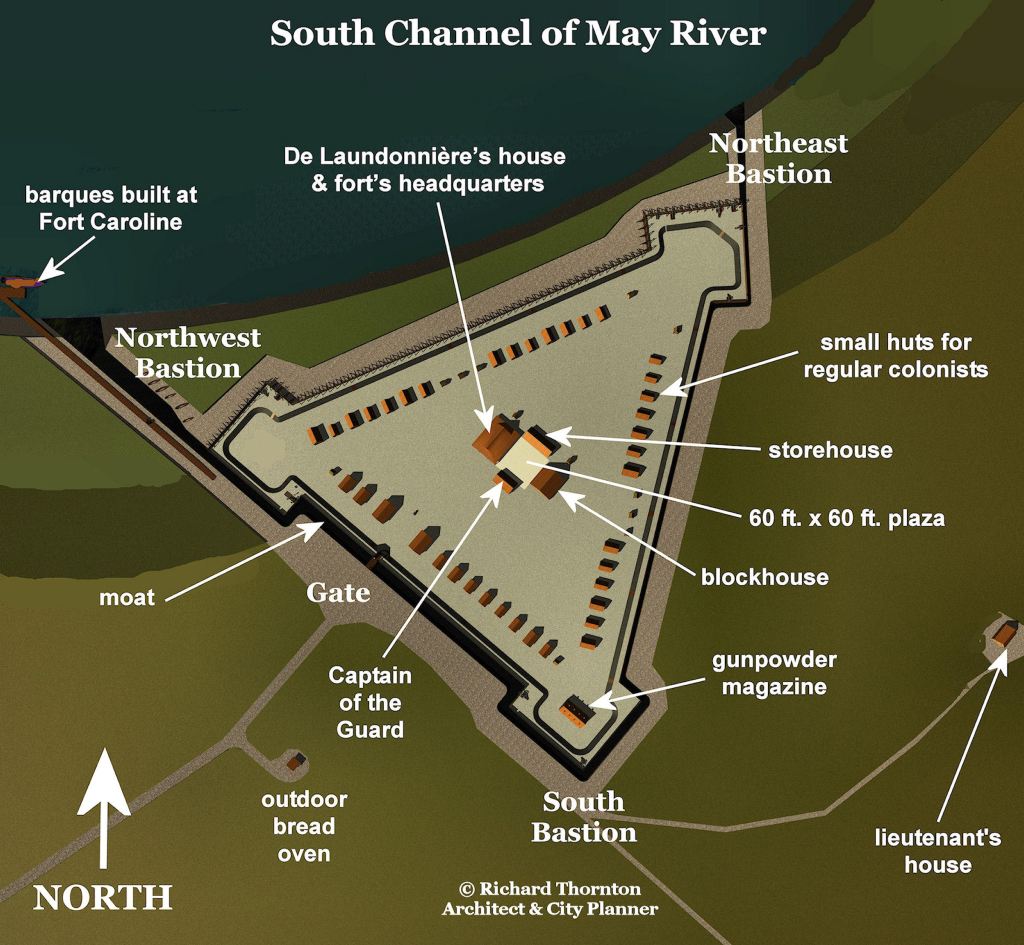
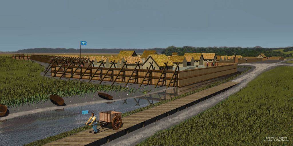
Fort Caroline (1564-1565)
On the south side of the Altamaha River’s mouth in Glynn County, Georgia*
*The myth that Fort Caroline was located on the St. Johns River near Jacksonville, Florida was created by a real estate speculator from New York in the 1840s. He also created the myth of the Fountain of Youth on his lands near St. Augustine, Florida. All European and American maps in the 1500s, 1600s and 1700s equated the May River with the Altamaha River in Georgia. If they labeled Fort Caroline’s location, it was placed about 11 miles from the ocean on the south bank of the Altamaha.
Botanist and explorer William Bartram visited the site of Fort Caroline, while staying at a plantation on Broughton Island, GA and described that visit in his famous book. In 1934, Smithsonian archaeologist, James Ford, unearthed many 16th century French and Spanish artifacts from the sites of Fort Caroline and San Marco on the Altamaha River.
The Fort Caroline that you see near Jacksonville is an inaccurate 1/12th scale model, built in 1961. Despite 80 years of digging by archaeologists, no 16th century artifacts have been found at the fake location of Fort Caorline. The real Fort Caroline was a massive, fortified town, designed to hold at least 1,000 residents.


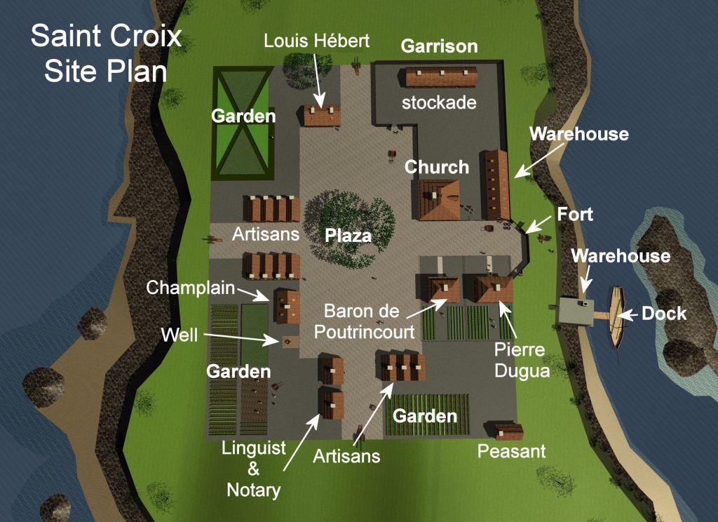
Ville de St. Croix (1604 – 1605)
An island in the St. Croix River between Maine and the Province of New Brunswick