
This is an astonishing advancement for regional historic preservation efforts. Now readers, who are exploring the Kingdom of Apalache with me in 2023 will be able to view and even download LIDAR images of the archaeological zones that we are visiting! The resolution and quality of this continuous imagery is superior to what I purchased from the county planning department for use in the Batesville, GA area. Above is the new imagery.
by Richard L. Thornton, Architect and Urban Planner
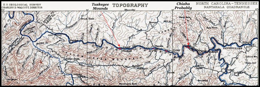
As stated in the De Soto and Juan Pardo Chronicles, the town of Chiaha was situation on a long island in the river, with the mounds being constructed on the upstream end of the island. Most of the island remained under water, when Fontana Lake was partially drained.

A big, standing up salute to the United States Geological Survey and the Library of Congress. Late in the Obama Administration, they completed digitization of their topographic map and satellite imagery archives. These were posted online in a user friendly website.
This information almost immediately enabled me to find the location of the famous Itza Maya town of Chiaha on an island in the Little Tennessee River in western North Carolina. It is now under Fontana Lake, but the archived maps contained an 1904 survey of the island before Fontana Lake was built and one of the old satellite images clearly showed the mounds above water, when the reservoir was drained for crews to make repairs to the dam.
The USGS is now adding very recent LIDAR imagery to their multi-layered website. One first sees a topographic map on the screen then has several options offered to enhance further analysis of the local. The LIDAR imagery is extraordinary, because it will enable researchers to quickly analyze vast areas of terrain for the vestiges of ancient and colonial period human occupation sites.
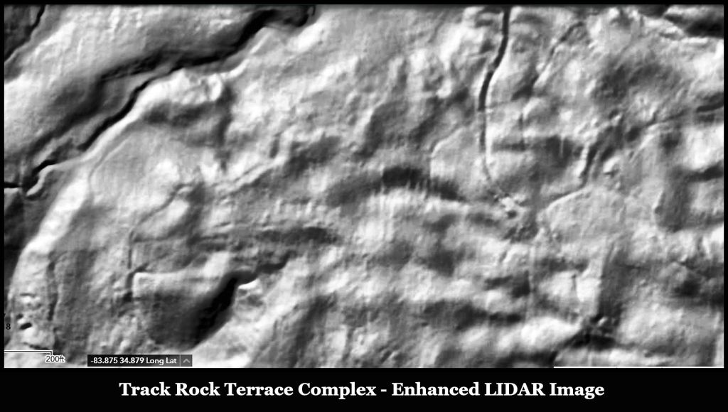
The Track Rock Terrace Complex
Based on the terrace complexes that I had seen in Chiapas State, Mexico and the Highlands of Guatemala, I have long suspected that the original terraces at Track Rock Gap, Georgia were much more extensive. They were created with logs. However, the LIDAR image created for the History Channel’s American Unearthed premier in 2012 by a contractor, only displayed visible stone walls. I had no affordable way to confirm my suspicions.
The more advanced equipment used by the US Geological Survey in 2022 also measured the infrared light absorbed by the soil. Thus, cultivated terraces soils were darker. The higher resolution of USGS LIDAR imagery provided an opportunity to look more closely at the soil surface.
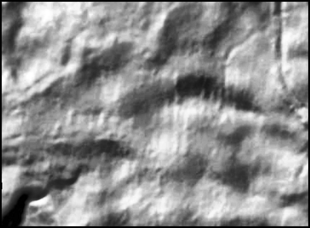
At the scale of the image of Track Rock Gap on the computer monitor screen, stone retaining walls are prominent, The much more numerous terraces, created by stacked log walls are faint. However, by enhancing the imagery with Corel software, I was able to distinctly see many more former terraces walls. Not only did the agricultural terraces cover the slope of Buzzard Roost Mountain, but they also were constructed far beyond the areas, where stone wall are visible. Below is a magnification of the central area of the image above.
Using the USGS website
Accessing and utilizing the USGS web site is quite simple.
- Go to: https://apps.nationalmap.gov/viewer/
- At the top of the screen, which you see at the top of this article click the “Layers” logo.
- On the pop down “Selections” window, click “3 DEP Elevation – Hillside stretch.”
- Either type in the Latitude and Longitude in the “Search Box” in the upper right hand corner of the screen or click a spot on the USGS topographic imagery on the screen. The USGS server will begin searching for and displaying any available LIDAR imagery for that location.
The LIDAR imagery is continuous. You can pan across the landscape with your mouse to look for other man-made features.
A word of caution
The latest LIDAR software is able to remove most man-made buildings from an image, but not the artificial grade created by construction of that building. The sites of houses and barns often appear as terraces. Almost always, these modern terraces are accessed by a road.
Happy Hunting!

THIS is so very cool, Richard!!! Thanks!
LikeLiked by 1 person
I very much enjoy reading your articles.
Wilma Morgan
LikeLiked by 1 person
Nice that you have this map to back up your research Richard. Very interesting. Hope all is well with you.
LikeLiked by 1 person