Mid-20th century archaeologists unearthed many, large Native American towns, burned, abandoned or buried under a deep layer of sand around 1700 AD in the southern tip of the Blue Ridge Mountains and the Blue Ridge Foothills. No scientists, since then, have tried to determine the cause of the catastrophes. In fact, academicians are generally unaware of this mystery, because the next generation of archaeologists redacted it from textbooks and lectures.
by Richard L. Thornton, Architect and City Planner
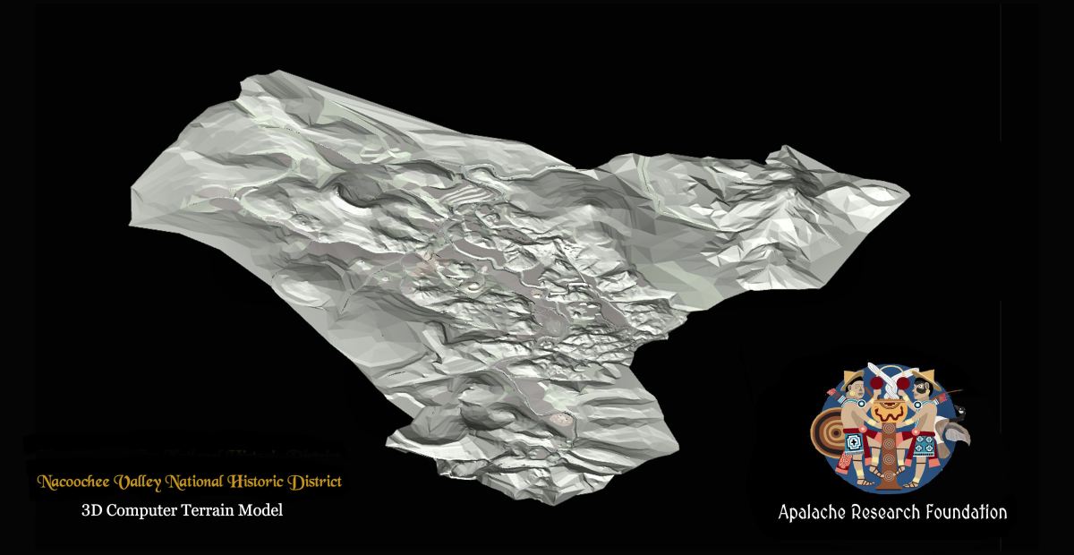
Image Above: This is a computerized terrain model of the Chattahoochee River Basin from its source on Brasstown Bald Mountain, 16 miles southward to its entrance into the Blue Ridge Foothills Region. Several large volcanic cones and craters are visible, which were once capable of devastating an entire region, but as far as anyone knows, these mountains have not erupted in many millions of years. However, like many property owners in the eastern part of the Nacoochee Valley, I have found young lava bombs and pockets of volcanic ash in my top soil. These may be from Chimney Mountain. seven miles to the north. Chimney Mountain and nearby Dick’s Knob are rarely erupting gas volcanoes. There many be a much more dangerous volcano, nearby, which everyone is missing.
Chimney Mountain in White and Habersham Counties, GA – now a gas volcano
Dick’s Knob in Rabun County, GA – now a gas volcano
There are dozens of extinct volcanoes in North Georgia’s landscape
In several earlier articles on the Chattahoochee River Headwaters Basin and the Nacoochee Valley, we have mentioned town sites occupied at least as early as 1000 BC that were abandoned around 1700 AD or town sites, covered in five to 15 feet by alluvial sand. The significance of these two traits are extremely important in understanding the region’s ancient history. Unfortunately, I can’t fully explain either one. However, I can tell you what is known at the present.
Early colonial explorers described what are repeatedly labeled the most advanced indigenous cultures, north of Mexico in the southern tip of the Blue Ridge Mountains. These accounts begin with the De Soto Expedition and continue onward until the 1690s, when Governor James Moore of Carolina led two expeditions in to the region. Then in the 1720s and 1730s, when the Provinces of Carolina and Georgia sent representatives of the colonial governments in to the region, they found no large towns and in reality, few residents.
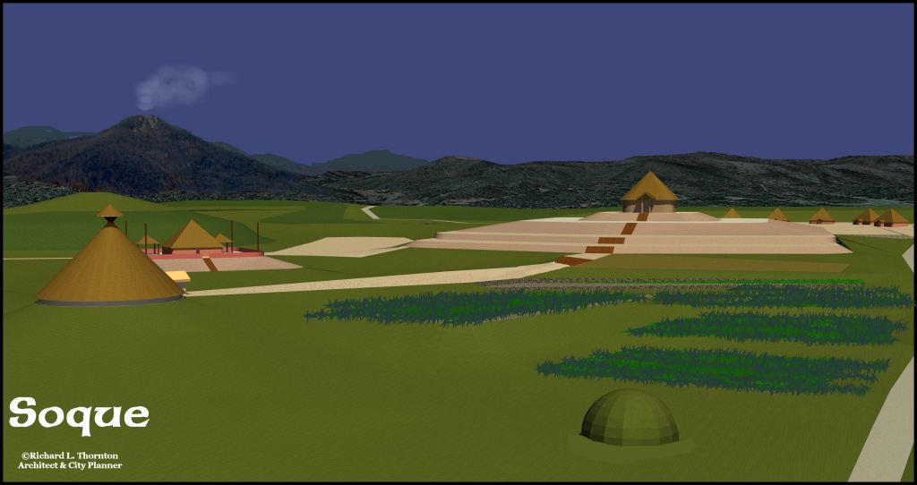
The Creek, Chickasaw, Soque and Uchee were agriculturalists, but lived in modest villages with no major public works (with the exception of the Soque Capital on the Soque River. Nevertheless, the Soque Capital obviously contained many more people in the past.
The Rev. Charles Wesley (Indian Agent for Georgia) in 1737 described Tugaloo on an island in a tributary of the Savannah River as “as a wretched village of about a hundred Uchees.” The island contained eight large mounds, but none were being utilized. A Georgia State Historical Marker today describes Tugaloo as “a great Cherokee town, the first in Georgia in 1350 AD, where Cherokee priest maintained sacred fires night and day.” Actually, until around 1700 AD, it was a great Creek town, founded around 800 AD.
Before 1700 AD
In 1646, Governor Benito Ruíz de Salazar Vallecilla had ordered construction of a road from St. Augustine to the headwaters of the Chattahochee River, where lay the largest Native American metropolis in North America. A fortified trading post was constructed there in order to develop the deerskin trade with the Apalache Indians of the Apalachen Mountains.
In 1653, English explorer, Richard Brigstock, spent most of a year there in the Nacoochee Valley. It was the capital of the Kingdom of Apalache. Its residents dressed in colorful tunics, very similar to those worn by the advanced peoples of Peru. There were no fortifications because the King of Apalache bragged that he could summon over 7,000 warriors within two days walk of the capital.
In 1693, Governor James Moore led an expedition of mounted Redcoats to visit the Capital of Apalache. As they approached the Nacoochee Valley from the east, the party saw numerous plumes of smoke. His Native American guides told him that the plumes were where numerous Spanish gold miners and their Apalache Indian laborers were smelting gold. The South Carolinians beat a hasty retreat.
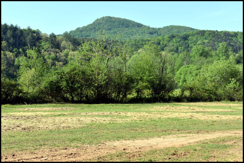
Archaeological Site 9WH28 – This section of the Nacoochee Valley is today the pasture for Chattahoochee Stables. In the foreground is the probable location of the 1646 Spanish fort. Beyond the tree line is the location of a Native American town site, excavated by archaeologist Robert Wauchope. It was permanently occupied from around 1000 AD to 1700 AD. Prior to that time period, it was a seasonal village site for hunter-gatherers. Over the town site, Wauchope had to cut through from 5 to 15 feet of alluvial sand, showing no evidence of human occupation. In the background is Sal Mountain, which is an extinct volcano . . . we hope!
Here is what we know
Maps – The last map to show the capital of the Apalache Kingdom (or Confederacy) in the Nacoochee Valley was Robert Morden’s Map of North America, published in 1693. The next map that showed any detailed information on that area was drawn by Colonel John Barnwell in 1721, while he was supervising the construction of Fort King George near present-day Darien, GA. It shows the Itsate Creek towns of Chote, where Helen, GA is now and Itsate, where Sautee, GA now is. There was no Chote in Tennessee until the 1750s. The Georgia Chote also outlasted the Tennessee Chote by three decades.
In 1818, Yale College Natural Scientist, Elias Cornelius, surveyed Etowah Mounds. Mound A looked quite different than today . . . more like the Pyramid of the Sun at Chichen Itza. Cherokee Indians, living nearby, said that when Cherokees moved to Northwest Georgia in 1793, the town at Etowah Mounds was abandoned. They never lived in or near the mounds, because “they were haunted.” Cornelius examined the largest trees growing among the mounds. The oldest were slightly more than a hundred years old . . . so humans were living there to around 1700.
In 1939, archaeologist Robert Wauchope spent much of the year excavating Native American town and village sites in the Nacoochee Valley. On all sites adjacent to the Chattahoochee River he encountered a layer of alluvial sand, containing very few artifacts and no evidence of human occupation. The sand seemed to have been deposited at one time. There were no obvious layers. Wauchope speculated that there had been an apocalyptic hurricane come through the mountains around 1700 AD or something had caused all of the snow on the mountains to melt instantly.
Above the sand stratum, all of the artifacts were those typical of European manufacture in the 1700s and early 1800s. Wauchope never found any definite Cherokee pottery or ornaments in Northeast Georgia!
Below the sand stratum there was a continuously evolving record of Native American presence going back to the Ice Age. In soil nearest the sand stratum was a mixture of the finest quality Lamar pottery and either 16th or 17th century European artifacts – mostly weapons, axes and copper pots.
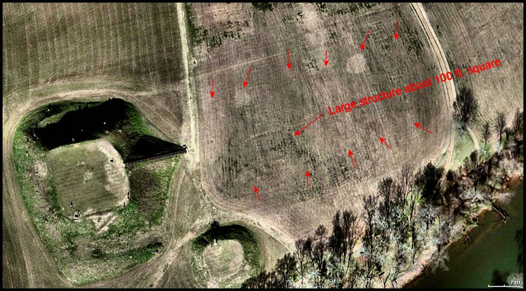
In 1954, archaeologists Arthur Kelly and Lewis Larson began preliminary work at Etowah Mounds. Noticing circles of greener grass on the main plaza, next to Mound A, Kelly ordered the sod to be scrapped away. What was found were two lines of 35-50 feet diameter houses, typical of the Apalache elite in the 1600s, plus a square structure about 100 feet on each side. Mixed with Lamar Culture artifacts, typical of the Creek Indians were 16th century European artifacts. Just as interpreted by Elias Cornelius, this occupation of Etowah Mounds had ended around 1700 AD.
In the early 1990s, a team of University of Georgia anthropology professors supervised the renovation of the Etowah Mounds Museum. They removed all references to and photographs of this 17th century occupation. They then created a false diorama as the focal point of the museum, which stated that the famous marble statues had been hurriedly buried around 1585 AD, when the town was about to be sacked by an enemy . . . implying it was the Cherokees. In fact, the statues were found in a collapsed tomb in the base of Mound C.
In 1957, archaeologist Joseph Caldwell fully excavated Tugaloo Island. He found that the large town on the island had been continuously occupied by ancestors of the Creek Indians from around 800 AD to 1700 AD, when the entire town burned down. It had been occupied about 10 years later, by a small village of crude round huts – the Uchee.
In 1953 and again in 1959, archaeologists Arthur Kelly and Joseph Caldwell excavated the Chauga Site on the South Carolina side of the Tugaloo River. The site chronology of Chauga was almost identical to Tugaloo Island. Its structures had burned around 1700 AD.
In 1968, archaeologist Arthur Kelly excavated the Sandtown site on the Chattahoochee River. Sandtown was the name of a late 18th century-early 19th century Creek town at that site. Underneath the historical town was a larger Lamar Culture (Proto-Creek) which had burned around 1700 AD.
So what happened?
Epidemic? – It is known that a smallpox plague swept through the Southern Highlands in 1696. Perhaps the survivors of these plagues burned their towns and moved south. However, that does not explain at all the massive flood, which occurred in the Nacoochee Valley around 1700 AD, which deposited up to 15 feet of alluvial sand.
Volcanic eruption? There are vague accounts of an eruption of Chimney Mountain around 1700 AD. It seems to have consisted of a massive gaseous explosion that blew part of the top off the mountain. It exploded again in 1886, immediately prior to the earthquake near Charleston, SC, but there was no damage outside the slopes of the mountain, other than some rocks being shot into the surrounding countryside. Between 2017 and 2019, hot gasses killed the vegetation on the upper part of the cone. I have photos to prove it. However, Chimney Mountain is far too small to have cause entire towns to burn as far away as Tugaloo Island and Sandtown.
Comet or asteroid explosion? A large comet or asteroid, burning in the earth’s atmosphere, would produce enough widespread heat to burn Native American thatch roofs, but there is no mention of this occurring in the Carolina Colonial Archives.
Inland Hurricane? Hurricanes Opel and Zeta certain did a lot of damage to the forests of Northeast Georgia and caused severe flooding farther south. Hurricanes don’t cause entire towns to burn down, plus there is no mention of such a massive storm in the Carolina Colonial Archives.
Cherokee-Creek War? This is a popular interpretation among North Carolina academicians and Cherokee-files. Real history makes that assumption impossible. In 1700, there was no Creek Confederacy or Cherokee tribe. The word, Cherokee, does not appear on any map of the Southern Colonies until 1715. The Cherokee Tribe was created by Colonel George Chicken of South Carolina in 1725.
The provinces and tribes that would later condense into the Cherokee Tribe and Creek Confederacy were members of the Apalachen Confederacy in 1700. They were allies. Besides, Native American wars could not possibly create enough heat to melt all the snow in the Georgia Mountains, which then flooded the Nacoochee Valley.
So what do you think caused the Great Apocalypse of 1700 AD?

WOW! This is very fascinating!
LikeLiked by 1 person
Richard, does USGS have modeling events of North Georgia from the 1700s?
The blue ridge mountains and Appalachian mountains did some bizarre plate shifting near Pigeon Mountain near Lafayette, in fact the two plates push together near there, and there was a massive disruption at some point with the water table actually dropping at Pigeon Mountain. There are old newspaper reports of Pigeon Mountain being a volcano in the 1800s, but these accounts in Newspapers of the time were dispelled as a hoax.
For multiple people to burn their villages at the same time makes little sense. A massive earthquake might have disrupted village camp fires and burned villages maybe with water tables being exposed lead to massive flooding throughout the region as well.
Trace the water, it flows back to the Tennessee River, south to north flow, but past pigeon however it flows down to Alabama to feed the Coosa River at Lake Weis. South Chickamauga creek flows south to North and drains in the Tennessee River…I think that fault line might have something to do with your answer, perhaps not all, but at least some.
I believe you might be referring to a massive fault line running across North Georgia, and possibly a massive earthquake near where the Appalachian and Blue Ridge fault lines converge. This might have rocked some people’s world at that time if the faults were actively colliding and breaking water tables in the mountains.
Very Respectfully,
Zac
LikeLiked by 1 person
Extreme NE Georgia is actually a tectonic zone with multiple faults intersecting near Chimney Mountain. I live on the crest of the rim of an extinct caldera, which is 12 miles in diameter. It was associated with one of the first mass extinction events long before the dinosaurs.
LikeLiked by 1 person
I also believe this plate shifting is responsible for the formation of Cloudland Canyon and Little River Canyon on Lookout Mountain.
Its an East to West fault. But Ellisons cave has deeper North to South fault lines too.
The East to West fault falls relatively in line with some awesome caves at Pigeon Mountain and Cloudland Canyon and actually to Sand Mountain as well, it might push further over to the east to John’s mountain and beyond.
Take a look at the geologic carnage that happened at these places on google maps… you’ll see a divide too with water flow alterations. Little River Canyon is one of the few exceptions to south to north flow for waters draining to the Tennessee River, and it actually flows north to south on lookout mountain makes its way down DeSoto falls, and eventually drains into Lake Weis feeding the Coosa River.
I think it may be a massive geologic event followed by massive flooding in the Nacooche Valley, as dams certainly didn’t limit raging river flow and water table runoffs during those times.
North Georgia was a land of trial and tribulation at some point, and some of the most amazing geological formations came as a result of geologic anamolies
Very Respectfully,
Zac
LikeLiked by 1 person
Im going with the sun. A X-15 class CME or better might create the conditions that trigger earthquakes, volcanic eruptions and most of all lightning. Lithosphere conditions in SE highlands are conducive to charged particle conduction. It is well known the Appalachian areas are highly conductive to the ionosphere. Many lay lines heavy metals and conductive crystals are present in our area. Note the gold deposits in and around the nachoochee valley. A significant CME or coronal hole stream (or both) well timed facing earth can very well cause highly conductive plasma streams to connect and ground out voltage from atmosphere to lithosphere. And only at points that are highly conductive to electricity. Such as the mountains of the SE.
The electric storms of the day must have been astonishing. But you would think someone would have noted it in a journal or two. Or maybe those were burned up in the process of the electric storms.
CH
LikeLike