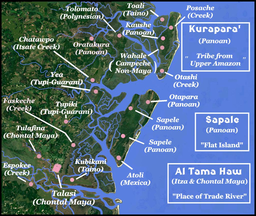
A detailed look at St. Catherines Island, Blackbeard Island, Sapelo Island and the mouth of the Altamaha River.
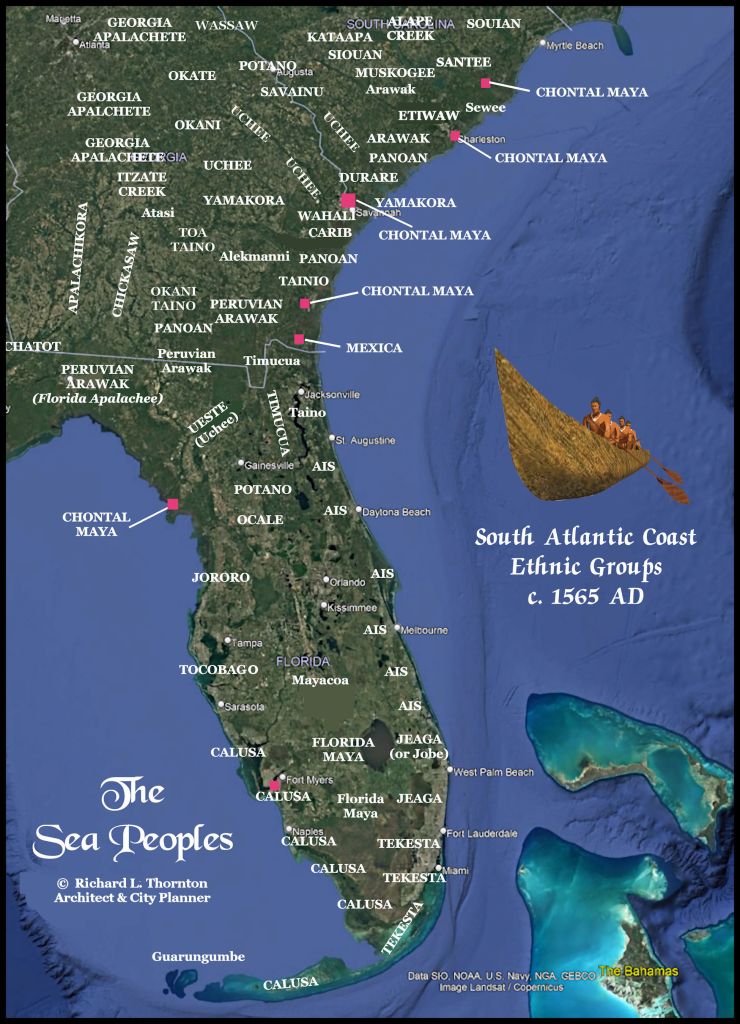
The ethnic identifies are based on a 20-year-long linguistic study of the surviving place names, tribal names and political titles from Winyah Bay, South Carolina to Key West, Florida.
Georgia had the highest population density and ethnic variety, because it contained the most land suitable for cultivation of Indian corn and Sunflowers. In contrast, most of Florida was monocultural.
These maps will also appear in the soon-to-be-published book, “The Sea Peoples of the South Atlantic Coast.”
by Richard L. Thornton, Architect and Planner