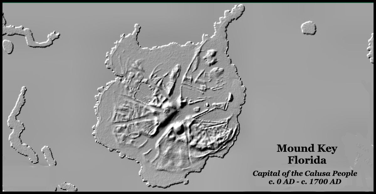
Application of the same type of USGS technology that I have been using in the Georgia Mountains has revealed extraordinary public works by the indigenous peoples of South Florida!
by Richard L. Thornton, Architect & City Planner
The Sea Peoples of the South Atlantic Coast series
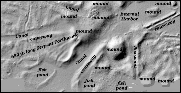
Details of the central area of Mound Key
Always learning something new!
Readers are probably getting tired of me saying that “this is what I know today. It might change tomorrow.” Here is another example. I have been forced to delay publishing the two books on the Indigenous Peoples of the South Atlantic region several months because of new discoveries.
First, archaeologist Bob Carr of the South Florida Archaeological and Historical Conservancy, Inc. sent me a copy of the archaeological site plan fpr the area in Downtown Miami, near the Miami River. where his team has been working. I was forced to re-create a computer model of that area, done for the Muscogee-Creek Nation 20 years ago. So much more has been uncovered since that time..
While working on the Miami computer model, I stumbled online upon a low resolution LIDAR run recently by archaeologists working on Mound Key, near Fort Myers, Florida. Even though individual ruins of architecture are not visible on their LIDA, it still suggests that the Calusa Capital was a complex town with many public works, not a simple village, occupied by hunter-gatherer people.
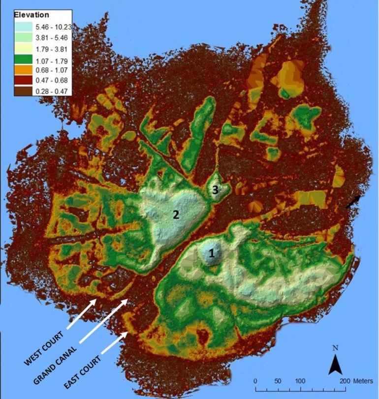
This is a LIDAR image of Mound Key, produced by an interdisciplinary research team, led by Dr. Victor Thompson from the University of Georgia and Dr. William Marquardt from the Florida Museum of Natural. The group includes partner institutions like Florida Gulf Coast University and Flagler College.
The type of LIDAR I use was developed by the US Geological Survey for use by architects and civil engineers for three-dimensional modeling. It is premised on the much more comprehensive knowledge of mathematics, physics and geology that is required by our professions, but enables us to obtain precise x-y-z dimensions of man-made structures on privately owned lands without crossing “no trespassing” signs. LOL Most of those massive stone or earthen structures that I have been showing readers in the past eight years are on private tracts, owned by family trusts. It is extremely difficult to get permission to go on-site with a laser measurer and surveying equipment.
Out of curiosity, I applied the US Geological Survey’s new remote sensing technology to Mound Key. As you can see, the results are astonishing. I am currently re-creating the computer model of Mound Key that I originally made 20 years ago . . . also for the Muscogee-Creek Nation. When it is finished, I will then apply the new LIDAR technology to the Ortona Site on Lake Okeechobee . . . also first done 20 years ago for the Muscogee-Creek Nation. I was able to see with much greater clarity and detail the ruins of canals, causeways, mounds, plazas and even fish ponds built many centruies ago.
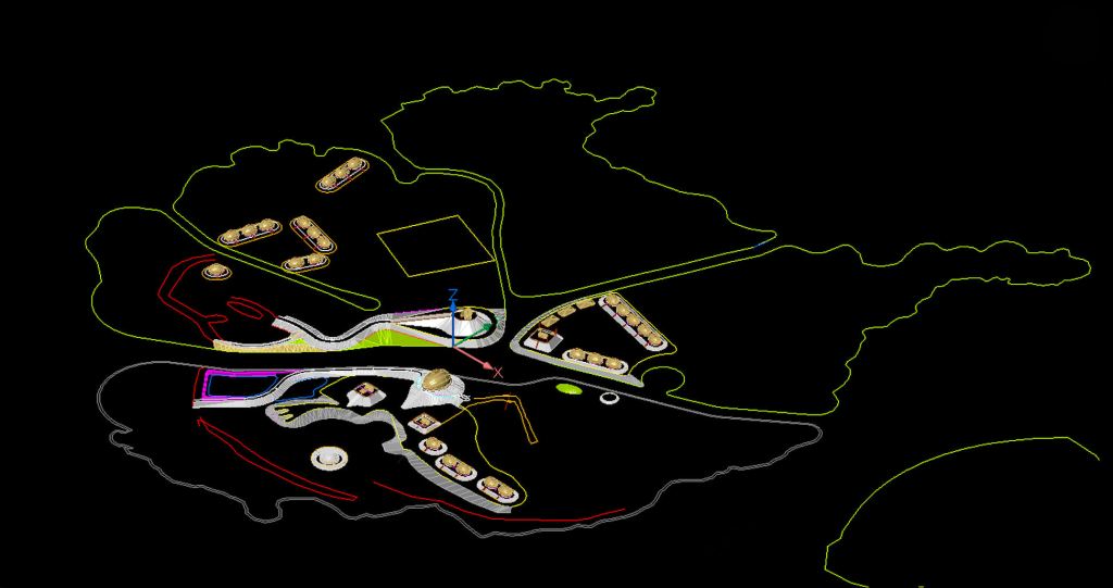
Snapshot made today (8/12/2026) of a work in progress. This is the appearance of the computer screen as I work on the CADD model for Mound Key.
Now you know!


Your work is amazing! what do you think about the recent research on the Pyramids of Giza based out of Italy? Do you think those satellite scans are really able to penetrate the earth to see that deep down? I’d like to think so, inquiring on your opinion of the subject.
LikeLiked by 1 person
The type of LIDAR I use will detect trees, boulders, modern buildings, building ruins, canals and ancient roads, but does not look deep into the earth. With this program, one is able to remove modern buildings and trees from the image, so you only see ancient structures.
I think that it is quite possible that the idea of building pyramids came from elsewhere. There are mounds in northern Louisiana and around Savannah, GA that long predate the pyramids in Egypt.
LikeLike
WOW! Great work, Richard! The images you are revealing to us are amazing. We appreciate the loads of information to your blog.
LikeLike
Thank you Mary Jane for your many kind comments!
LikeLike