Learn the REAL history of this famous archaeological site.
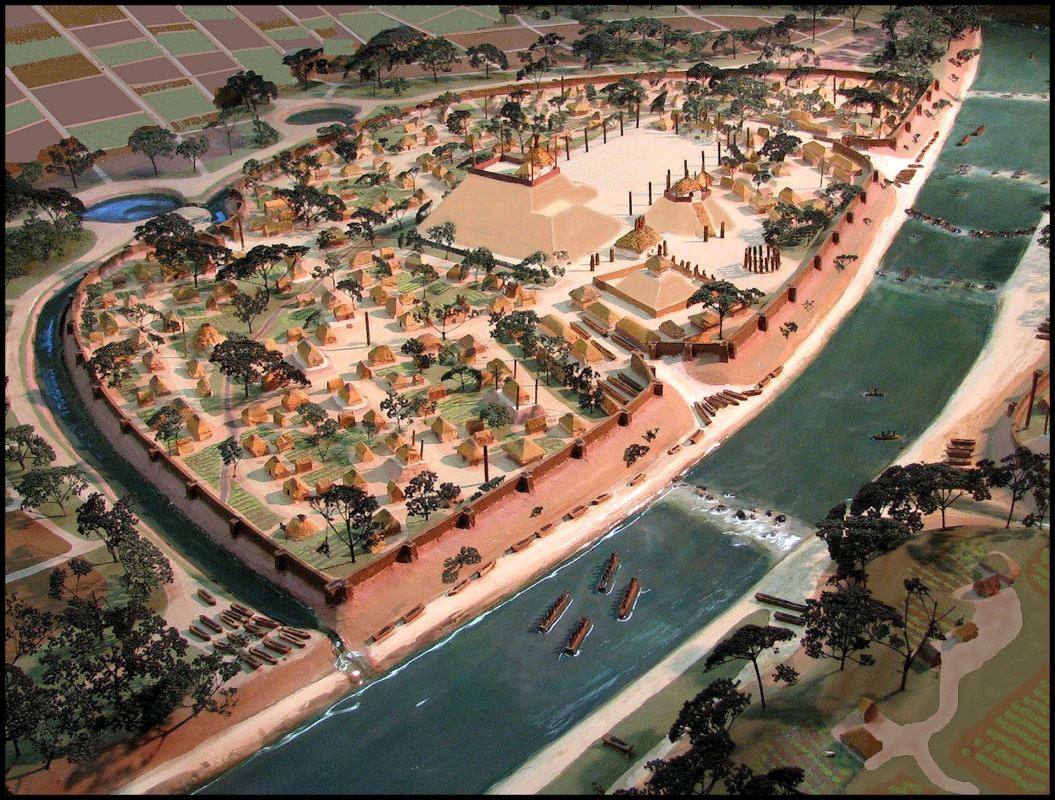
The archaeologists working at this great Creek town site in the 1950s, were not aware that until around 1200 AD, the Etowah River flowed around the northern end of the town.
Also, because archaeologist Robert Wauchupe did not publish the report on his 1939 work at Etowah, the 1950s archaeologists were not aware that original town of Etula (Etowah) covered the area now occupied by the river, plus a broad swath to the south.
Then in the early 1990s, “museum consultants” from the University of Georgia, who had absolutely no qualifications in museum design, rearranged and/or removed exhibits in the museum to create a fairytale that the Etowah site had never been lived on until “mysterious mound-builders” arrived around 1000 AD. The mysterious mound-builders were replaced by the Cherokees around 1585 AD. “No one knows what became of the mound-builders. ”
Then the state of Georgia replaced the documentary film in the museum auditorium with a program with a fictional 1000-year-history of the Cherokees in Georgia, hosted by Cherokee actor Wes Studi. Actually, the Cherokees never lived at Etowah Mounds and only arrived in the Etowah Valley in 1785.
Then in 2006, the Muscogee-Creek Nation contracted with me to build a world-class model of the town as it looked in 1375. I was only to show buildings revealed by infrared and LIDAR, or identified by archaeologists. However, the archaeologists did not know that the appearance of Mound A had changed radically in the 1800s. Artifact collectors paid the landowners $50 a week to dig there.
Then in the summer and early autumn of 1864, the First Ohio Volunteer Regiment, USA modified Mound A to make it an artillery fort. As they were being mustered out of service, the the Union veterans carried hundreds of artifacts home with them or else sold them to their commander, Col. Gates P. Thruston.
The real history of Etowah Mounds
SLIDE SHOW
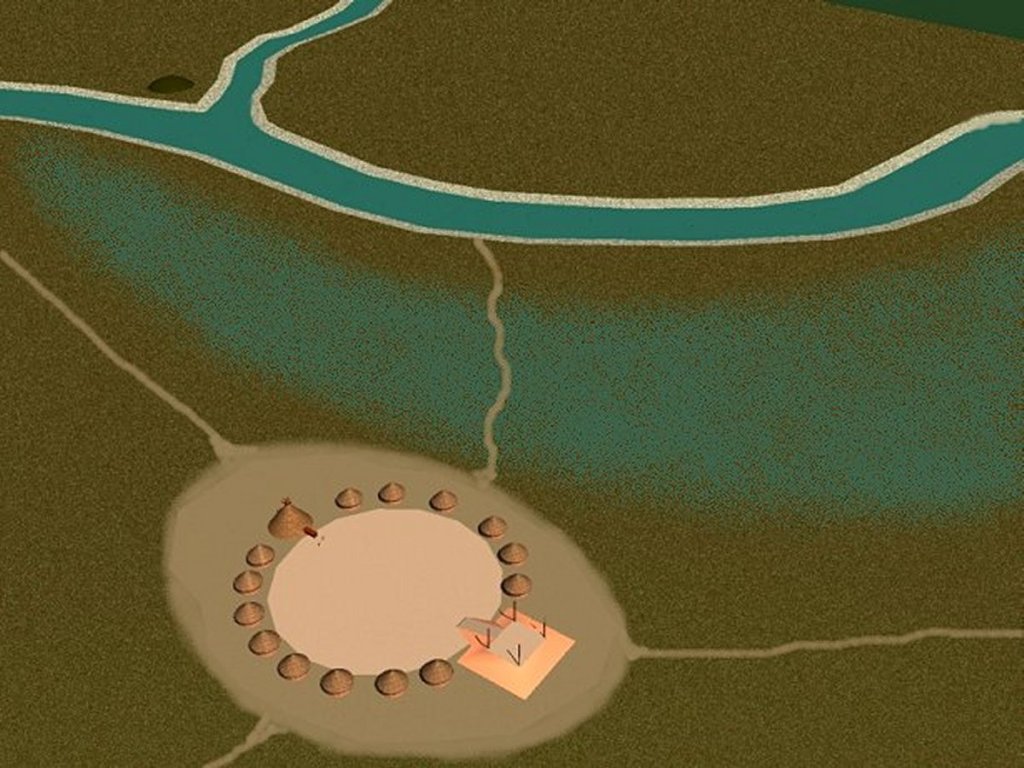
C, 800 AD – a small village of gardeners is founded on the south side of the river.
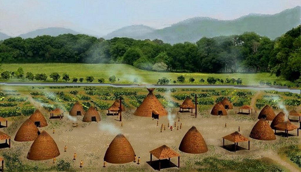
View of the gardening village
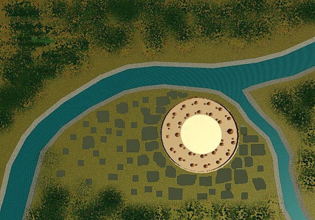
c. 800 AD – Woodstock Culture village on the south side of the river
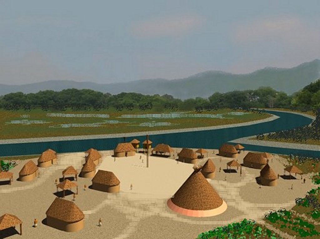
900 AD – Transitional Culture hamlet – probably Chontal Maya
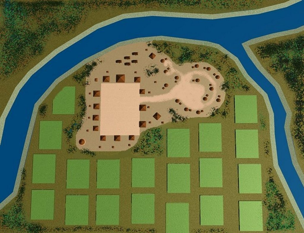
1000 AD – Much larger village of newcomers develops around over Woodland Culture village.
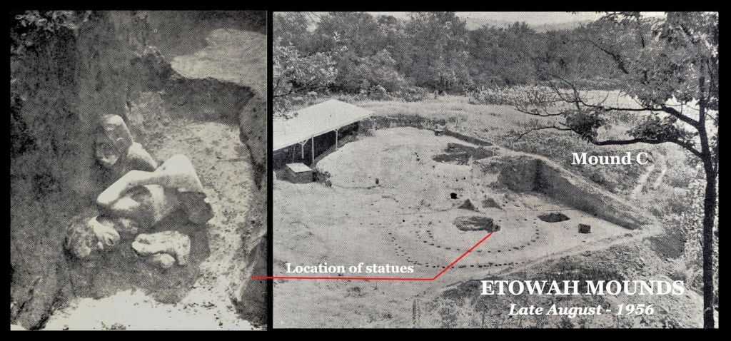
One of the first acts of the newcomers is to build a log temple, containing two marble statues. According to the famous Mexican archaeologist, Román Piña Chán, the statues were dressed in the mandatory clothing of Maya commoners. These statues would be discovered beneath Mound C on the last scheduled day of excavation in 1956.
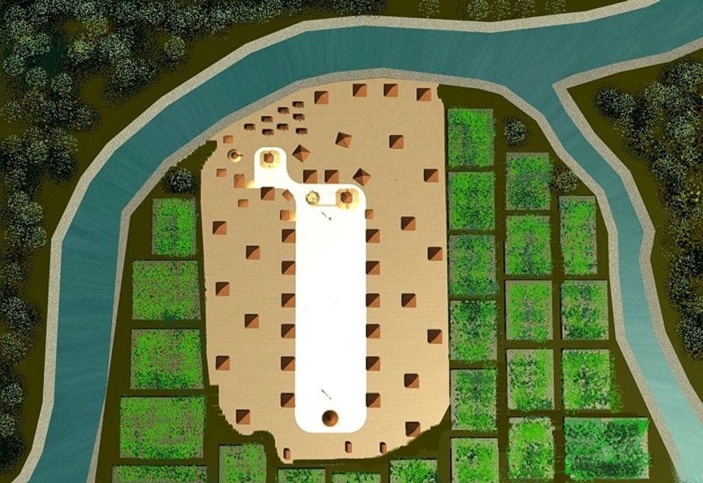
This village quickly grows into a large town on the south side of the river
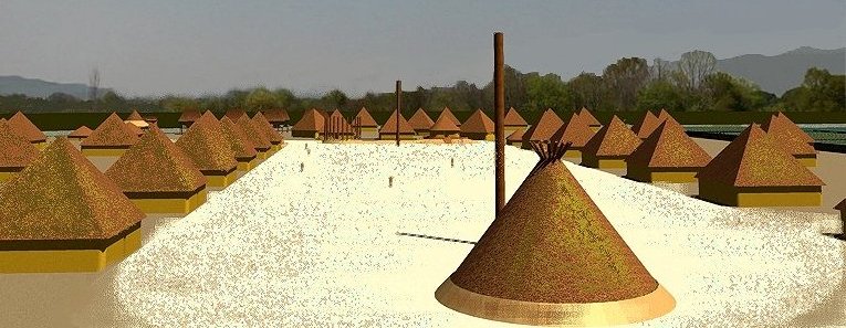
The houses in this town are identical to those in the suburbs of Chichen Itza. The chokopa on the south end of the town was excavated by archaeologists several years ago on the current south side of the river.
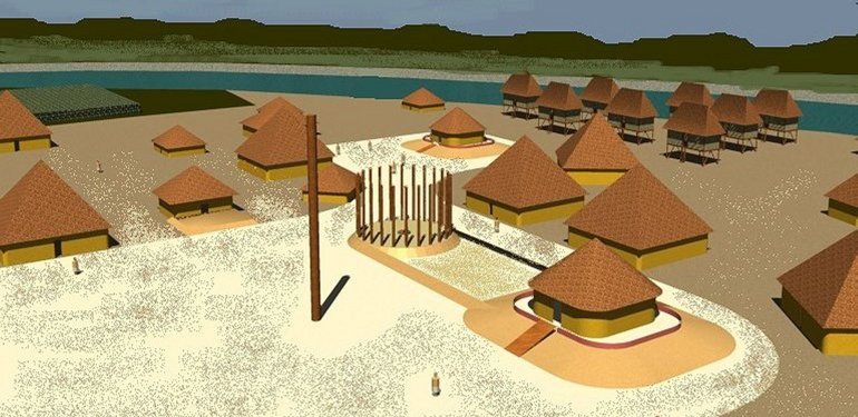
Modest mounds are constructed on the north end of the town’s plaza
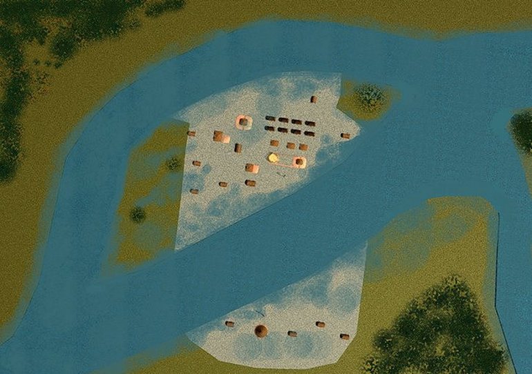
C. 1200 AD – a catastrophic flood covers the large town and cuts a channel through the heart of it.
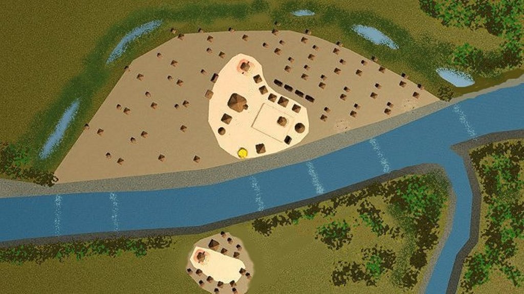
Around 1250 AD, people begin returning to the two tips of the town, now split by the river.
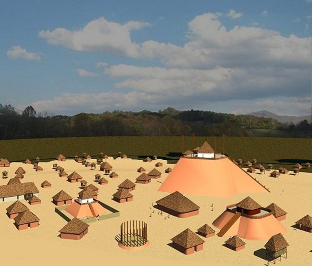
The new town began to grow rapidly as the existing mounds were greatly enlarged.
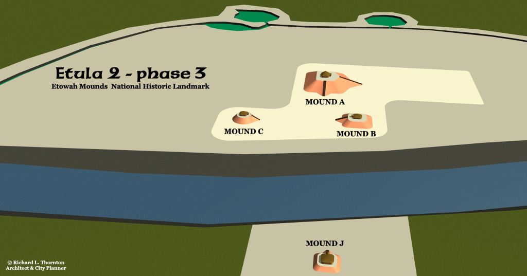
Some of the old mounds on the new south side of the river were also enlarged.
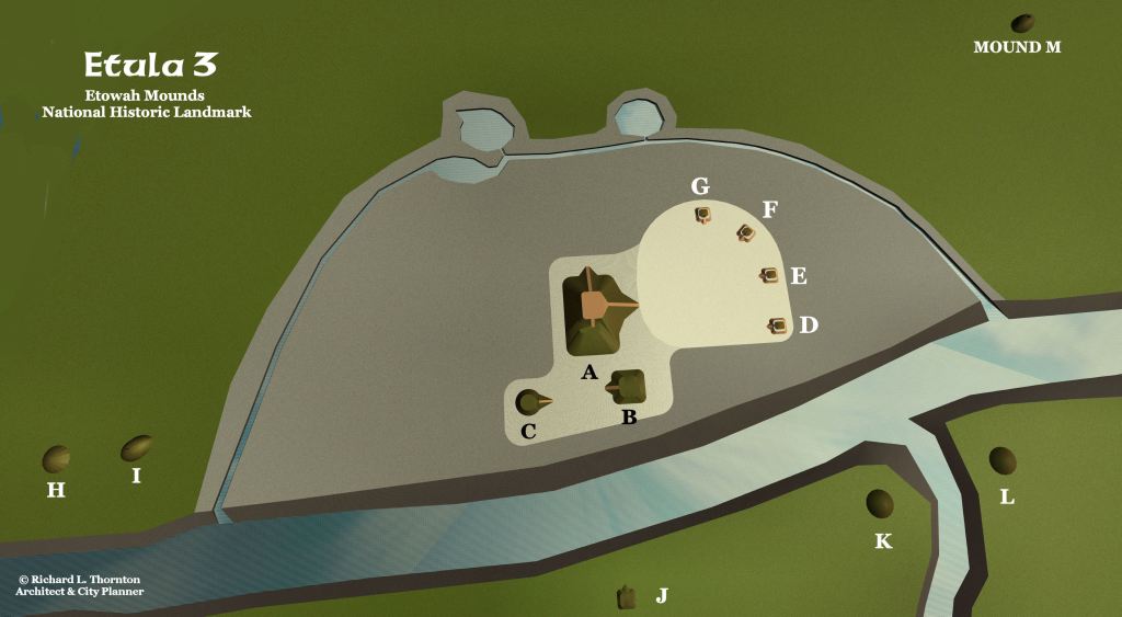
Around 1375 AD, Etula became an important town in the powerful province of Kaushe (Kusa). Mound A was not completely abandoned, but was not enlarged significantly.
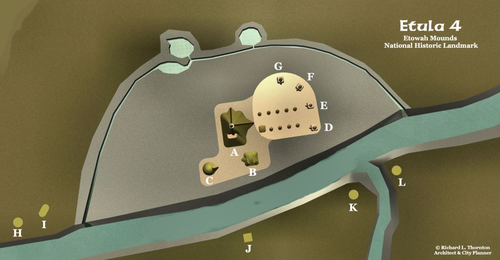
The Apalachicola Creeks Elite arrived around 1600 AD., They built large round houses on the old plaza and began expanding Mound A. Note the many mounds in and around the state-owned land that are not mentioned in museum exhibits.
Mound A was in its final form, a man-made volcano!
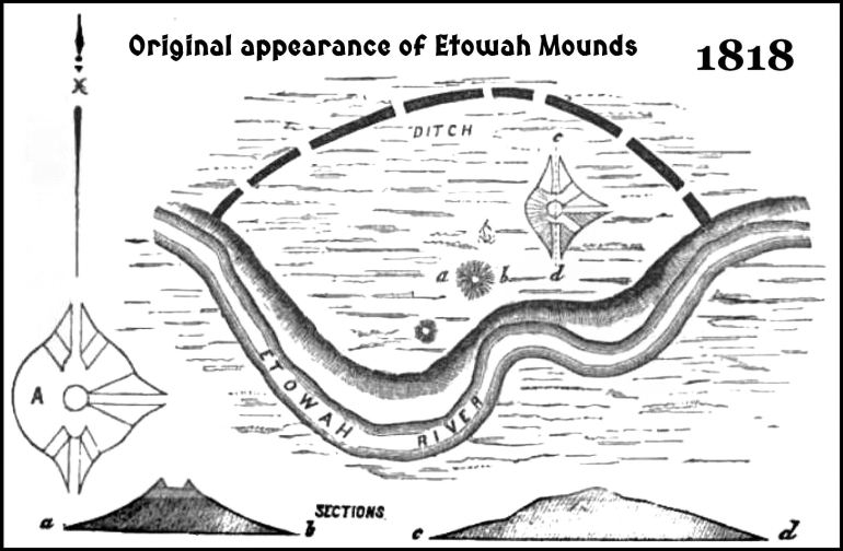
When surveyed by Professor Elias Cornelius in 1818, Mound A was about 100 feet tall. He noted in his drawings that even at early date, someone had excavated a pit in the top of the mound, probably looking for artifacts or gold.
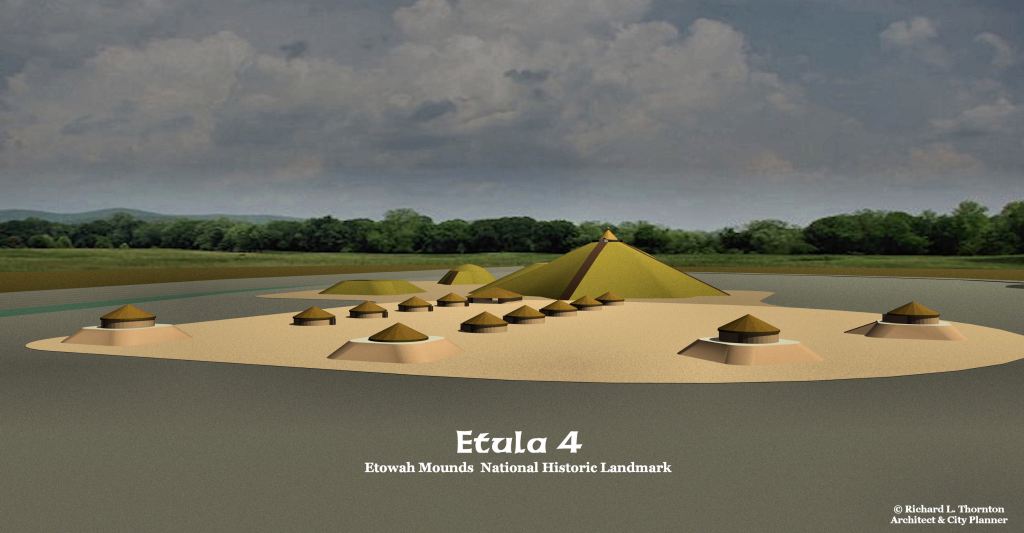
In 1818, Yale College professor, Elias Cornelius checked the ages of the largest trees growing on the Etowah town sites. They were about 100 years old. This suggests that the village at the mounds was abandoned about a hundred years earlier. However, several Apalachicola villages moved from the Northwest Georgia to the region around Pensacola, Florida at the end of the French and Indian War – 1764, Several more, located between Etowah Mounds and present-day Rome, GA, were allowed to remain when the Cherokees were given northwest Georgia in 1784. They were amonth the 3,000 Creeks, still living in Northwest Georgia when the Cherokees were deported by the US Government to the Indian Territory. Only about 800 of these ex-patriot Creeks were captured by soldiers and forced to join the Cherokees.
Now you know!

