38° 25′ 49.69″ N, 85° 36′ 56.06″ W
by Richard L. Thornton, Registered Architect & City Planner
President Thomas Jefferson considered Devil’s Backbone to be one of the most important archaeological sites in the United States. It is still arguably the most important archaeological site in Indiana, but has yet to be studied thoroughly by archaeologists.
Early Anglo-Celtic settlers in the Ohio Valley encountered abandoned fieldstone forts on hill top promontories in the region. They were assumed to have been built by an extinct European race since Native Americans were thought to be intellectually incapable of creating stone architecture. Popular explanations included that they were the ruins of castles, built by the Welsh colonists of Prince Madoc . . . that they were the ruins of towns built by the “Ten Lost Tribes of Israel . . . or that they were the ruins of forts, built by Roman legionnaires.
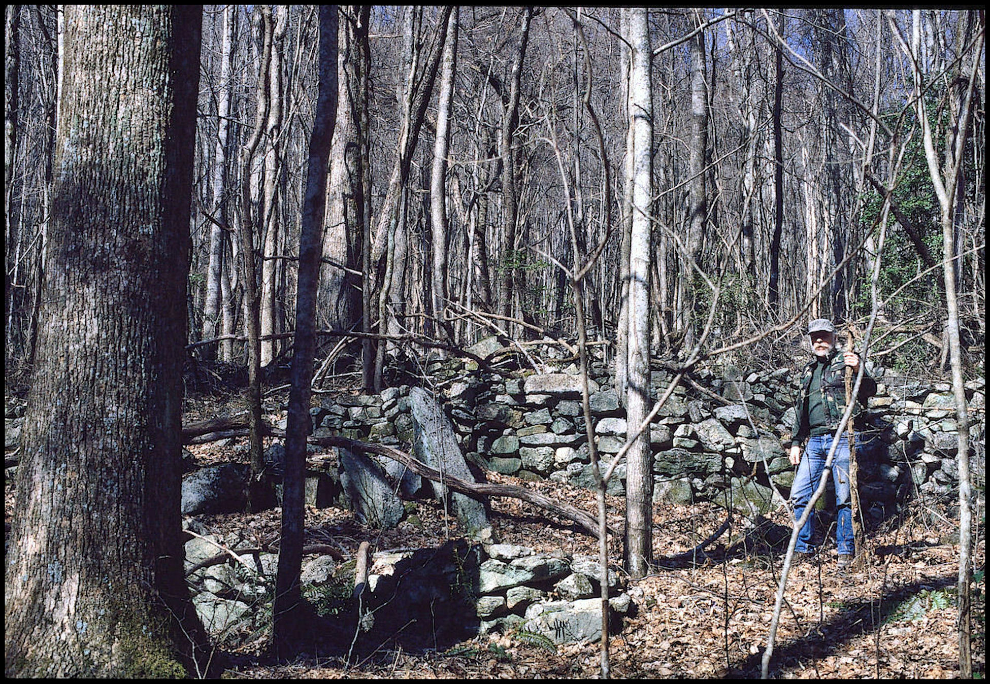
What these settlers found were sites that generally survived as linear heaps of fieldstones along the crests of natural terraces or flattened hilltops. There was little, if any evidence of residential or communal structures, other that a few earthen or fieldstone mounds. There were gaps in the stone “walls” that suggested gateways. The original appearance of these ruins was left to the imagination of the frontiersmen. Some imagined ancient castles. Others assumed that they were livestock enclosures. Serious, professional studies of these sites only began in the late 1800s after many had been seriously damaged by locals seeking building stones or buried treasures.
Until the late 20th century, the construction of these field stone enclosures were assigned by the archaeology profession to the “Hopewell People” that lasted roughly 200 BC through 500 AD. Many sites clearly also had ceremonial functions associated with the azimuth of the sun.
Now, archaeologists are not so certain about these sites, and if the Hopewell cultural traits even constituted one ethnic group. Some evidence provided by artifacts unearthed at these sites suggests that at least some of the “stone forts” were ceremonial sites initiated by participants in the Hopewell Cultural Complex. However, other evidence suggests that the construction of stone walls occurred during the time of the Fort Ancient Culture.
The Fort Ancient Culture is named after a fortified hill site near Cincinnati, Ohio. It first appeared around about 100 years after the town of Ocmulgee was founded in Georgia, and shared many cultural traits with the Southerners. However, like the ancestors of the Chickasaws of northern Georgia, northern Alabama and Tennessee, the Fort Ancient people lived in small towns or villages almost identical to known Chickasaw villages of that period until the 1700s, and did not build large mounds. That’s right! There is no hard evidence that the Fort Ancient Culture People built Fort Ancient. There was a Fort Ancient Culture village nearby, however.
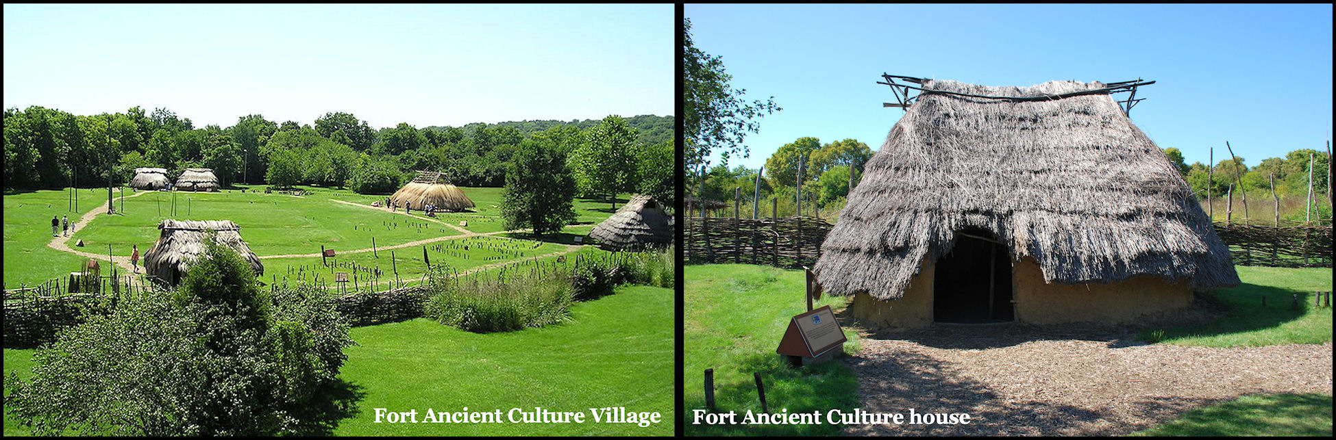
Although the Fort Ancient villages seem to be contemporaneous with the stone fortifications scattered in their midst, known Fort Ancient villages did not have stone architecture. Was there some other ethnic group in the region that erected stone architecture and established itself as feudal lords over the Fort Ancient People?
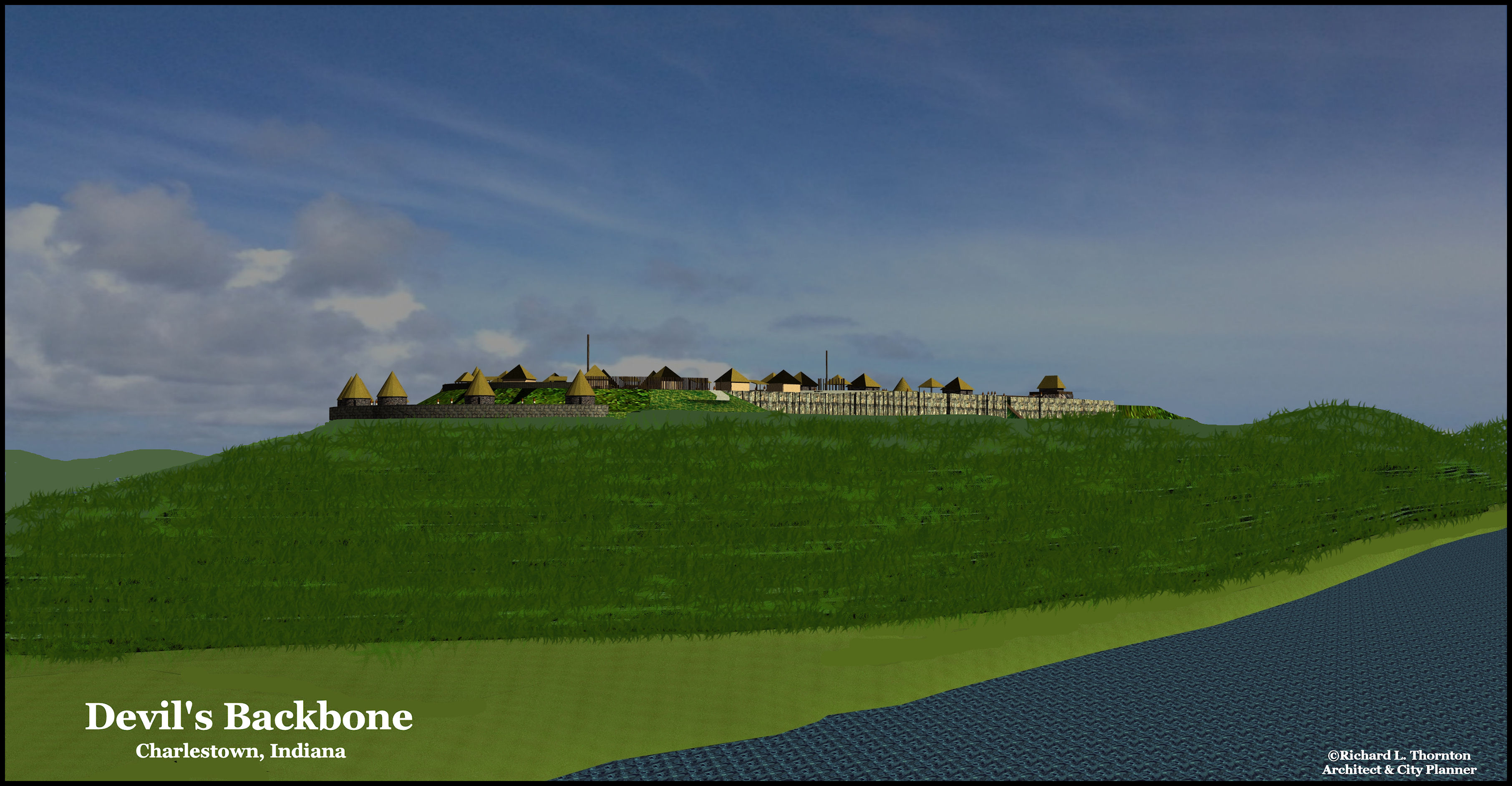
Devil’s Backbone Archaeological Zone
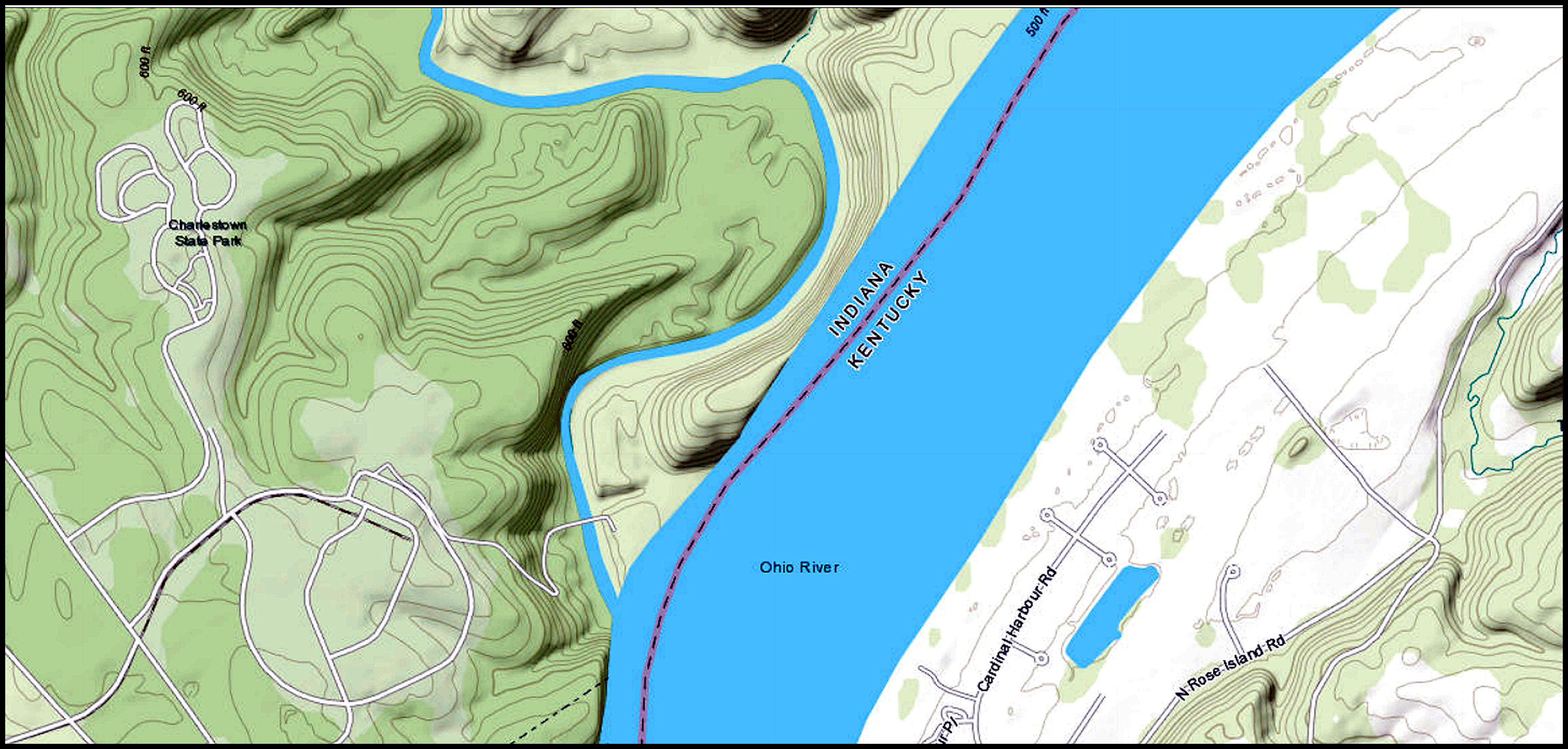
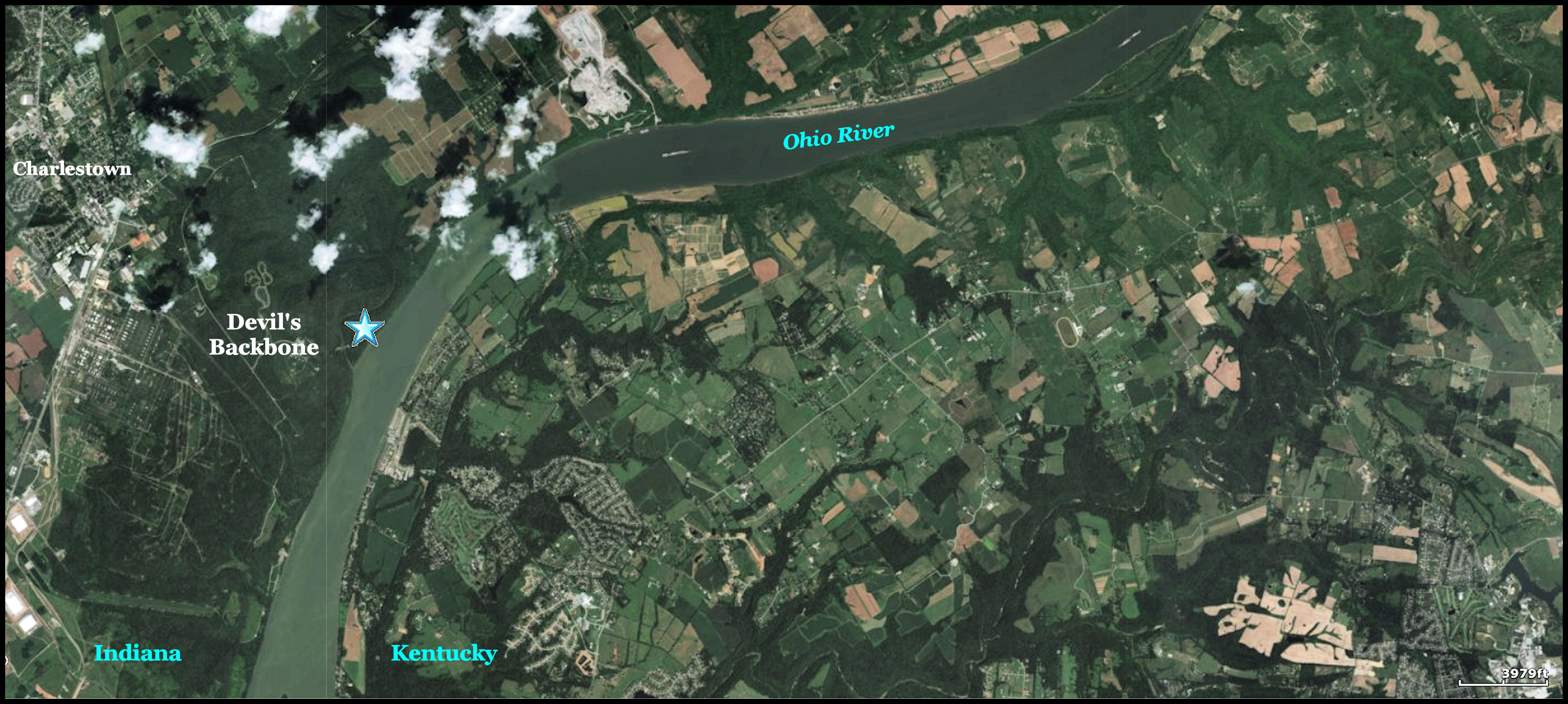
Devil’s Backbone is a sedimentary rock escarpment and peninsula formed by the flow of Fourteen Mile Creek into the Ohio River. The escarpment rises up to about 240 feet above the average elevation of the Ohio River. It is located within Charlestown State Park near Charlestown, Indiana and across the Ohio River from Louisville, Kentucky. This geological formation is believed to have been created by the processes of glaciation where a combination of ice sheet advances, meltwater flows and a diversion of the Ohio River left an isolated bedrock ridge remaining between two valleys.
Devil’s Backbone is a rock formation and peninsula formed by the flow of Fourteen Mile Creek into the Ohio River. The escarpment rises to about 240 feet above the average elevation of the Ohio River. It is located within Charlestown State Park near Charlestown, Indiana and six miles downstream from Louisville, Kentucky. The Backbone is believed to have been formed by the processes of glaciation where a combination of ice sheet advances, melt water flows and a diversion of the Ohio River left an isolated bedrock ridge remaining between two valleys.
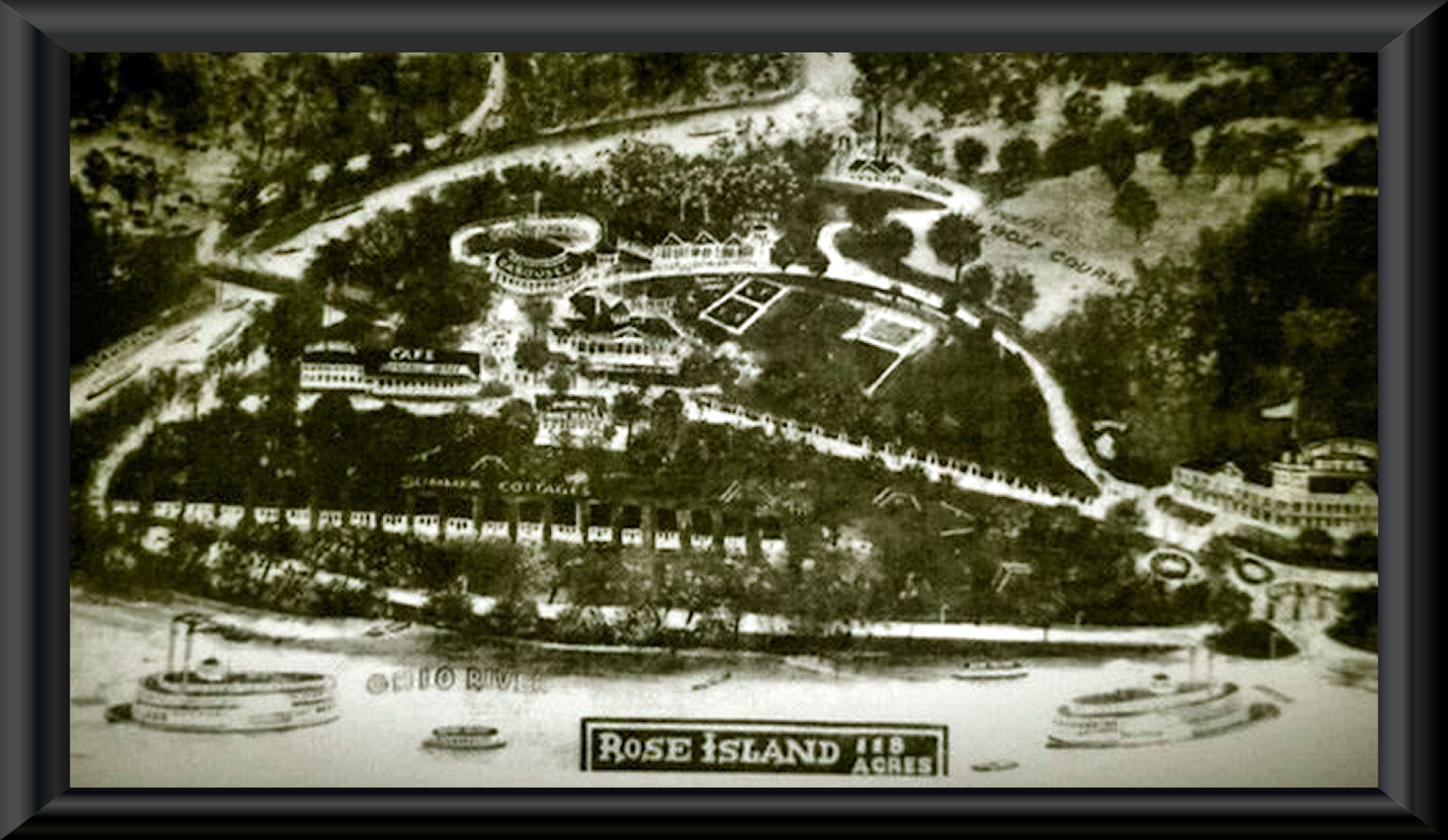
Rose Island, a Victorian Era amusement park, which remained popular until the Great Depression, was destroyed by the 1937 Ohio River Mega=Flood. It stood on the flood plain at the base of the ridge. The ruins of the amusement park are now incorporated into the landscape of the Charleston State Park. While grading was being done for the state park, a Moche-style figurine was found near the bank of the Ohio River. Earlier, another Moche-style figurine was found near the confluence of the Ohio and Tennessee River. It is on display at the St. Louis History Museum.
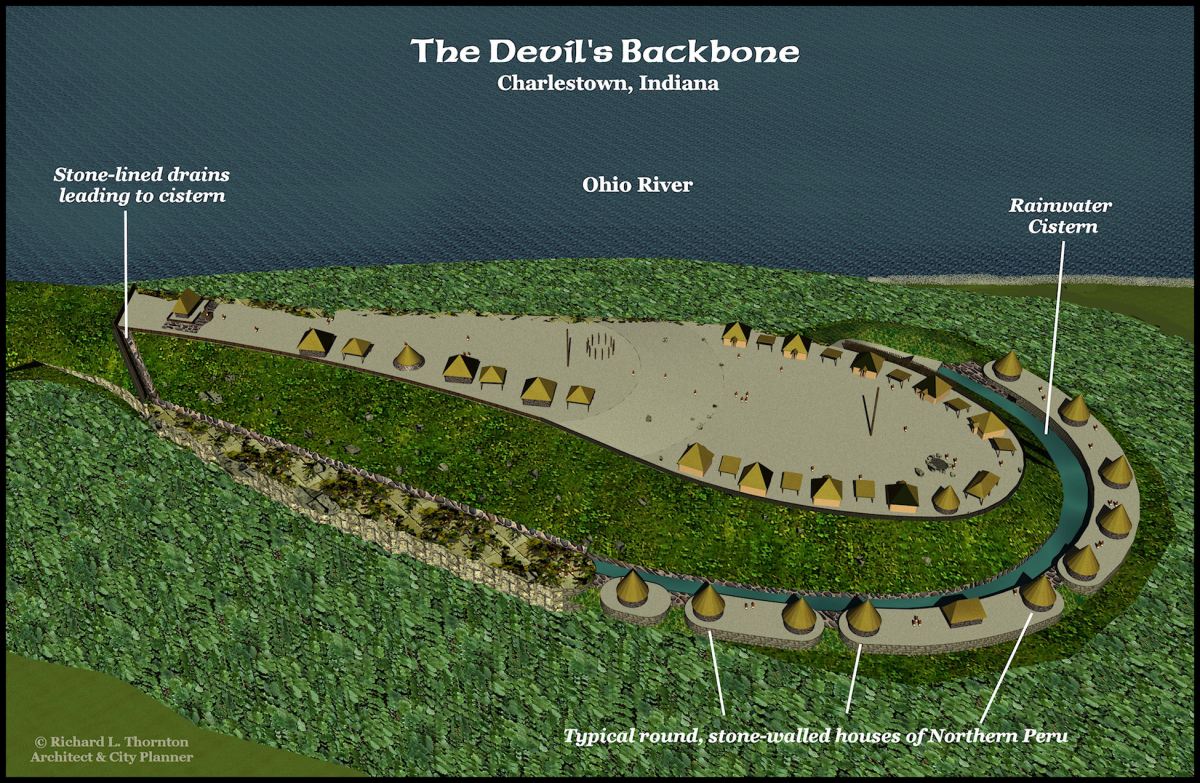
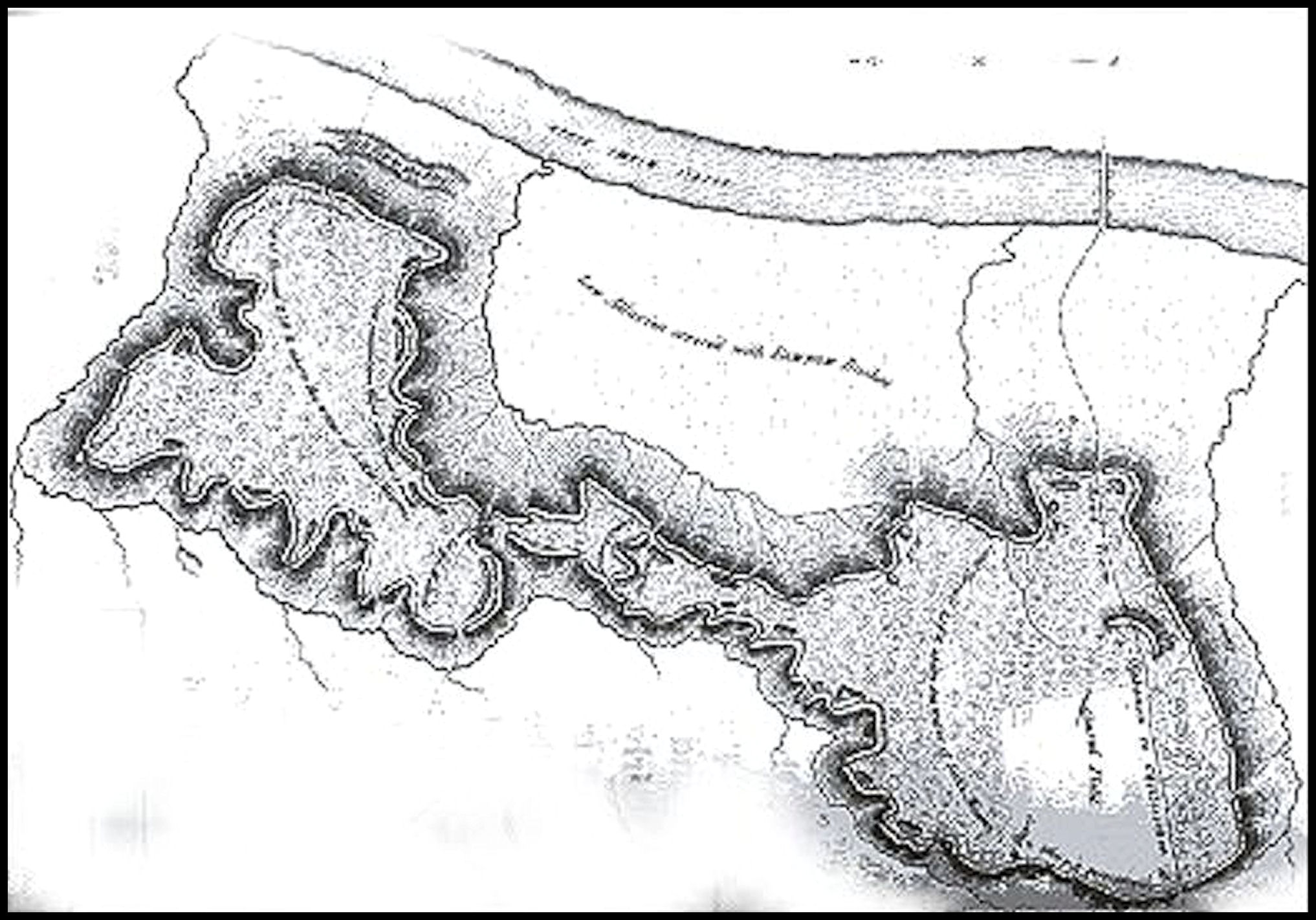
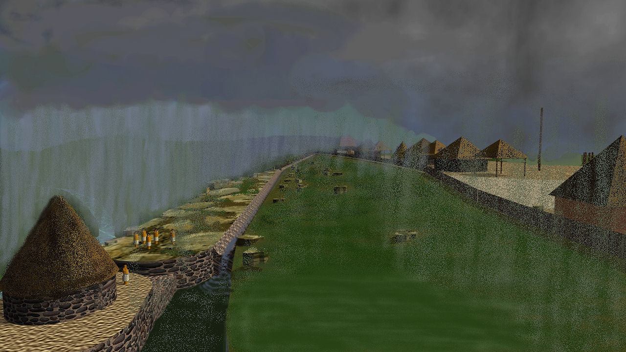
Enigmatic stone ruins are thickly scattered about the 20+ acre mesa atop Devil’s Backbone. What is especially unusual about this ite is the quantity of round and rectangular field stone structures. The southwest and northwest faces of the mesa contain large basins for storing rainwater. At the highest point on the escarpment is the ruins of a large, pyramidal mound that was veneered with stone in ancient times . . . just like many of the Meso-American pyramids and some Peruvian structures.
Before being destroyed by early settlers, the Devil’s Backbone site was considered one of the most important archaeological sites in the young United States. President Thomas Jefferson directed Meriwether Lewis to study the site on his way to leading the Corps of Discovery into the Louisiana Territory.
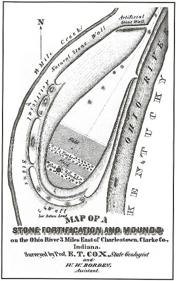
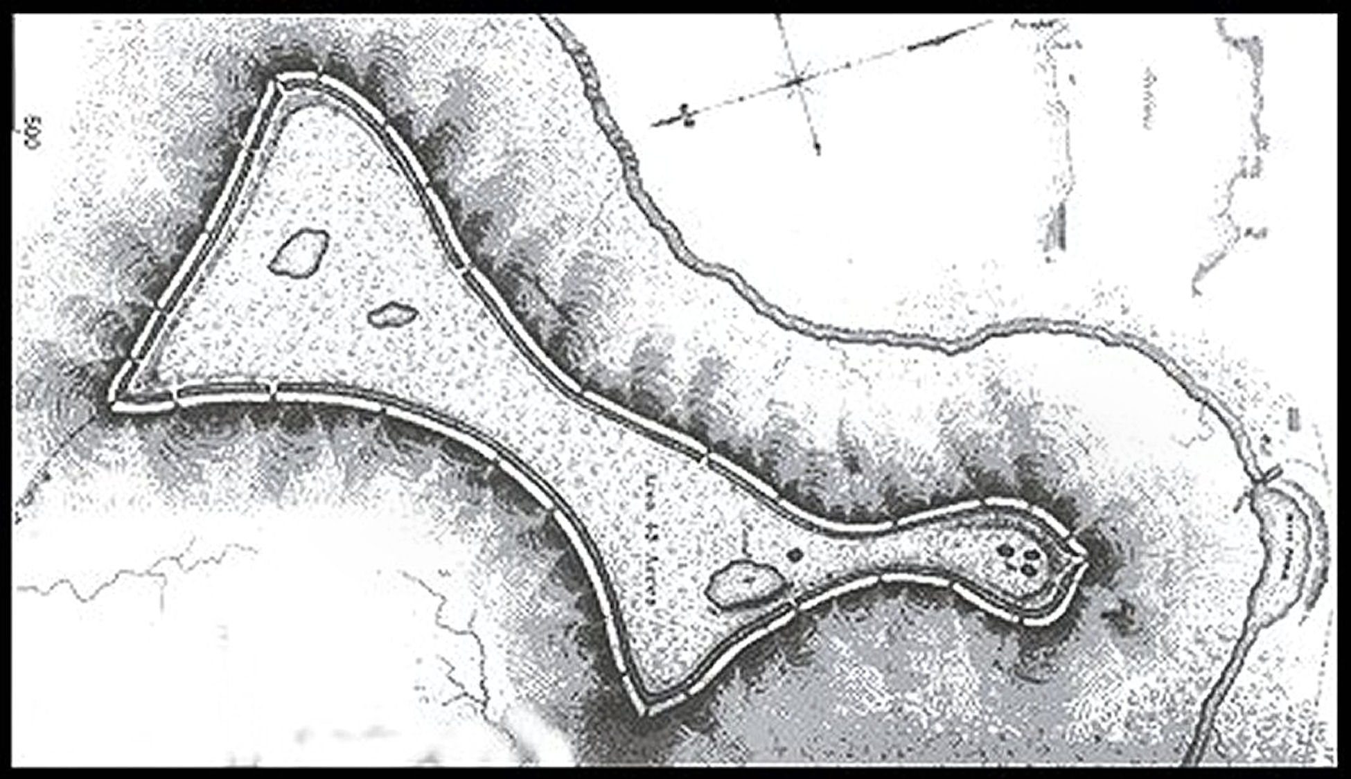
The earliest survey of the area, done in 1873 by state geologist E. T. Cox and his assistant, William Borden. They found a prehistoric stone fortification on the hilltop. A man-made limestone wall, 150 feet long and 7.5 feet high in some places, stood along the front and one side of the hill where the cliffs could be scaled, Cox said in his report. He estimated that there were visible stone foundations or walls of about 24 round and square buildings. The report also mentioned an area near the hill, which contained hundreds of human skeletons near the surface. It was described as an “Indian cemetery,” but could have been the scene of a massacre or plague.
The wall no longer exists, the area’s early settlers having taken the huge, quarried and field stones to build foundations, bridges and fences that can still be seen throughout the rolling countryside around Charlestown.
An archeological overview in 1984 of a former 10,000 acre munitions plant property that once included the Devil’s Background, concluded that the research value of enigmatic stone ruins could be quite high. Under federal law, Indian mounds and artifacts must be protected from development, and they could provide a unique look at southern Indiana’s early population. Yet . . . to this day . . . no professional archaeological investigation has been carried out there. Archaeologists appear to be afraid of what they would find.
Film makers seek answers for two century old questions
In 2008, Jon Haskell and Paul Barlow, partners in an Indiana-based film company that specialized in TV documentaries on archaeological sites in the Americas, became interested in Devil’s Backbone site. They announced plans in southern Indiana newspapers to film a documentary on the connection between the Devil’s Backbone and the Legend of the Welsh prince, Madoc. (Link to newspaper article) On a humid, summer’s day that year, they braved swamps, ticks, dense thickets of vines and numerous varieties of prickly plants to explore Devil’s Backbone. It is normally off-limits to the public. They were accompanied by author Dana Olson, who had written a book about the evidence for Welsh colonization in North America during the Early Medieval Period.
Archaeologist Sundea Murphy was retained as an advisory to the documentary film, which was to be based on the book by Dana Olson. Murphy insisted on a rational, scientific analysis of the available evidence of Welsh colonization. However, she remains open-minded to the possibility of immigration to North America from Europe prior to the voyages of Christopher Columbus. Murphy has not carried out an archaeological investigation of the Devil’s Backbone.
Barlow was initially interested in the Devil’s Backbone, because he was from Ireland. In a 2009 newspaper article, he announced his intent to create a three dimensional digital model of the site. However, the skills required to create an accurate 3D terrain model, integrated with prehistoric architecture, are far beyond that of a standard CADD technician or Registered Architect.
While inspecting the site, Haskell and Barlow only saw potsherds and stone points, typical of indigenous Americans, so both men soon seriously began to doubt the folklore that Prince Madoc had built the stone fortress. They could not, in good conscience, produce a film that supported that theory, but continued to film Native American sites around the eastern United States, which contained stone ruins.
In 2011, after reading several articles that I had written in the National Examiner on Indigenous American stone ruins in the Southeast, Haskell and Barlow approached me about carrying out an architectural analysis of the Devil’s Backbone. I was to make no presumptions concerning the ethnicity or age of the fortified village. Instead, I was to strictly focus on the probable functions and appearances of both the structures that were still visible and the outer wall, which had been demolished.
Upon completion of her university education, Paul Barlow’s wife was unable to obtain Permanent Resident Status in the United States. In -mid-2011. she instead took a job in Australia . . . about the same time that I finished my study of the Devil’s Backbone. Paul eventually followed her after getting a job in Australia. In the meantime, Jon Haskell had obtained a film permit for the Track Rock Terrace Complex in Georgia. Seven months later, the US Forest Service refused to issue film permits for the Track Rock Site to PBS, National Geographic and the History Channel. That is the reason that Jon Haskell appeared in the opening scenes of the premier of America Unearthed on History Channel H2. Their documentary on The Devil’s Backbone was never completed.

Architectural analysis
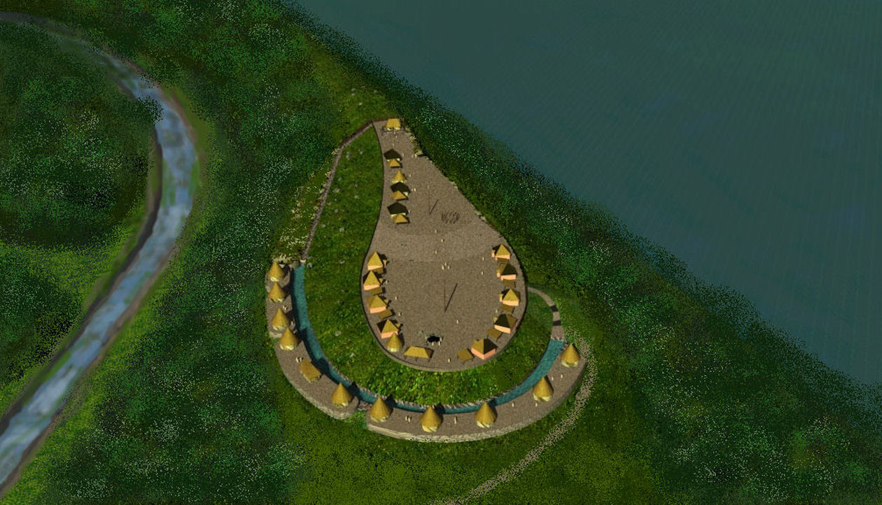
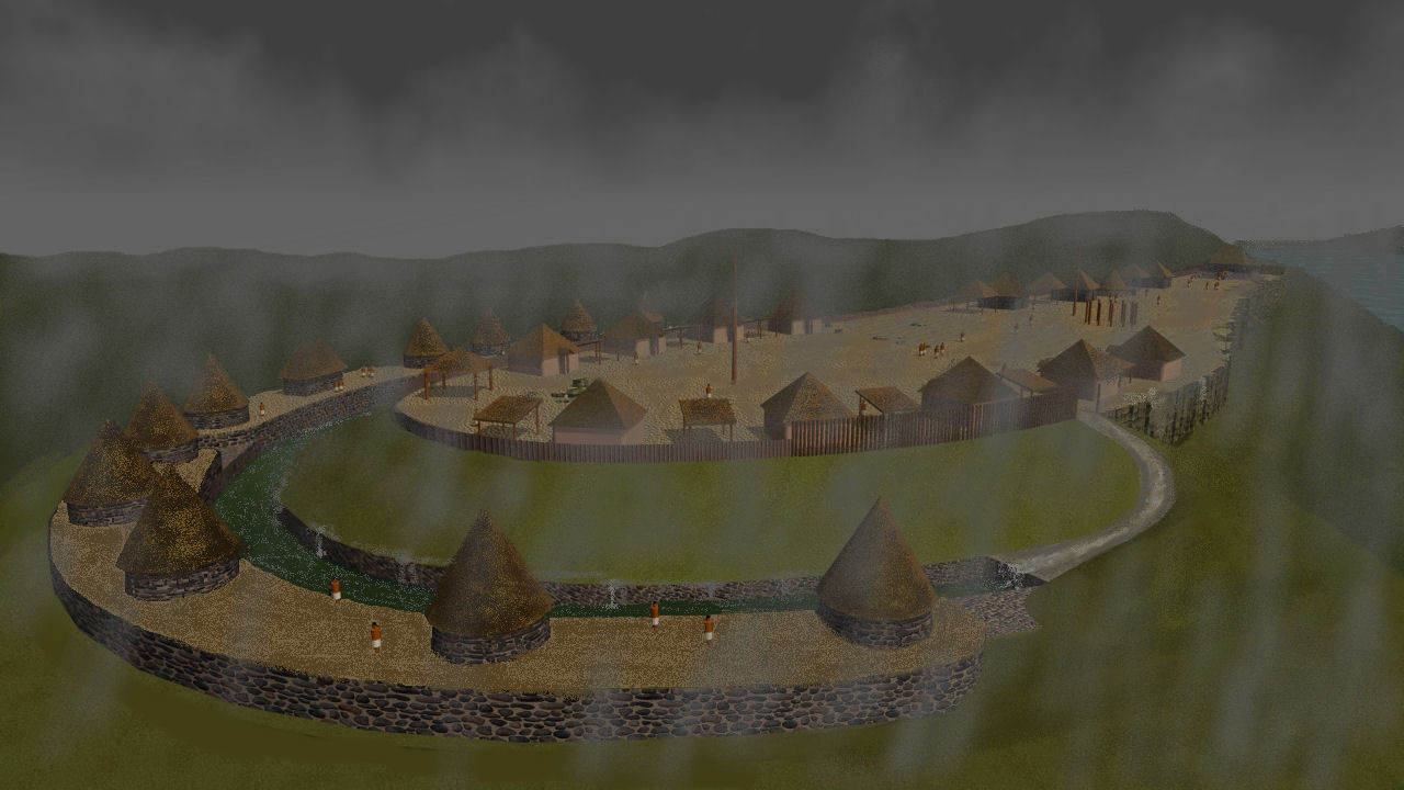
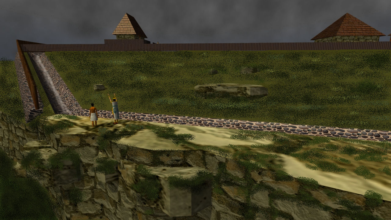
Community functions: This site was clearly developed as both a small fortress town and as a ceremonial center for an elite. The community on the top would be extremely difficult to assault, even with modern firearms. The primary entrance to the mesa is a narrow ramp and stairwell cut into the southeastern rock escarpment. All edges of the mesa were protected by sheer rock cliffs or stacked stone walls up to 7.5 feet (2.3 m) high. The cliffs also had low walls on them. Thus, a secondary function of the wall was to channel rainwater into the cistern. [See Cisterns.]
Astronomical orientation: The centroid line of the top of the mesa is approximately the azimuth of the Winter Solstice Sunset. December 21st marked the ending and beginning of the solar year in most Mesoamerican calendars.
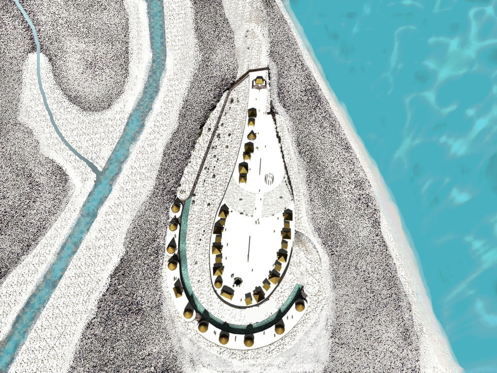
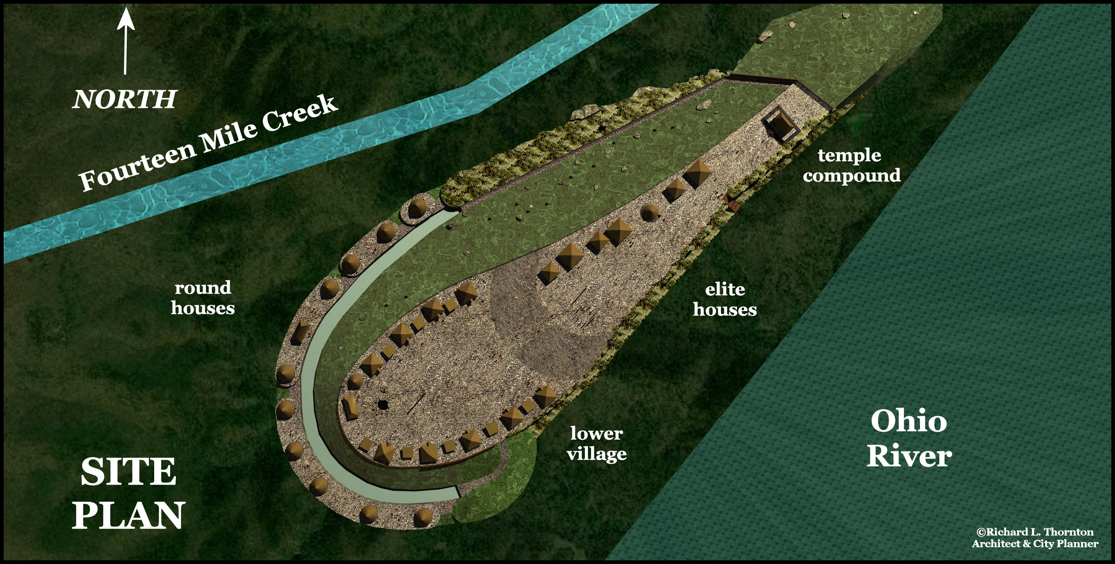
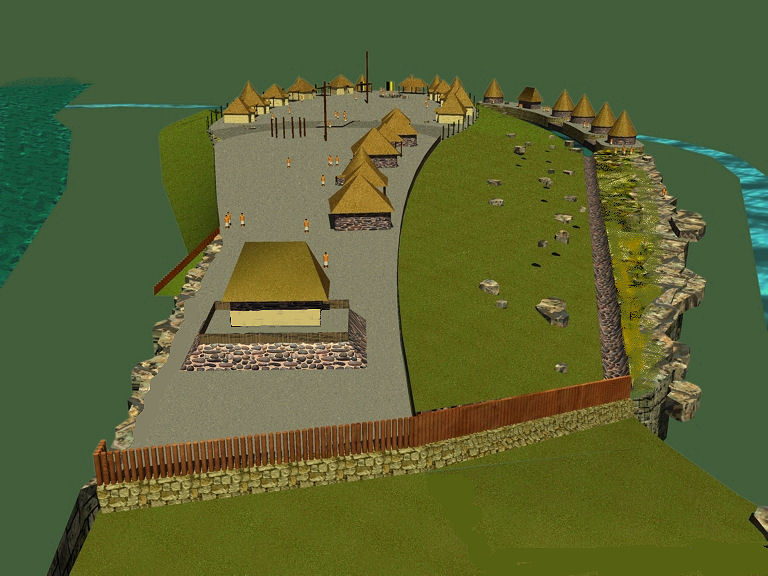
Community Plan: The community consisted of four precincts, each with its own architectural style. Ramped terraces separated the three precincts on the mesa, while the fourth occupation precinct was on the outer edge of the cistern, about 50 feet (15.25 m) below the lowest terrace.
- Temple – On the extreme northeast end of the mesa, the stone-veneered pyramid supported a rectangular temple. There was a rectangular plaza, which separated the temple from the elite housing.
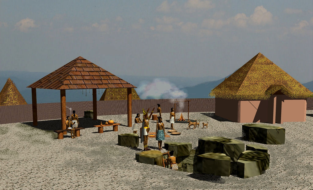
- Elite – There were approximately six or seven large square houses with field stone walls to the southwest of the temple plaza. Such houses were typical of the Zoque elite living in the highlands of Vera Cruz, Tabasco and Chiapas. The Zoque elite, living in the Lowlands, constructed identical foor plans, but with wattle and daub walls and clay foundations. The Zoque claim to have been the founders of the so-called Olmec Civilization . . . which actually had no connection to the Olmecs.
- Lower Village – On the southwest side of a large sloping ramp, were approximately 10 smaller square or rectangular houses. Some were built of stone. Others were wood-framed with post-ditch construction. This style of housing was typical of the Zoque Commoners in southern Mexico.
- Round houses – Entirely different style of housing was constructed on the curving plaza, outside the water cistern. It is possible that they were granaries, but their shaded location next to a large cistern filled with water would seem to be prone to mold growth, so his is probably not the case. This style of housing is typical of northern and central Peru, but not Mesoamerica. The stone foundations of identical houses have been found in Northeast Georgia and extreme northeastern South Carolina.
Cisterns: The archaeological site also contains the remains of a massive rainwater cistern that could have held up to 270,000 cubit feet of water. The cistern was constructed out of quarried limestone blocks, mortared with clay and apparently sealed with hydraulic lime stucco.
Sinkhole and Cave – In the northwestern section of the Lower Village is a sinkhole, which leads down to a cavern. Rainwater accumulates in the bottom of the cavern, so it also functioned as a cistern to store water. In the initial phase of the community’s occupation, this would have been the only convenient source of potable water by the residents. Such an asset made the site extremely valuable from a military perspective.
Caves were considered especially sacred places in Mesoamerica, several parts of South America and in the Southern Highlands of North America. The existence of a cavern inside Devil’s Backbone would have made especially important locale for religious ceremonies and rights.
Agricultural terraces – The southwestern slope of the promontory would have been an ideal location for agricultural terraces. This is their typical location in the numerous terrace complexes found in northern Georgia, east-central Alabama and extreme northwestern South Carolina. However, the dense undergrowth and tree coverage on this side of the Devil’s Backbone makes it nearly impossible to ascertain the past existence of terraces by eyesight. A combination of LIDAR and infrared analysis is recommended to study the site further.
Conclusion
The Devil’s Backbone is an extremely important archaeological zone . . . probably the most important one in Indiana. It is inexplicable that the Indiana State Historic Preservation Office has not long ago nominated the archaeological zone as National Historic Landmark or at least, the National Register of Historic Places. As soon as possible, funds should be earmarked for a comprehensive archaeological investigation of both Devil’s Backbone and Rose Island.
Furthermore, my professional opinion as a Historic Preservation Architect is that economic development officers in Charlestown and the State of Indiana should stop linking this geological feature to the Prince Maddoc Legend or the “Lost Ten Tribes of Israel” thing. I saw absolutely no evidence of Early Medieval British Architecture. The Native American potsherds on the site suggest a Late Woodland-Southeastern Ceremonial Cult Period chronology.
The presence of many Native American skeletons nearby MAY indicate that a large battle was fought there, but it may also be merely a cemetery. Scenes of massacred civilians (skeletons show violent injuries), probably carried out by soldiers from Cahokia Mounds, HAVE been found farther downstream on the Ohio, so this remains a possibility. On the other hand, a massive flood could have swept through a Native American town.
I identified three indigenous American architectural traditions at the Devil’s Backbone site . . . Zoque (Gulf Coast Lowland Mesoamerican), Muskogean – (Gulf Coast Highland Mesoamerican) and Moche (Central Highlands of Peru). This strongly suggests that the occupants of this village were not indigenous to the Midwestern United States. They seem to be hybrids composed of bands from the Lower Southeast, southern Mexico and the central highlands of Peru.
As a Creek Indian architect-city planner, I am often able to see things that North American archaeologists miss. However, I can see only what I can see. This is clearly a situation where professional archaeological investigation is sorely needed. We will only have a more complete understanding of the Devil’s Backbone, when more artifacts are unearthed in situ, plus radiocarbon dates and human DNA samples are taken.

Knowing Indiana’s penchant for penny-pinching, don’t hold your breath. They pride themselves as being one of the only states in the black. Most things have to be funded privately. This site needs a patron.
LikeLike
Is there any indication as to what became of the skeletal remains buried at Devil’s Backbone?
LikeLiked by 1 person
My understanding was that the skeletons were found near the river bank, not on the hill. However, I have never read any explanation as to what was done with the bones.
LikeLike
Several Caches of Roman coins have been found only a few miles away at Clarksville and across the river in Kentucky.There was supposedly a skeleton found with copper armor found at Clark’s Point.We have all heard or read about how these remains found at sites like this and in mounds seem to disappear, never to be seen again. If possible Dna tests should be performed on any bones found at and near this site. I have read of more than one site where piles of skeletal remains were found nearby and the story from Native locals is that there was a battle tween Natives and another people of a different race. We know much was Taken/destroyed to build structures in the area plus Rose Island Park was built and a flood destroyed that. How much was erased during these events? This definitely needs investigating.
LikeLiked by 1 person