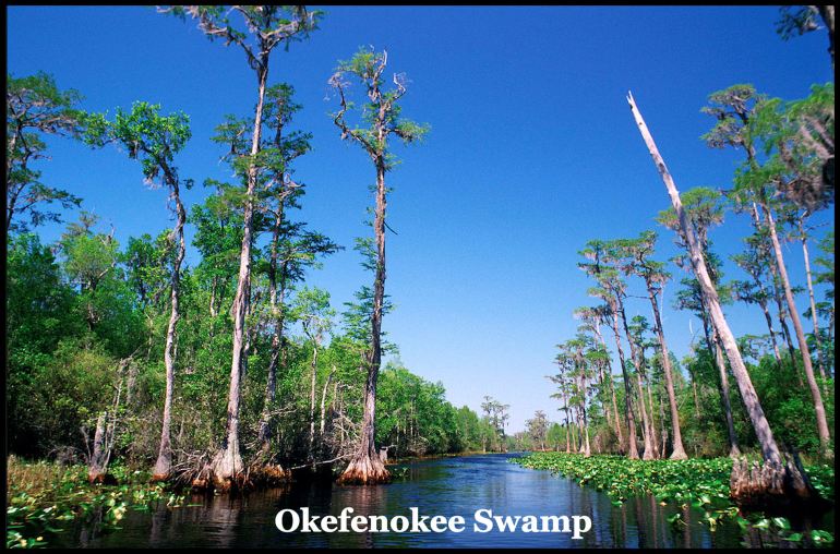
The Okefenokee Swamp in Georgia has been officially inscribed as a UNESCO World Heritage site, the first natural site in the U.S. added in over 30 years. The Okefenokee Swamp, encompassing roughly 400,000 acres, is North America’s largest blackwater swamp and one of the most intact freshwater wetlands in the world.
Okefenokee actually means “Water Shaking” in the Itsate- Creek language, not “Land of the Trembling Earth” in the Muskogee-Creek language . . . as stated in a legion of national media articles. Muskogee-speaking Creeks never lived in that part of Georgia. Muskogee-Creeks did not use the word, oka, for water.
by Richard L. Thornton, Architect and City Planner
Geological origins
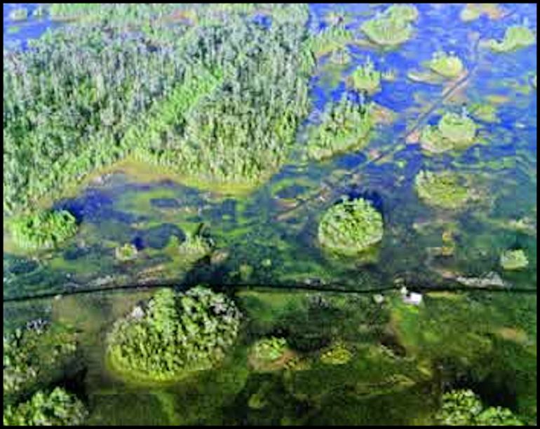
The Okefenokee Swamp occupies a saucer-shaped depression that was once part of the ocean floor approximately 7,000 years ago. . This basin lies on the edge of an ancient Atlantic coastal terrace, a remnant of a Pleistocene estuary . Surrounding the swamp is Trail Ridge, a strip of elevated land believed to have formed from coastal dunes or an offshore barrier island, which helped contain water and influence the swamp’s hydrology.
Radiocarbon dating indicates that the deepest peat deposits are about 6,500 years old, marking the beginning of the swamp in its current form. . Peat continues to accumulate slowly, with roughly one inch forming every 50 years, creating layers that can exceed 15 feet in depth in some areas
The swamp is home to over 1,270 species of plants and animals, including threatened or endangered species such as the red-cockaded woodpecker and the eastern indigo snake, and supports a dense population of American alligators.
Native American Inhabitants
The Okefenokee Swamp Basin has been inhabited as long as humans have lived in present-day Southeast Georgia. Archaeologists, employed by the federal government, surveyed the swamp and its edge during the early 1970s. They identified at least 74 Indian mounds, but assumed that there were several more now covered by water,
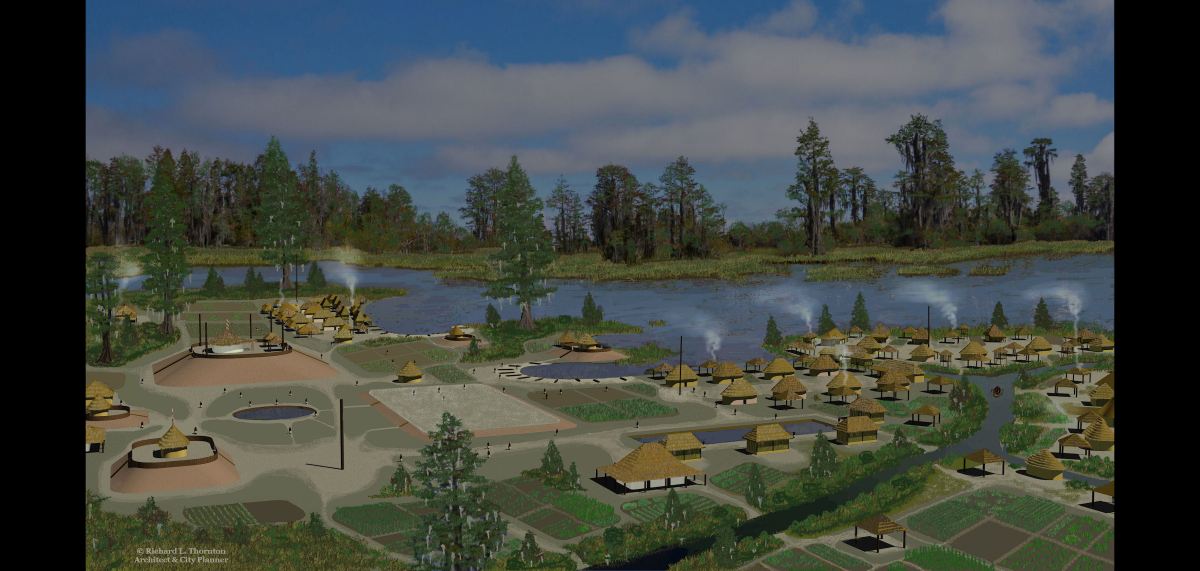
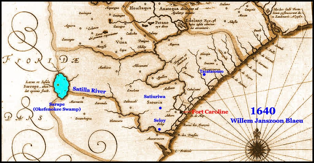
French Huguenots from Fort Caroline were the first Europeans to document their visit to the Okefenokee, which was then a large shallow lake with a large island on the western side with smaller islands scattered about. The lake was name Sarape, which is a Panoan word from eastern Peru, meaning “banks sloughing into the lake.” There was an important shrine, dedicated to the Sun Goddess, Amana, on the large island. The northwest side of the lake was occuppied by a Taino Tribe called the Okani, who name means “Sacred Place.”
The lake would swell to cover much of present-day Southeast Georgia during the springtime, according to explorer William Bartram in 1776. At this time, the Okefenokee Region was occupied by Itsate-speaking tribes such as the Tallasee, Okate, Oconee and Tamahiti. As late as the 1880s, the swamp was occupied by mixed-blood Creek families, who spoke an Itsate language similar to Miccosukee. They were called the Ware County Creeks or Ware County Indians. They often worked as overseers or foremen for turpentine plantation owners. Most of the Ware County Creeks were driven out of the swamp by large timber companies in the late 1800s, who seized the swamp without paying for it.
Implications and Future Considerations
The International Union for Conservation of Nature (IUCN) endorsed the site, and the World Heritage Committee formally inscribed it during its 48th session in Busan, South Korea, in July 2026
While UNESCO designation does not confer new legal protections or alter ownership—the U.S. Fish and Wildlife Service continues to manage the refuge—the recognition raises global awareness and is expected to boost tourism, potentially increasing annual visitors from 800,000 to over 1.5 million by 2035. The designation also strengthens conservation efforts, particularly against threats like mining near the swamp’s edges.


In 3rd grade at Enota (I know you attended Enota as well) in Georgia History we learned The Land of the Trembling Earth as the meaning of Okefenokee. I always wondered what made the land tremble. LOL
LikeLiked by 2 people
Love this, I’ve canoed the south portion that goes into Florida and turns into the Suwannee. Definitely one of my favorite expeditions.
LikeLiked by 1 person
Well done Richard. I spend several years as a boy fishing the St. Mary’s River and the Okefenokee. A treasure that is essential to preserve. Love the new explanation of Native language correctly applied. Too many digs and too little language study apparently skew archaeological study.
LikeLike
Hey Joe, Don’t know if you saw my article on St. Marys, but all the NA towns and villages around St. Marys Sound and most on Cumberland Island have Aztec names. Their capital was a word that means “Earthen pyramid surround by marsh.” The tribal name means “The Corn Beer People.” (Atolliteka)
I no longer have your regular email address, so awhile back I sent you this message on LinkedIn. I am in good health, but currently working on a will. I have over a hundred biological children via a fertility clinic in Asheville, plus a son in France and two Swedish children somewhere? Neither they or my official relatives have shown any interest in my vocation or my new vocation in anthropology. I would like to leave my Mesoamercan artifacts, 3000+slides of Mexico/Guatemala, 52 hand made Indigenous American musical instruments from Central and South America, plus my extensive architectural history and archaeology library to Reinhardt University.
Georgia Tech and Georgia State are just big corporations with transient faculty members, who are totally disinterested in anything about the past in the Southeast and Mesoamerica. Whereas I have very warm, memories of the Reinhardt faculty and administration.
I don’t know who to talk to at Reinhardt in order to determine if they would want these donations.
LikeLike